
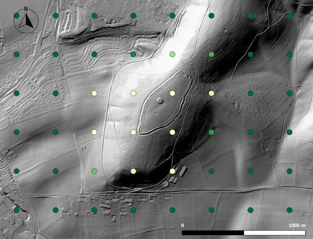
Figure 1
Example prediction result shown on LiDAR background. Grid points with brighter colours indicate higher confidence of a hillfort being nearby (DEM: DEFRA).
Table 1
Result metrics for test regions.
| REGION | KNOWN HILLFORTS | PREDICTED BY AI | TP | FP | FN | TN | PRECISION | RECALL | F1SCORE |
|---|---|---|---|---|---|---|---|---|---|
| Northumberland National Park | 71 | 182 | 49 | 133 | 22 | Not applicable | 0.27 | 0.69 | 39% |
| Northampton | 9 | 15 | 5 | 10 | 4 | 0.33 | 0.56 | 42% | |
| Taunton (Cornwall) | 32 | 108 | 26 | 82 | 6 | 0.24 | 0.81 | 37% | |
| Total | 112 | 305 | 80 | 225 | 32 | 0.26 | 0.71 | 38% |
Table 2
Detection improvement with fine-tuning using local landscape data.
| AI MODEL USED | HESSE F1 SCORE | MOLISE F1 SCORE |
|---|---|---|
| England model only | 21% | 12% |
| England model plus fine-tuning with 3,000 random patches + 22 (Hesse)/32 forts (Molise) | 38% | 34% |
Figure 2
Illustration of the procedure for processing the AI output.
Table 3
Timing breakdown for the North of England analysis.
| STAGE 1 | STAGE 2 | |||||
|---|---|---|---|---|---|---|
| AI CONFIDENCE SCORE | # SAMPLES | TOTAL TIME (HRS) | # SAMPLES | SAMPLE RATIO | TOTAL TIME (HRS) | RESULTS |
| 90–100% | 89 | 00:17 | 24 | 27% | 01:37 | No candidates |
| 85–90% | 168 | 00:31 | 29 | 17% | 01:27 | Two candidate enclosures, each from one sample |
| 80–85% | 235 | 00:18 | 11 | 5% | 00:23 | no candidates |
| 75–80% | 285 | 00:07 | 8 | 3% | 00:05 | One candidate enclosure |
| 70–75% | 377 | 00:13 | 14 | 4% | 00:49 | Two candidate enclosures, one from two samples. This latter is auxiliary to a recorded medieval site |
| 66–70% | 346 | 00:15 | 9 | 3% | 00:30 | One candidate enclosure from a single sample |
| TOTALS | 1500 | 01:41 | 95 | 04:51 | ||
| Average | 0:04 min | 3:03 min | ||||
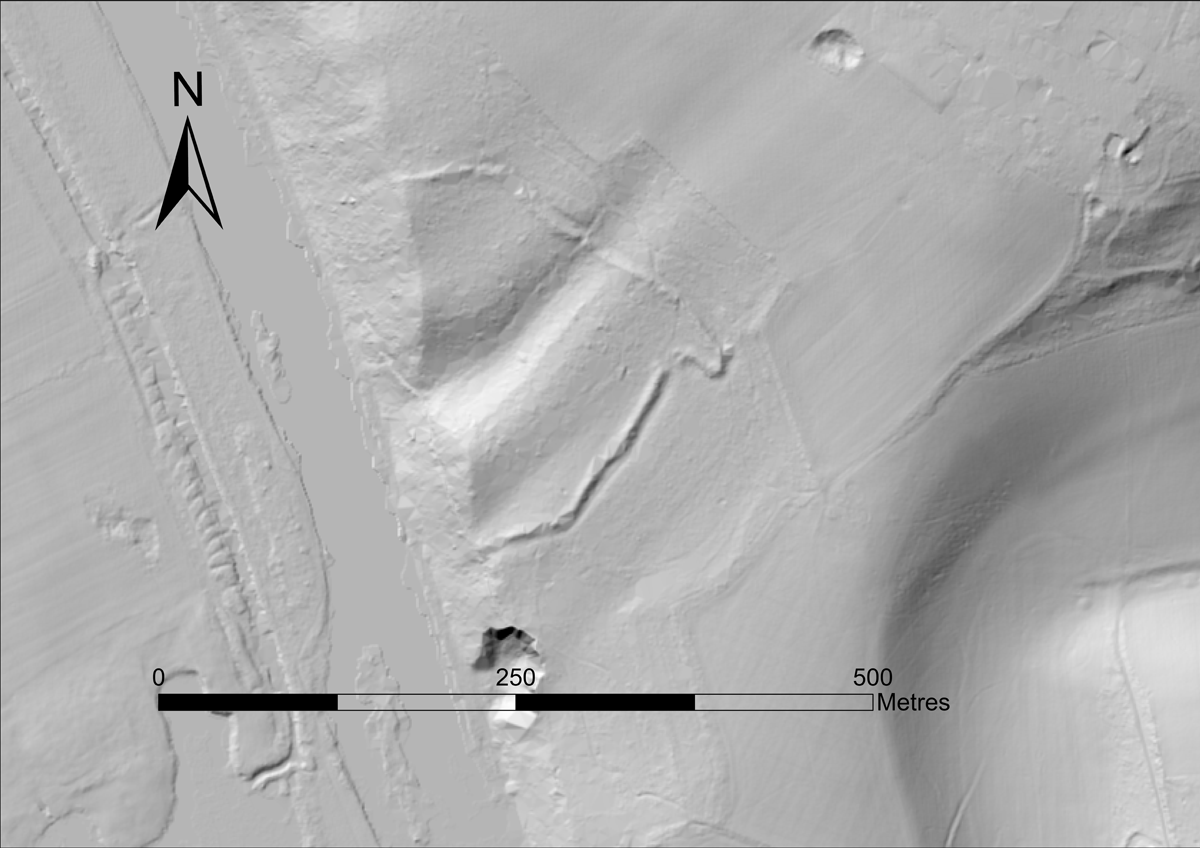
Figure 3
Previously unrecognized English hillfort in the Chilterns region, independently identified by the project (DEM: DEFRA).
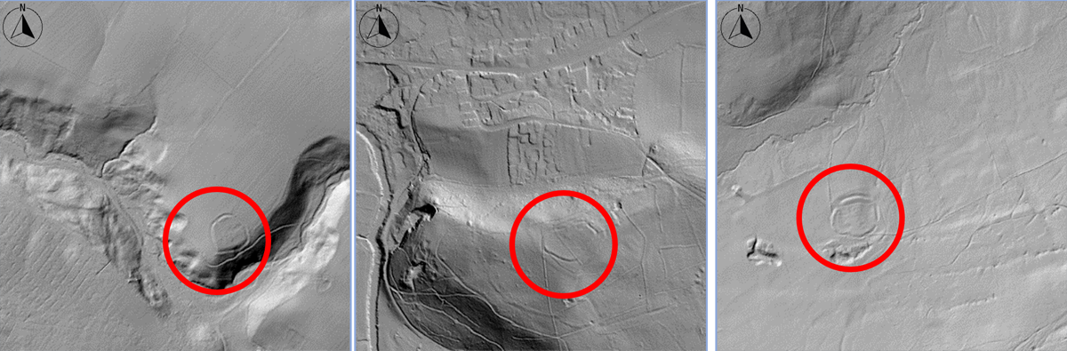
Figure 4
Possible hillforts in Northern England found by AI, not in the Atlas but documented in the HER (DEM: DEFRA, vignette size 768 m ×768 m).
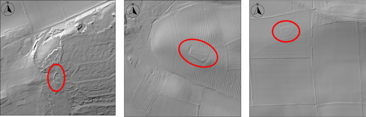
Figure 5
Examples of False Positives (DEM: DEFRA, vignette size 768 m ×768 m).
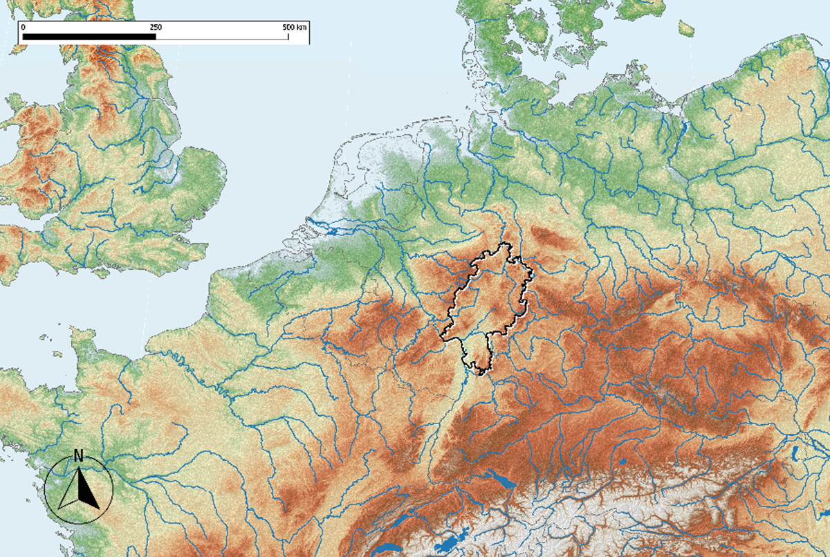
Figure 6
The German state of Hesse in Europe (SRTM USGS-authored or produced data and information are in the public domain).
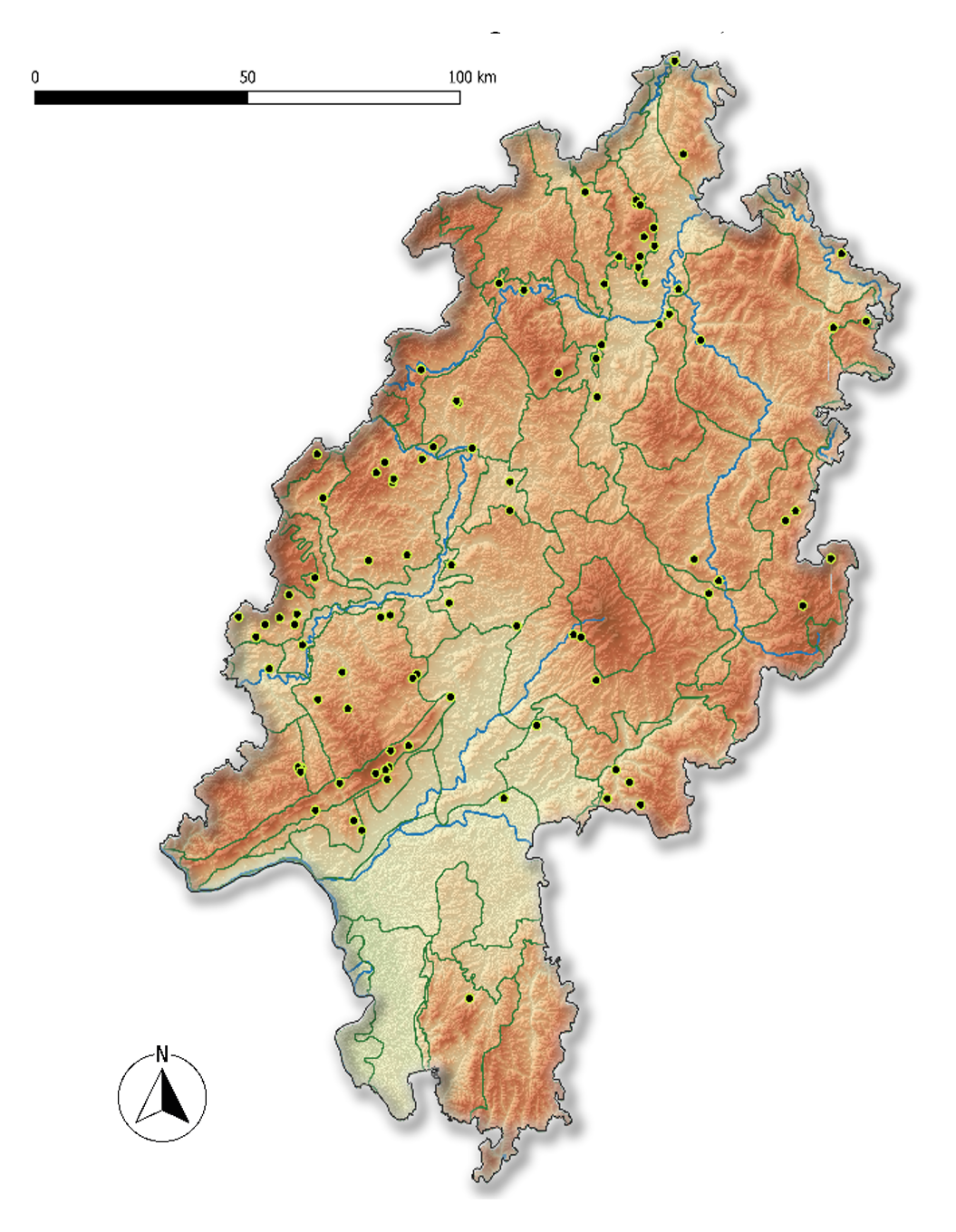
Figure 7
Known hillforts in the state of Hesse (SRTM USGS-authored or produced data and information are in the public domain; natural regions BFN; forests GDS Hessen).
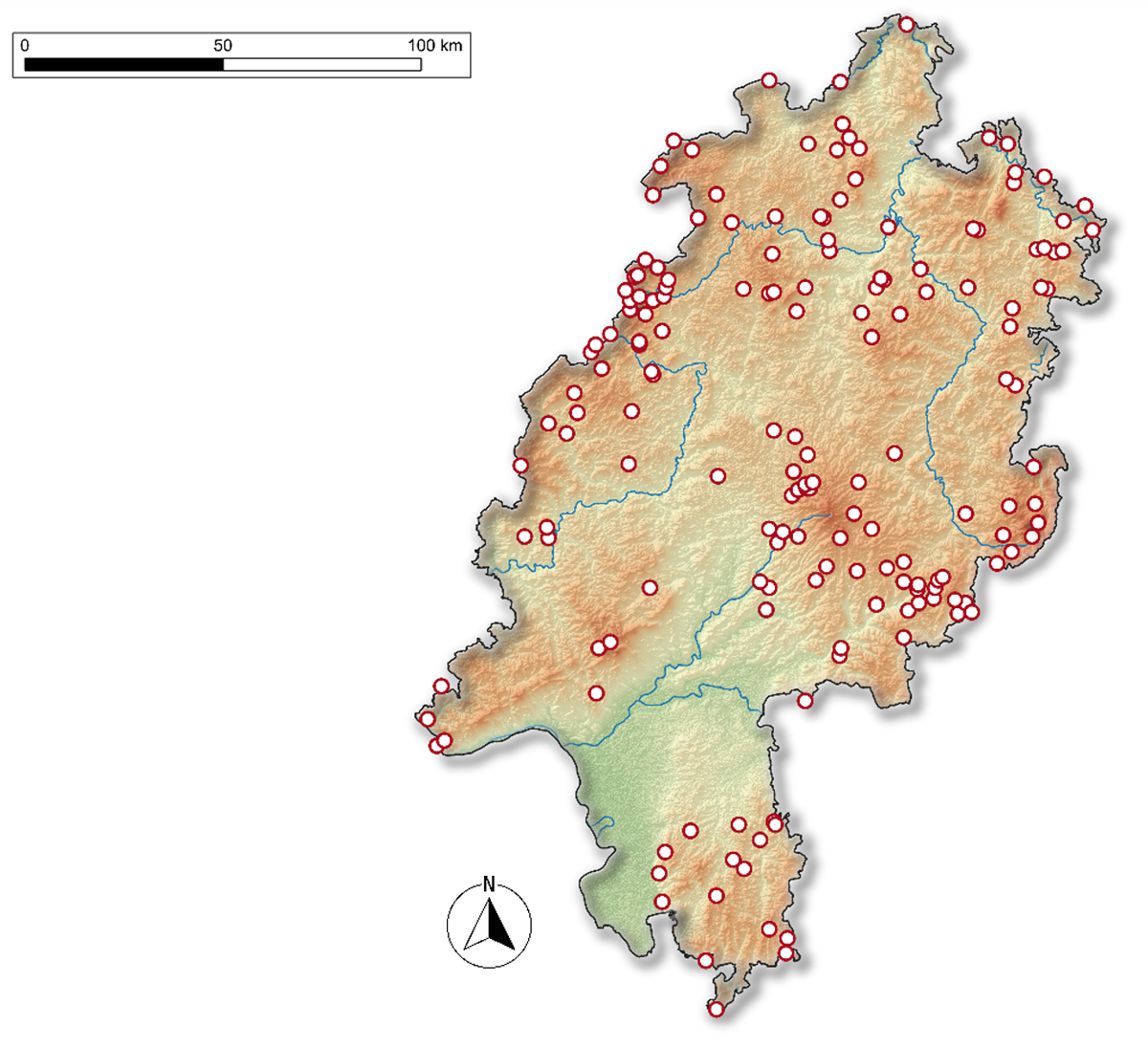
Figure 8
Potential hillforts sites with a confidence value of >90% in the state of Hesse. (SRTM USGS-authored or produced data and information are in the public domain).
Table 4
Classification of the potential hillfort likeliness of findings with a confidence value >90%.
| EVALUATION | # SITES |
|---|---|
| Obvious false positives | 148 |
| Hillfort site (known), often medieval castle or ringwall | 12 |
| Maybe hillfort | 4 |
| Road | 2 |
| Waste disposal site | 2 |
| Geological formation (other) | 1 |
| Total | 169 |
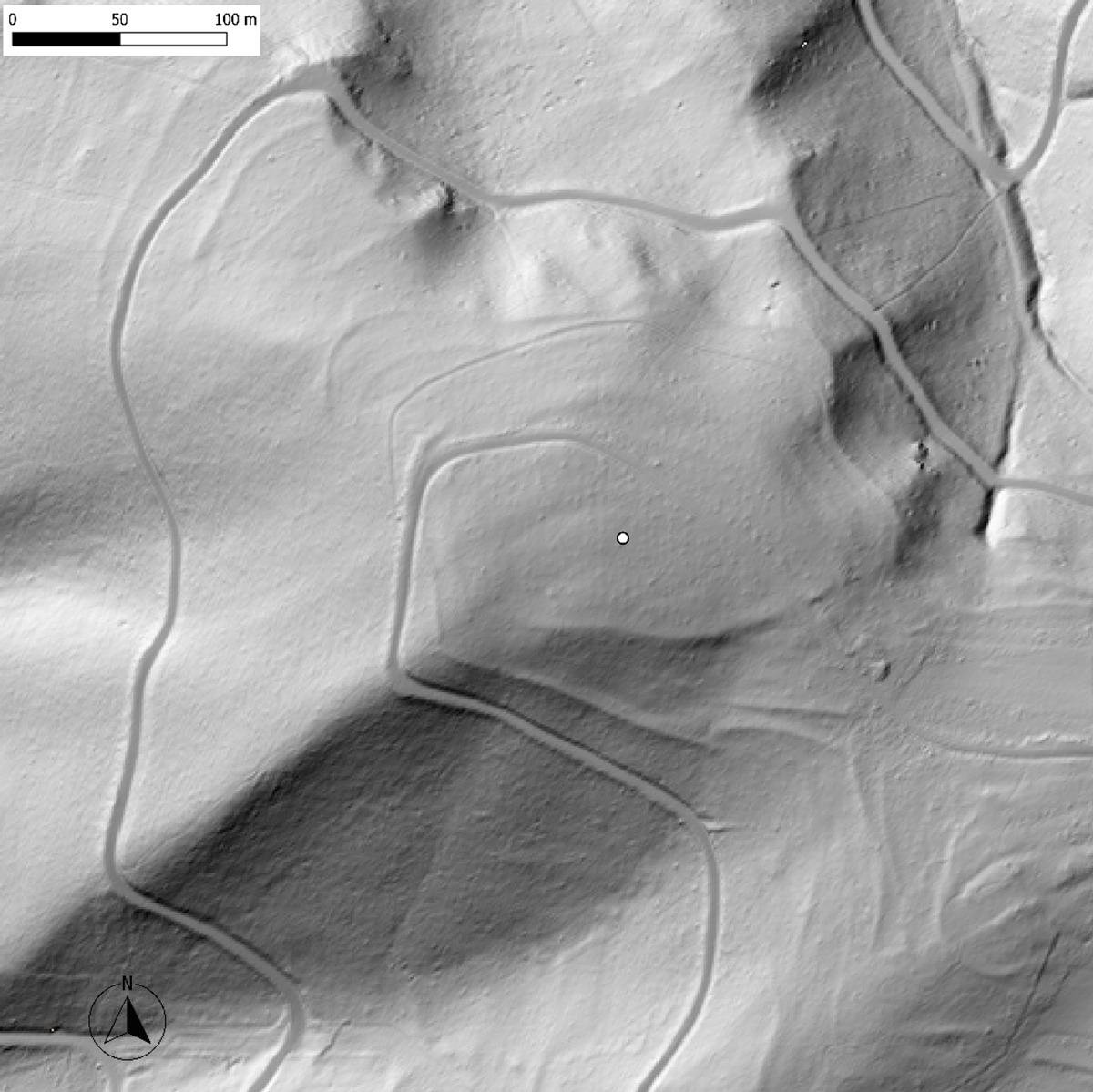
Figure 9
Hillshade DEM vignette of a potential hillfort site (DEM: HVBG).
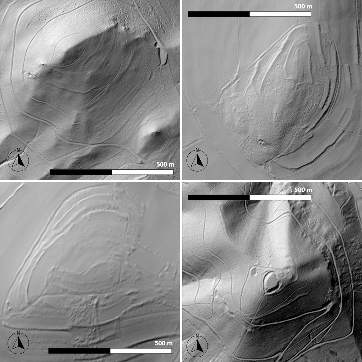
Figure 10
Examples of possible hillforts (as classified by AI).
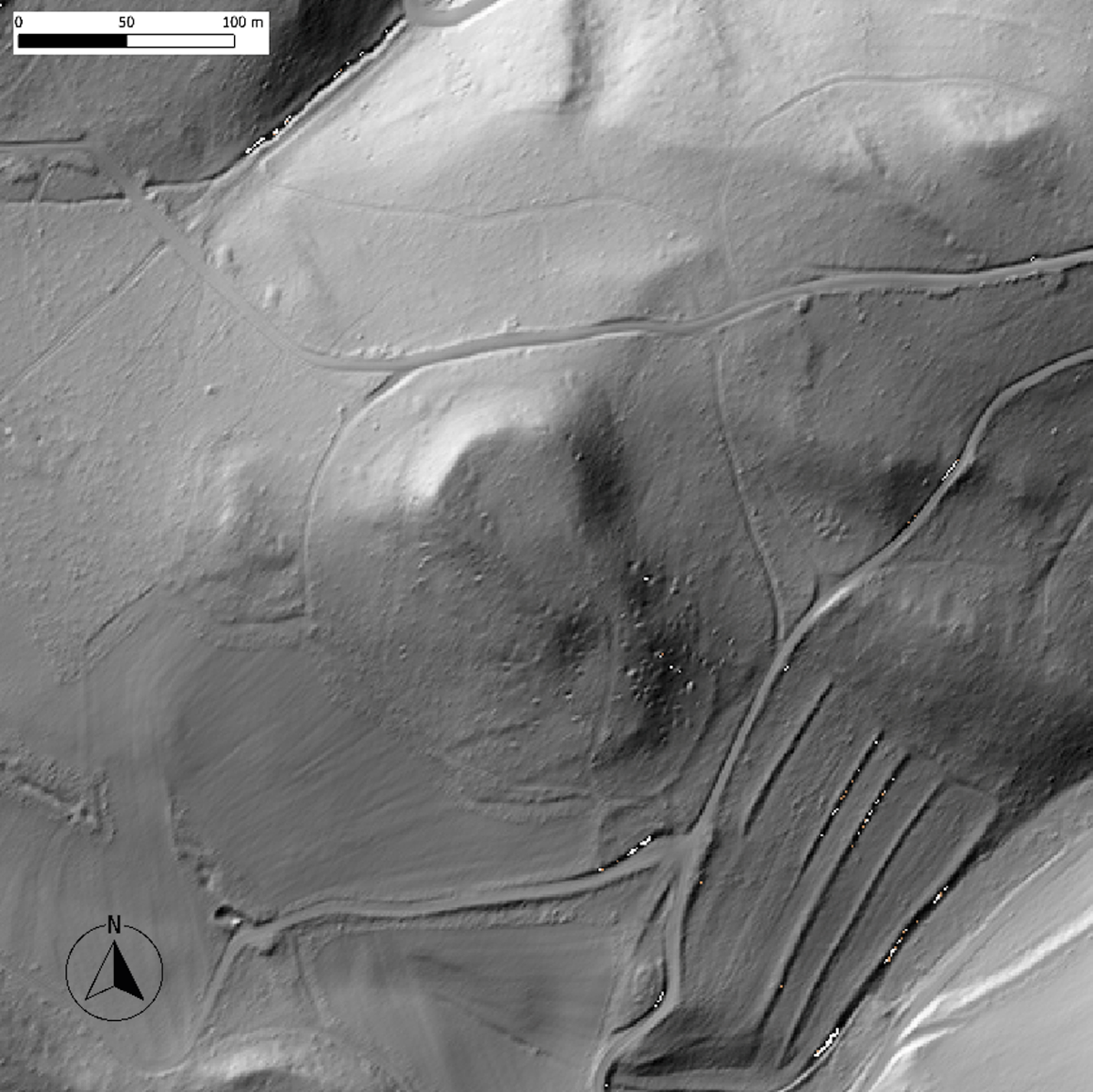
Figure 11
Example of a false positive candidate, most likely wrongly classified due to existing forest paths and terrain structures (DEM: HVBG).
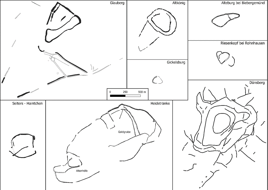
Figure 12
Differing shapes and sizes of prehistoric hillforts in Hesse (same scale, all north oriented).
Table 5
Classification of the top 100 detections corresponding to confidence value above 0.94.
| DETECTIONS | |
|---|---|
| True positives | 15 |
| False positives | 85 |
| DETECTIONS BY TYPE | |
| Hillforts | 15 |
| Villages | 10 |
| Field systems | 10 |
| Terrain features | 65 |
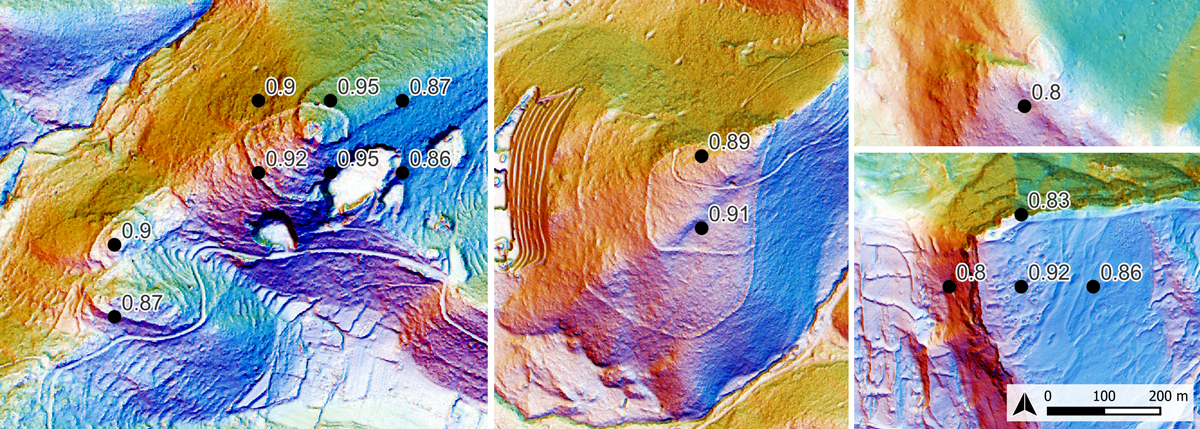
Figure 13
Examples of hillforts correctly detected by the AI classifier.
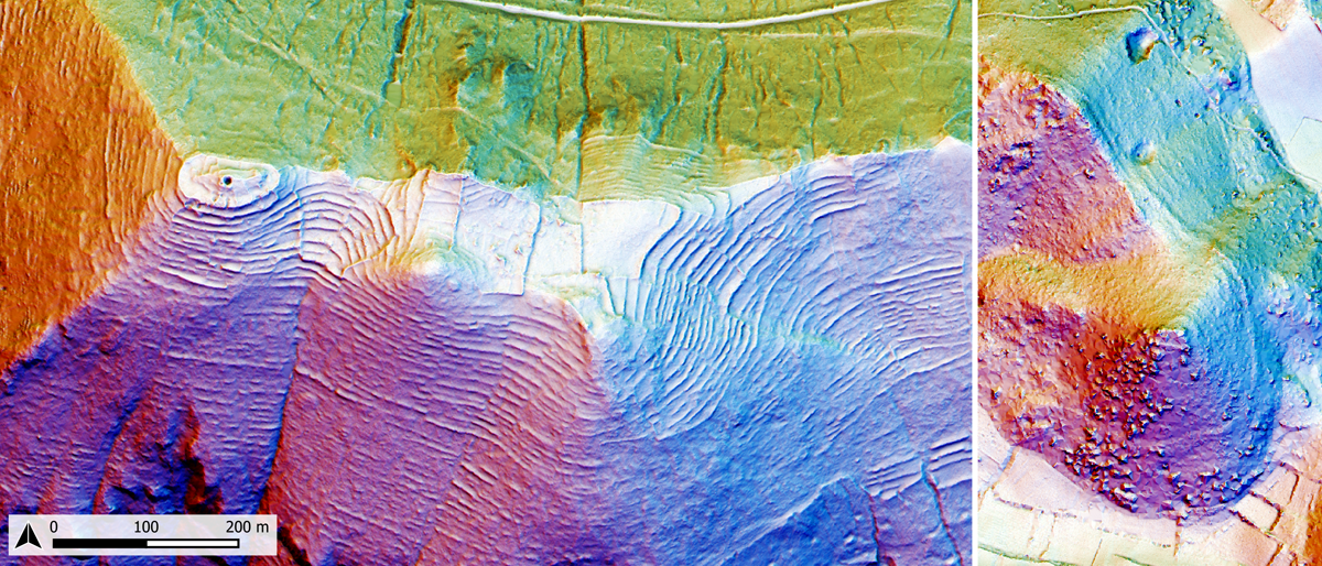
Figure 14
Examples of false negatives related to the characteristics terraced (left) and maquis landscapes of the Mediterranean (right). The black triangles indicate the fortification circuits of the hillforts.
Table 6
LiDAR data details.
| REGION | SPATIAL RESOLUTION | VERTICAL ACCURACY | INTERPOLATION | COVERAGE | DATA FORMAT | ACQUISITION PERIOD | PROVIDER | URL |
|---|---|---|---|---|---|---|---|---|
| England (UK) | 1 m | +/–15cm RMSE | bilinear | 99% | GEOTiff | 2000–2022 | Department for Environment Food & Rural Affairs (DEFRA) | https://environment.data.gov.uk/survey |
| Hesse (Germany) | 1 m | +/–10 cm | undisclosed | 100% | GEOTiff or XYZ | undisclosed | Hessische Verwaltung für Bodenmanagement und Geoinformation | https://hvbg.hessen.de/landesvermessung/geotopographie/3d-daten/digitale-gelaendemodelle |
| Molise (Italy) | 1 m | +/–15cm | undisclosed | 66% | XYZ | 2008–2015 | Ministero dell’Ambiente e della Tutela del Territorio e del Mare (MATTM) | https://gn.mase.gov.it/portale/home |