

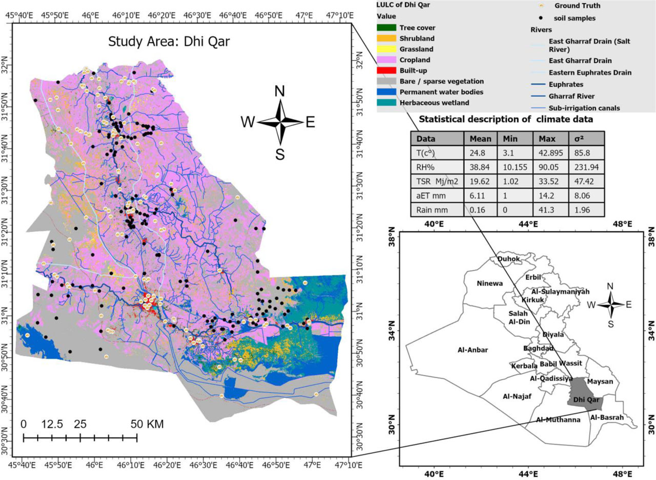
Figure 1:
Study area
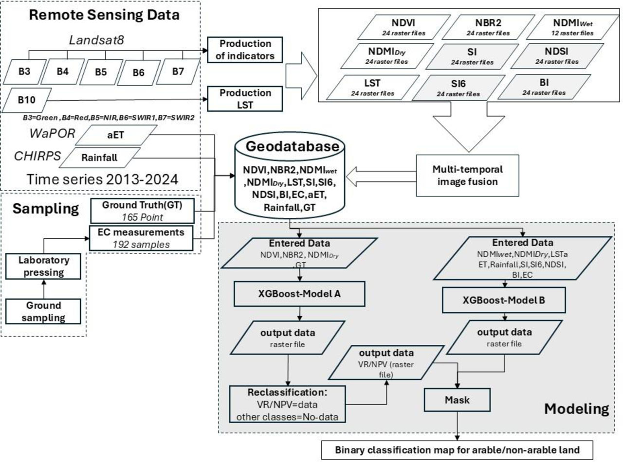
Figure 2:
Methodological framework for the research
Table 1:
The indicators and data used in the research
| Data/Index | Mathematical Formula | Source | Time |
|---|---|---|---|
| aET [mm] | ***************************** | WaPOR(v2and v3) | 2013–2024 |
| Rainfall [mm] | ***************************** | CHIRPS | 2013–2024 |
| NDVI [-] | Landsat8(B5,B4) | 2013–2024 | |
| NBR2 [-] | Landsat8(B6,B7) | 2013–2024 | |
| NDMI [-] | Landsat8(B5,B6) | 2013–2024 | |
| LST [kelvin] | ***************************** | Landsat8(B10) | 2013–2024 |
| SI [-] | Landsat8(B4,B3) | 2013–2024 | |
| SI6 [-] | Landsat8(B4,B5,B3) | 2013–2024 | |
| NDSI [-] | Landsat8(B4,B5) | 2013–2024 | |
| BI [-] | Landsat8(B3,B4,B5) | 2013–2024 | |
| River data [-] | ***************************** | NCWRM | 2013–2024 |
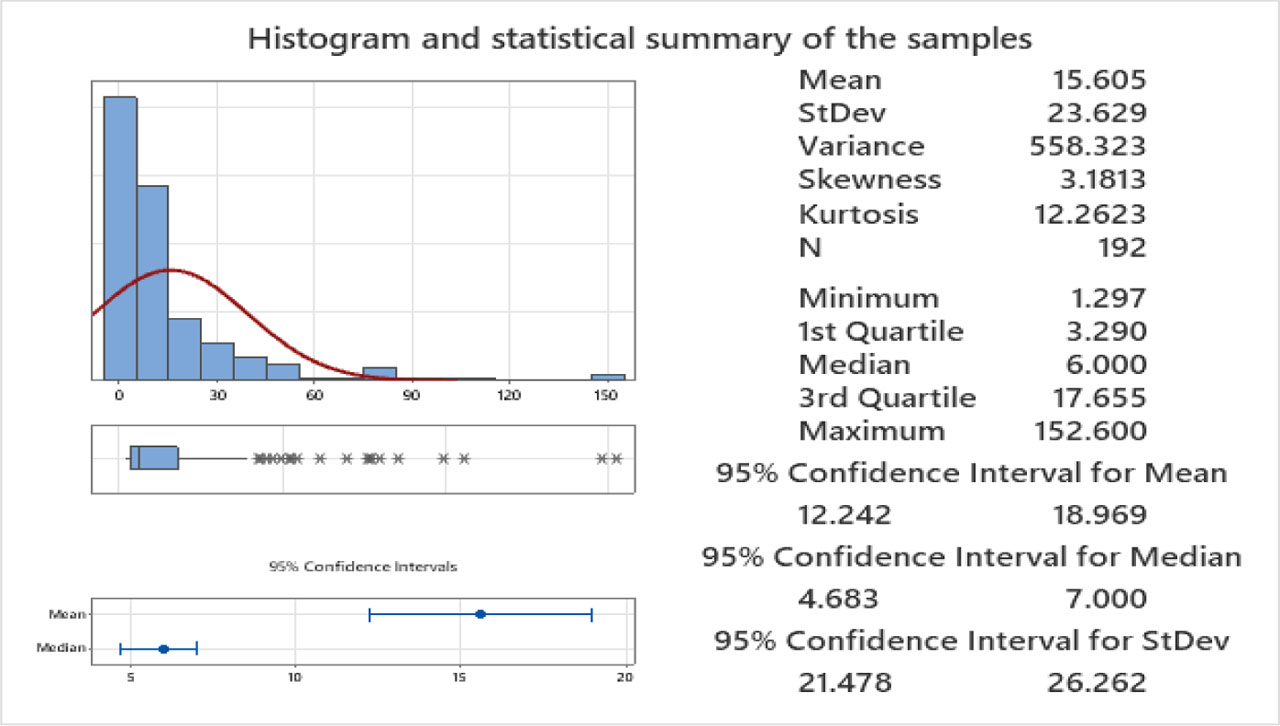
Figure 3:
Histogram and summary statistics for soil samples
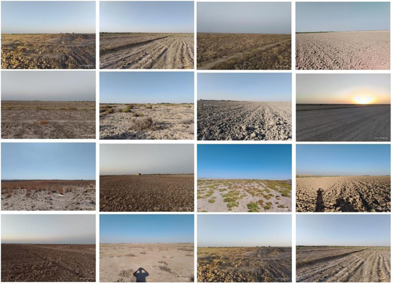
Figure 4:
Ground truth points
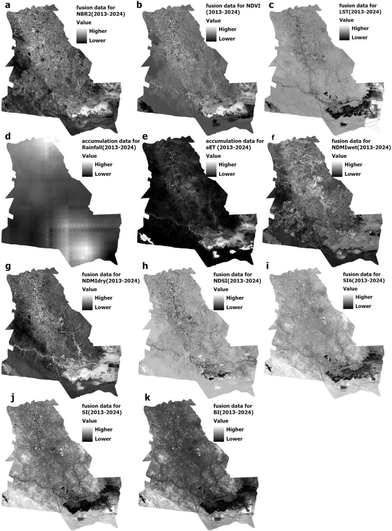
Figure 5:
Multi-temporal image fusion and cumulative data. a,b,c,f,g,h,I,j, and k multi-temporal image fusion for NBR2, NDVI, LST, NDMI (dry and wet season), NDSI, SI6, SI, and BI, respectively. d and e cumulative annual rainfall and aET data, respectively
Table 2:
Modeles Characteristics
| Model Characteristics | XGBoost-Model A | XGBoost-Model B |
|---|---|---|
| Number of Trees [-] | 100 | 180 |
| Leaf Size [-] | 1 | 11 |
| Tree Depth Range [-] | 2–6 | 2–8 |
| Mean Tree Depth [-] | 3 | 3 |
| Percentage of Training Available per Tree [-] | 100 | 100 |
| Number of Randomly Sampled Variables [-] | 1 | 3 |
| Percentage of Training Data Excluded for Validation [-] | 10 | 10 |
| L2 Regularization (Lambda) [-] | 1.00 | 1.00 |
| Minimum Loss Reduction for Splits (Gamma) [-] | 0.00 | 0.00 |
| Learning Rate (Eta) [-] | 0.30 | 0.30 |
Table 3:
Model A performance
| Phases | F1-Score [-] | MCC [-] | Accuracy [-] | Category | Sensitivity [-] |
|---|---|---|---|---|---|
| Training | 0.99 | 0.99 | 0.99 | SoilVR/NPV | 1 |
| other classes | 0.99 | ||||
| Validation | 0.93 | 0.79 | 0.99 | SoilVR/NPV | 1 |
| other classes | 0.78 |
Table 4:
Model B performance
| Phases | F1-Score [-] | MCC [-] | Accuracy [-] | Category | Sensitivity [-] |
|---|---|---|---|---|---|
| Training | 1 | 1 | 1 | arable | 1 |
| non-arable | 1 | ||||
| Validation | 0.94 | 0.90 | 0.95 | arable | 1 |
| non-arable | 0.88 |
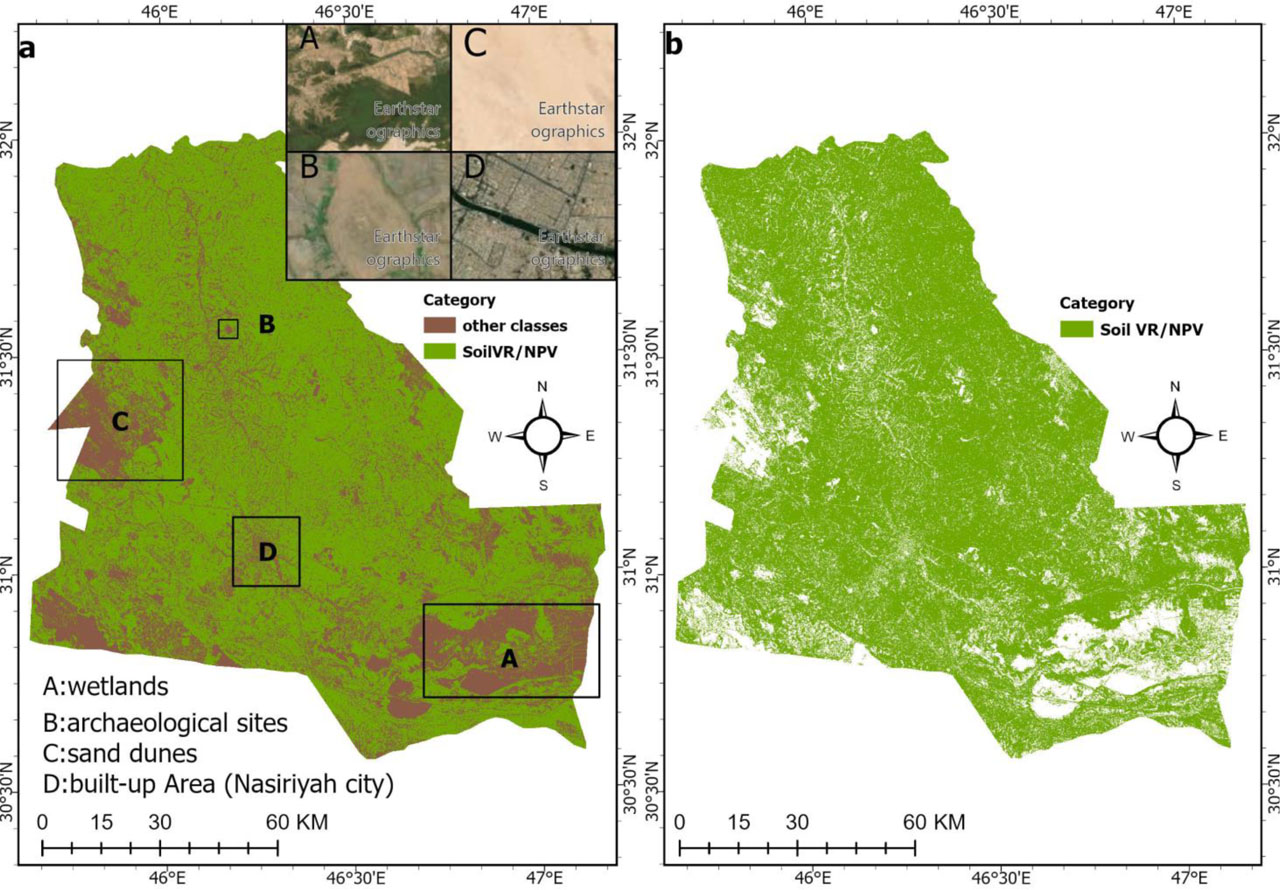
Figure 6:
Results of Model A. a -Binary classification of SoilVR/NPV and other LULC classes. b-Spatial distribution of SoilVR/NPV
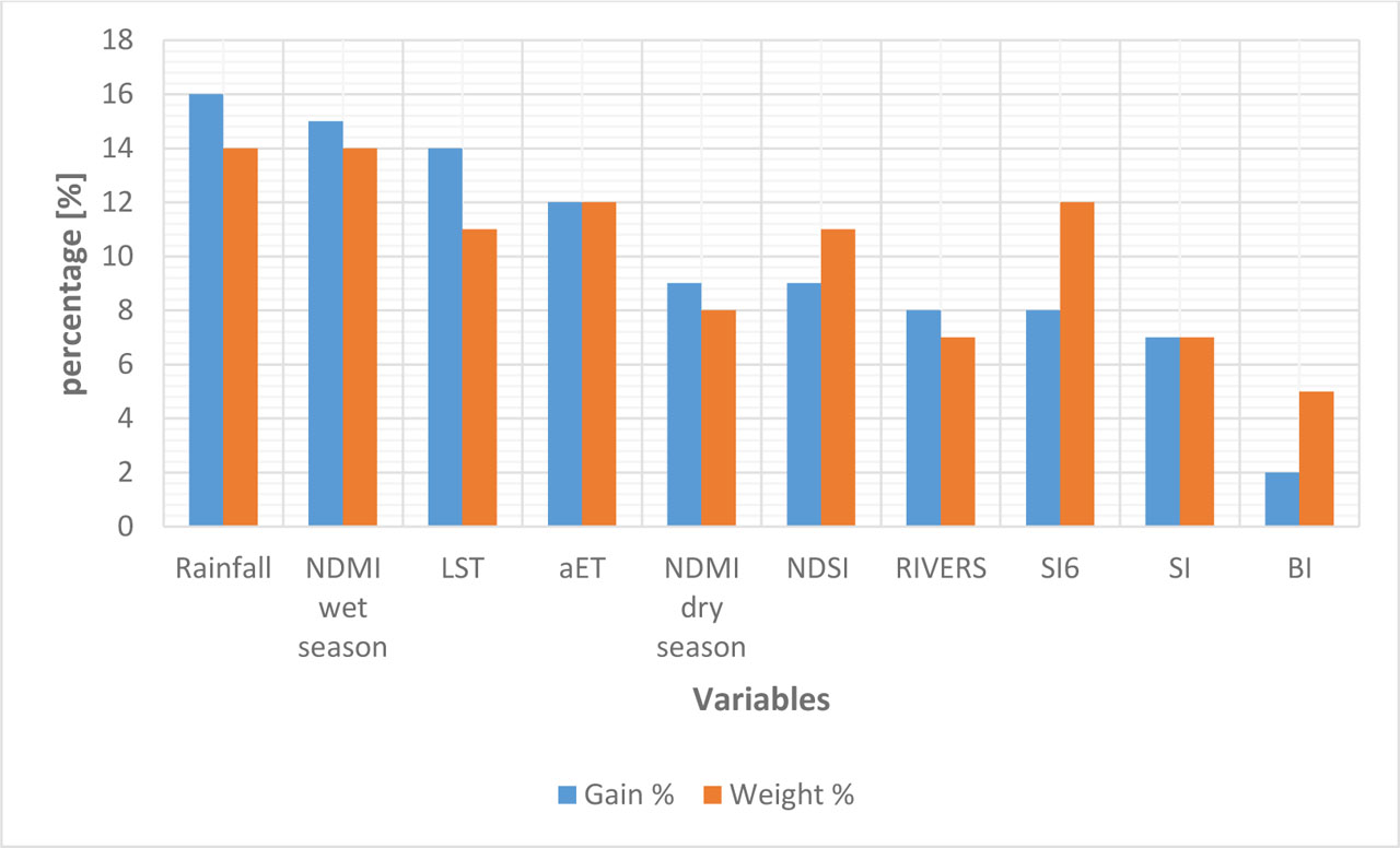
Figure 7:
Analysis of Gain and Weight Regarding the Importance of Variables
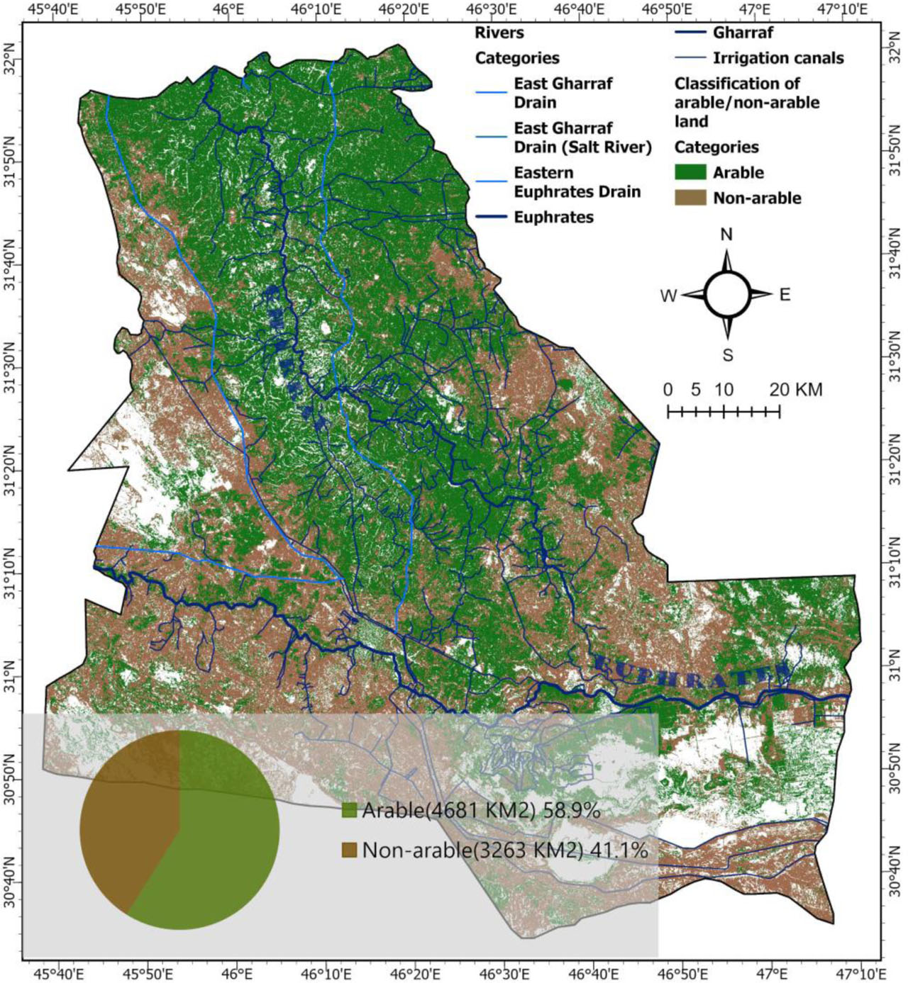
Figure 8:
Spatial distribution of arable/non-arable land