
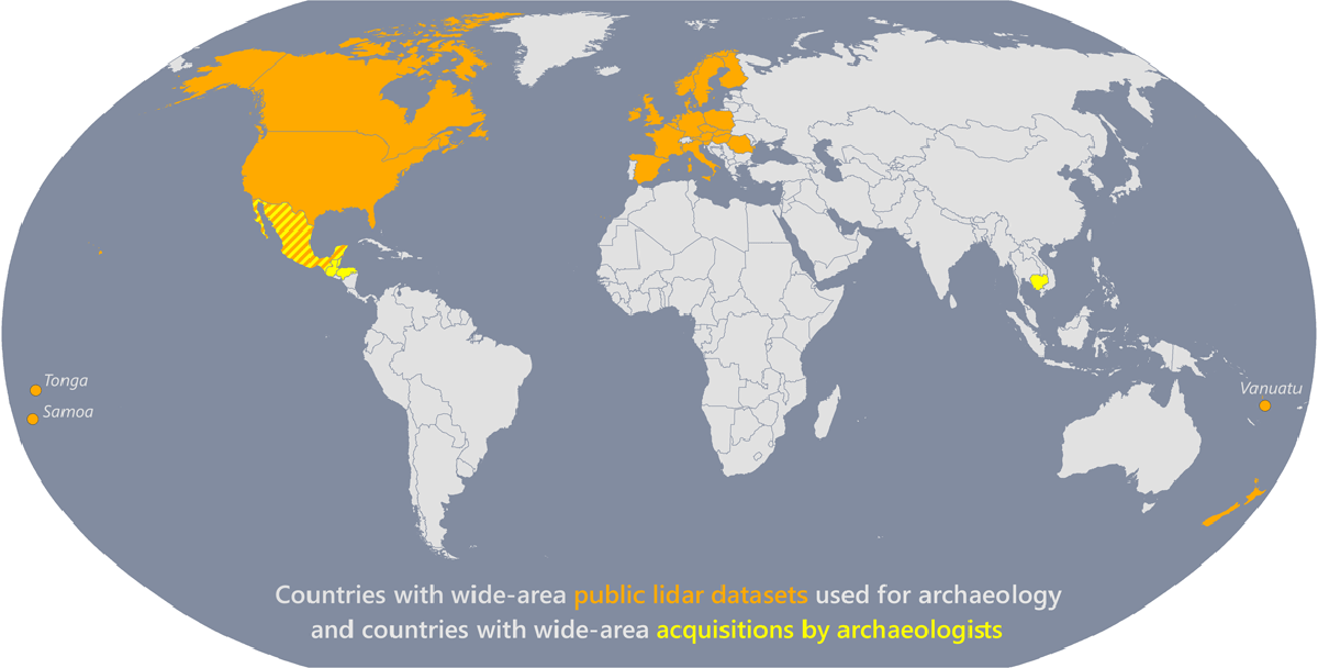
Figure 1
Map of countries for which there are wide-area public lidar datasets used for archaeology and countries with wide-area acquisitions by archaeologists in the peer-reviewed literature (https://angkorlidar.org/bibliography/). We define “wide-area” as >100 km2.
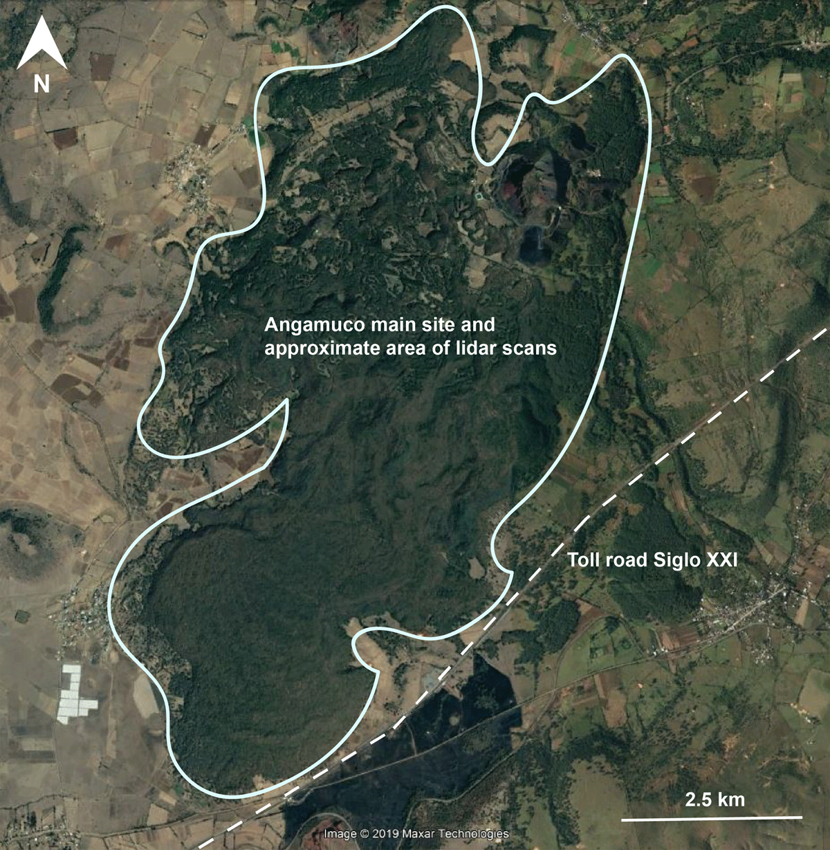
Figure 2
Map showing the location of the toll road (Auto Siglo XII) that was constructed after we had completed lidar scans of the ancient city of Angamuco, Mexico. While the toll road does not go through the heart of the site and architecture, the construction activities and modified landscape impact archaeologists’ abilities to interpret the hinterlands around the site.
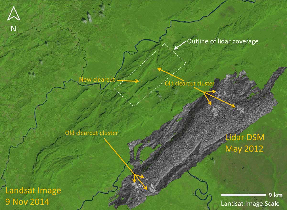
Figure 3
Image of clearcut in the Mosquitia region of Honduras that is visible in a lidar-derived Digital Surface Model (DSM). Arrows point to clearcut that had occurred prior to the lidar scans, and another example of deforestation that occurred after our scans. Lidar data were collected in May 2012. Base map is a Landsat 8 image collected 9 Nov 2014. Modified from image by Juan Carlos Fernández-Diaz.
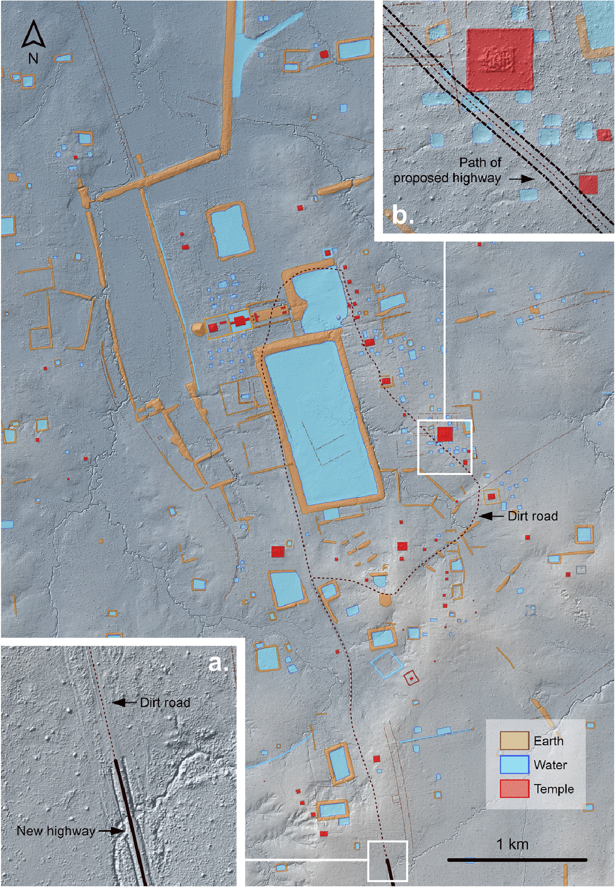
Figure 4
Archaeological map of Koh Ker, in Cambodia, including a lidar hillshade/elevation composite and showing (a) where work was halted on the highway system; and (b) features that were under threat of destruction from the road works. Map data by Sarah Klassen and Damian Evans.