
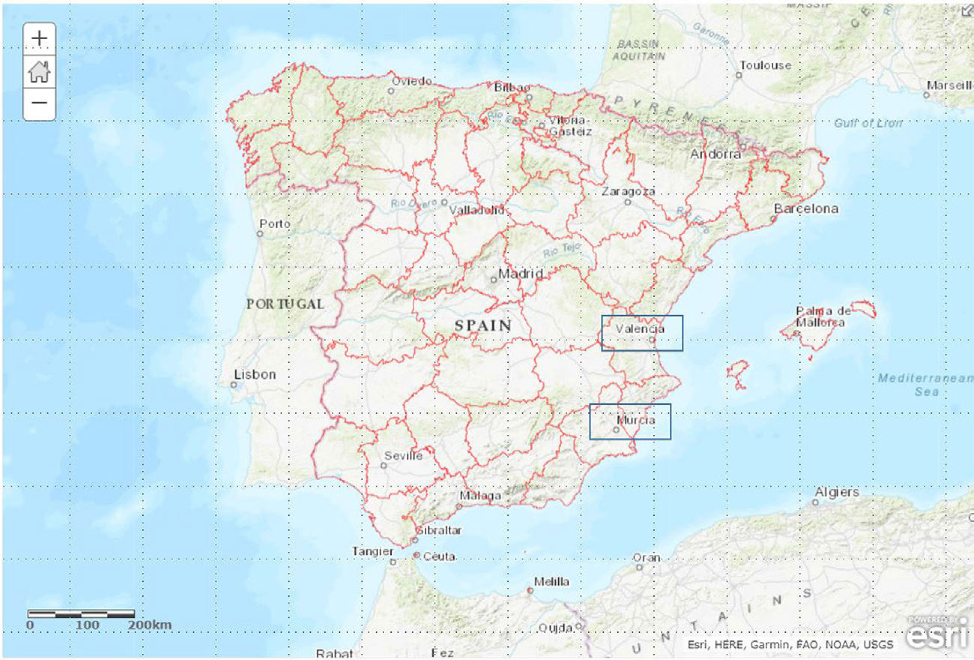
Fig. 1
Location of Murcia and Valencia.
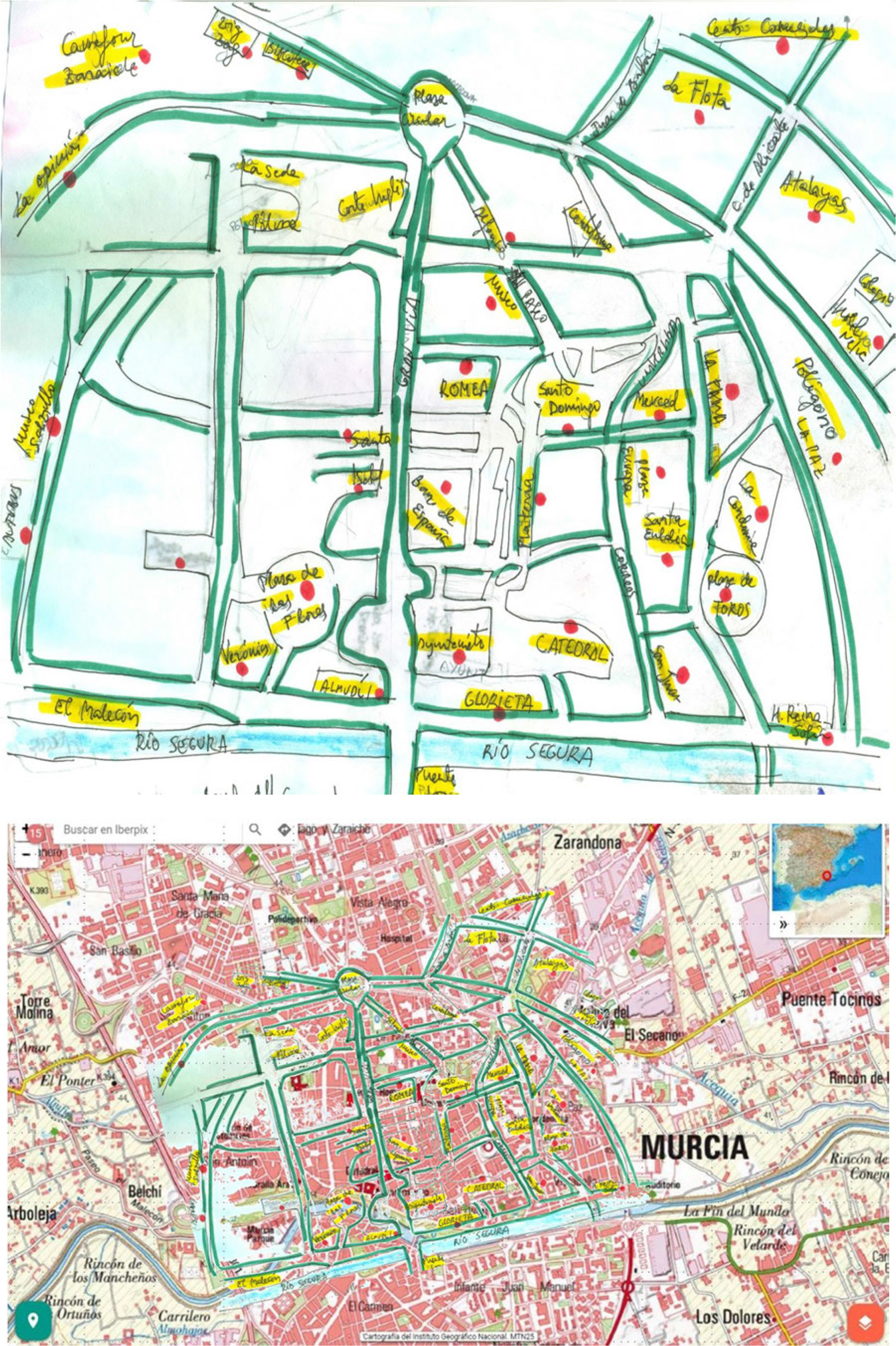
Fig. 2
A sketch of Murcia students’ perception and the same perception on a real map of Murcia.
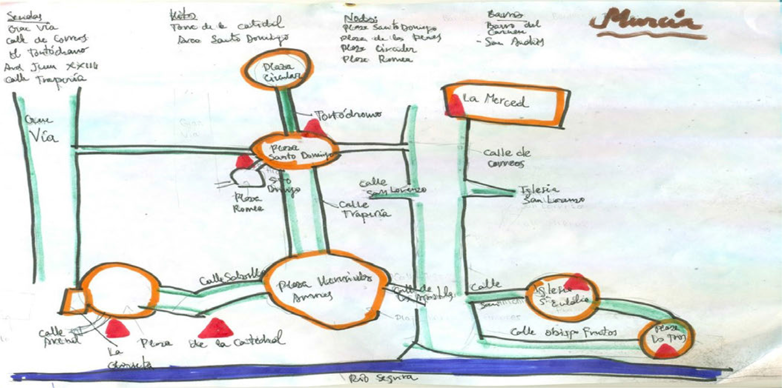
Fig. 3
A collective map of Murcia made by a group of 8 students presenting their perception about paths (sendas), landmarks (hitos), nodes (nodos) and districts (barrios). It highlights Murcia center-east because it is the traditional university leisure district. At the South, the Segura river as a border.
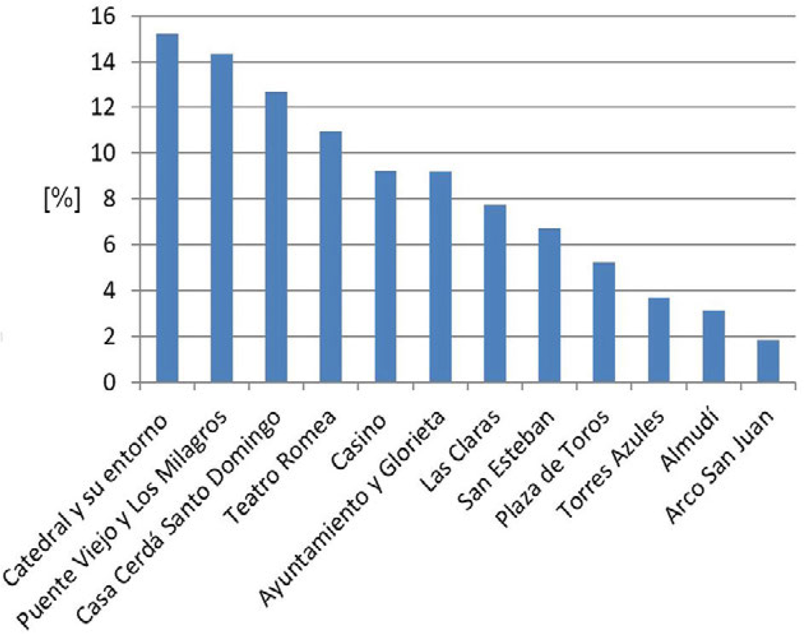
Fig. 4
Murcia landmarks according to survey results (% of the total respondents).
Table 2
Murcia elements highlighted by respondents in the categories established by Lynch (1960).
| Landmarks | Nodes | Paths | Edges or Borders |
|---|---|---|---|
| Cathedral and cathedral tower | Santo Domingo, Romea, Las Flores or Apóstoles Squares | Gran Vía Street | South ring road |
| Bullring (Plaza de toros) | Town Hall | Paseo Alfonso X Street | Segura River |
| Town Hall (Ayuntamiento) and Town Hall Square | Redonda, Diez de Revenga and Juan XXIII Square | Platería | Railway (El Carmen) |
| Almudí Palace | Morales Meseguer Hospital | Trapería | Malecón |
| Verónicas Market | Vieja Condomina | Alejandro Seiquier (post-office) | San Antón and Garay roads |
| Segura river bridges | La Merced University | Avenida de la Fama | |
| San Esteban | El Carmen railway station | Avda. Liberty (Libertad) | |
| Las Claras | Bus station | Avda. Juan de Borbón | |
| Romea Theatre | Floridablanca and La Pólvora Gardens | Avda. Juan Carlos I | |
| North and East roads | |||
| Casino | El Rollo | Avda. Floridablanca | |
| Blue Towers | Cartagena Street | ||
| Godoy Tower |
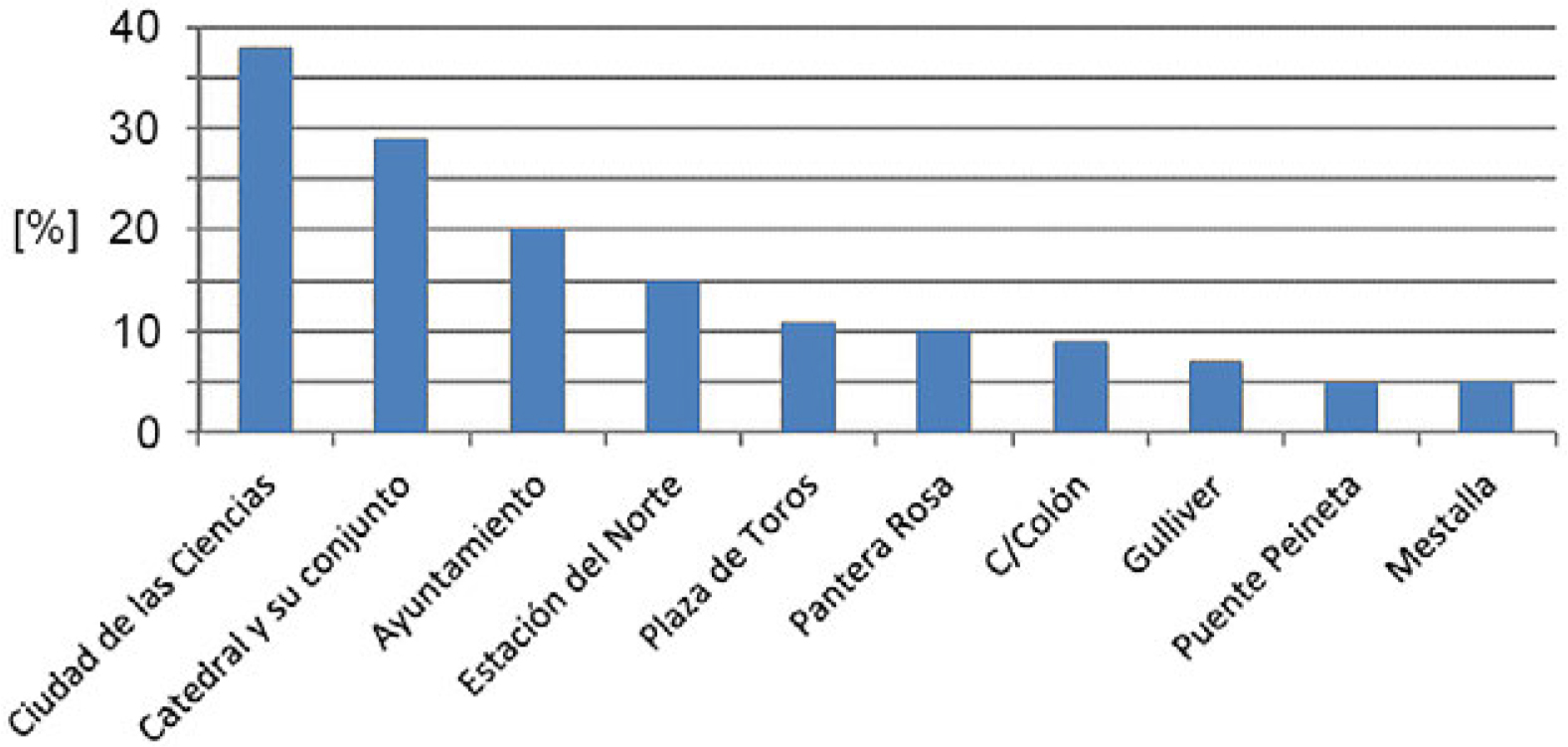
Fig. 5
Valencia landmarks according to survey results (% of the total respondents).
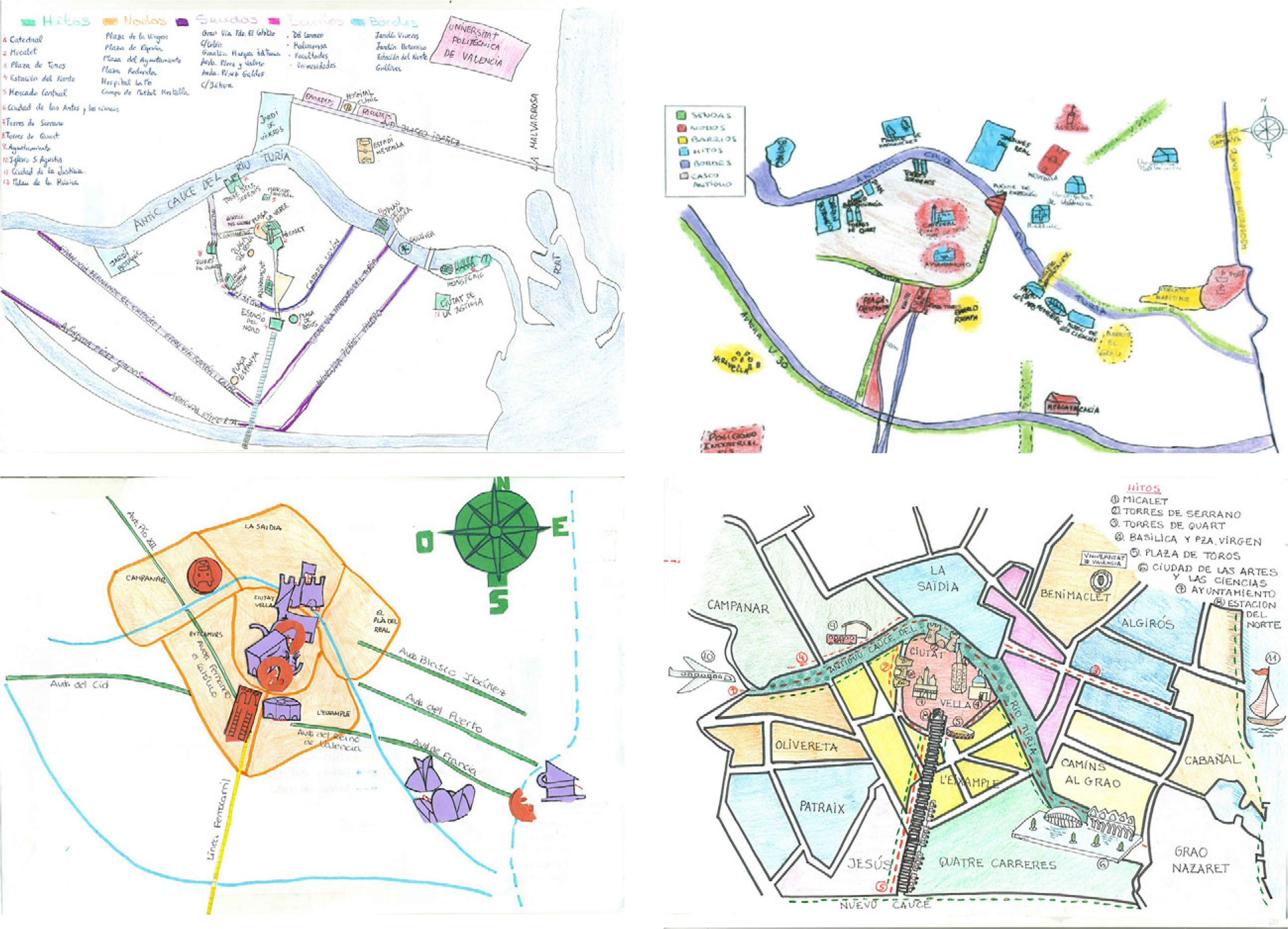
Fig. 6
Drawings of perceptions of Valencia made in groups of 6–9 university students of Valencia.
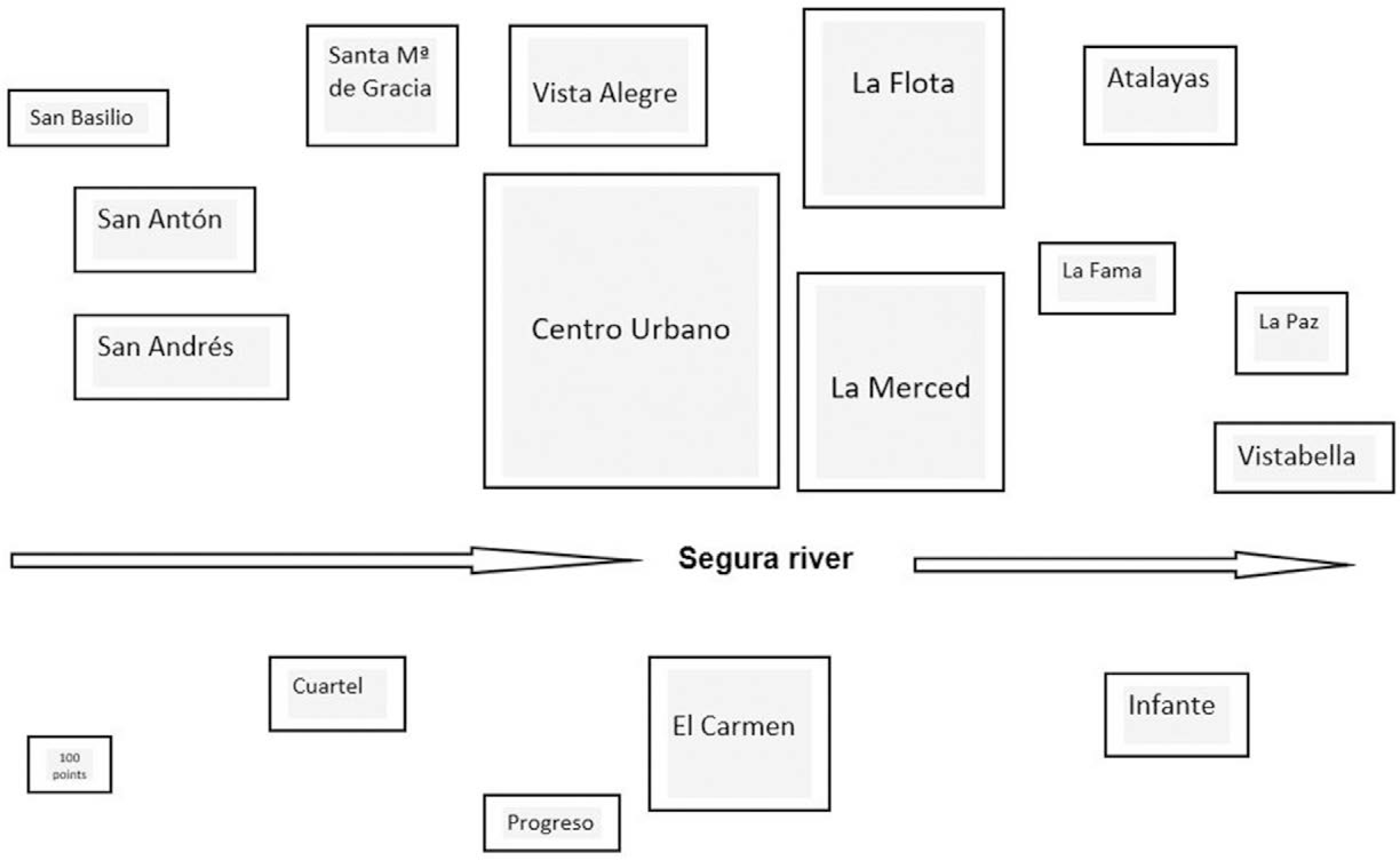
Fig. 7
Murcia’s neighbourhoods.
Table 3
Valencia’s elements highlighted by respondents in the categories established by Lynch (1960).
| Landmarks | Nodes | Paths | Edges or Borders |
|---|---|---|---|
| Cathedral | La Virgen | Colón, Guillén de Castro and Xátiva streets | Streets of La Pechina, De la Alameda, Avda. Francia |
| La Reina | |||
| Town Hall | |||
| Miquelet | España and Redonda squares | San Vicente Mártir | Turia river (old and new riverbed) |
| Bullring | La Fe Mestalla Hospital | Ruzafa street | Railway |
| Ciutat de les Arts i les Ciències | University | Barón de Cárcer | Sea border |
| Serrano Towers | North railway station | Avda. de Fernando el Católico/Ramón y Cajal | |
| Quart Towers | Bus station | Pérez Gáldos/Giorgeta | |
| Town Hall | Perís y Valero/Ausías March | ||
| La Música Palace | Germanías/Marqués del Turia | ||
| Central and Colon Markets | Blasco Ibañez/El Puerto avenue | ||
| Bridges |
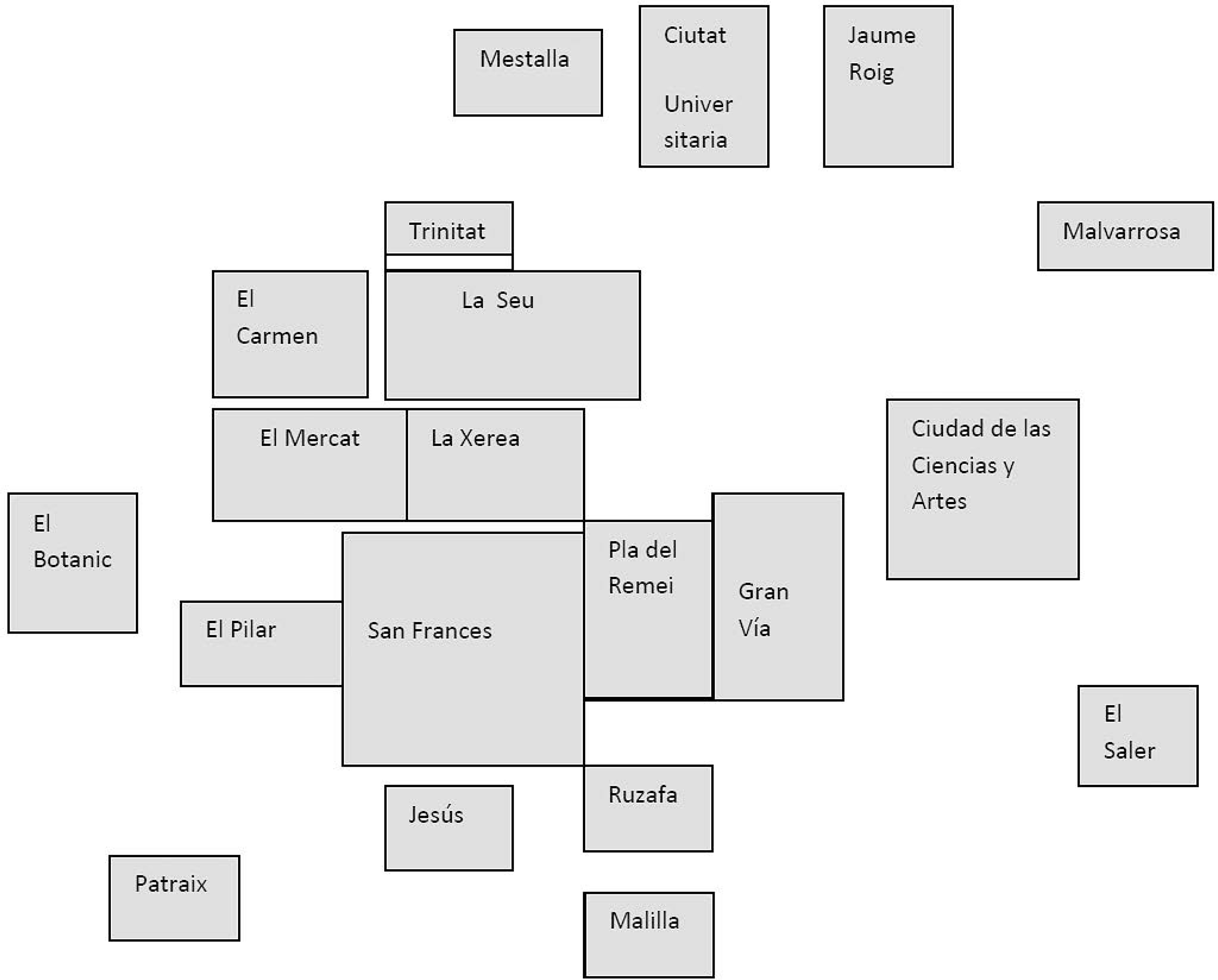
Fig. 8
Valencia’s neighbourhoods.
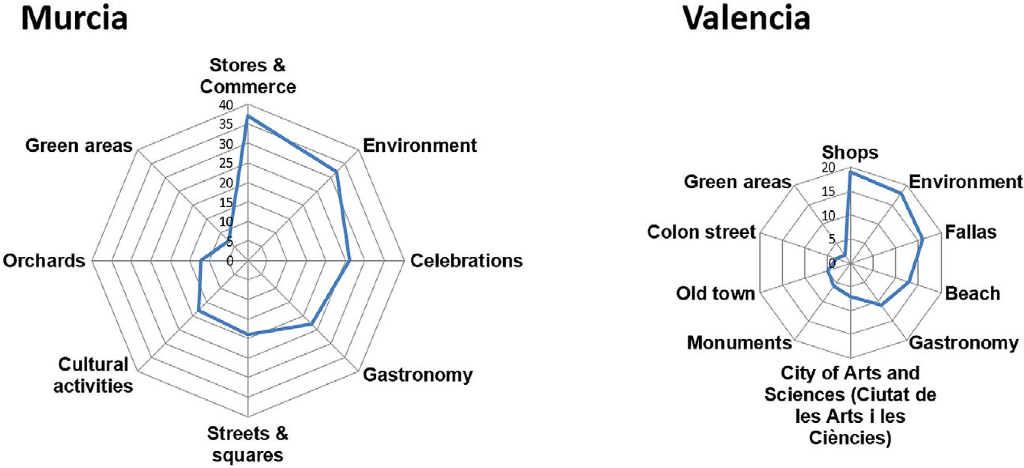
Fig. 9
Elements in Murcia and Valencia that respondents consider they would miss on leaving the city.
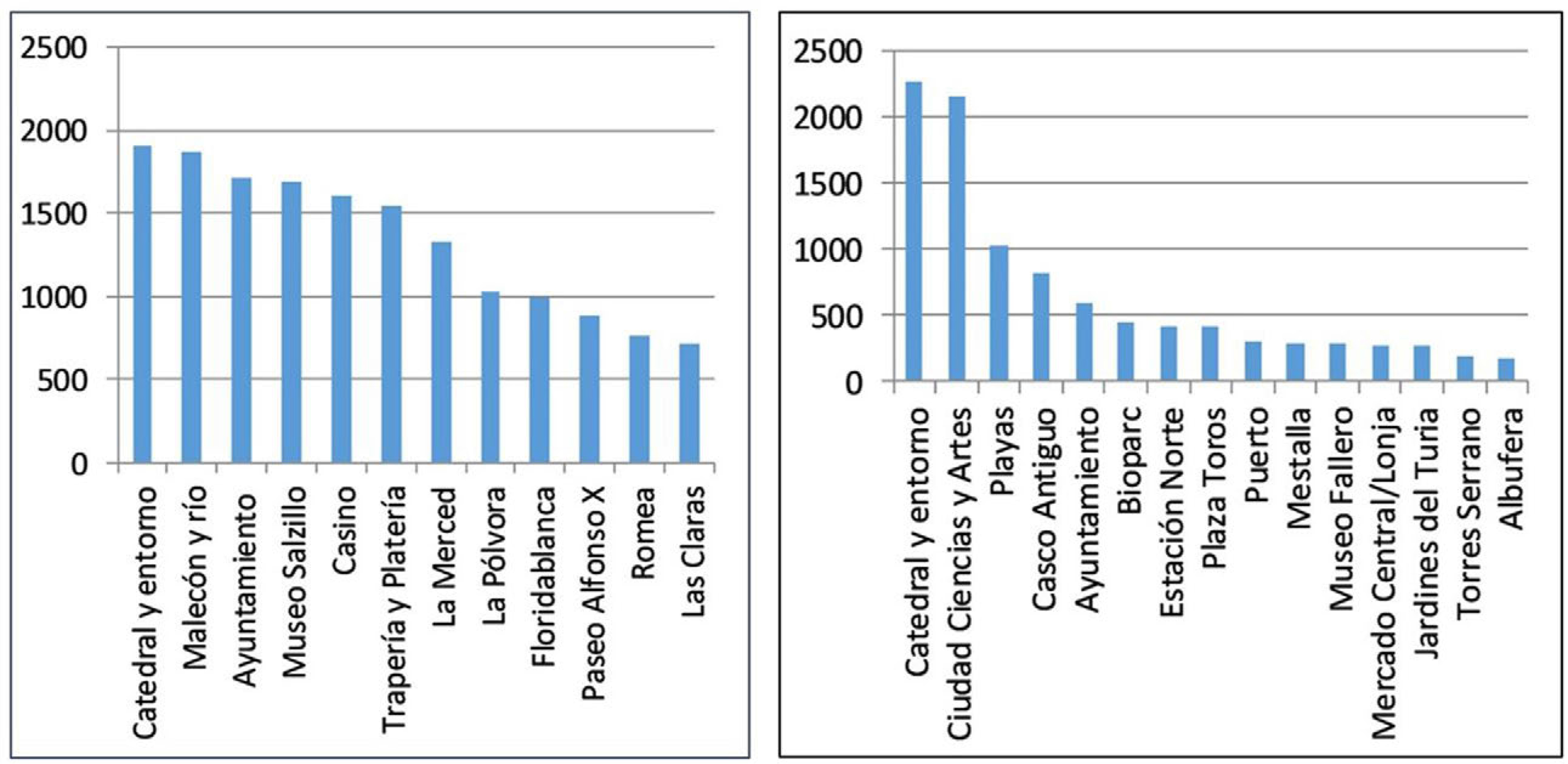
Fig. 10
Places to show to other visitors, the scores assigned according to the responses of the surveys in Murcia (left) and Valencia (right).