

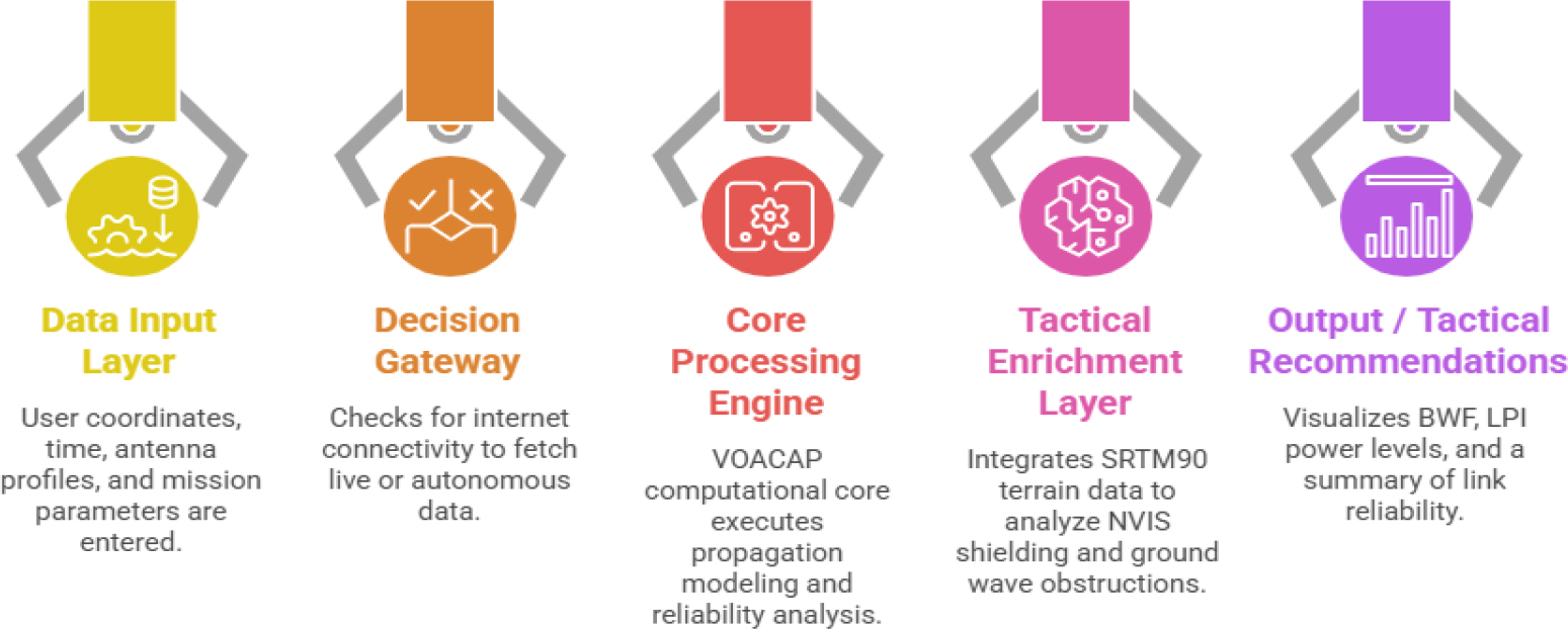
Figure no. 1:
System Operational Architecture: Integrated data fusion and decision logic flow for HF Predictor Romania
(Source: Authors, AI-generated)
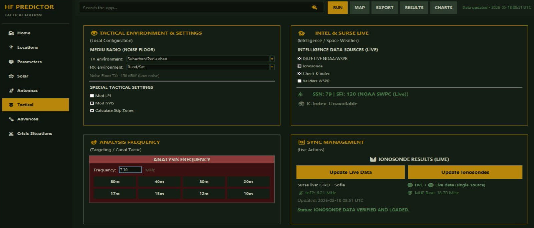
Figure no. 2:
The tactical configuration interface of HF Predictor Romania, illustrating the integration of live ionospheric data, solar indices, and tactical environment settings
(Source: Authors, original application GUI)
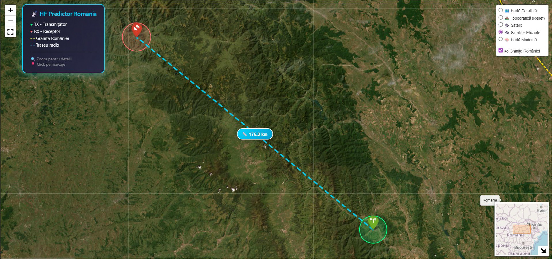
Figure no. 3:
Geographical configuration of the analysed HF link. The 176.3 km great-circle propagation path is visualized on a topographic map to assess potential terrain-induced obstructions (In-app view of the integrated geographical context module)
(Source: Authors, image generated using the Folium Python library. Map tiles by © OpenStreetMap contributors, OpenTopoMap, and Esri World Imagery)
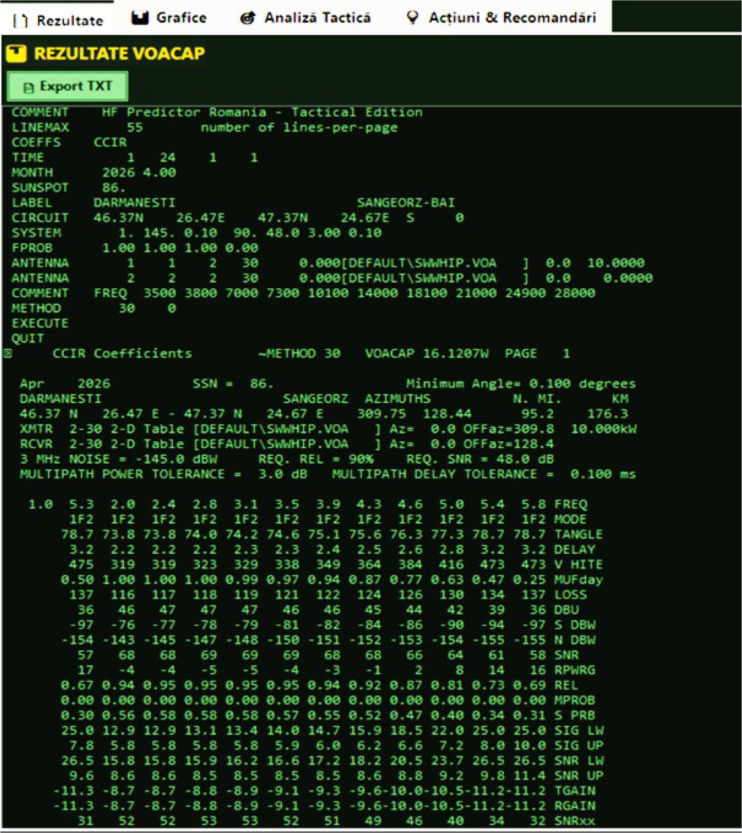
Figure no. 4:
The results matrix of VOACAP simulation for the Dărmănești – Sângeorz-Băi HF radio link, providing an hour-by-hour assessment of propagation reliability and signal quality
(Source: Authors, results of simulation by VOACAP engine)
Table no. 1
Key Findings and Tactical Advantages of the HF Predictor Simulation-Example
| Metric | Standard Static VOACAP | HF Predictor Romania | Operational Significance |
|---|---|---|---|
| Data Basis | Historical Monthly Medians | Live GIRO + NOAA Fusion | Eliminates risk of planning on outdated atmospheric models. |
| Daytime Frequency Selection | 7.0 MHz | 5.3 MHz (Adjusted for foF2 drop) | Prevents link failure due to skip-zone penetration or ionospheric penetration. |
| Power Output Strategy | Fixed 100 W (Default) | Optimized to 15 W (LPI Module) | ~60% power-scale reduction; minimizes signature against enemy DF. |
| Operator Setup Time | ~5-10 Minutes (Manual data input) | < 10 Seconds (Automated execution) | Fast decision support in high-stakes tactical scenarios. |