
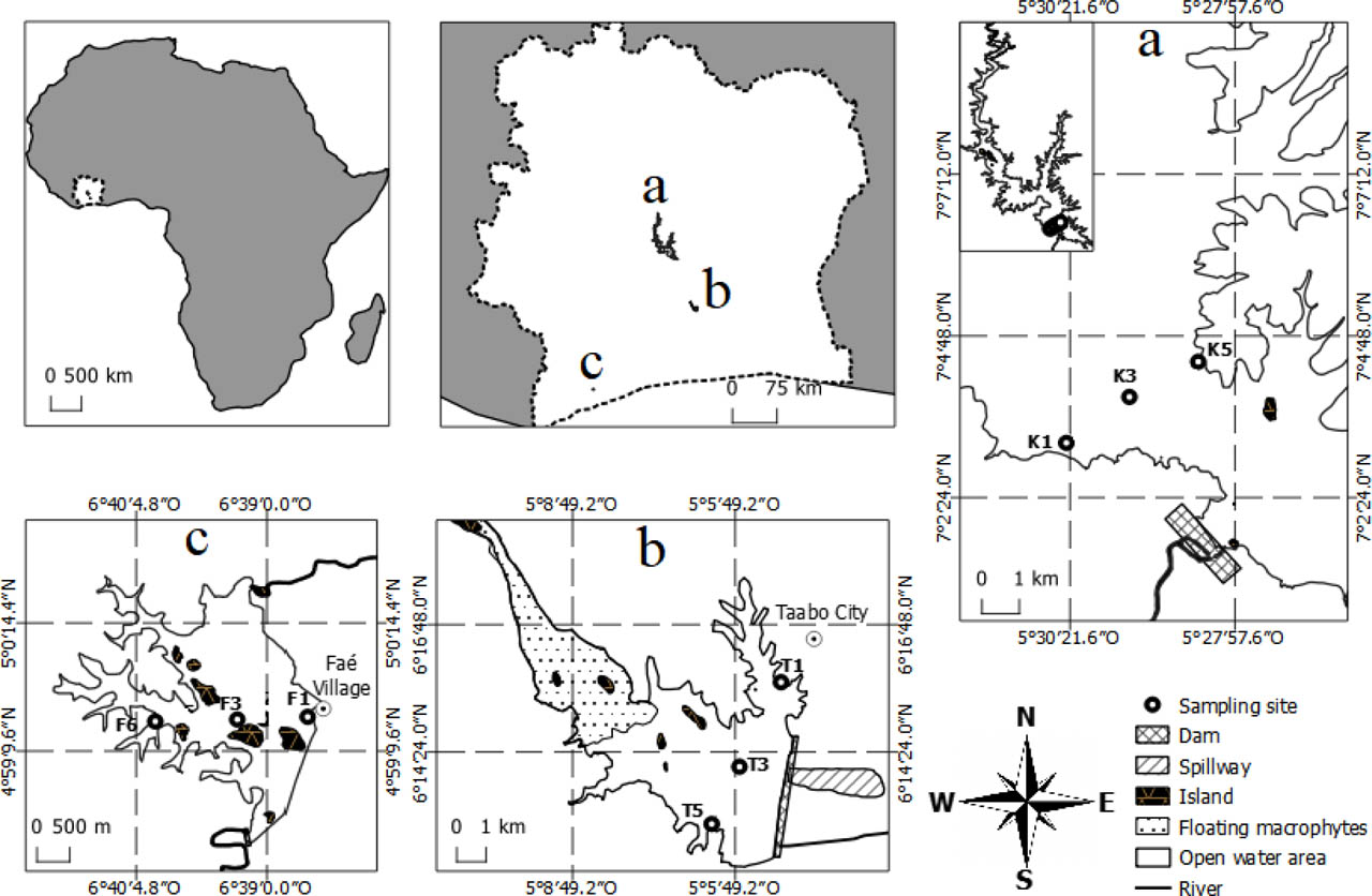
Fig. 1
Location of sampling stations in the studied reservoirs. a: Lake Kossou; b: Lake Taabo; c: Lake Faé (Tiémoko et al. 2025)
Table 1:
Coordinates and characteristics of the sampling sites in each man–made reservoir
| Reservoirs | Sampling points | Description of land use types | Coordinates | |
|---|---|---|---|---|
| Latitude (N) | longitude (W) | |||
| Kossou | K1 | Small village near of the lake, cattle farming, mining activities in the shore | 07°03′12.5″ | −05°30′25.1″ |
| K3 | Fishing area | 07°03′53.3″ | −05°29′30.1″ | |
| K5 | of the lake, cattle farming | 07°04′24.6″ | −05°28′30.2″ | |
| Taabo | T1 | Urban zone near of lake, cattle farming on the shore, agriculture (hevea, cassava crops) | 06°15′46.6» | −05°04′57.4» |
| T3 | Fish farming into the lake, fishing area | 06°13′58.3» | −05°05′45.2» | |
| T5 | Big village close to the lake, fishing area, agriculture | 06°12′59.2» | −05°06′14.6» | |
| Fae | F1 | Big village very close to the lake, fishing area | 04°59′24.2» | −06°38′01.3″ |
| F3 | Fishing area, watercourse pathway, agriculture on the shore (cocoa, hevea) | 04°59′26.3» | −06°39′00.8″ | |
| F6 | Fishing area, agriculture on the shore (cocoa, hevea crops) | 04°59′24.5» | −06°39′55» | |
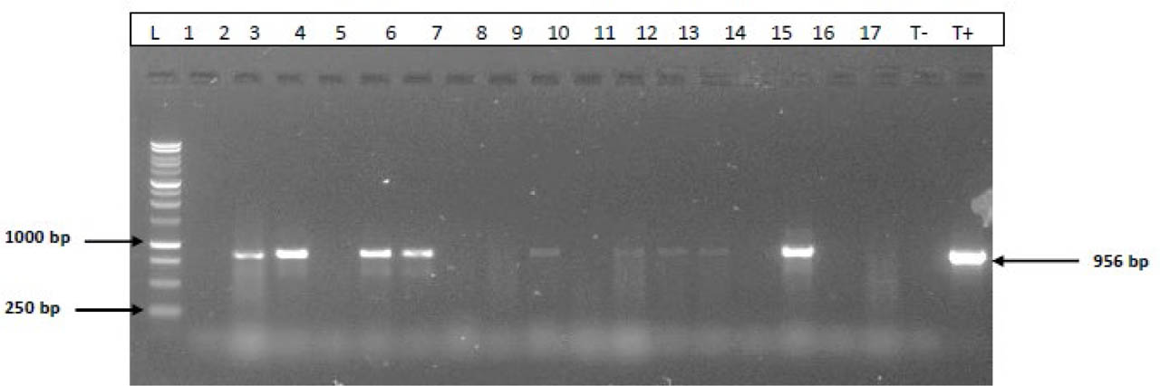
Fig. 2
Gel electrophoresis (1.5%) of amplified 16S rRNA gene products from P. aeruginosa. L: molecular weight marker (1kb); 1–17: samples; T-: negative control, T+: positive control (956 bp)
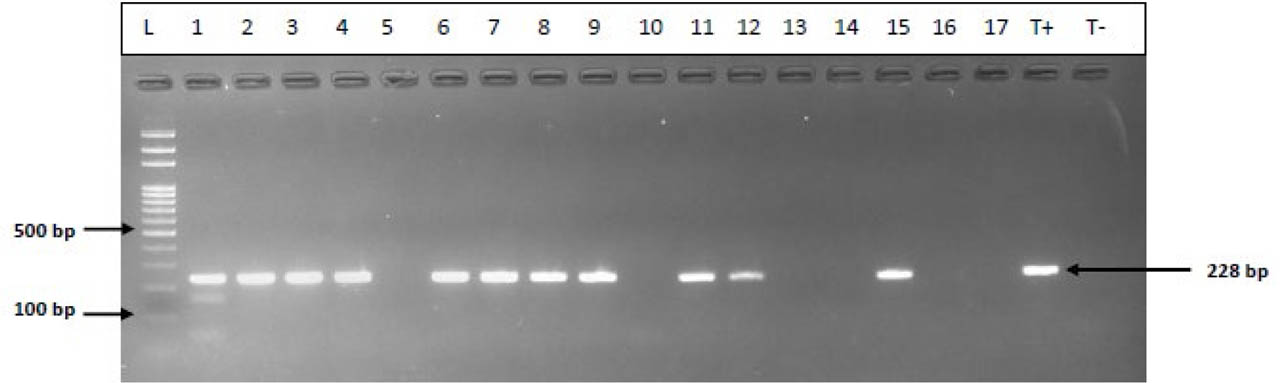
Fig. 3
Gel electrophoresis (1.5%) of amplified 16S rRNA gene products from S. aureus. L: molecular weight marker (100 bp); 1–17: samples; T-: negative control, T+: positive control (228 bp)
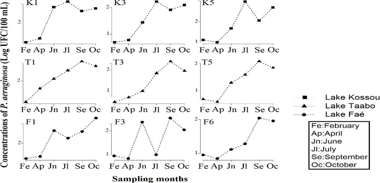
Fig. 4
Spatial and temporal variation of P. aeruginosa in hydroelectric reservoirs. Lake Kossou sampling sites: K1, K3, K5; Lake Taabo sampling sites: T1, T3, T5; Lake Faé sampling sites: F1, F3, F5.
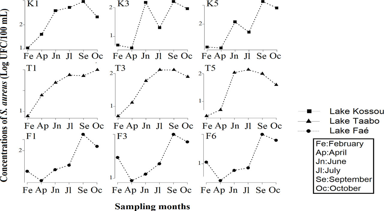
Fig. 5
Spatial and temporal variation of S. aureus in hydroelectric reservoirs. Lake Kossou sampling sites: K1, K3, K5; Lake Taabo sampling sites: T1, T3, T5; Lake Faé sampling sites: F1, F3, F5.
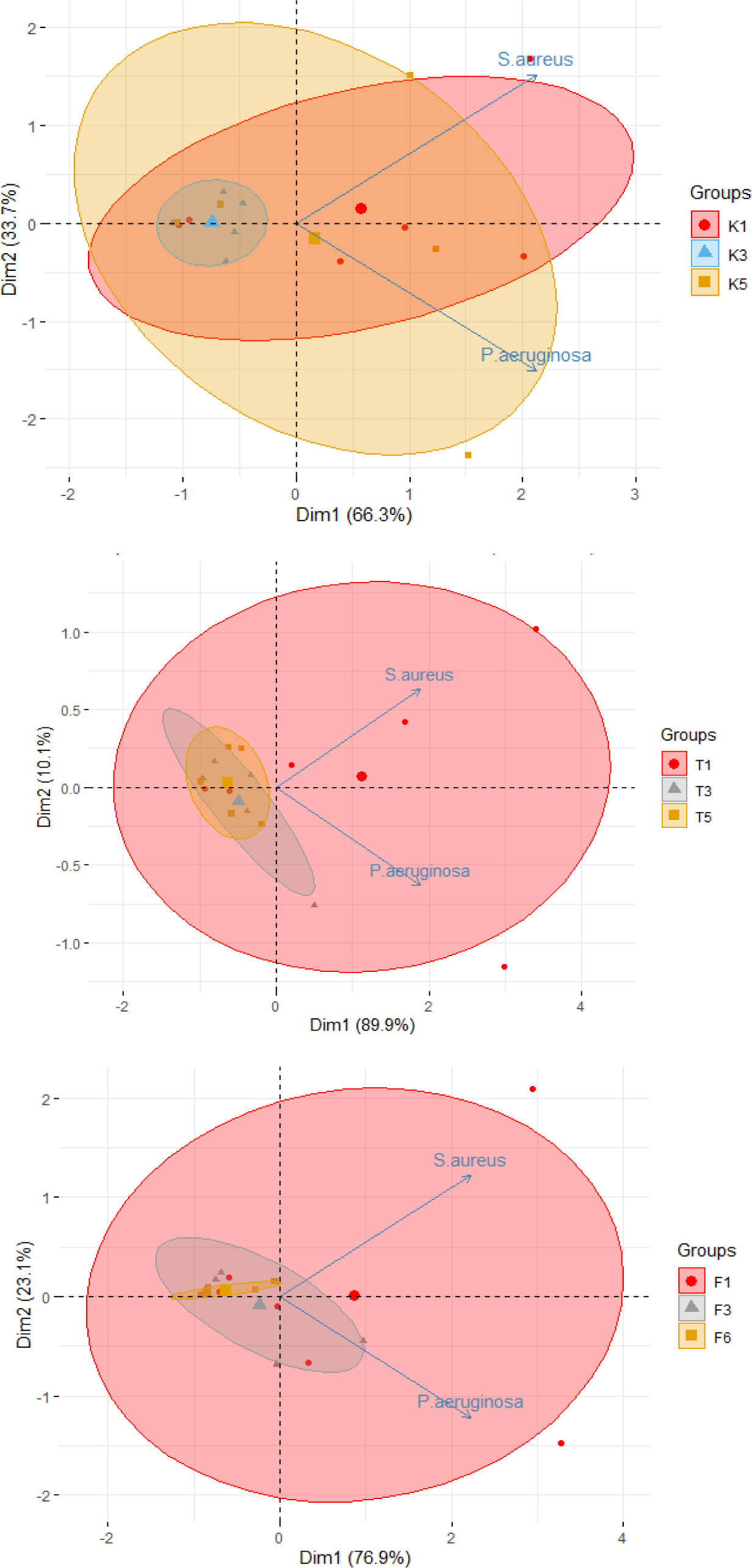
Fig. 6
Principal Component Analysis (PCA) on the distribution of bacteria; Pseudomonas aeruginosa: P. aeruginosa; Staphylococcus aureus: S. aureus; Lake Kossou sampling sites: K1, K3, K5; Lake Taabo sampling sites: T1, T3, T5; Lake Faé sampling sites: F1, F3, F6
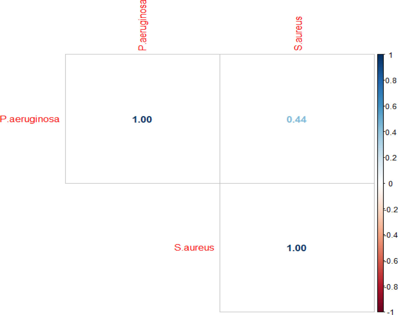
Fig. 7
Relation between pathogen bacteria in all hydroelectric reservoirs