
Table 1.
Results of OSL dating of river sediments adjacent to the studied lakes.
| Sample number | Sample name (depth) | Laboratory sample number LUB | 40K | 226Ra | 228Th | Annual dose rate dr | Cosmic dose rate de | Age OSL |
|---|---|---|---|---|---|---|---|---|
| [m] | [–] | [Bq kg-1 | [Gy ka-1] | [Gy] | [ka] | |||
| 1 | Piaseczno P1 (1.3) | 6340 | 117±6 | 1.26±0.21 | 6.81±0.53 | 0.68±0.09 | 16.58±0.45 | 24.75±3.75 |
| 2 | Piaseczno P2 (2.0) | 6341 | 128±5 | 8.43±0.58 | 7.10±0.67 | 0.87±0.10 | 21.88±0.53 | 25.15±2.67 |
| 3 | Piaseczno P6.1 (0.7) | 6428 | 157±6 | 3.06±0.39 | 6.84±0.60 | 0.87±0.11 | 19.44±0.64 | 22.47±2.94 |
| 4 | Piaseczno P6.2 (1.1) | 6429 | 114±6 | 4.42±0.54 | 4.33±0.36 | 0.70±0.10 | 18.37±0.64 | 26.25±3.86 |
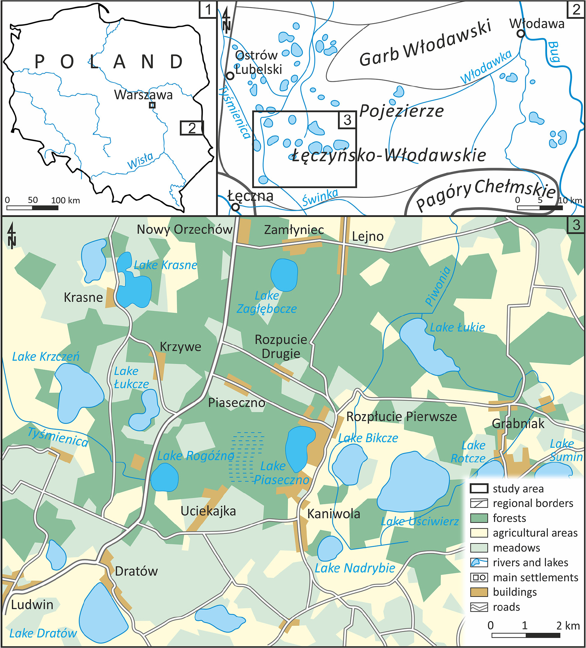
Fig. 1.
Location of the study area.
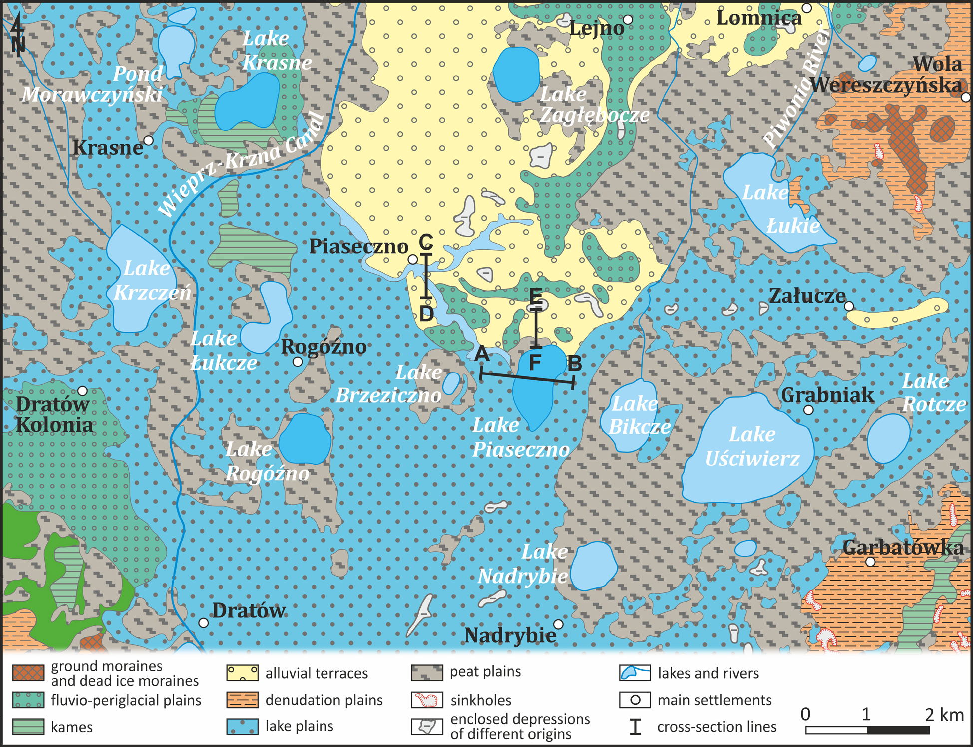
Fig. 2.
Geomorphological sketch of the areas around the studied lakes (according to Liszkowski 1977, 1979; Buraczynski, Wojtanowicz 1979, 1981; Krawczyk 2021, 2023; Kucharska 2021, 2023).
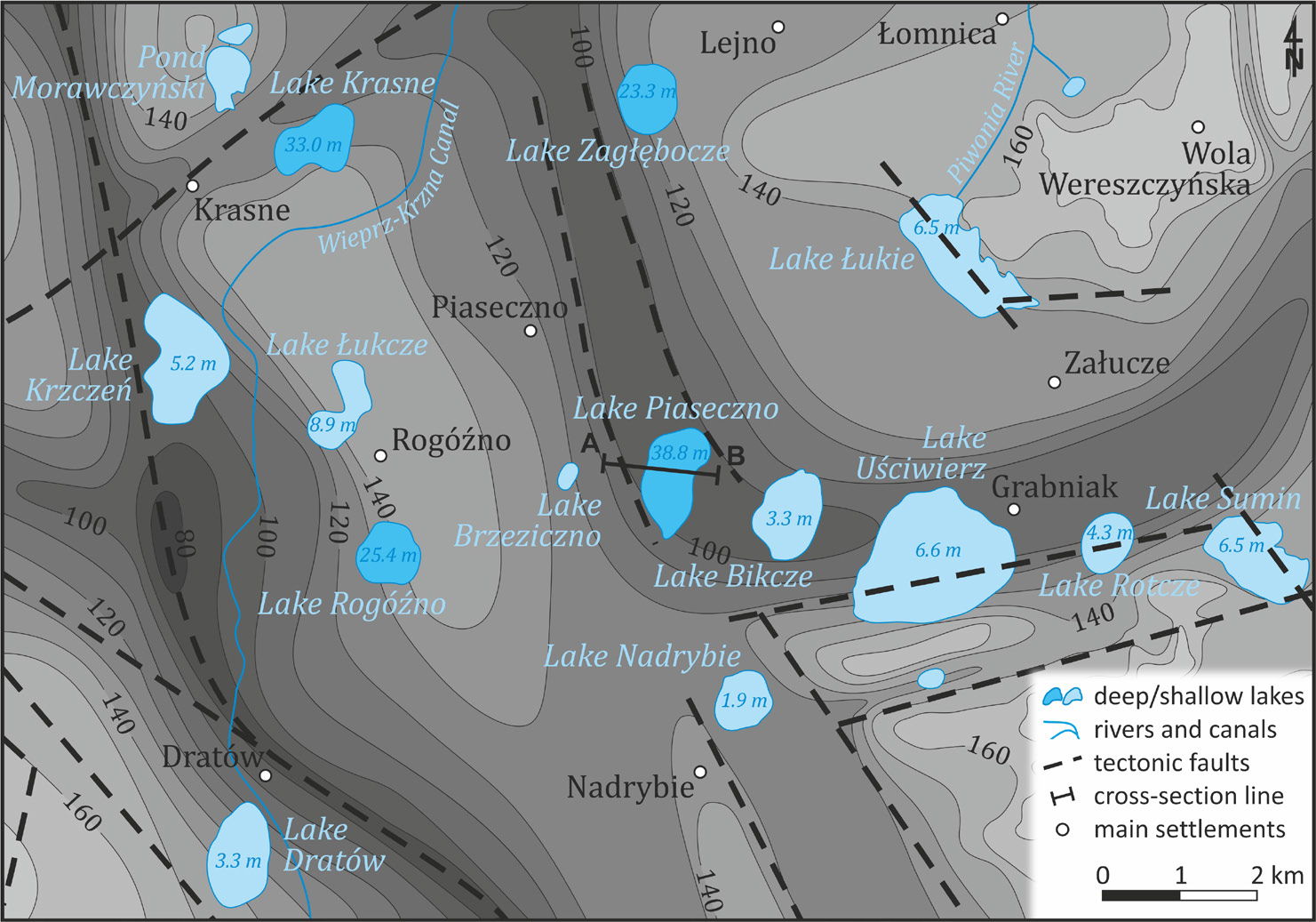
Fig. 3.
The shape of the bedrock surface of the Quaternary sediments (according to Liszkowski 1979; Buraczynski, Wojtanowicz 1981; Krawczyk 2023; Kucharska 2023).
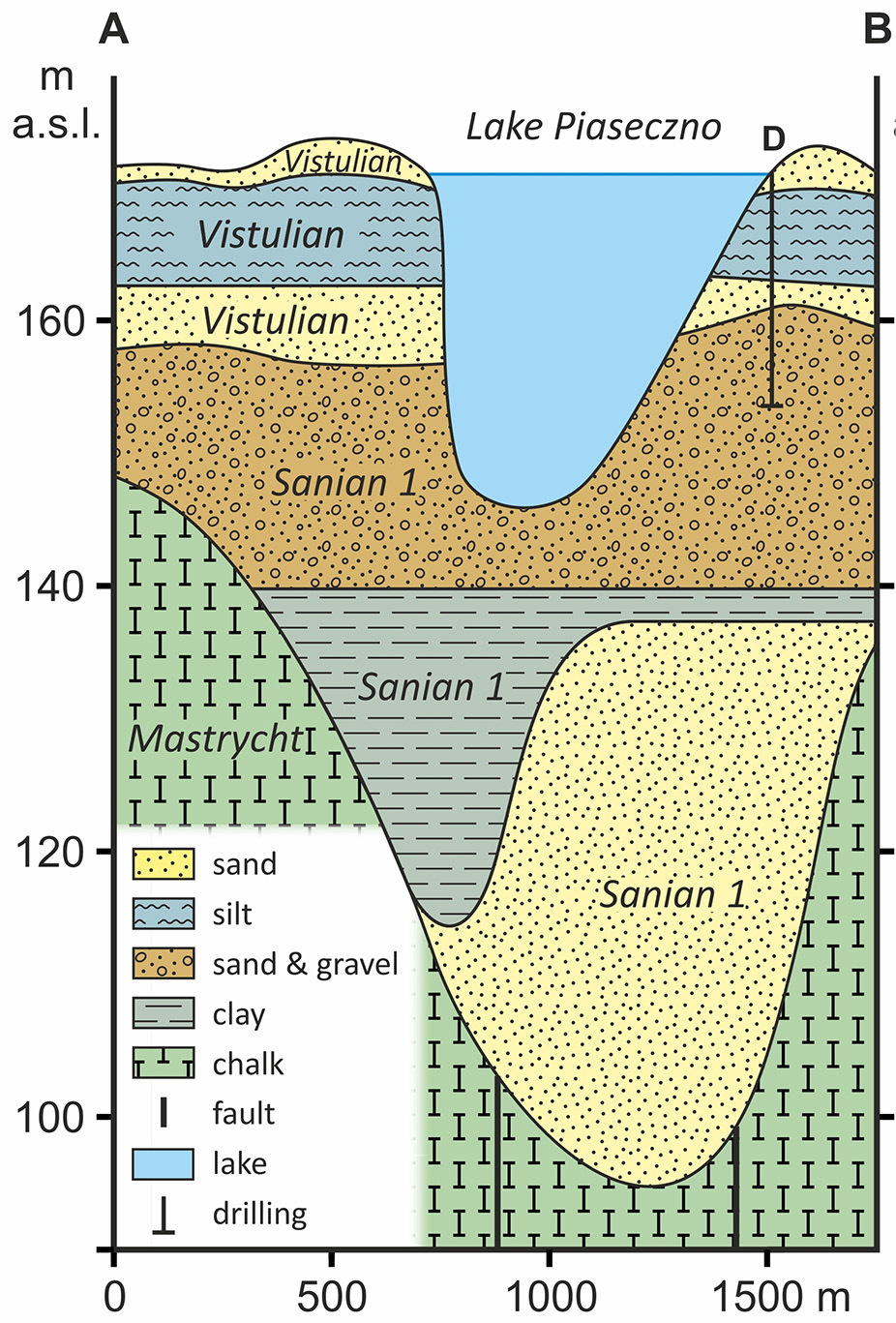
Fig. 4.
Morphological and geological cross-section A–B through the Quaternary sediments of the Piaseczno Lake area (by Harasimiuk (1996, p. 8); sediment stratigraphy according to Kucharska (2023).
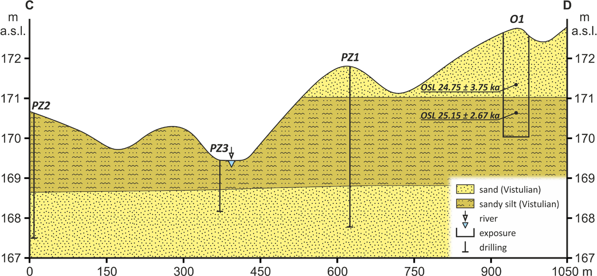
Fig. 5.
Morphological and geological cross-section C–D through the Vistulian sediments of the Piaseczno Lake area.
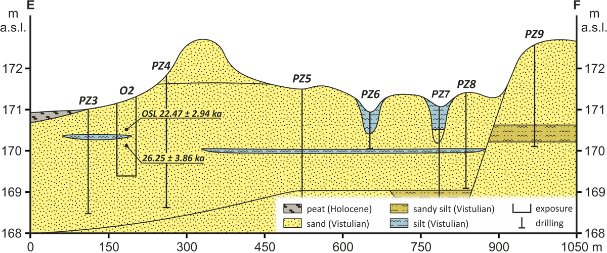
Fig. 6.
Morphological and geological cross-section E–F through the Vistulian sediments of the Piaseczno Lake area.
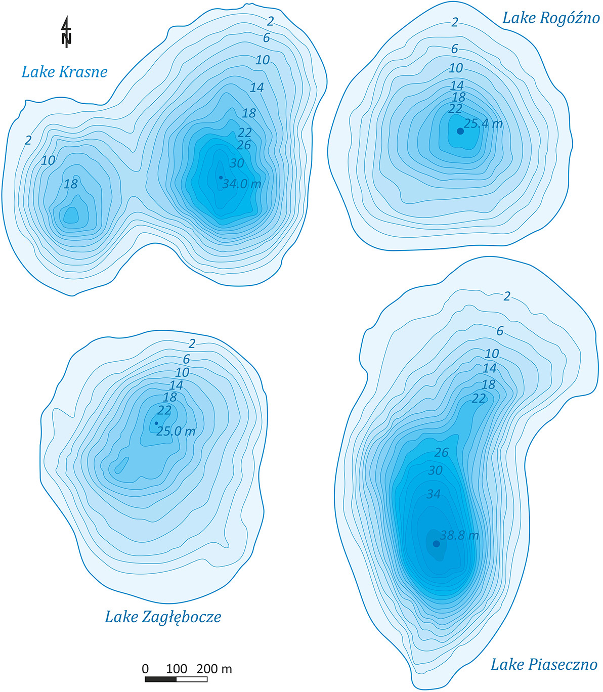
Fig. 7.
Morphometry of selected lakes Łęczna-Włodawa Lakeland by Wilgat (1954).
Table 2.
Morphometric parameters of selected lakes of the Łęczna-Włodawa Lakeland (after: Wilgat 1954, Michalczyk, Wilgat 1998).
| Lake Name | Elevation | Area | Length | Width | Lake shape index | Depth | Volume | Average gradient of slopes |
|---|---|---|---|---|---|---|---|---|
| [m a.s.l.] | [ha] | [m] | [–] | [m] | [1.000 m3] | [–] | ||
| Krasne | 164.0 | 75.9 | 1228 | 856 | 0.50 | 33.0 | 8180 | 4°55' |
| Piaseczno | 170.6 | 84.7 | 1464 | 819 | 0.40 | 38.8 | 10674 | 4°50' |
| Rogóźno | 167.7 | 57.1 | 938 | 846 | 0.65 | 25.4 | 4209 | 3°20' |
| zagłębocze | 166.8 | 59.0 | 942 | 798 | 0.66 | 25.0 | 4279 | 3°15' |
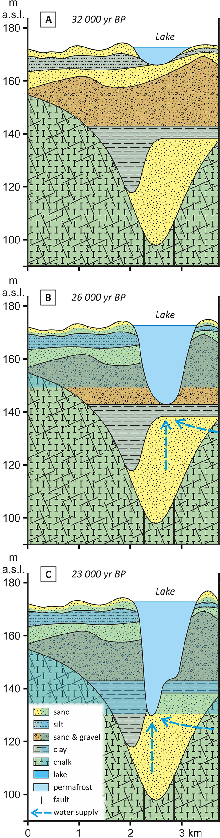
Fig. 8.
Stages of development of the Piaseczno Lake basin (stratigraphy as in Fig. 4).
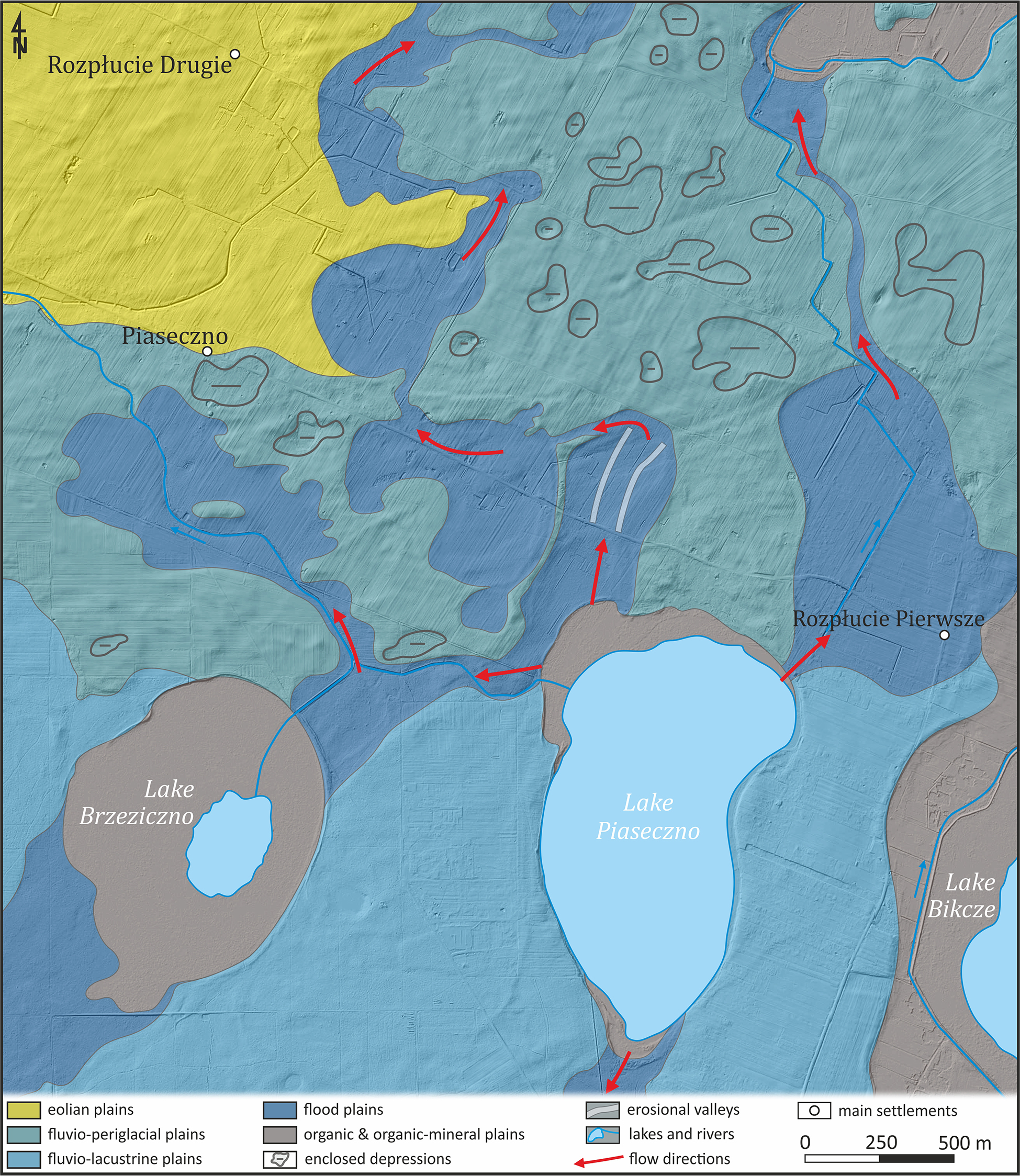
Fig. 9.
Directions of water outflow from Lake Piaseczno during the main stadial.