
Fig. 1.
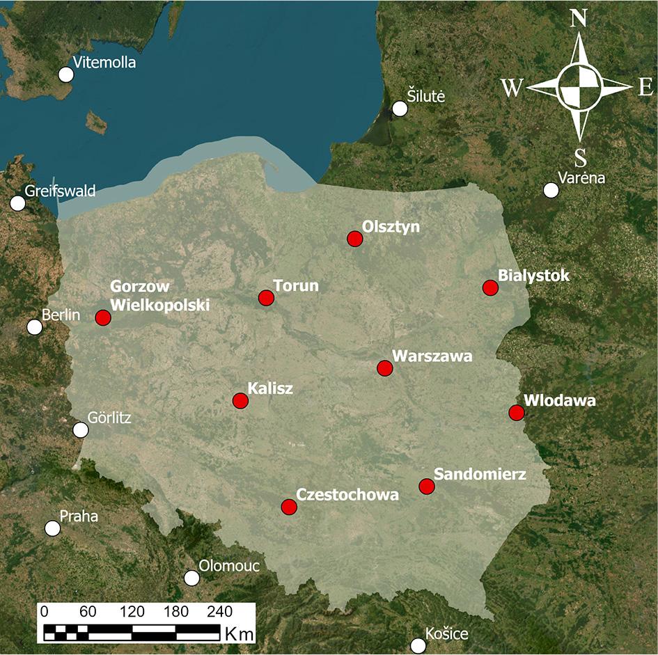
Fig. 2.
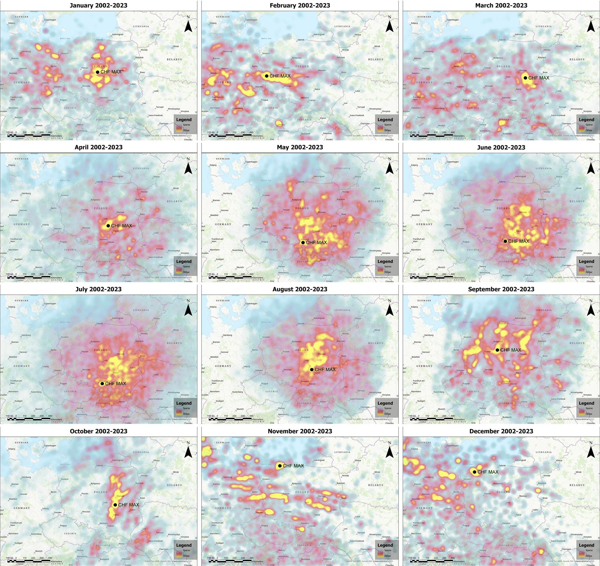
Fig. 3.
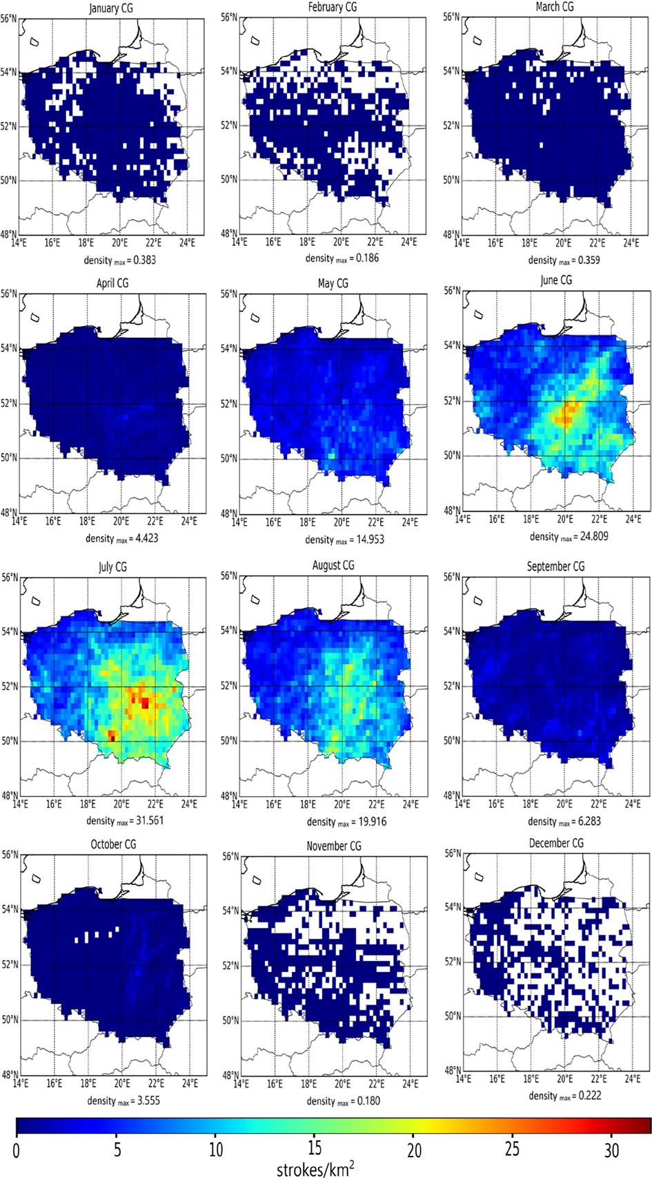
Fig. 4.
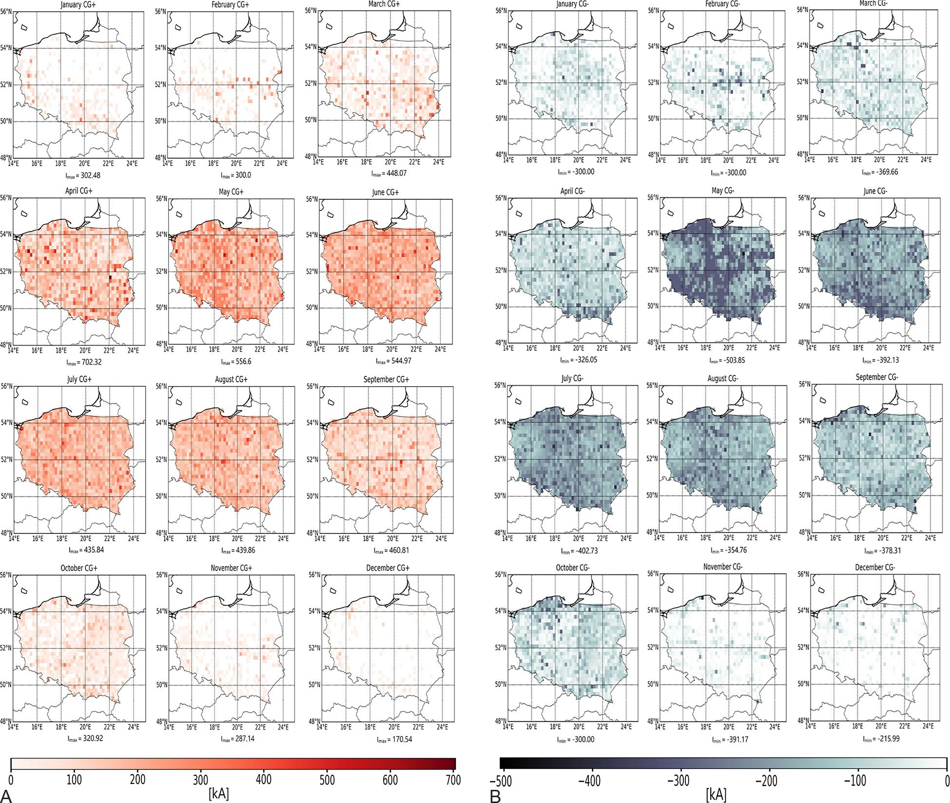
Fig. 5.
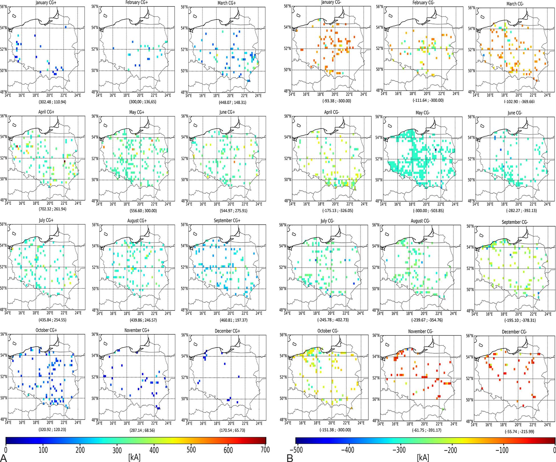
Fig. 6.
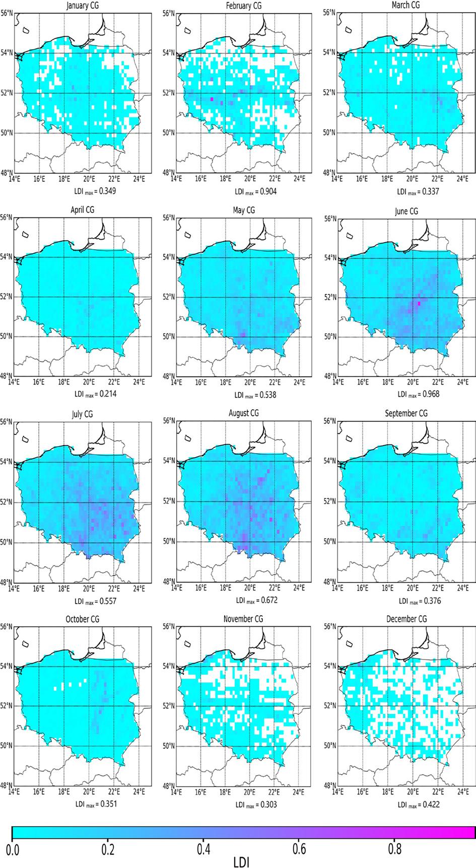
Fig. 7.
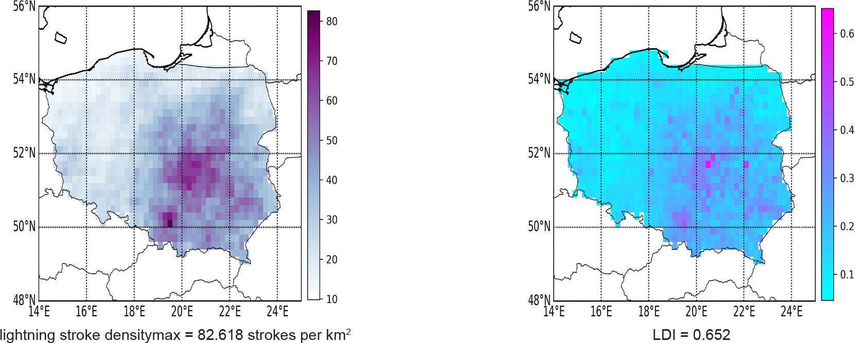
Fig. 8.
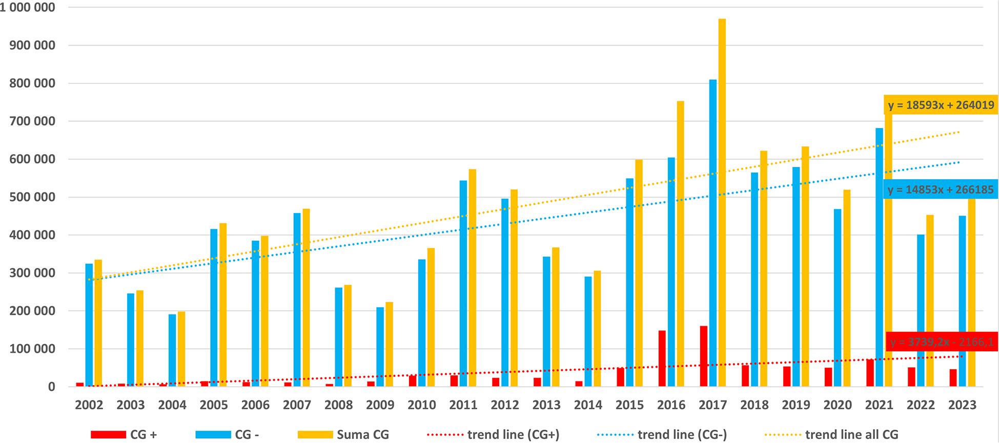
Linear regression equation (y = ax + b) and determination coefficient (R2) calculated for both CG lightning stroke polarities throughout all analysed periods_
| Month | Lightning stroke polarisation | |||
|---|---|---|---|---|
| CG+ | CG– | |||
| y = ax + b | R2 | y = ax + b | R2 | |
| January | y = 13.879x + 3.66 | 0.6181 | y = –11.31x – 64.467 | 0.2391 |
| February | y = 14.863x + 13.61 | 0.3034 | y = –10.373x – 30.107 | 0.2824 |
| March | y = 11.839x + 147.99 | 0.4005 | y = –6.4458x – 164.47 | 0.1545 |
| April | y = 22.99x + 148.22 | 0.4399 | y = –7.3853x – 226.65 | 0.4459 |
| May | y = 12.473x + 233.57 | 0.6575 | y = –5.1407x – 270.09 | 0.2713 |
| June | y = 15.614x + 216 | 0.5637 | y = –8.3806x – 247.83 | 0.3875 |
| July | y = 13.932x + 221.91 | 0.6835 | y = –12.032x – 227.91 | 0.6370 |
| August | y = 10.588x + 241.13 | 0.5576 | y = –6.3636x – 259.84 | 0.4303 |
| September | y = 13.974x + 206.04 | 0.6347 | y = –7.6922x – 238.83 | 0.6388 |
| October | y = 7.1687x + 210.76 | 0.3345 | y = –4.3605x – 245.87 | 0.1555 |
| November | y = 9.7656x + 94.167 | 0.3599 | y = –16.427x – 49.258 | 0.5741 |
| December | y = 13.813x + 31.565 | 0.5812 | y = –12.436x – 67.113 | 0.3457 |