
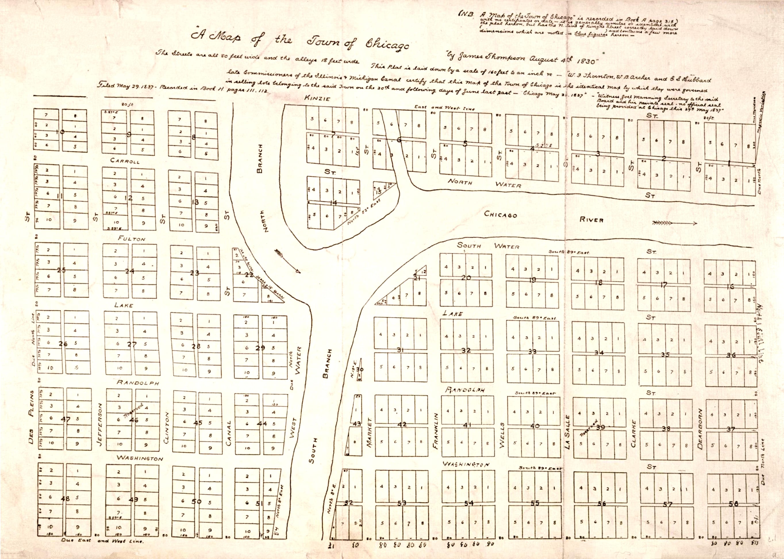
Figure 1
James Thompson’s plan of Chicago, made on 4 August 1830 to the order of the Illinois and Michigan Canal Commissioners. This marked the first formal recognition of a place named ‘Chicago’. (Chicago History Museum, ICHi-034284, with restoration by John M Wolfson).
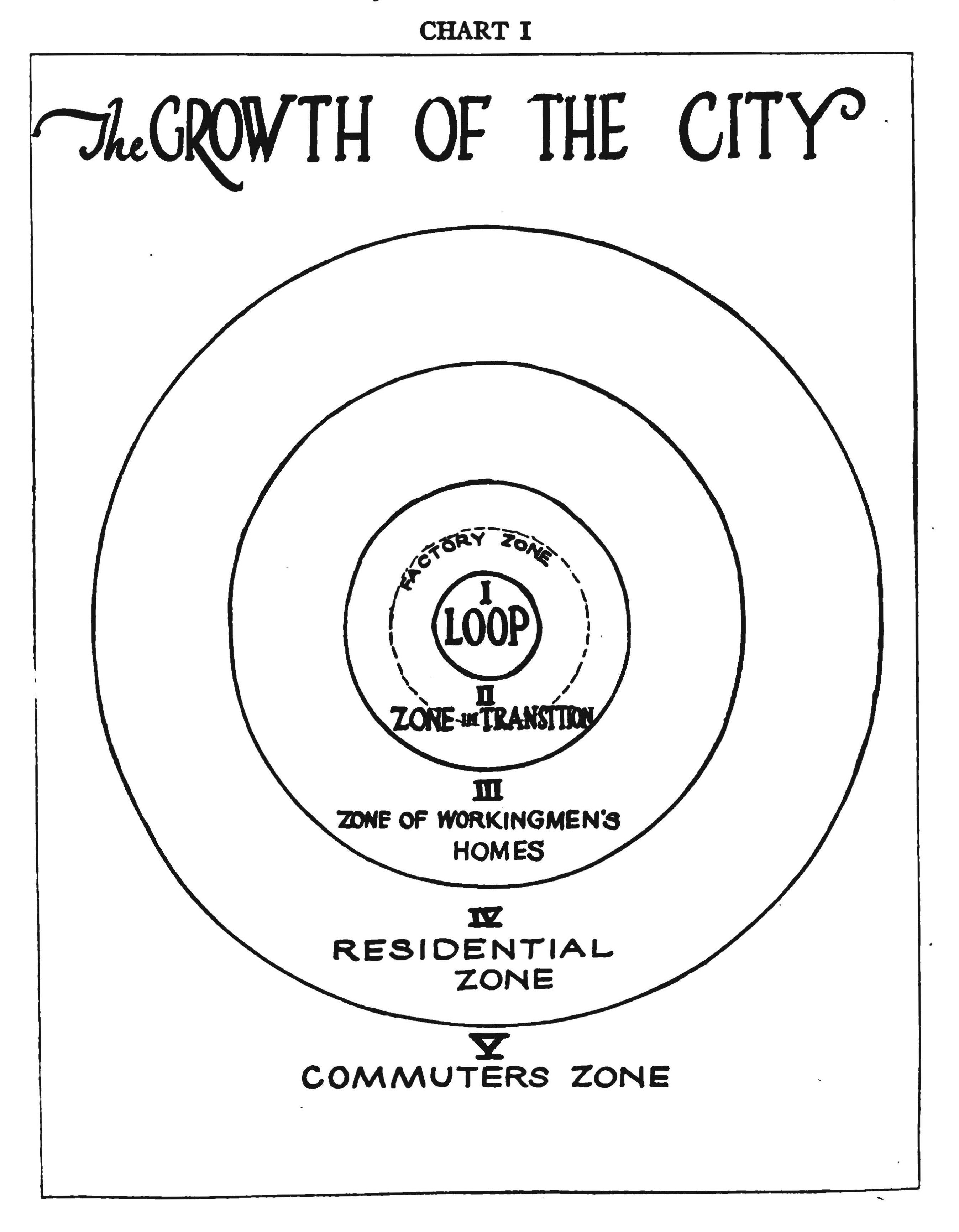
Figure 2
Chart I (from Park R, Burgess E, McKenzie R. The City: Suggestions for Investigation of Human Behavior in the Urban Environment. University of Chicago Press; 1925: p. 51)
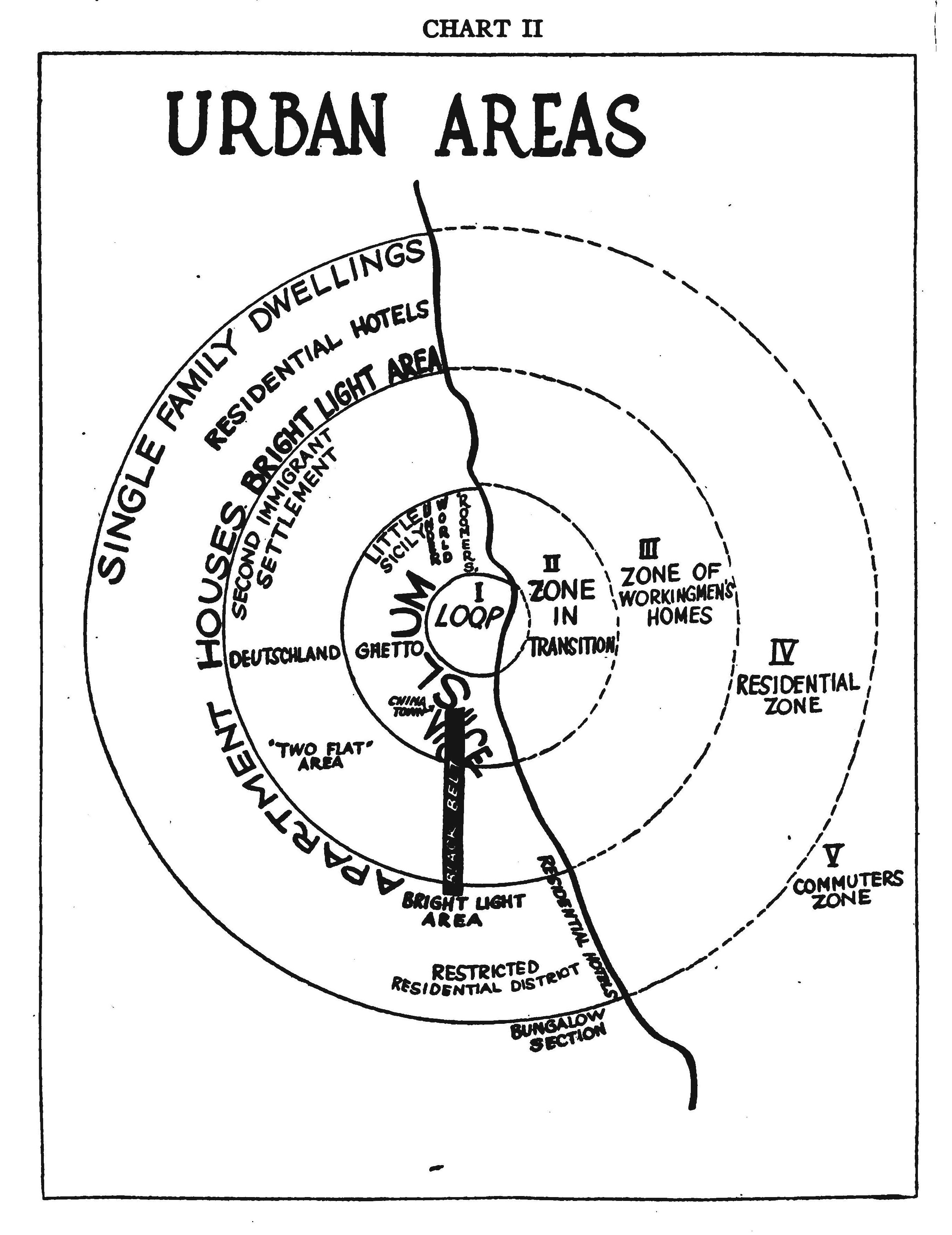
Figure 3
Chart II (from Park R, Burgess E, McKenzie R. The City: Suggestions for Investigation of Human Behavior in the Urban Environment. University of Chicago Press; 1925: p. 55)
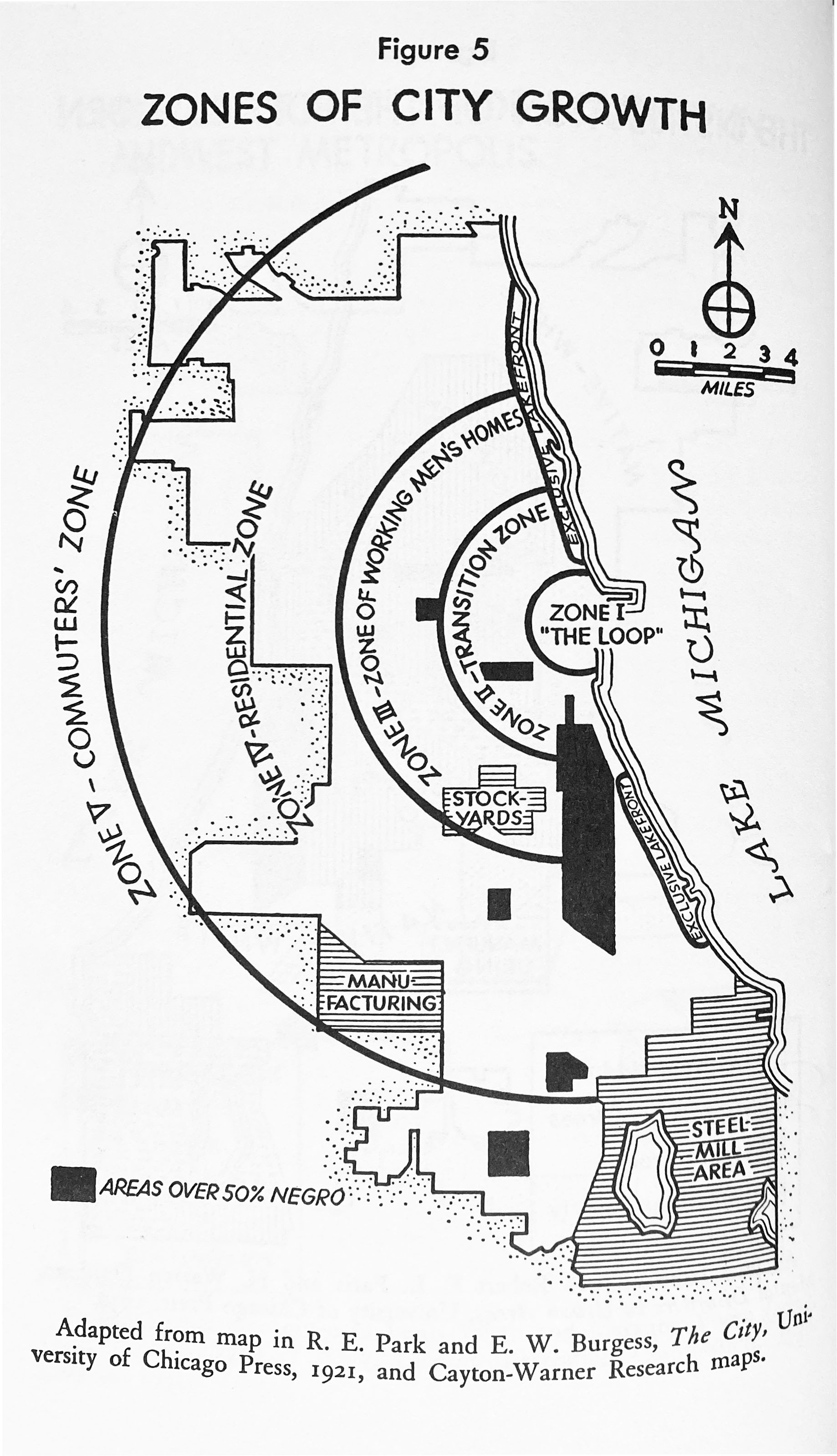
Figure 4
Zones of City Growth, Adapted from map in Park RE, Burgess EW. The City, University of Chicago Press; 1921, and Cayton-Warner Research maps. (Courtesy of the Houghton Mifflin Harcourt).
Figure 5
Colour-coded Home Owners’ Loan Corporation map of Chicago, c. 1940.
Figure 6
West Woodlawn map, 20212. Prepared by Grimes et al. Based on the City of Chicago Vacant Land Inventory and a survey of the neighbourhood.