
Table 1
Selected Humanitarian Projects of Commercial Satellite Imagery
| Project | Location | Active Date | Satellite Imagery Provider | Information Analysis | Information Distributor | Website/ Report link |
|---|---|---|---|---|---|---|
| Geospatial Technologies and Human Rights Project | Afghanistan, Burma, Chad, DR Congo, Ethiopia, Kyrgyzstan, Lebanon, Libya, Nigeria, Pakistan, Somalia, South Ossetia, Sri Lanka, Syria, and Zimbabwe | 2006-Present | DigitalGlobe/ GeoEye/ ImageSat International | American Association for the Advancement of Science | Amnesty International USA/ Eyes on Pakistan/ Human Rights Watch/ Physicians for Human Rights | URL |
| Eyes on Darfur | Darfur, Sudan | 2007-2009 | ImageSat International, GeoEye, DigitalGlobe, Orbimage | American Association for the Advancement of Science | Amnesty International USA | URL |
| URL (separate reports from AAAS) | ||||||
| Crisis in Darfur* | Darfur, Sudan | 2007-2009 | Google Earth | United States Holocaust Memorial Museum | Google Earth | URL |
| Satellite Sentinel Project* | South Kordofan and Blue Nile, Sudan | 2010-Present | DigitalGlobe | Harvard Humanitarian Initiative (2010-2012)/ UNITAR-UNOSAT (2011)/ Enough Project with DigitalGlobe (2012-present) | Enough Project/Not On Our Watch | URL |
| Syria Satellite Crowdsourcing Project* | Syria | 2011 | DigitalGlobe | Standby Task Force crowd-sourced data | Amnesty International USA | URL |
| Somalia Satellite Crowdsourcing Project | Somalia | 2011 | DigitalGlobe | Standby Task Force crowd-sourced data | UNHCR | URL |
| Baba Amr report | Homs, Syria | 2012 | DigitalGlobe | Human Rights Watch | Human Rights Watch | URL |
| Human Rights in Burma | Burma | 2012-2013 | Astrium/ DigitalGlobe | Human Rights Watch | Human Rights Watch | URL |
| URL | ||||||
| URL |
[i] *Projects examined as case studies in this article
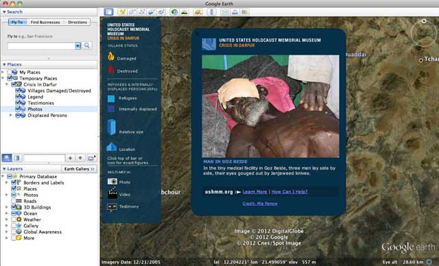
Figure 1
USHMM report overlaying Google Earth satellite imagery. The caption reads: ‘In the tiny medical facility in Goz Beide, three men lay side by side, their eyes gouged out by Janjaweed knives.’
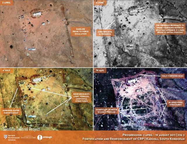
Figure 2
SSP-17 Imagery on fortification of the CRP over time.
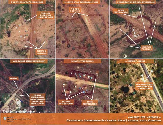
Figure 3
SSP-18 Imagery of SAF Checkpoints around Kadugli.
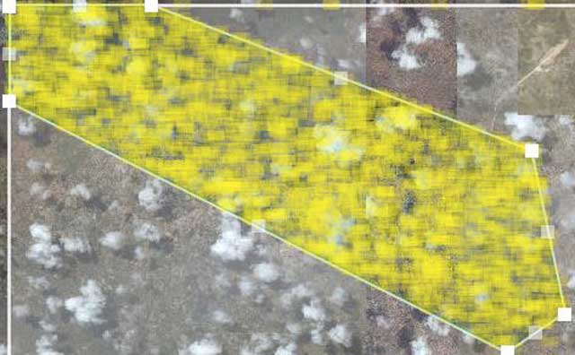
Figure 4
SBTF Micro-tasking of Syria Imagery.