
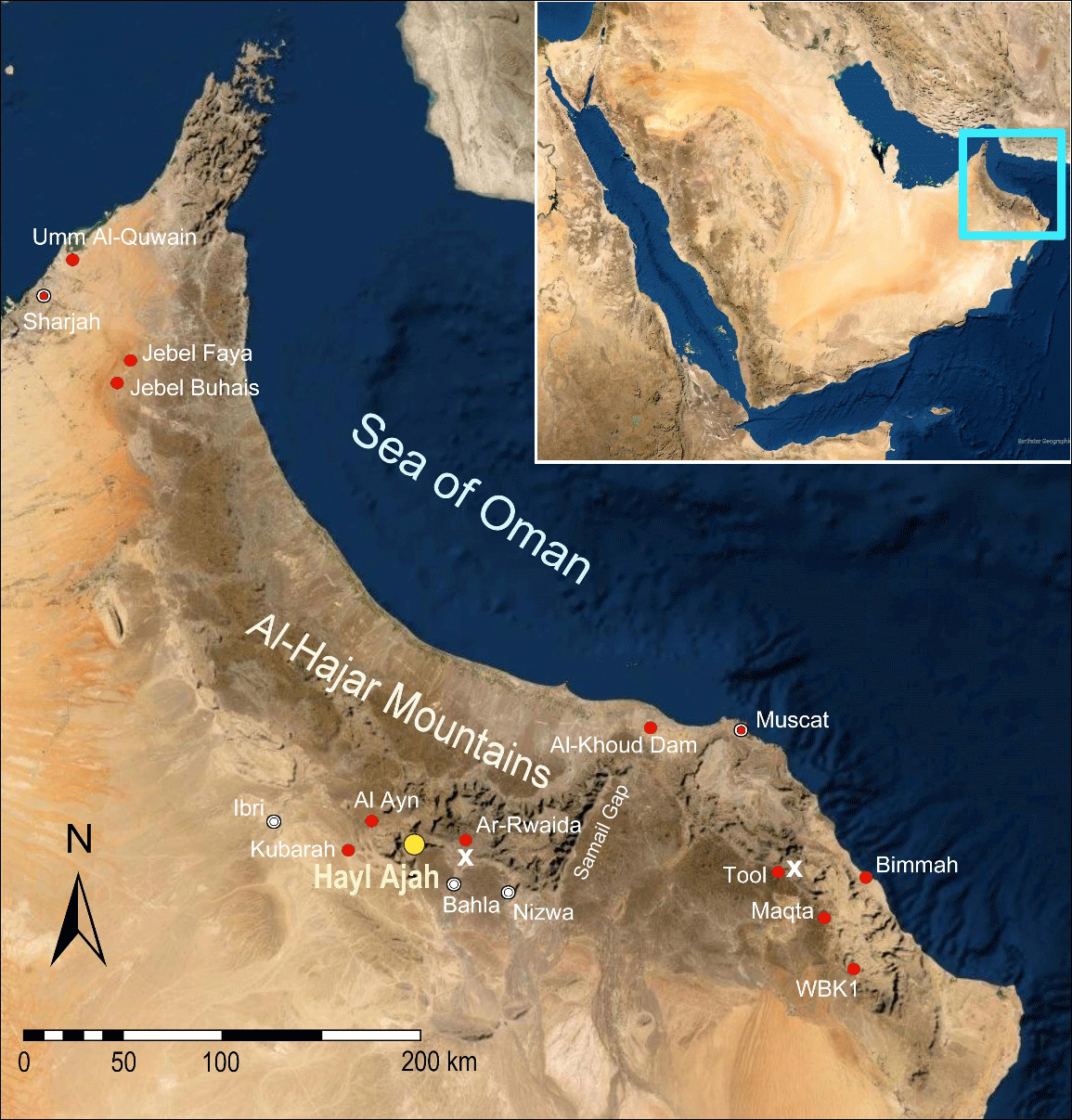
Figure 1
Al-Hajar Mountains (Oman and United Arab Emirates). Western and Eastern Al-Hajar Mountains separated by the Samail Gap. SIPO project site (yellow); sampled and mentioned sites (red); limestone plateaus similar to the Sint Karst Plateau of Hayl Ajah (x). Map source: Google Earth.
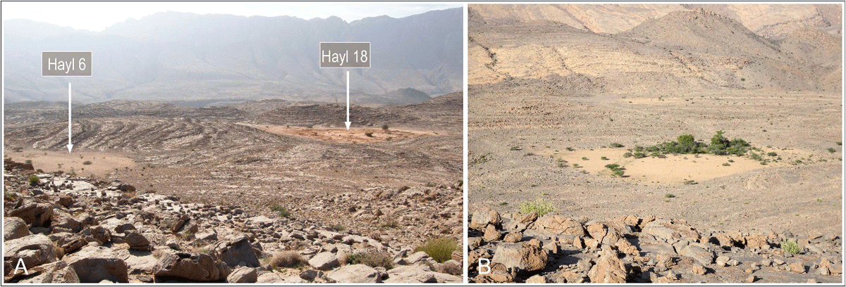
Figure 2
A: Sint Karst Plateau in November 2018, view from a hilltop towards the south-west. Left: Hayl 6 (intact silty top-layer); right: dredged Hayl 18 (terra rossa exposed). The sub-horizontal fractured karst plateau with its rhythmically spaced hillocks and huyul is separated from the slopes of Jebel Kawr by a deep wadi gorge. B: A sanctuary for mountain biota, Hayl 5 receives run-off, silt and organic matter from surrounding rock surfaces.

Figure 3
Sint Karst Plateau. Sediment-filled karst depressions (mountain plateau huyul), intact (yellow) and recently dredged (red). Water sampling points (blue). Sediments from the tops of Hill 1 and Hill 5 have been analysed. White line: the new road, a short-cut across the plateau to the area of Al-Hamra and Bahla. The wadi Amqah gorge drains the Sint intermountain basin. Outlying oases: Al-Nazara (abandoned) and Amqah. Overspill huyul (yellow dashed line): Hayl 15 and Hayl Ajah. Rose diagram of fissures derived from measurements within Hayl Ajah at the ponor, demonstrating the tectonic control of the preferential drainage (n = 48, max. 16.7%). Map source: Google Earth.
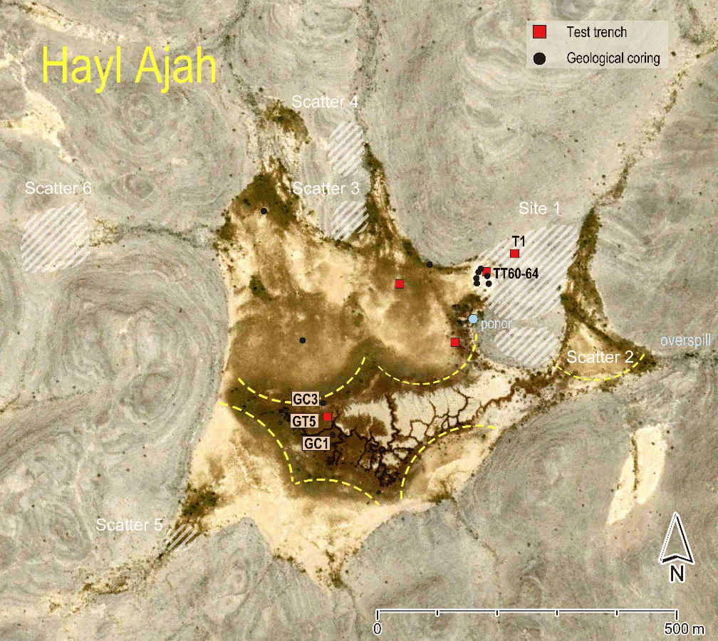
Figure 4
Karst depression Hayl Ajah. Central infiltration zone with suffosion channels and trees, defined by level silty fans in front of radial gullies. Main drill holes GC1 (2018), GC3 (2022), and the main geological-palaeoenvironmental trench GT5. Subsidiary drill holes (black dots); archaeological and geological trenches (red squares). Site HA1: archaeological test trenches T1 and TT60–64 (2018). Lithic scatters 2–6. Vertical drainage shaft (ponor). Overspill to a flanking tributary 100 m below. Map source: Google Earth.
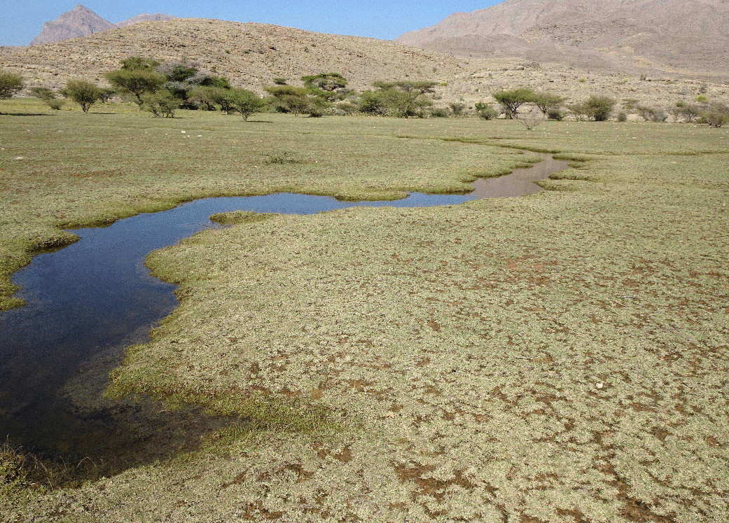
Figure 5
Hayl Ajah (December 2019). After covering the withered and grazed remains of former grass for less than a day, standing water fills the shallow suffosion channels in the hayl for weeks (information from residents).
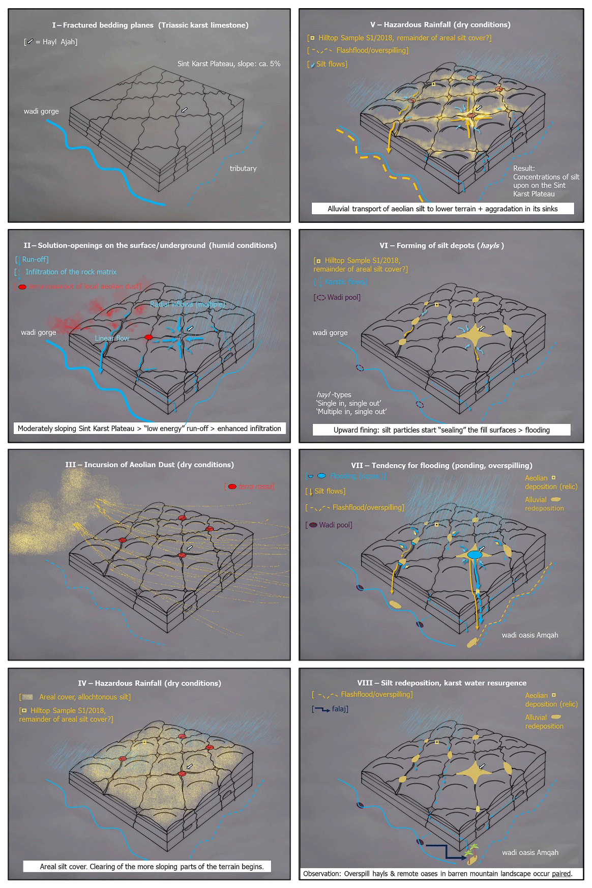
Figure 6
Hypothetical model of silt mobility on the Sint Karst Plateau.
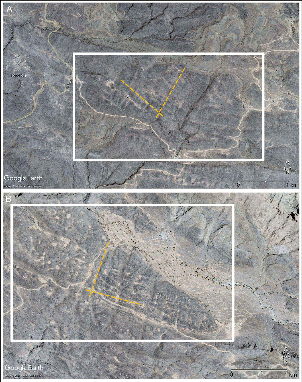
Figure 7
Sub-horizontal plateaus comparable to the Sint Karst Plateau with mountain plateau huyul (sg. hayl) at other karst formations of the Al-Hajar Mountains above 1000 m a.s.l. (A: north-east of Hoti Cave and Ar-Rwaida; B: north-east of Tool).
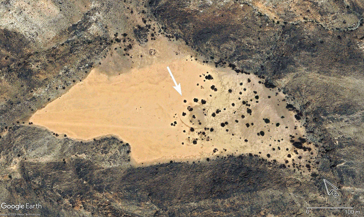
Figure 8
Contour of a circular doline at the bottom of a mountain plateau hayl (ca. 980 m a.s.l.), approximately 10 km west-northwest of the settlement Tool (Eastern Al-Hajar Mountains).
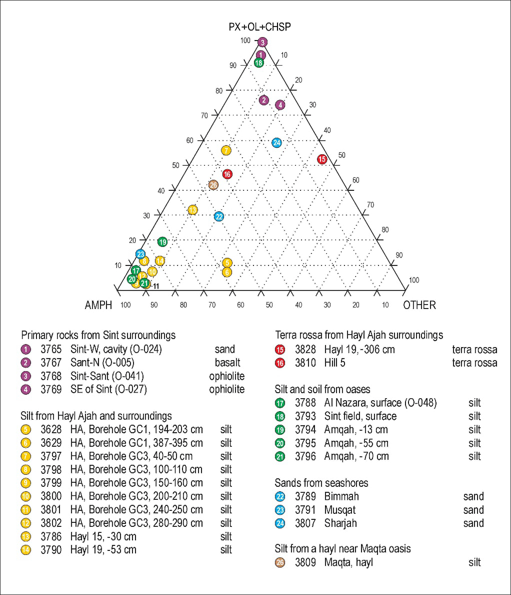
Figure 9
Translucent heavy mineral analysis (Supplementary File 1). Comparison of sediment samples from Hayl Ajah and surrounding huyul, from the nearby oases Al-Nazara, Amqah and Sint and from a karst depression at the mountain oasis Maqta (Eastern Al-Hajar Mountains) with potential source rocks from local and distant areas. The top corner indicates relation to an ophiolite suite source (pyroxene, olivine and chromspinel) and the left-hand corner an association with amphibole. The right-hand corner refers to remnant minerals from more distant sources.

Figure 10
Translucent heavy mineral composition in sediment and rock samples of the Sint Karst Plateau and ophiolitic (dark-coloured) Sint Basin (Supplementary File 2). Comparisons of relative proportions of translucent heavy minerals in sediments from huyul (Hayl Ajah, Hayl 15, Hayl 19), top of Hill 5 and oases horticultural plots (Al-Nazara, Amqah and Sint) with primary sources from the Sint Basin. Map source: Google Earth.
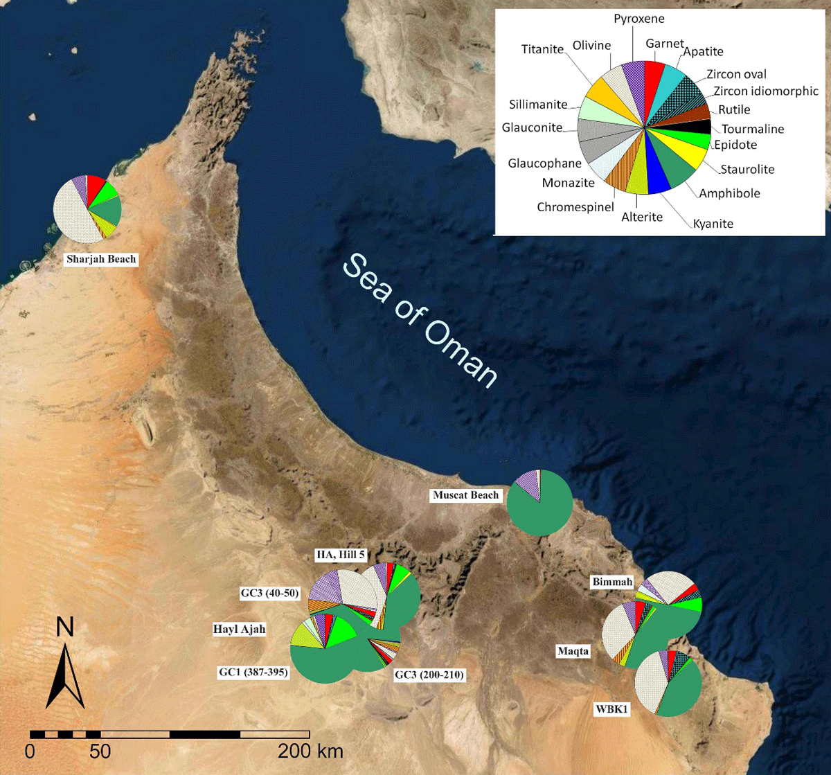
Figure 11
Translucent heavy mineral composition in sediment samples of selected sites in the south-eastern Arabian Peninsula (Supplementary File 2). Map source: Google Earth.

Figure 12
Micropalaeontological compositions in sediment samples of the Sint Karst Plateau and Sint Basin (Supplementary File 3). Comparison of microfossil proportions in sediment samples from Hayl Ajah (borehole GC1), Hayl 15 (depth 30 cm) and Hayl 19, together with samples taken from the top of a hillock (Hill 1) and from horticultural plots in the oases Al-Nazara, Amqah and Sint. Map source: Google Earth.
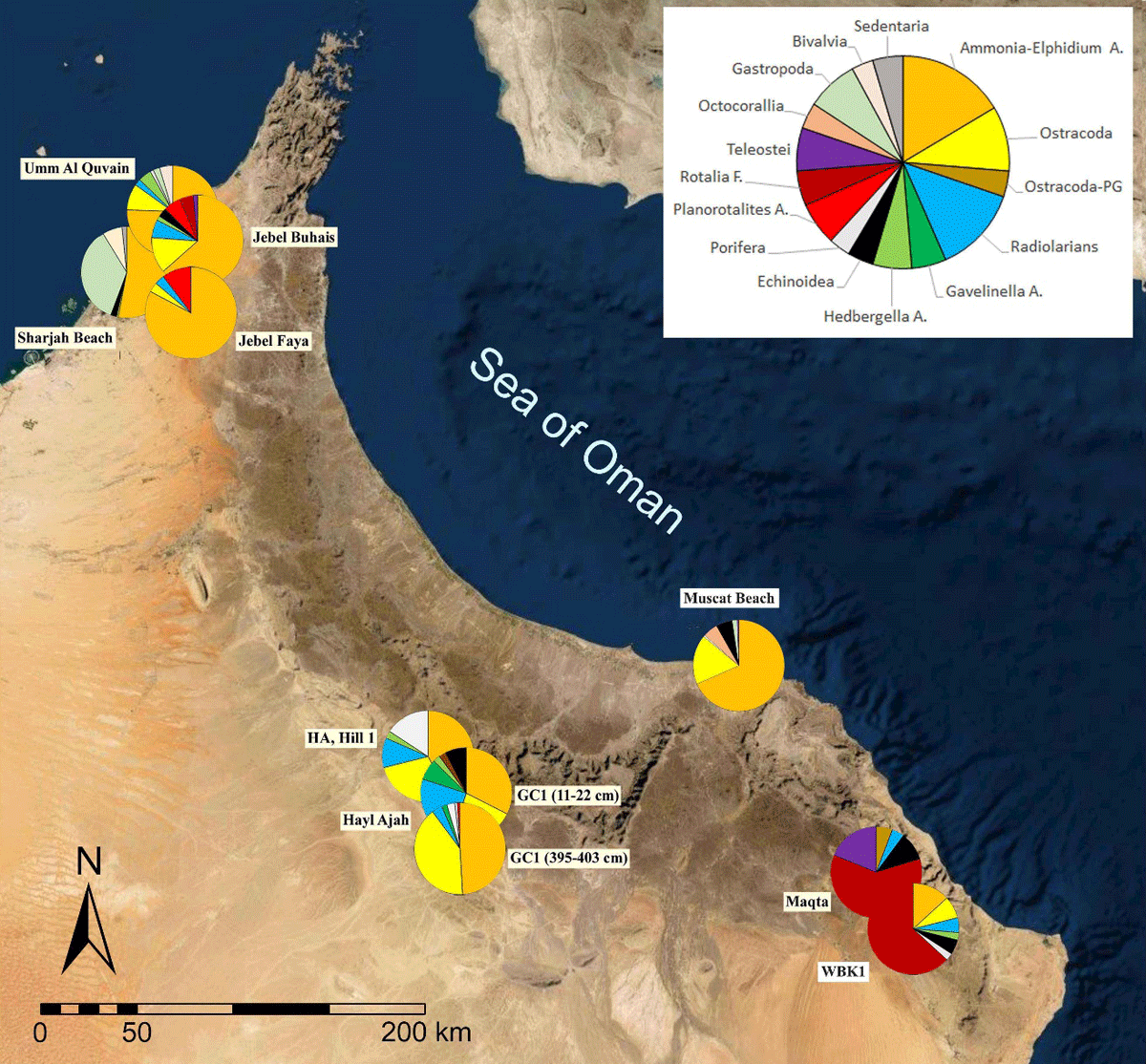
Figure 13
Microfossil pseudoassociations (Supplementary File 3). Comparative analyses reveal similarities between the dominant Ammonia-Elphidium and ostracod fauna found in the silty infill of Hayl Ajah and distant coastal sediments. Map source: Google Earth.
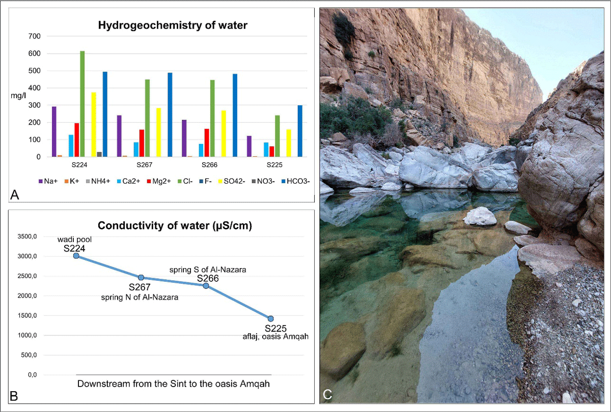
Figure 14
Hydrogeochemistry (A) and conductivity (B) of water samples taken in the wadi Amqah gorge. The samples are ordered downstream. C: Wadi pool with Garra fish at the head of the falaj irrigation channel of Amqah oasis (view up-drainage).

Figure 15
A: Possible primary sources of microfossils and translucent heavy minerals in the sediments of Hayl Ajah. B: Thin section of Triassic Megalodon limestone with agglutinated foraminifer and ooids, Hayl Ajah. C: Thin section of Upper Jurassic–Lower Cretaceous radiolarian limestone, Kubara. Scale bars = 0.5 mm.

Figure 16
Flooding at the mountain plateau hayl Ar-Rwaida (ca. 1100 m a.s.l.; above the Hoti Cave), approximately 25 km due east of Hayl Ajah. Source: Google Maps (Photo: Mohammad Al-Hatali).