
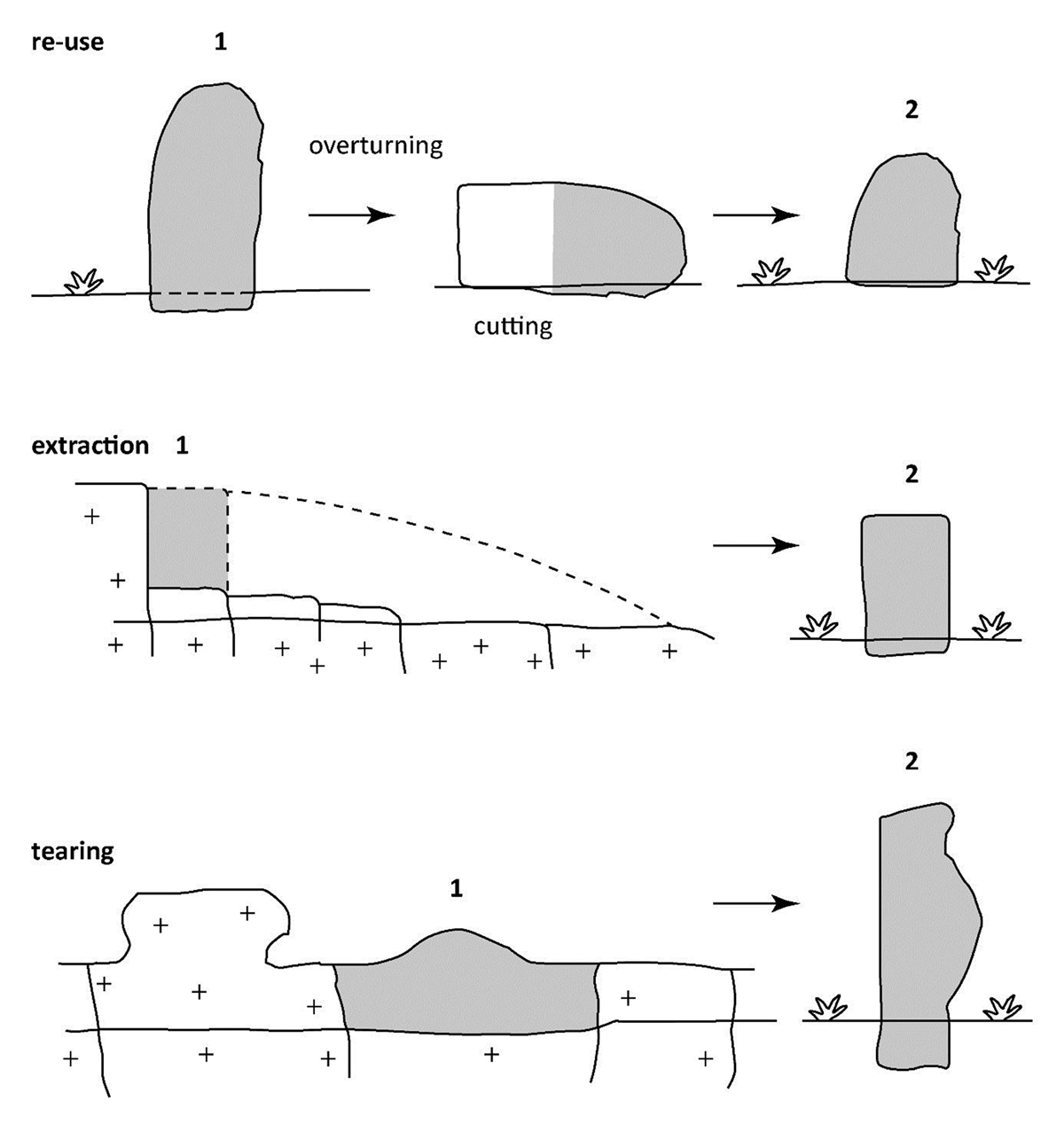
Figure 1
The terms of supply in megalithic monoliths and the consequent traces of pre-megalithic erosion found on the derived standing stone. Modified from Sellier (2013: 16).
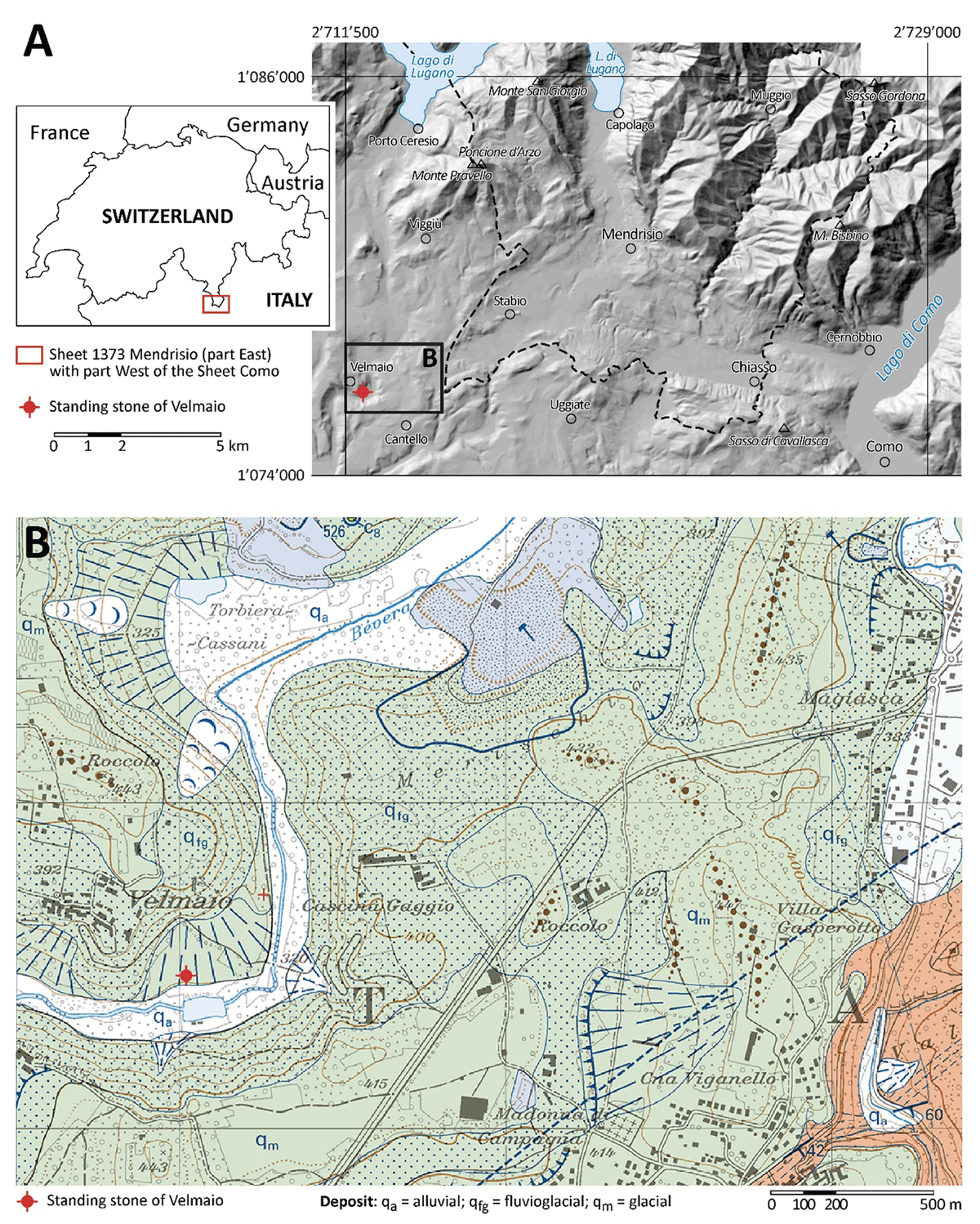
Figure 2
Geographical and geological context of the Velmaio standing stone. A: General location and extension of Sheet 152 of the Geological Atlas of Switzerland 1:25,000 (GA25, see: Bernoulli et al. 2017). B: Detail from GA25 showing the location of the standing stone and the surrounding Quaternary deposits. The entire Sheet of the GA25 and the complete legend are available on the mapping platform of the Swiss Confederation: https://map.geo.admin.ch Data and sources: A: Hillshade based on the digital elevation models swissALTI3D (©Swiss Federal Office of Topography swisstopo) and DTM 5 × 5 (ed. 2015) of the Lombardy Region (©Regione Lombardia); B: ©Swiss Federal Office of Topography swisstopo. Coordinates are in the system CH1903+ / LV95.
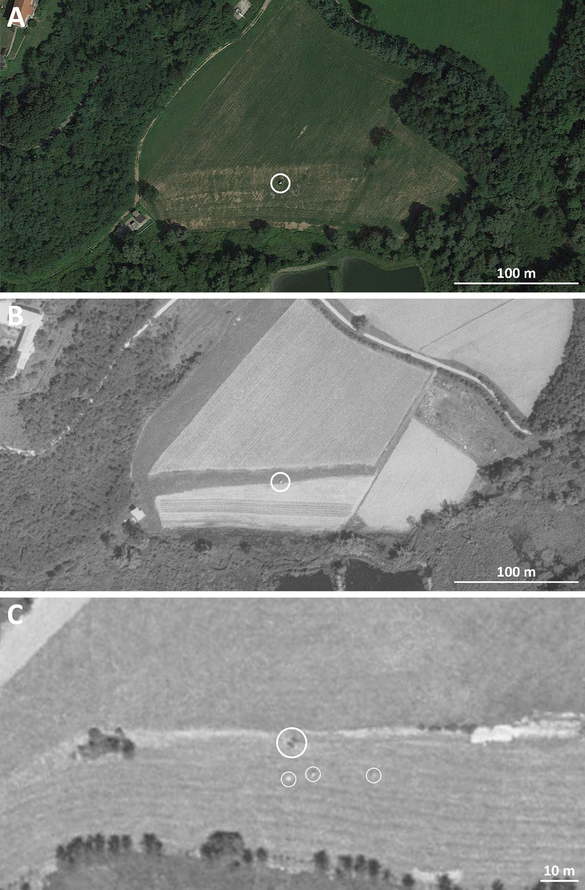
Figure 3
Aerial photographs of the Velmaio standing stone (main circle). A: Google Earth image of the 14 August 2021. B: LUBIS image 19770770014364 of the 16 June 1977. C: LUBIS image 19450320090098 of the 15 June 1945. The standing stone can be recognized by its shadow (large circle). Three other smaller boulders appear to be present to the south and south-east of the Velmaio standing stone. Sources: A: ©Google Earth; B: ©Swiss Federal Office of Topography swisstopo.
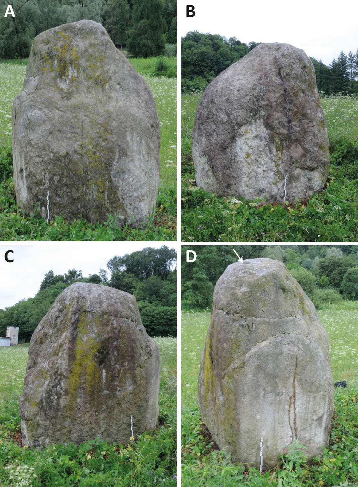
Figure 4
Photographs of the four faces of the Velmaio standing stone. A: north-western face; B: south-western face; C: south-eastern face; D: north face. The arrow indicates the sampling point for 26Cl surface exposure dating. Photos: F. Cousseau, 15 July 2019.
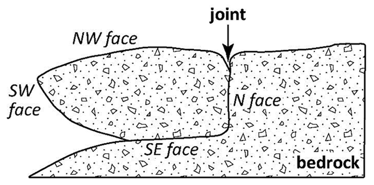
Figure 5
Proposal of restoring the original position of the boulder attached to its bedrock.
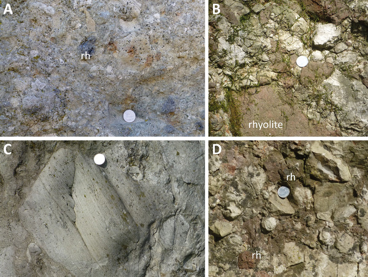
Figure 6
Lithologies of the standing stone of Velmaio and of the Invorio Breccia near Invorio superiore. A and C: Lithology of the boulder of Invorio Breccia at Velmaio. A: Clast-supported breccia with closely packed angular to subangular clasts of San Salvatore Dolomite (Middle Triassic) and subordinate clasts of Permian rhyolite (rh). C: Clast of laminated dolomite. B and D: Invorio Breccia (presumably Lower Jurassic) near Invorio superiore: clast-supported breccia with closely packed, angular to subangular clasts of San Salvatore Dolomite and Permian rhyolite (rh). Diameter of coins is 20 mm. Photos: D. Bernoulli, 22 March 2013 (A and C) and 31 March 2017 (B and D).
Table 1
36Cl exposure dating results for the Velmaio standing stone. AMS blank value used 4.0 × 10⁻¹⁴.
| SAMPLE NAME | VELMAIO | |
|---|---|---|
| Latitude | XX.XXXX | 45.8308 |
| Longitude | XX.XXXX | 8.8803 |
| Elevation | (m a.s.l.) | 323 |
| Thickness | (cm) | 2 |
| Topographic shielding | 0.9963 | |
| 36Cl | 106 at/grock | 0.6787 ± 0.0280 |
| Exposure age no erosion | (ka) | 89.72 ± 5.10 |
| Exposure age with an erosion rate of 1 mm ka-1 | (ka) | 89.42 ± 5.47 |
Table 2
Major and trace element concentrations required for exposure age calculation of the Velmaio standing stone. *AMS measured.
| SAMPLE NAME | VELMAIO | |
|---|---|---|
| Al2O3 | (%) | 13.85 |
| CaO | (%) | 1.00 |
| Fe2O3 | (%) | 3.13 |
| K2O | (%) | 3.47 |
| MgO | (%) | 1.04 |
| MnO | (%) | 0.048 |
| Na2O | (%) | 2.98 |
| P2O5 | (%) | 0.02 |
| SiO2 | (%) | 70.83 |
| TiO2 | (ppm) | 0.27 |
| Sm | (ppm) | 1.8 |
| Gd | (ppm) | 1.5 |
| U | (ppm) | 3.5 |
| Th | (ppm) | 10.2 |
| Cl* | (ppm) | 26.62 ± 0.18 |
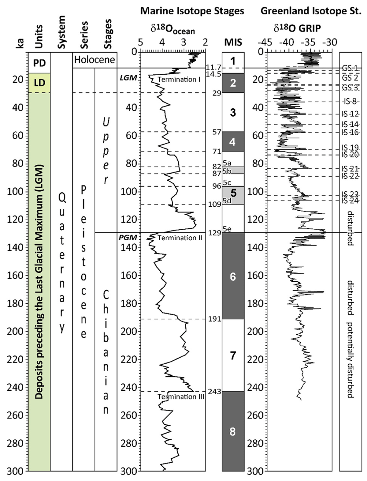
Figure 7
Chronostratigraphical units defined in the South-Alpine area (“Units”) and correlation with the Quaternary stratigraphy (Cohen & Gibbard 2022), the marine isotope stratigraphy (McManus et al. 1999; Lisiecki & Raymo 2005) and the Greenland isotope stratigraphy (Dansgaard et al. 1993) for the last 300 ka. LD = Last Glacial Maximum Deposits; LGM = Last Glacial Maximum; MIS = Marine Isotope Stage; GRIP = Greenland Ice Core Project; GS = Greenland Stadial; IS = Greenland Interstadial; PD = Postglacial Deposits; PGM = Penultimate Glacial Maximum. Modified from Bernoulli et al. (2018: 21).
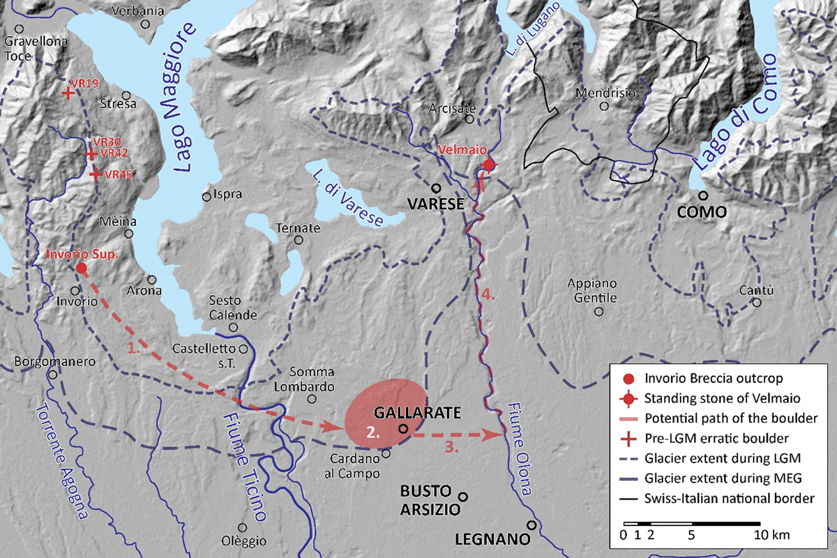
Figure 8
Potential migration of the Velmaio boulder from the outcrop of the Invorio Breccia in Invorio Superiore to the place of final emplacement on the shore of the Torrente Bévera in Velmaio. 1. Glacial transportation during the PGM from Invorio Superiore to the potential zone of deposition as an erratic boulder in (2.) in the most downstream position possible. 3. Anthropic displacement from the zone of glacial deposition to the Fiume Olona. 4. Transportation on the Fiume Olona and Torrente Bévera up to Velmaio. Base map of the Common Information Platform for Natural Hazards (Swiss Federal Office for the Environment FOEN and European Environment Agency EEA). Glacier extent during the Last Glacial Maximum (LGM) from Kamleitner et al. (2022), and Monegato et al. (2022) for the Ticino-Toce glacier system and from Bini et al. (2009) for the Ticino-Adda and Adda glacier systems. Glacier extent during the Most Extensive Glaciation (MEG) reconstructed on the basis of the morainic amphitheatres and data of Bini et al. (1996). VR19, VR 30, VR42 and VR45: pre-LGM erratic boulders dated with 10Be by Kamleitner et al. (2022).