
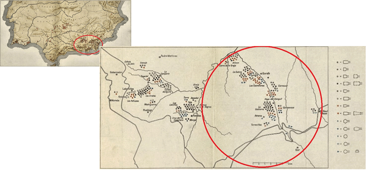
Figure 1
Megalithic area on the southeast of the Iberian Peninsula, [16].
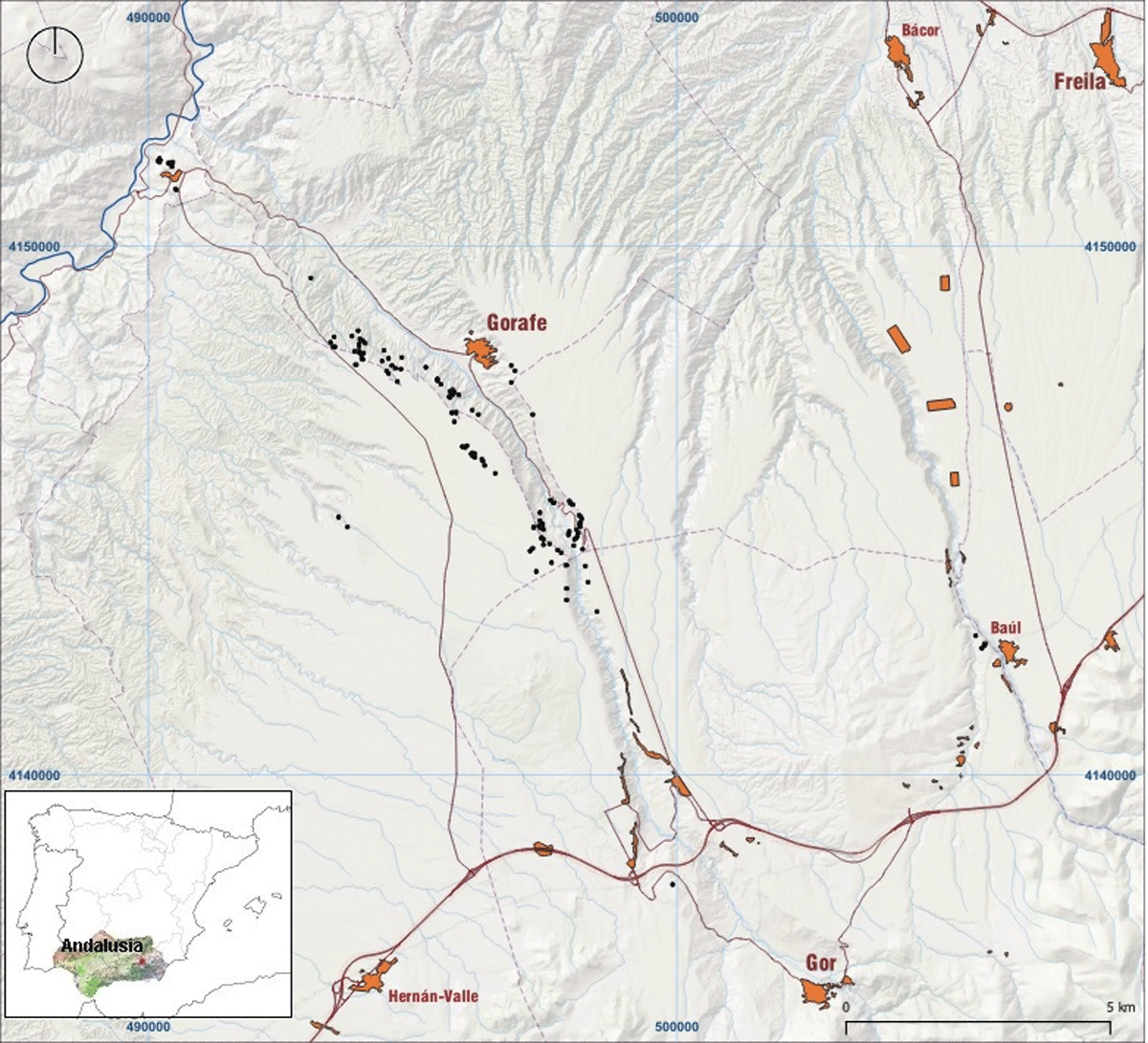
Figure 2
Location of the 151 documented dolmens along the Gor River valley.
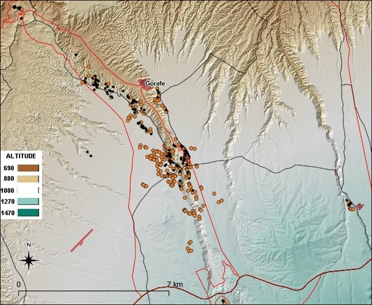
Figure 3
In black, the 151 megaliths identified in the terrain. In orange, the 230 new possible megaliths identified by DTMs based on LiDAR data. Taken from [9].
Table 1
Results of radiocarbon dating and samples analysed. N = number of the megalith where the dated bone was found. Calibration according to IntCal20 [18]. Using Calib 8.1.1. program.
| N. | BONE PART | AGE | GENDER | DATES BP | CULTURAL PERIOD |
|---|---|---|---|---|---|
| 65 | radius | adult | 2690 ± 30 | Final Bronze Age | |
| 67 | talus | adult | male | 3839 ± 31 | Final Copper Age |
| 67 | humerus | adult | 2796 ± 30 | Final Bronze Age | |
| 68 | ulna | adult | 2740 ± 30 | Final Bronze Age | |
| 69 | femur | adult | male | 2748 ± 30 | Final Bronze Age |
| 70 | tibia | adult | 2719 ± 31 | Final Bronze Age | |
| 70 | skull (occipital) | adult | 4120 ± 32 | Copper Age | |
| 71 | humerus | adult | 3659 ± 31 | Final Copper/Ancient Bronze Age | |
| 103 | fibula | adult | male | 4307 ± 33 | Ancient Copper Age |
| 112 | tibia | adult | 3358 ± 30 | Bronze Age | |
| 132 | humerus | adult | 3729 ± 32 | Final Copper Age |
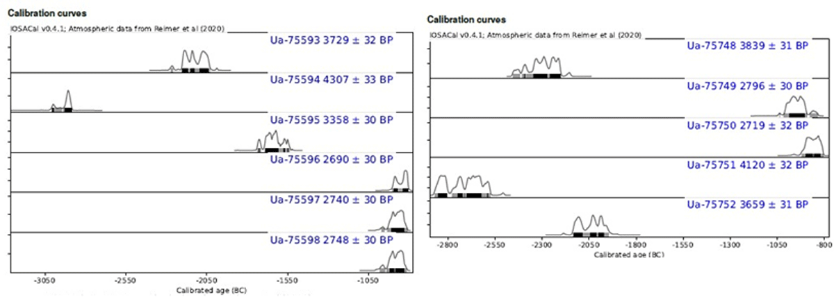
Figure 4
Results of the radiocarbon dates.
Table 2
General squeme of the variables.
| VARIABLE CATEGORIES | VARIABLES |
|---|---|
| Id | Identification |
| Location | Coor. X, Coor. Y., Area, Municipality, etc. |
| Constructive | Typology, Orthostates of the chamber, Orthostates of the corridor, Chamber lenght, Chamber width, etc. |
| Spatial | Orientation of the corridor, Viewshed, Slope, Height, Distance to the Gor River, etc. |
| Others | Conservation status, Geology, Lithology, Erosion, etc. |
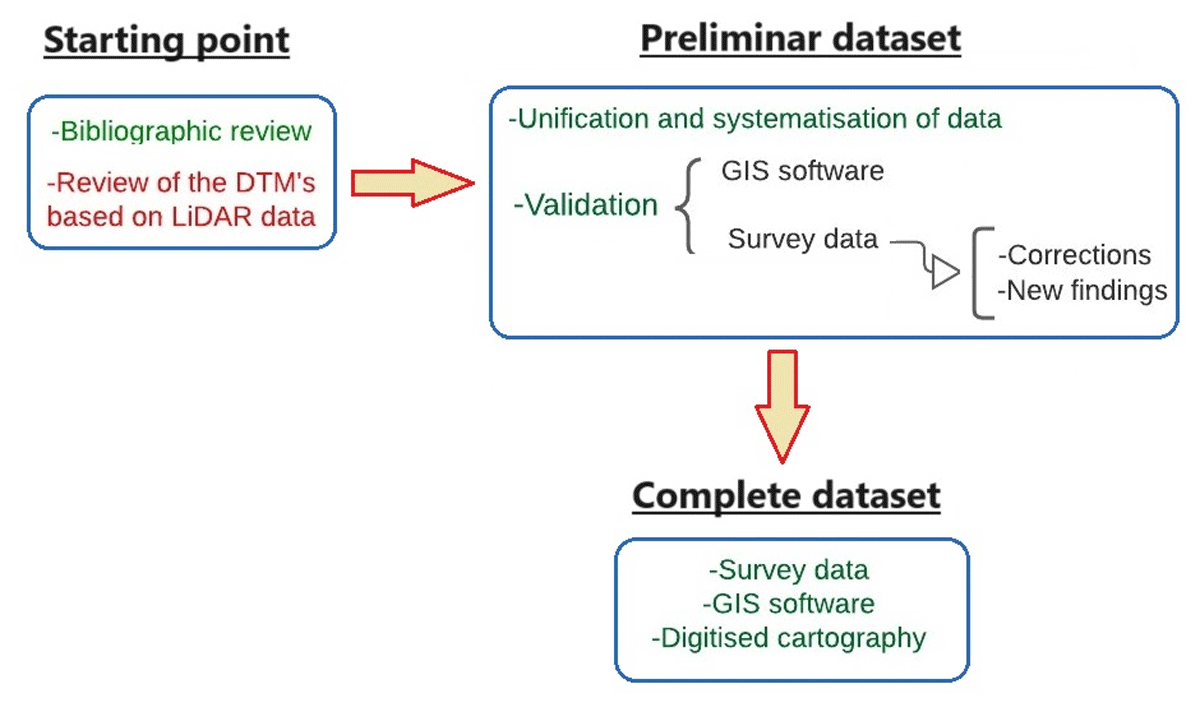
Figure 5
Conceptual model of data collection, processing and validation. In green, the model of the first dataset. In red, the model of the second dataset.