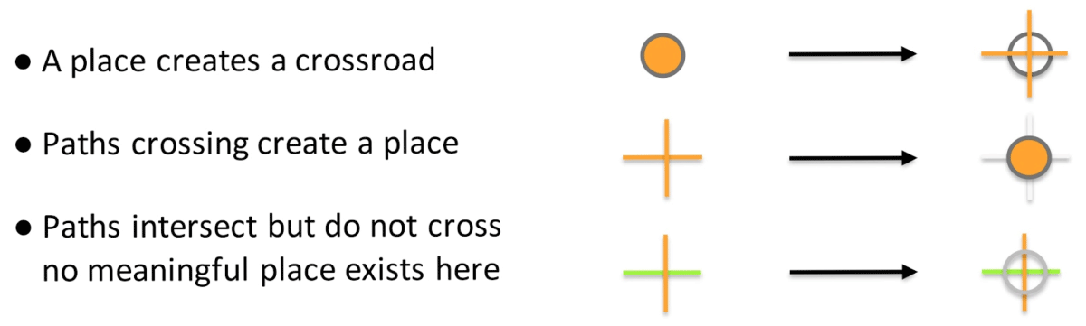
Have a personal or library account? Click to login
Developing FAIR Ontological Pathways: Linking Evidence of Movement in Lidar to Models of Human Behaviour Cover

Developing FAIR Ontological Pathways: Linking Evidence of Movement in Lidar to Models of Human Behaviour

Open Access
|Apr 2020

Figures & Tables

jcaa-3-1-46-g1.png
Figure 1

The dilemma of the intersection.
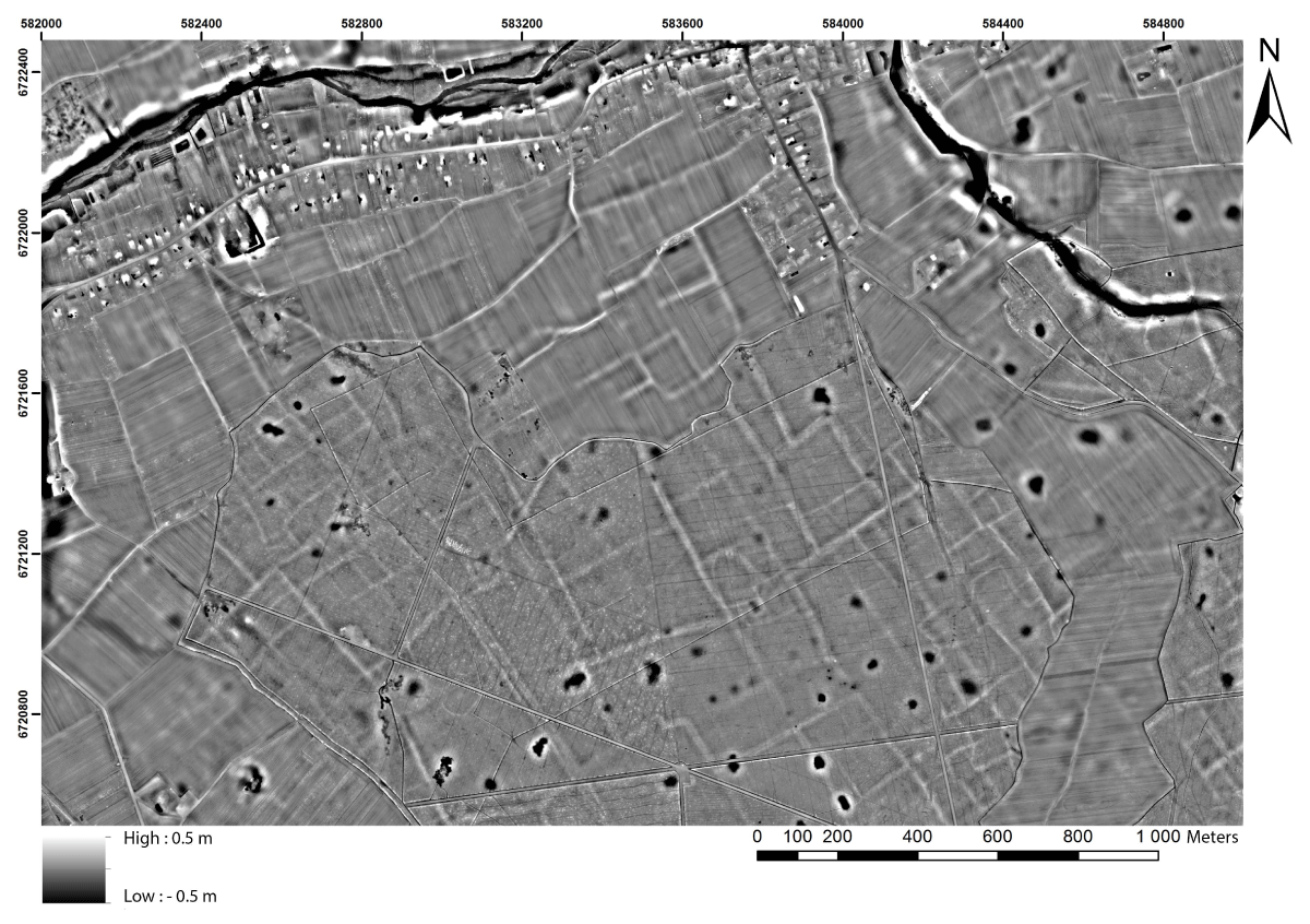
jcaa-3-1-46-g2.png
Figure 2

Topographic evidence of headlands visible on a LDTM (linear banks in white), visualised as a Local Relief Model stretched between –0.5 and 0.5 m. This example is located at the border of the forest of Boulogne (Huisseau-sur-Cosson, Loir-et-Cher, France). Source: SoLidar Project.

jcaa-3-1-46-g3.png
Figure 3

Schematized field system. Black = parcel, yellow to green = parcel aggregates (districts) in a field system (the whole area), red = field limits used as potential path.
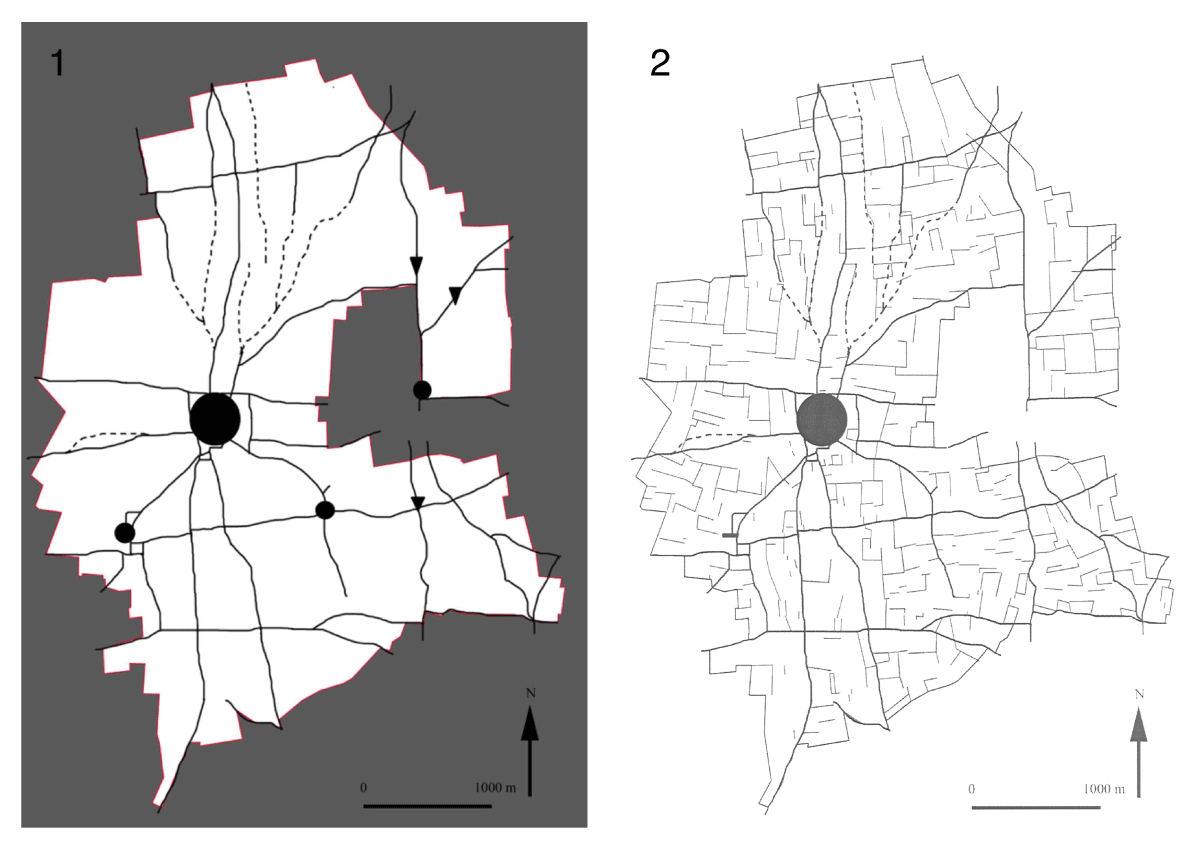
jcaa-3-1-46-g4.png
Figure 4

1) Map of the road network mentioned on the plan of the “Terrier” in 1696, 2) Map of the road network, and the headlands declared by the “tenanciers” (tenants) in 1696. Source: Leturcq (2008).
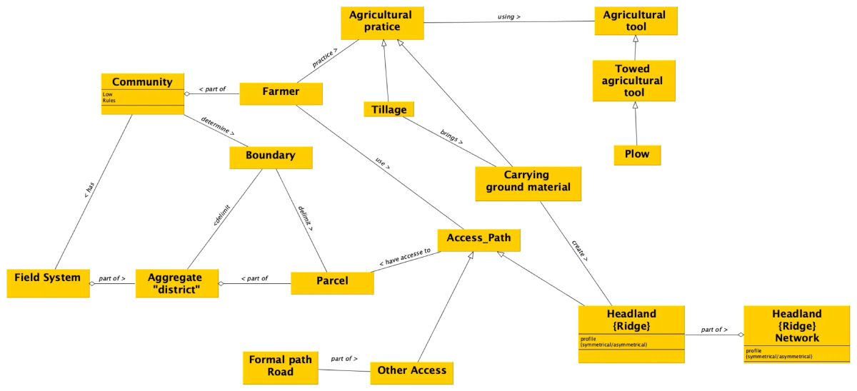
jcaa-3-1-46-g5.png
Figure 5

Example of mapping the headlands system with a UML schema editor. This is a simplified model focusing on topographical observations only.
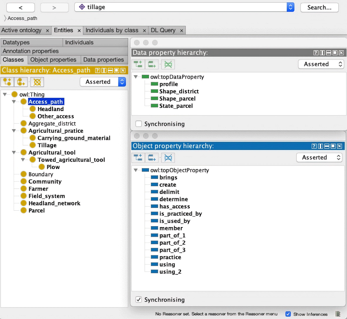
jcaa-3-1-46-g6.png
Figure 6

Example of formalization of the headlands system using an ontology editor (Protégé).

DOI: https://doi.org/10.5334/jcaa.46 | Journal eISSN: 2514-8362
Language: English
Submitted on: Nov 1, 2019
Accepted on: Mar 24, 2020
Published on: Apr 15, 2020
Published by: Ubiquity Press
In partnership with: Paradigm Publishing Services
Publication frequency: 1 issue per year

© 2020 Laure Nuninger, Rachel Opitz, Philip Verhagen, Thérèse Libourel, Clément Laplaige, Samuel Leturcq, Nathanael Le Voguer, Catherine Fruchart, Žiga Kokalj, Xavier Rodier, published by Ubiquity Press
This work is licensed under the Creative Commons Attribution 4.0 License.