
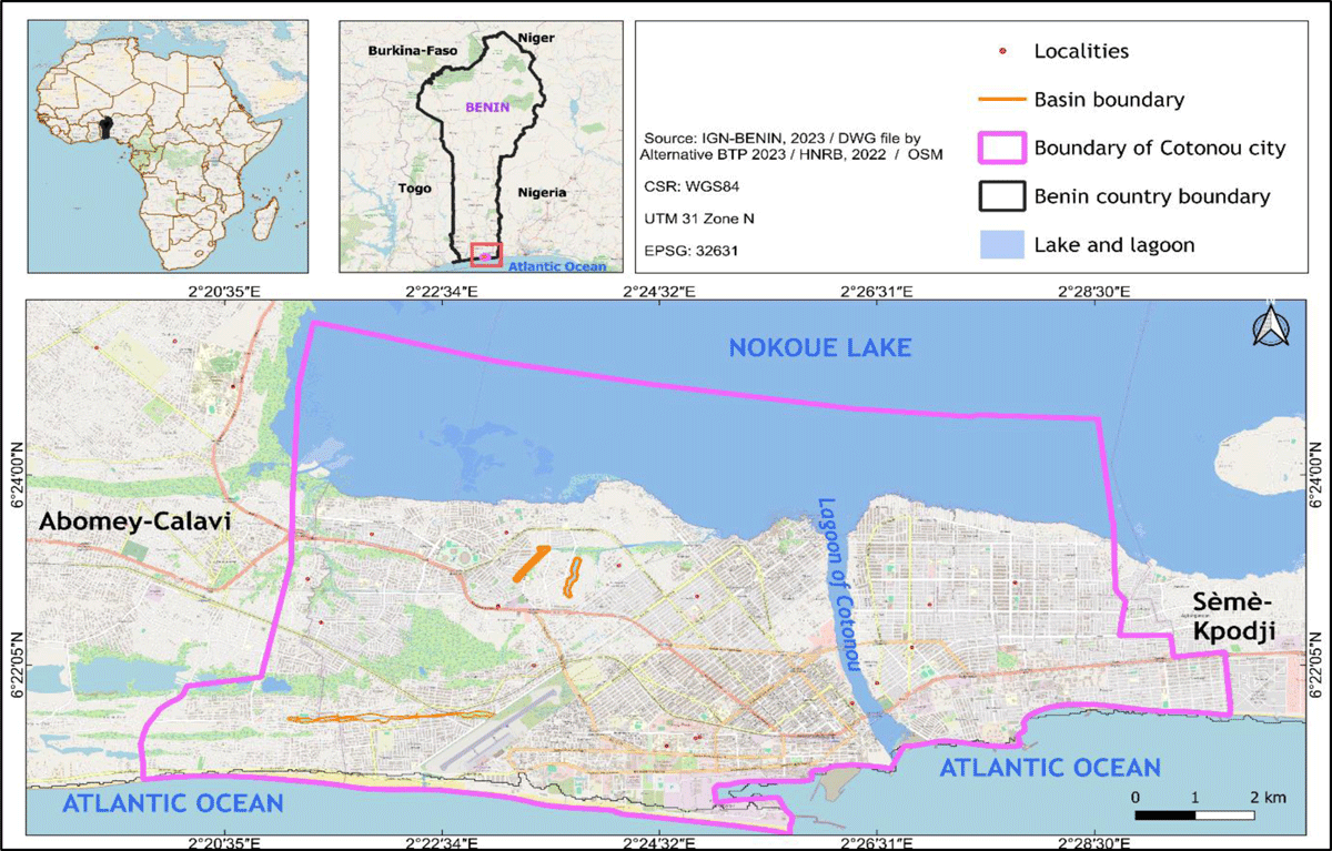
Figure 1
Geographic location of Cotonou city.
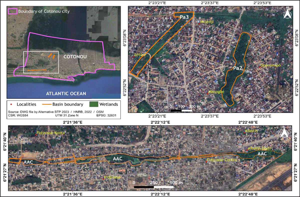
Figure 2
Geographic location of the Pa2, Pa3, and AAC basins in Cotonou.
Table 1
Areas and proportions of different types of occupation (habitats) at the level of the 3 PAPC basins surveyed.
| LAND USE UNITS | AREA (ha) | PROPORTION (%) |
|---|---|---|
| Agglomérations | 6178,30 | 88,19 |
| Swamp forests | 818,02 | 11,68 |
| Marsh meadows | 4,52 | 0,06 |
| TOTAL | 7000,84 | 100 |
Table 2
Diversity of different plant formations within the 3 retention basins.
| RETENTION BASIN | MAIN PLANT FORMATIONS | SPECIES RICHNESS | FAMILY DIVERSITY |
|---|---|---|---|
| AAc | High thick high marsh medows | 11 | 8 |
| Dense swamp forests | 34 | 17 | |
| Subtotal | 45 | 25 | |
| Pa3 | Swamp forests | 14 | 11 |
| Low marsh medows | 12 | 8 | |
| high marsh medows | 7 | 6 | |
| Subtotal | 33 | 25 | |
| Pa2 | Dense swamp forests | 11 | 8 |
| Dense swamp forests degraded | 16 | 11 | |
| Low marsh medows degraded | 9 | 7 | |
| Subtotal | 36 | 26 | |
| TOTAL | 114 | 76 |
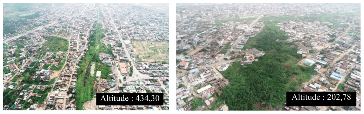
Figure 3
Drone-based imagery of the AAC and Pa2 basins.
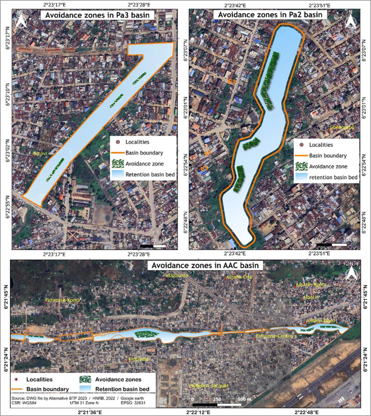
Figure 4
Final delineation of avoidance zones in the Pa3, Pa2, and AAC basins.