
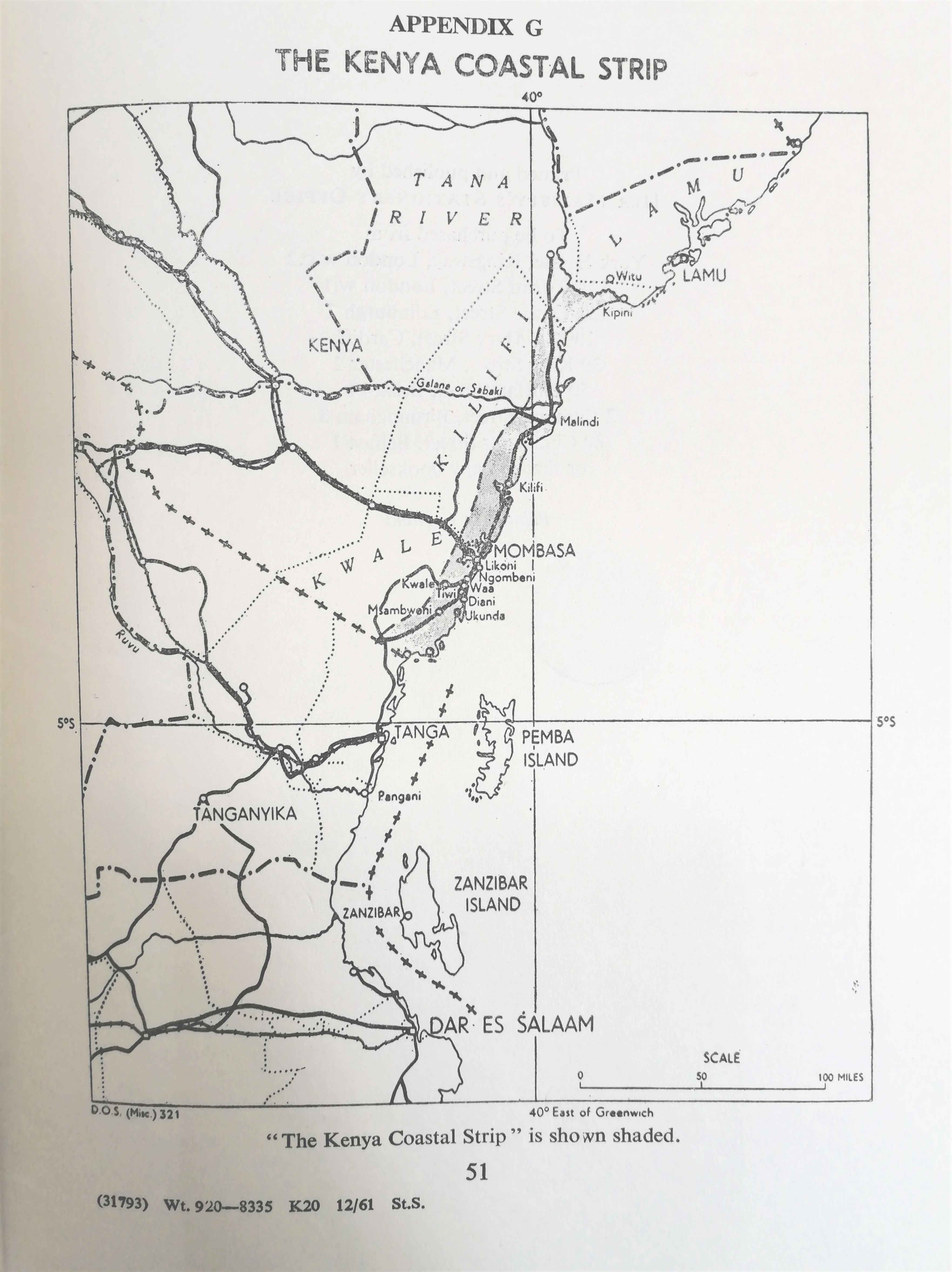
Figure 1
A map showing the former Kenyan Coastal 10-mile strip drawn by the British colonial administration that formally recognized the Sultanate of Zanzibar dominions. Source: British Museum.
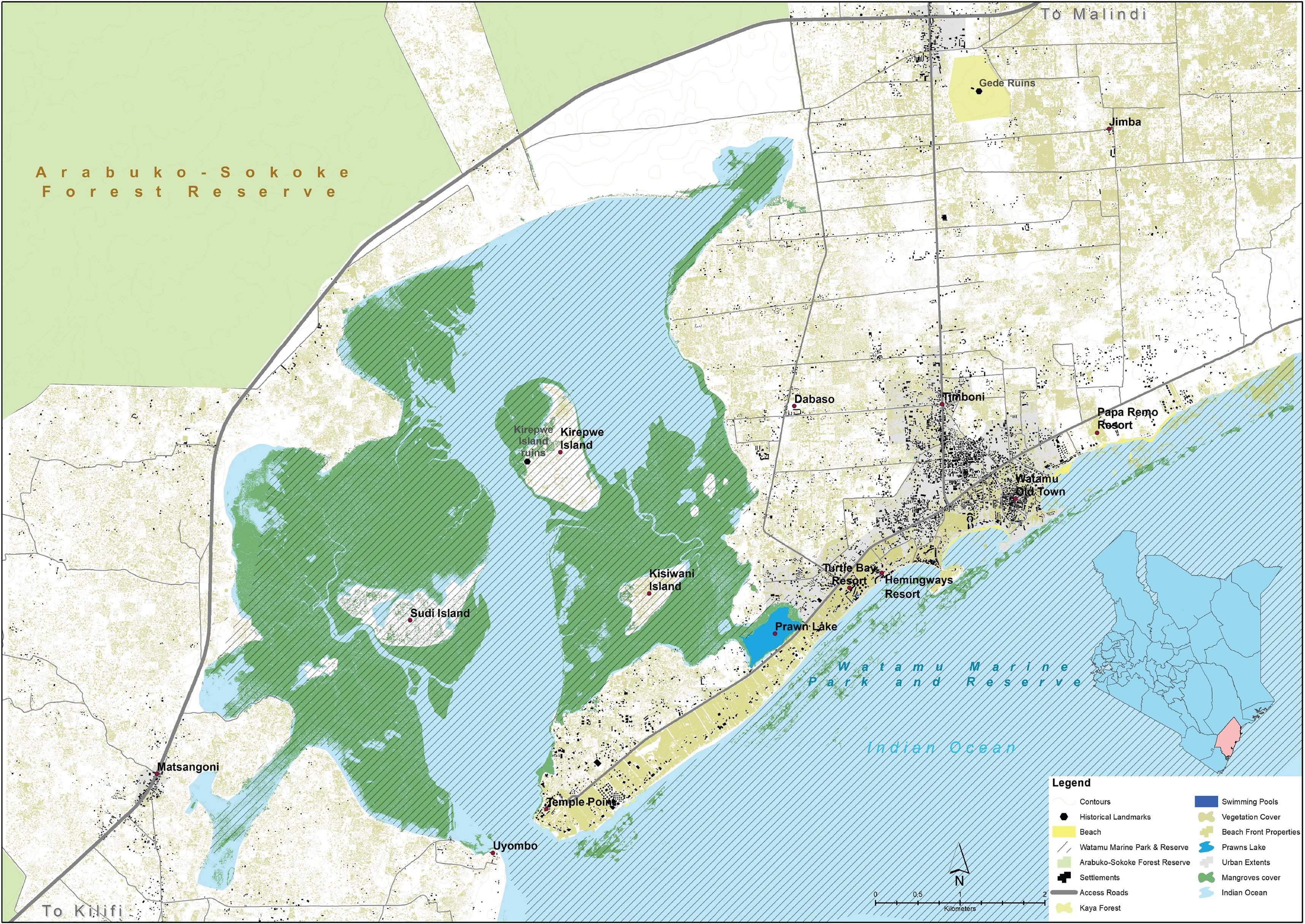
Figure 2
Map of the case study area Mida Creek showing the indigenous Arabuko-Sokoke forest reserve to the top left corner and the adjacent mangrove forest ecosystem that is within the Watamu marine park and reserve. Authors (December 2022).
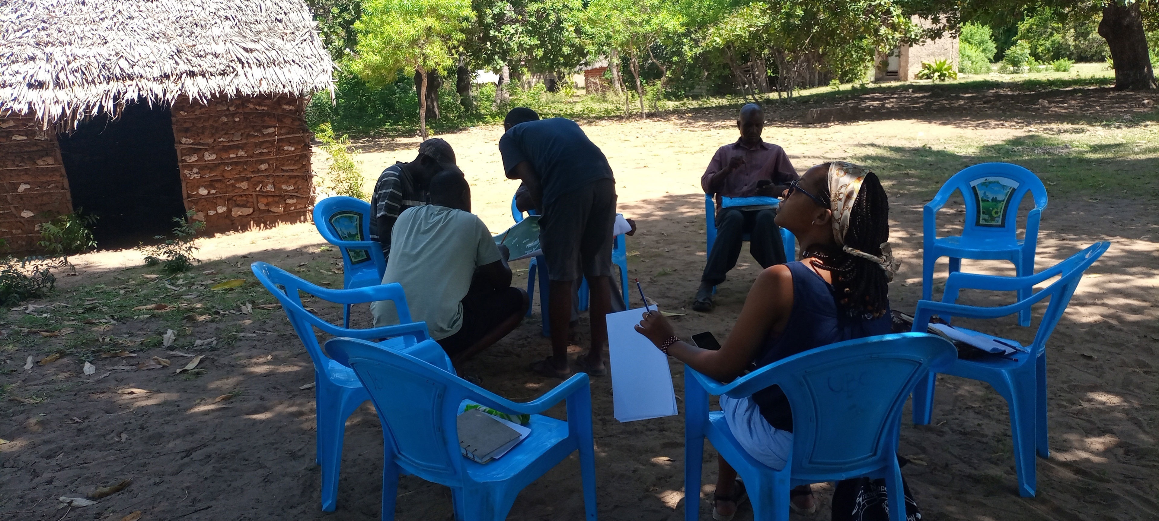
Figure 3
The authors engaging in participatory mapping during fieldwork surveys around the Mida Creek area, Source Authors 2022.
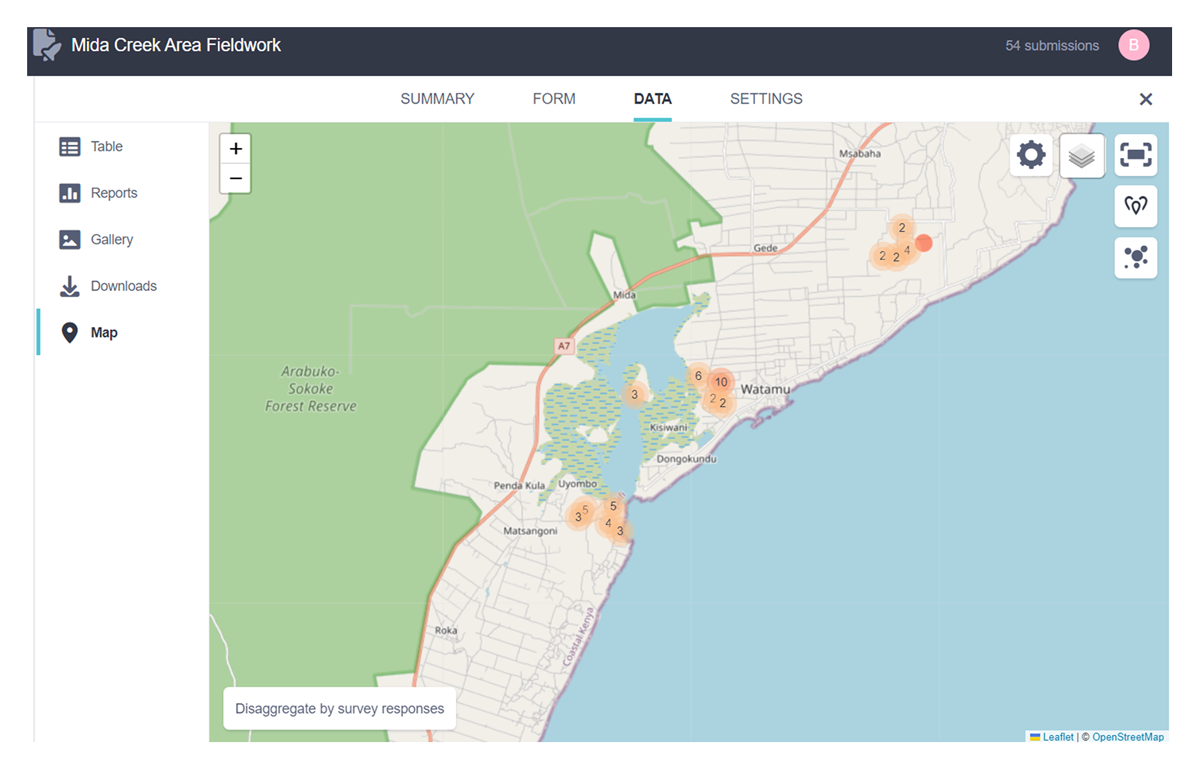
Figure 4
Map showing the spatial distribution of nineteen Community-Based Organizations and household survey data collected using the KoboCollect mobile data collection application (KoboToolbox, 2022). Source: Authors, 2022.
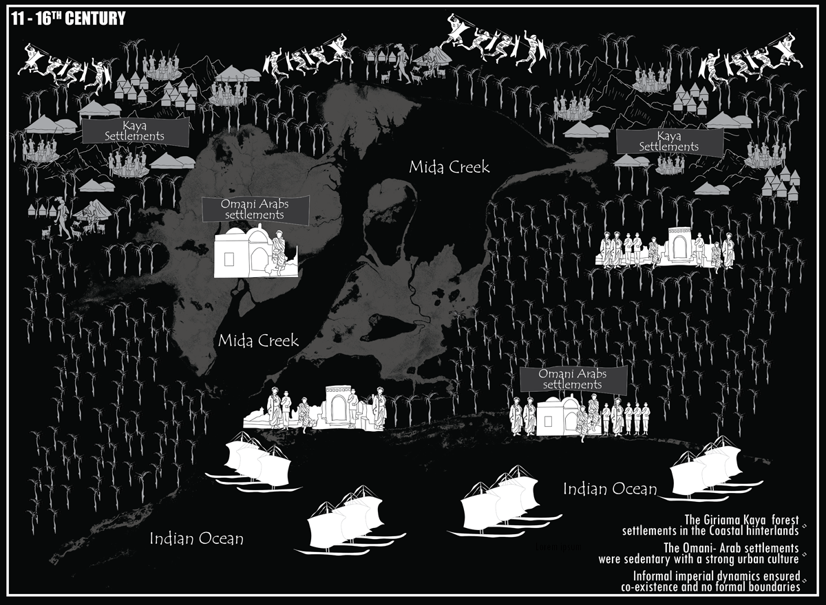
Figure 5
A historical caricature showing the informal imperial dynamics evident in Mida Creek area during 11–16th century. Source: Authors, 2024.
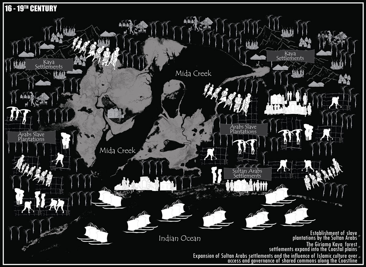
Figure 6
A historical caricature showing the informal imperial dynamics evident in Mida Creek area during 16–19th century. Source: Authors, 2024.
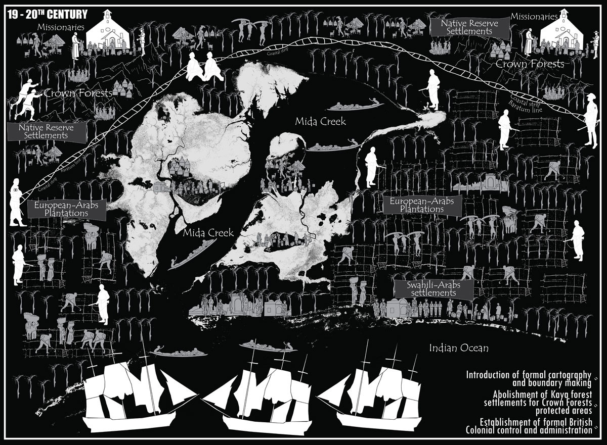
Figure 7
A historical caricature showing the informal imperial dynamics and formal colonial control evident in Mida Creek area during 19–20th century. Source: Authors, 2024.
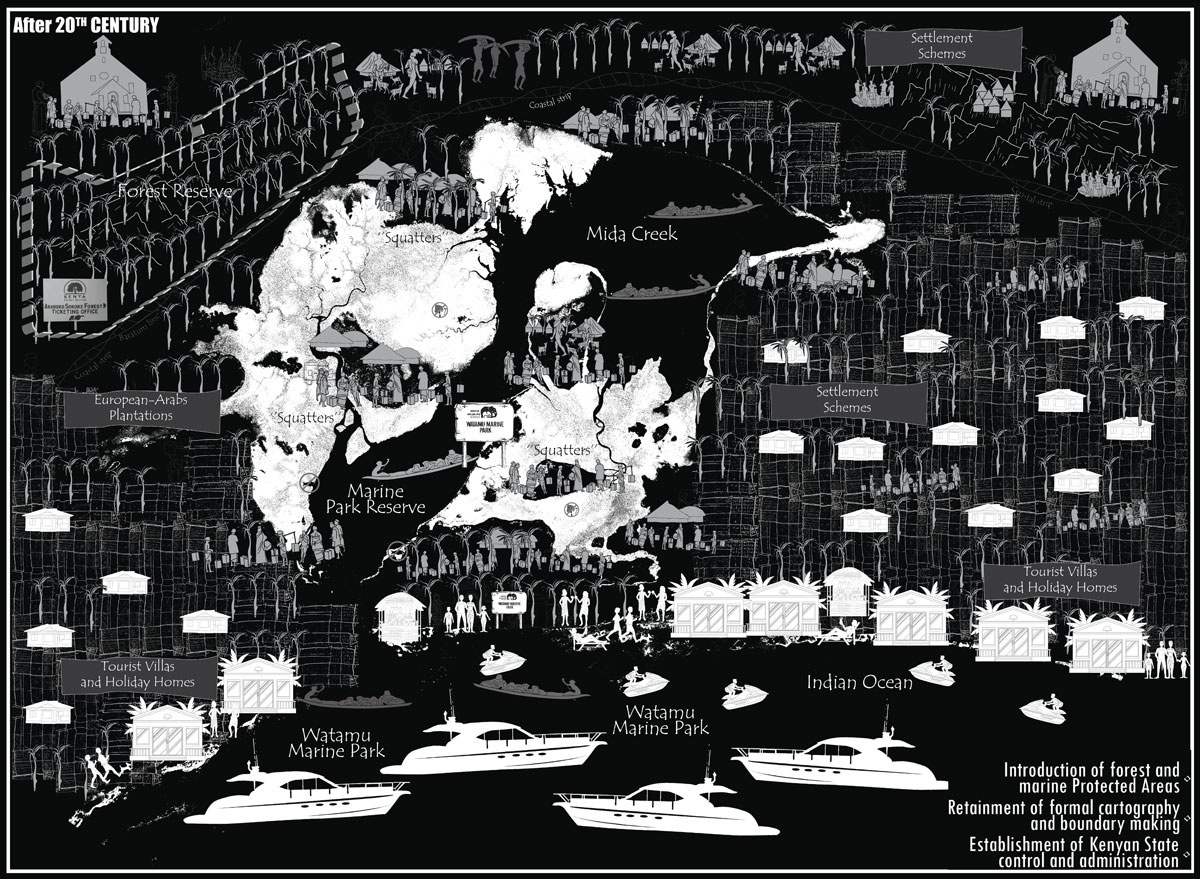
Figure 8
A historical caricature showing the formal colonial and post-colonial dynamics evident in Mida Creek area after the 20th century. Source: Authors, 2024.
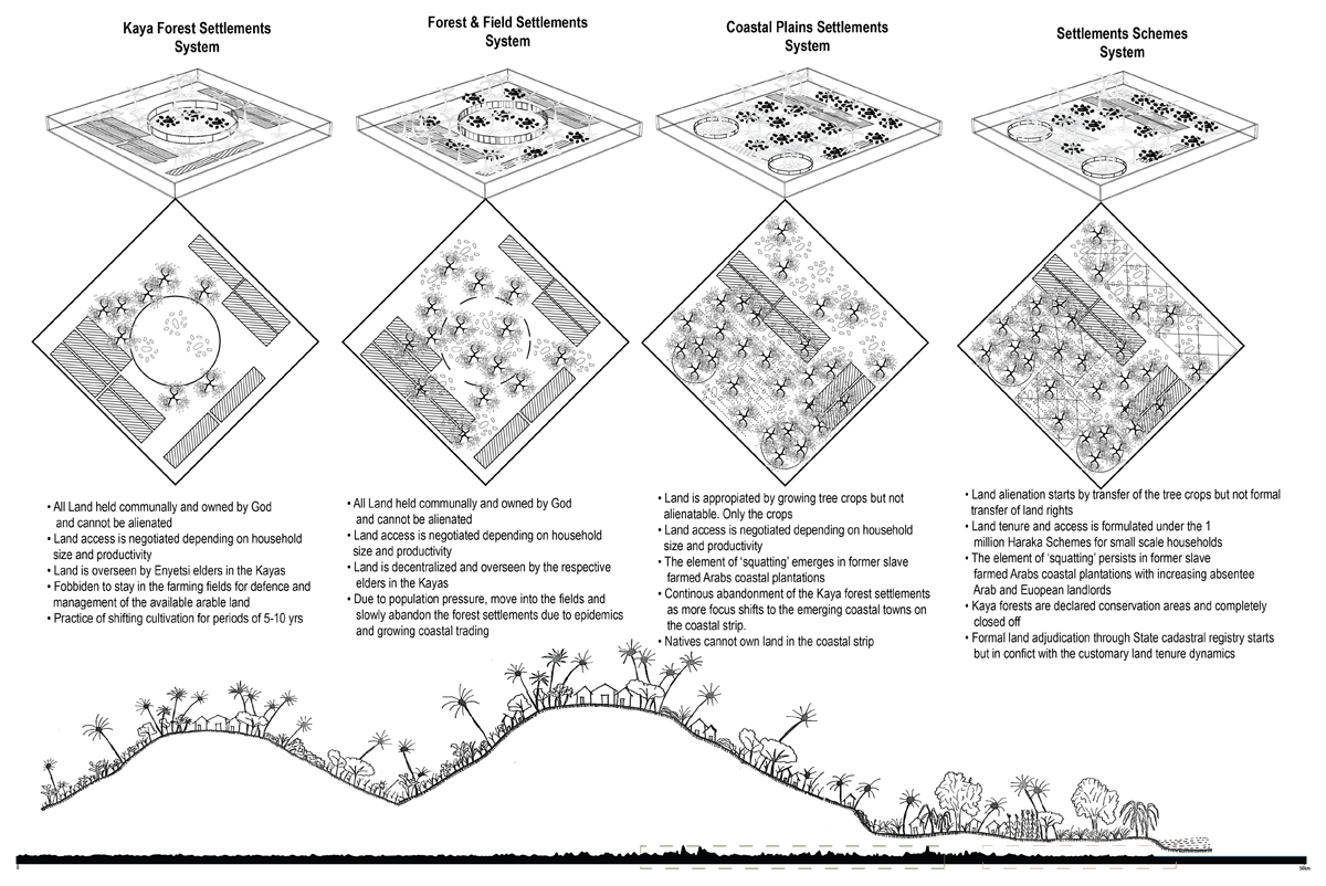
Figure 9
Illustration showing the transformation of the Giriama Kaya settlements commons to the post-colonial settlement schemes. Source: Authors, 2023.
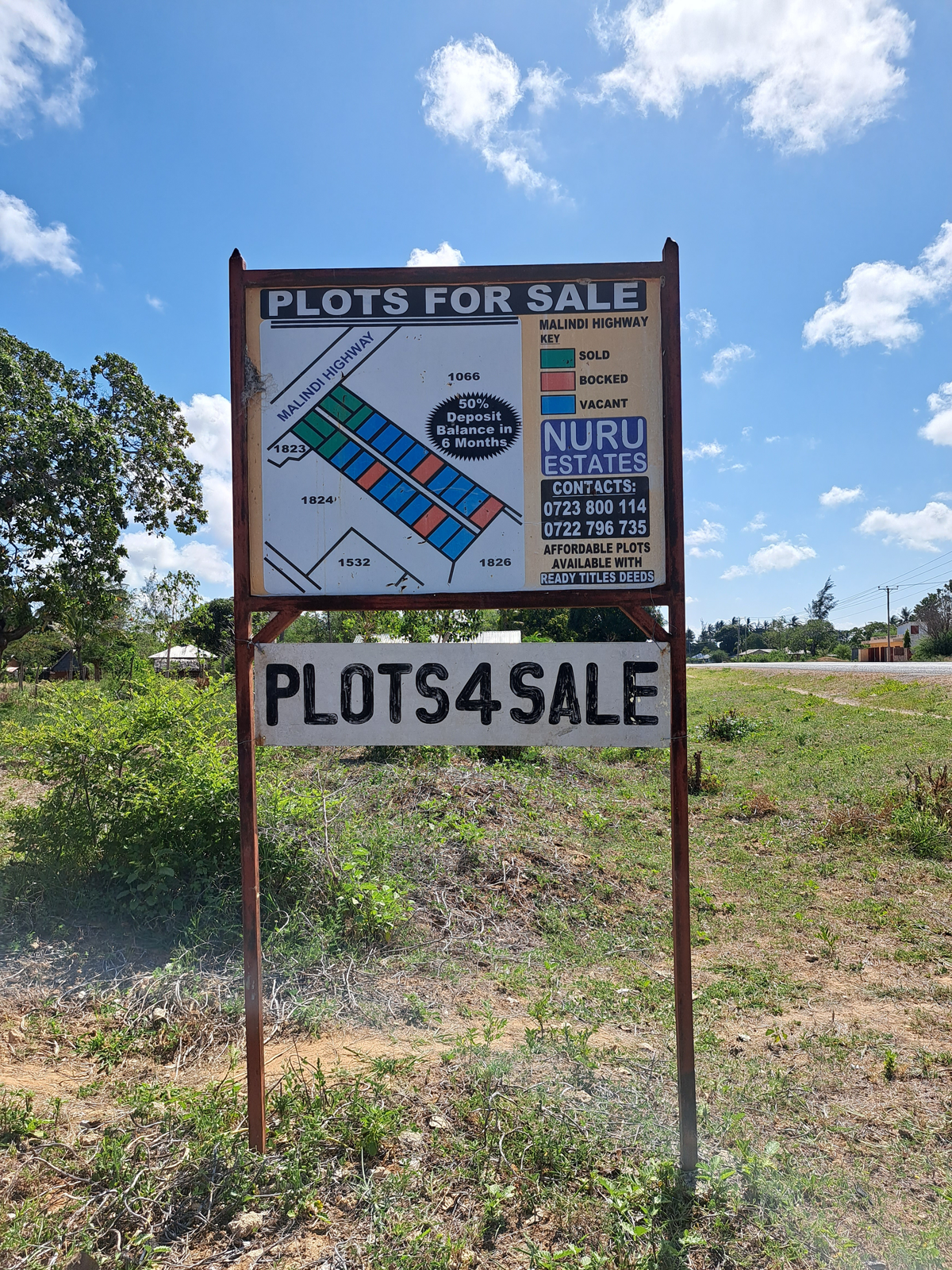
Figure 10
A signboard along the Mombasa-Malindi highway showing increased land speculation and fragmentation within Mida Creek area. Source: Authors, 2021.
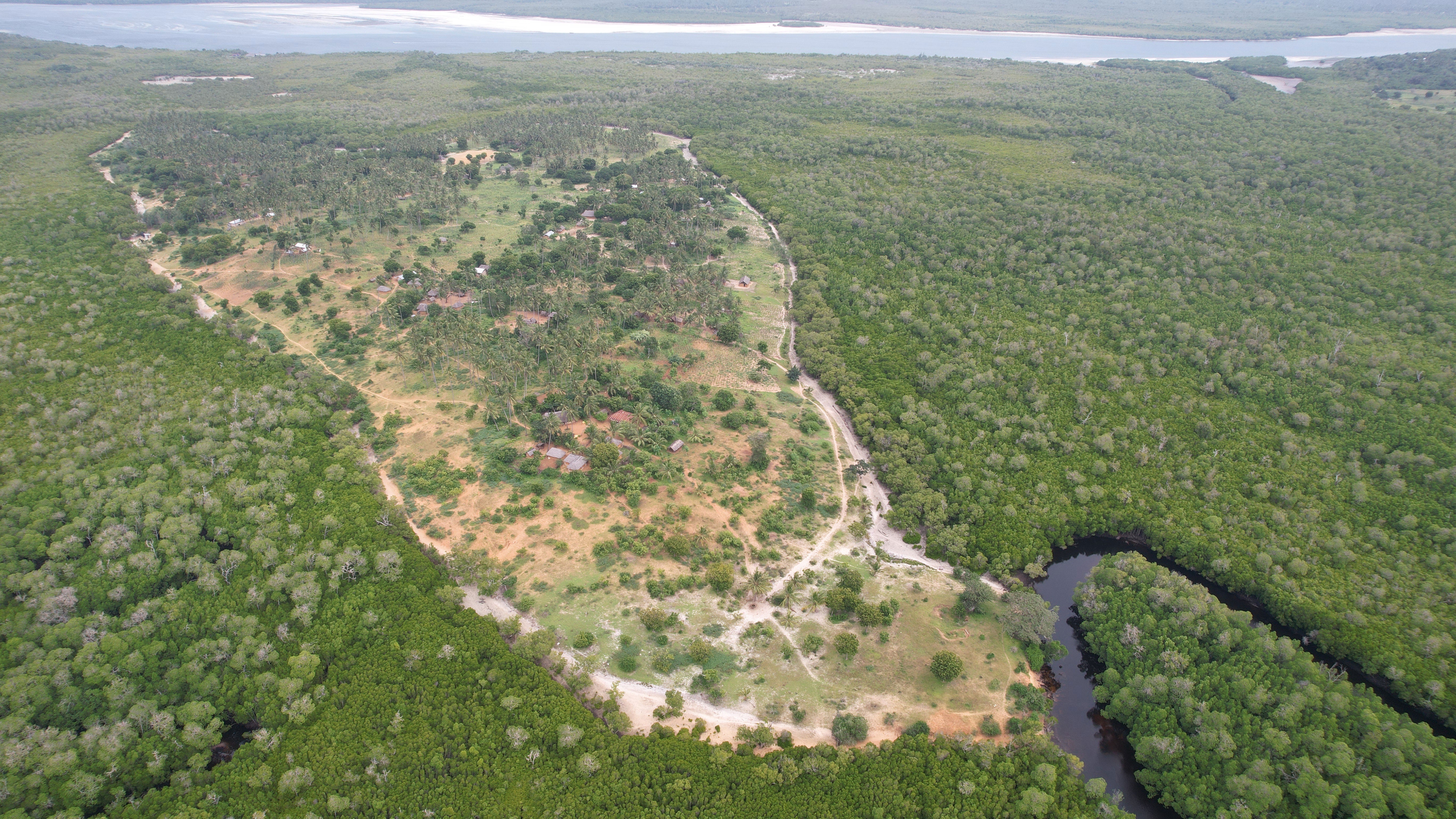
Figure 11
A drone imagery of the Kisiwani Island settlement within the Watamu Marine Reserve. It demonstrates that the Giriama community are still maintaining their traditional forest settlements logic and co-existing with the mangrove forest ecosystem. Source: Authors (August 2023).
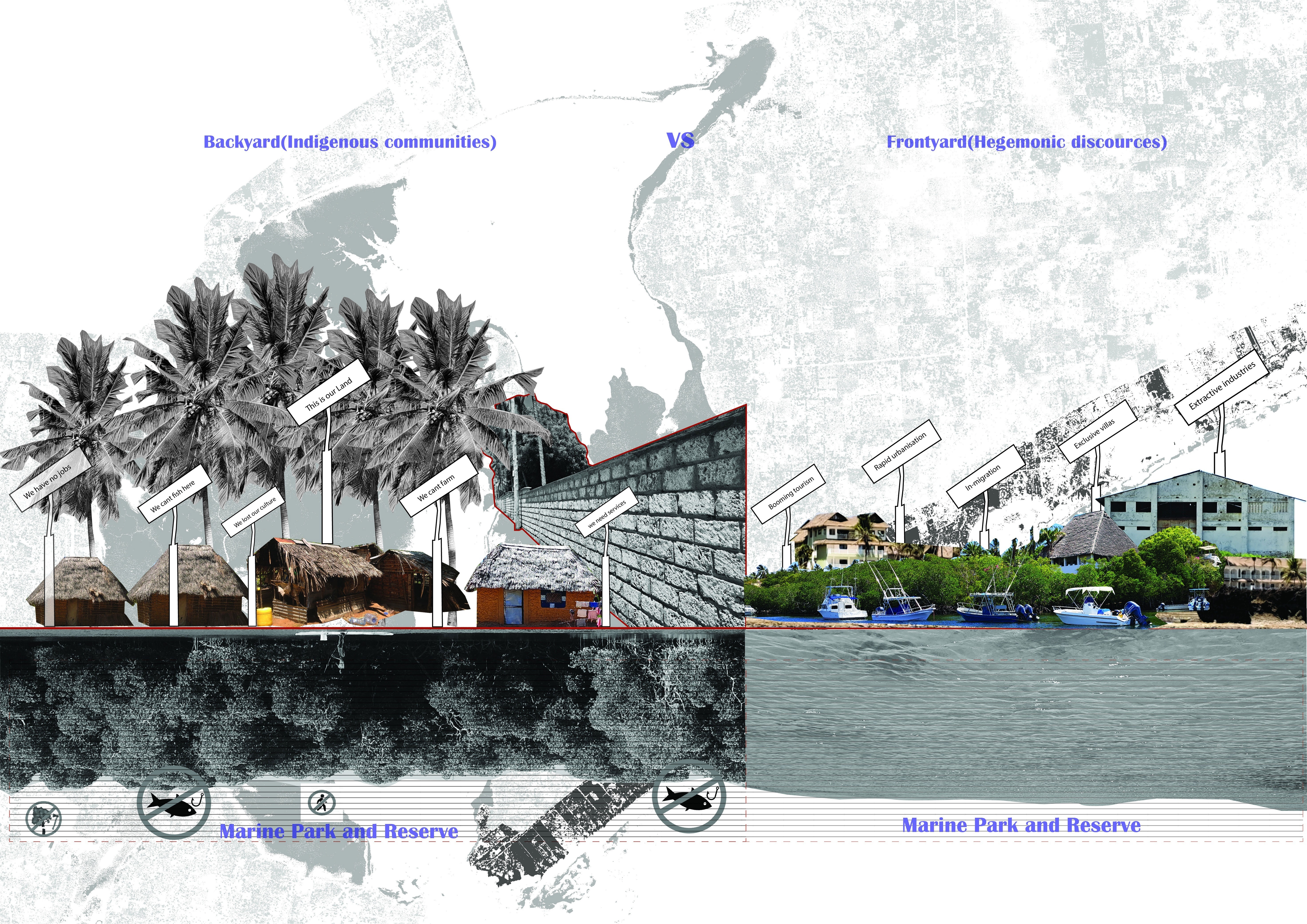
Figure 12
A Collage showing the spatial inequalities manifesting in Mida creek area. Framed in two paradoxical lenses labelled as ‘backyard’ and ‘front yard’. The former is the invisible reality that the Giriama community live in, while the latter is the mainstream identity of Mida Creek area as a booming tourist hub. Source: Authors, 2023.
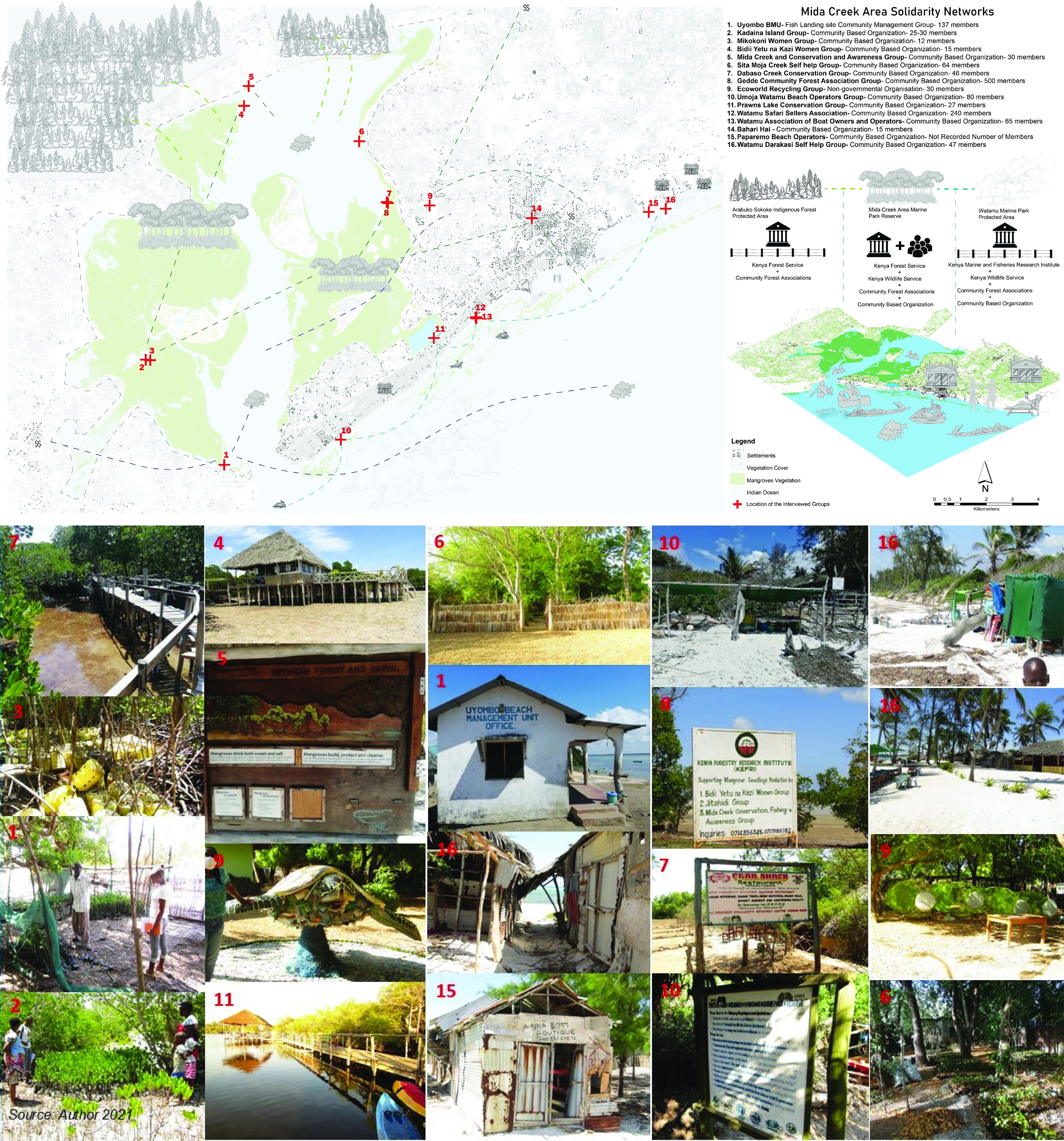
Figure 13
An annotated map illustration with corresponding images showing a network of Community Based Organizations’ that are actively engaging in re-negotiating for access to commons and commoning processes within Mida Creek area. Source: Authors (Dec 2021).