

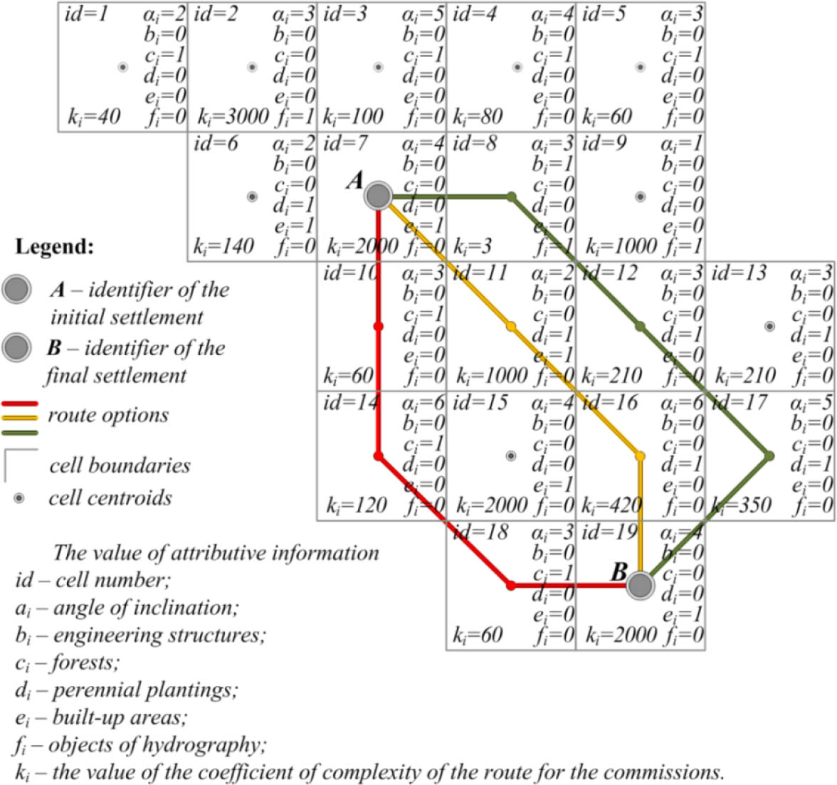
Figure 1
Generalised scheme of laying the route
Table 1
Calculation of the coefficient of complexity ki (impedance) of routing
| Dist(red)A,B | Dist(orange)A,B | Dist(green)A,B | |||
|---|---|---|---|---|---|
| cell | value ki in the cell | cell | value ki in the cell | cell | value ki in the cell |
| id7 | 2000 | id7 | 2000 | id7 | 2000 |
| id10 | 2060 | id11 | 3000 | id8 | 2003 |
| id14 | 2180 | id16 | 3420 | id12 | 2213 |
| id18 | 2240 | id19 | 5420 | id17 | 2563 |
| id19 | 4240 | id19 | 4563 | ||
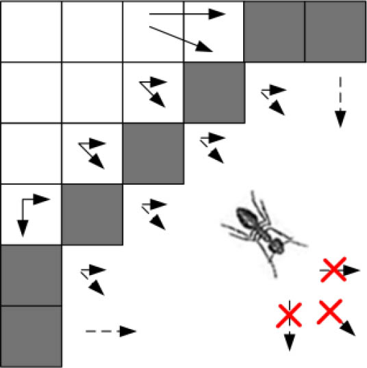
Figure 2
Lack of possibility of further movement
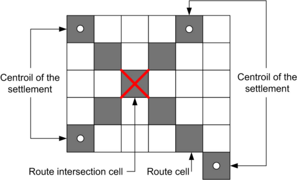
Figure 3
Self-intersection of the route
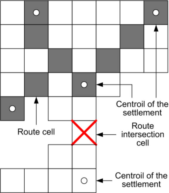
Figure 4
The point is found, but does not belong to the shortest route
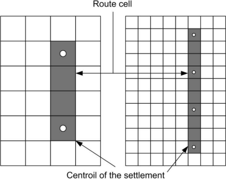
Figure 5
Excessive detailing of the territory
Table 2
Comparison of road network options
| Region | Existing networks | Simulated version | ||
|---|---|---|---|---|
| Total length [km] | Network density [km/km2] | Total length [km] | Network density [km/km2] | |
| Vyzhnytsya | 294.1 | 0.33 | 196.6 | 0.22 |
| Hertsaiv | 151.1 | 0.49 | 133.8 | 0.43 |
| Hlybokaje | 234.8 | 0.36 | 184.9 | 0.28 |
| Zastavnivskyi | 243.3 | .0.40 | 199.4 | 0.33 |
| Kelmenets | 266.7 | 0.40 | 171.7 | 0.26 |
| Kitsman | 203.6 | 0.33 | 196.0 | 0.32 |
| Novoselytsky | 237.9 | 0.32 | 195.9 | 0.27 |
| Putil | 195.3 | 0.22 | 292.5 | 0.33 |
| Sokyryany | 238.4 | 0.36 | 174.7 | 0.26 |
| Storozhynets | 338.3 | 0.29 | 231.0 | 0.20 |
| Khotyn | 269.1 | 0.38 | 211.6 | 0.30 |