
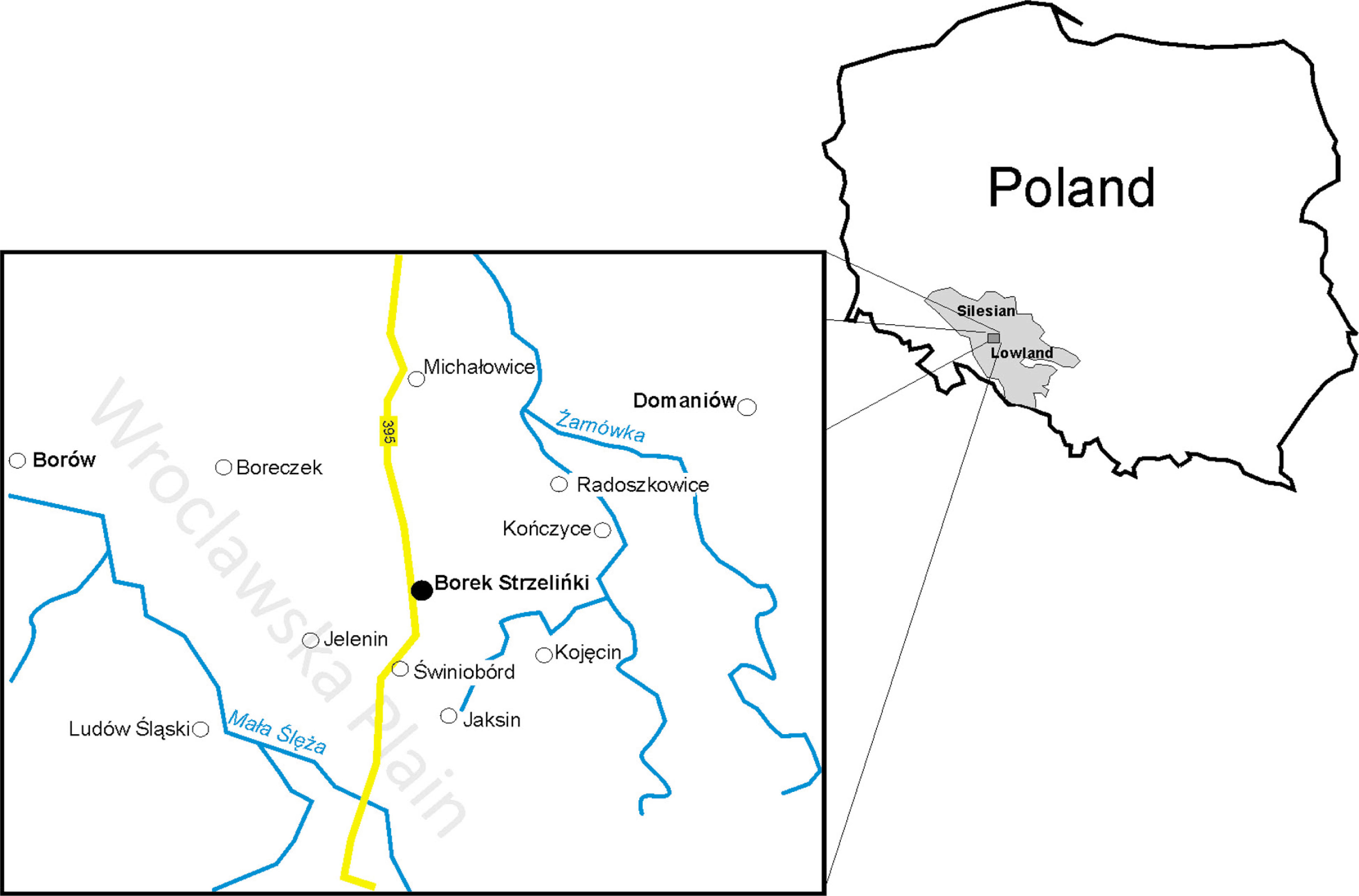
Fig. 1
Location of Borek Strzeliński against the background of the region and Poland.
Source: J. Lach.
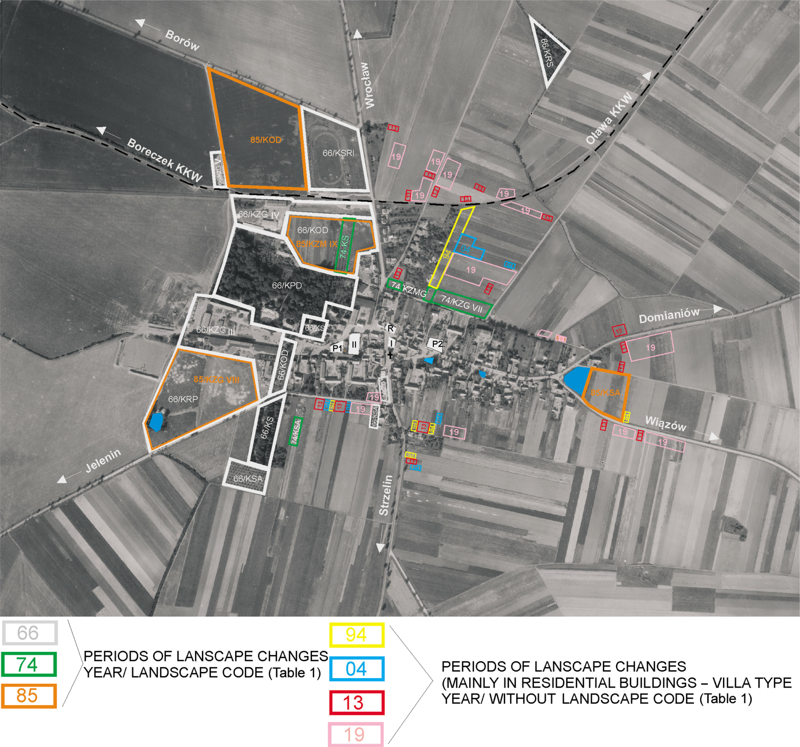
Fig. 2
Structure and function of landscape transformation of Borek Strzeliński in the period 1966–2019.
Source: J. Lach.
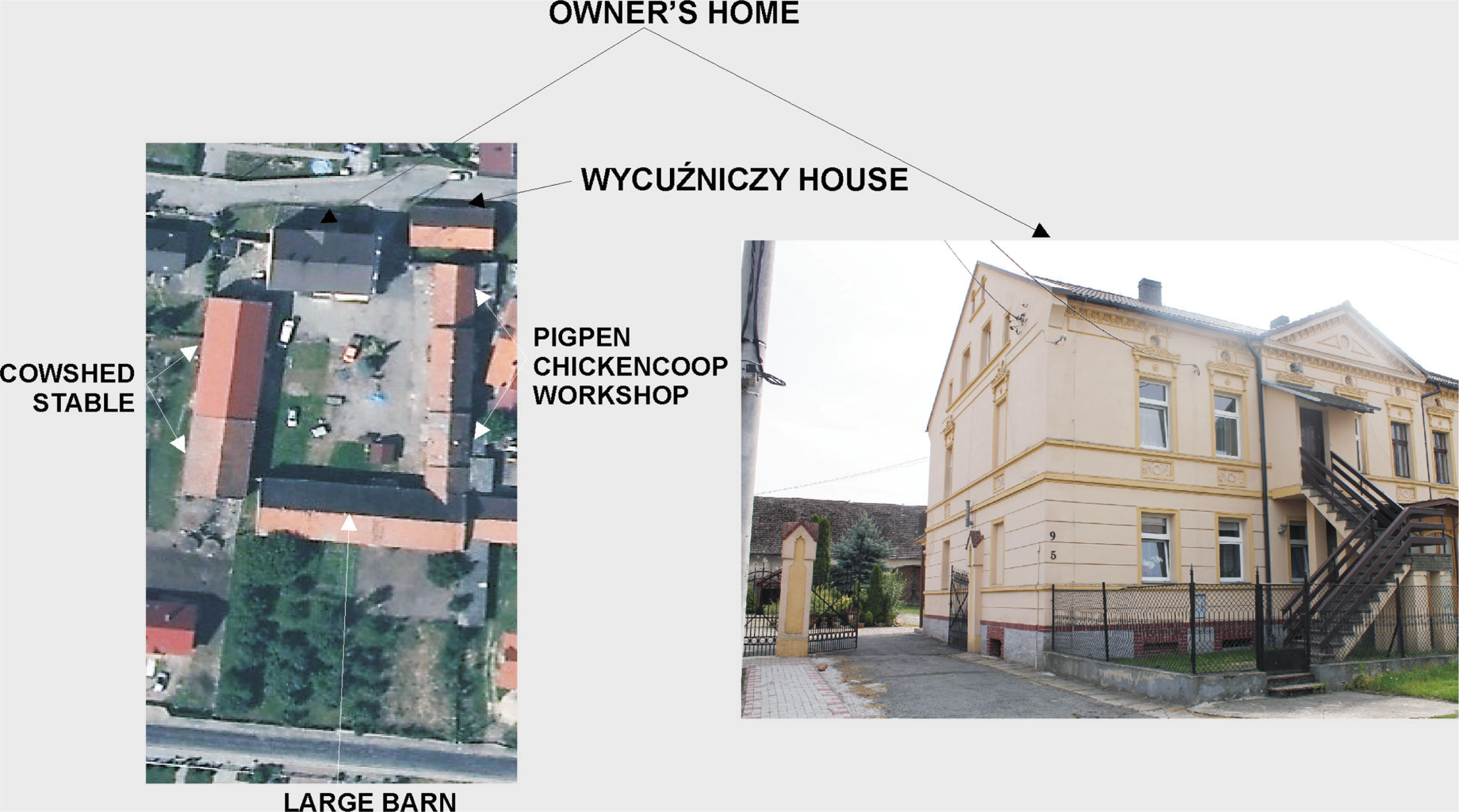
Fig. 3
The spatial and functional layout of a Franconian homestead in Borek Strzeliński in Św. Floriana St.
Source: J. Lach.
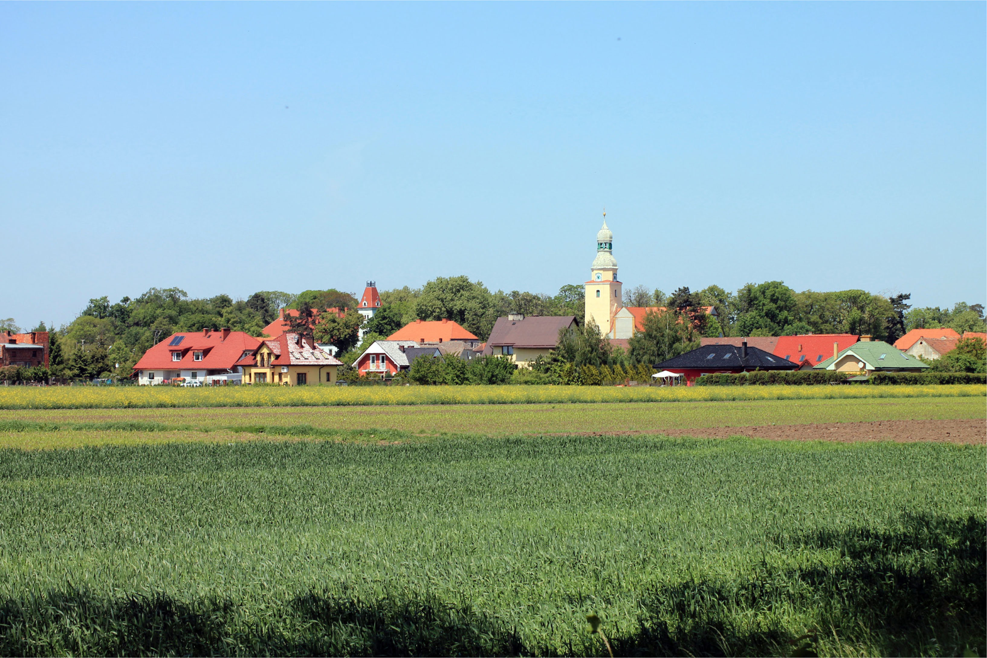
Fig. 4
The tower of the parish church in Borek Strzeliński dominates in the panorama of the village from the south.
Source: J. Lach.
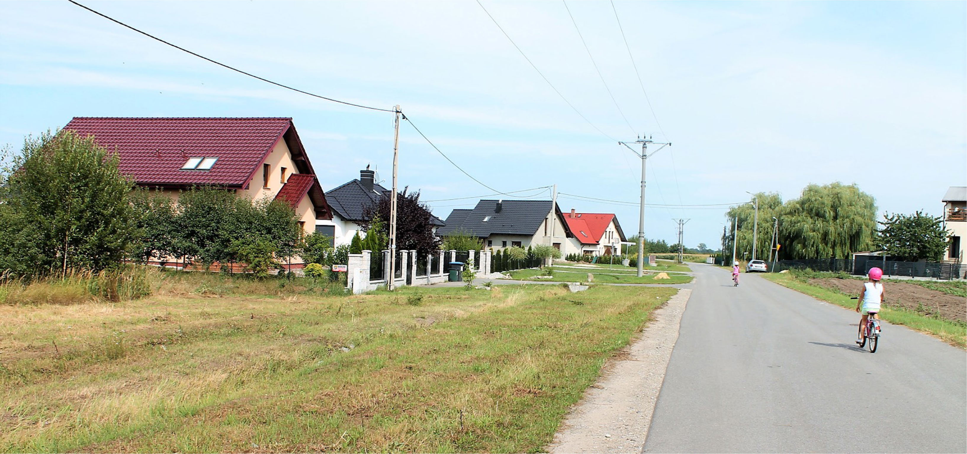
Fig. 5
A new model of the settlement space of Borek Strzeliński in its northern area – a villa type characteristic of a suburban area.
Source: J. Lach.
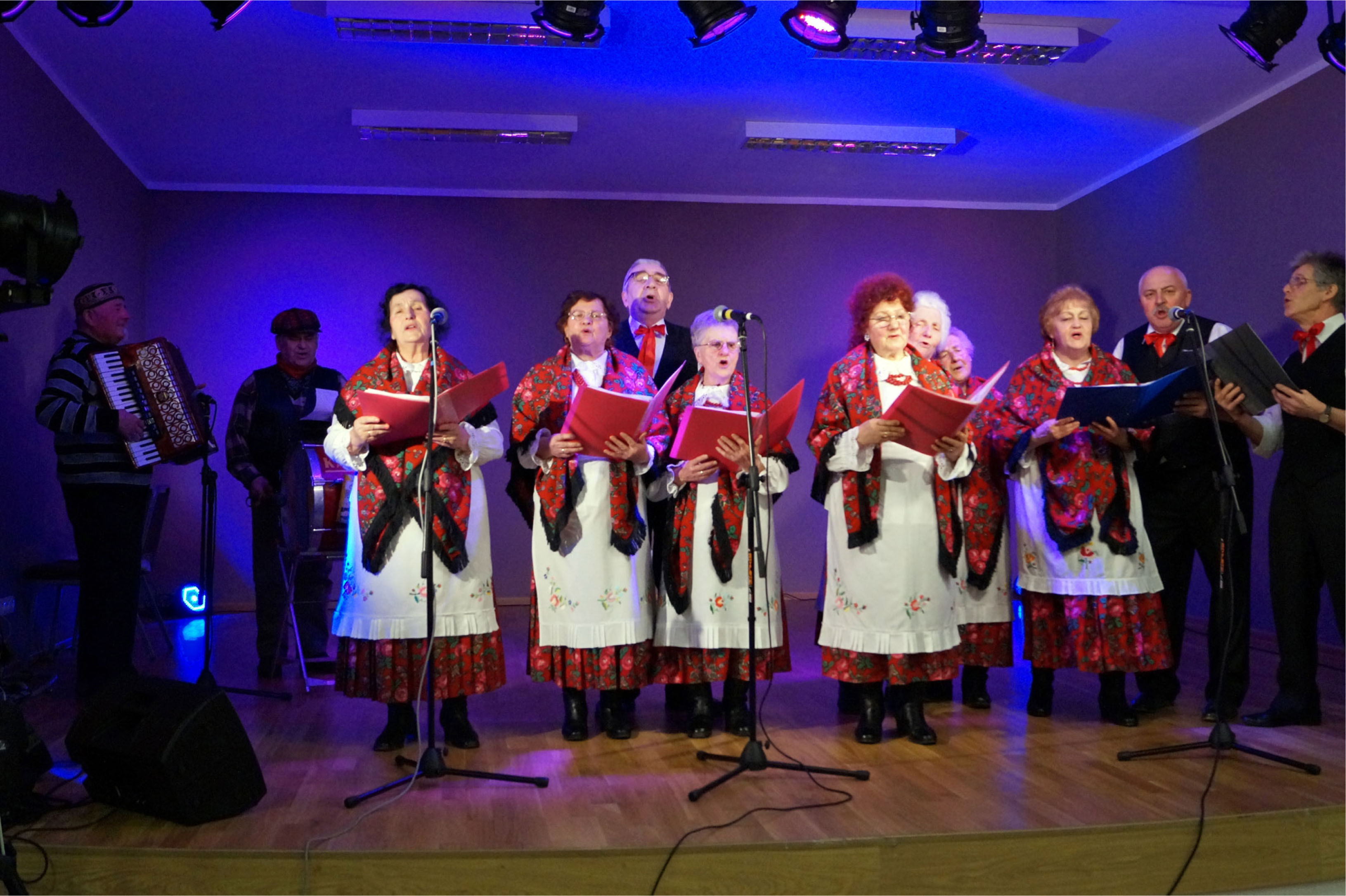
Fig. 6
The Ślężanki Folk Group during a performance at the Culture Centre in Borek Strzeliński in 2017.
Source: S. Zawer/Communal public library in Borów.
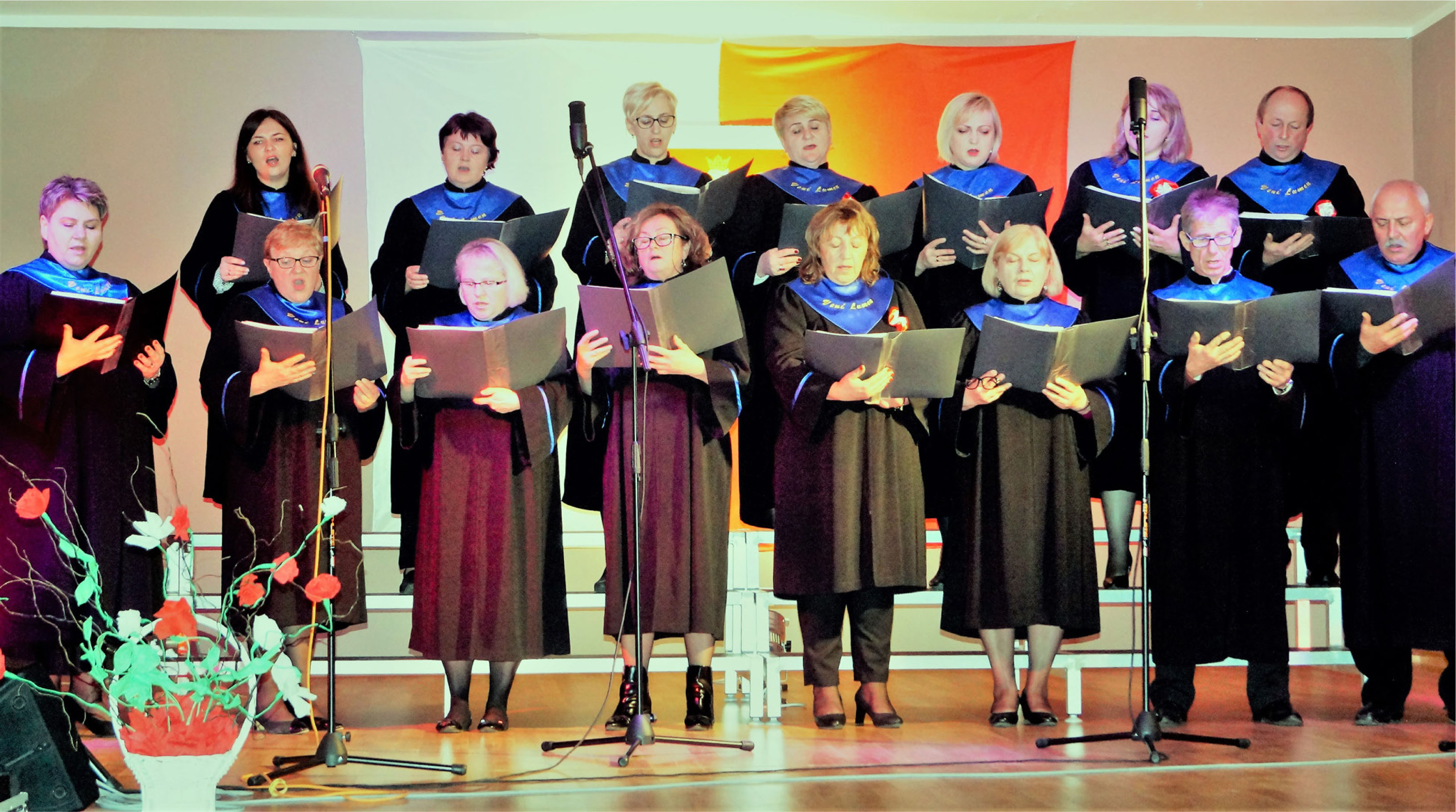
Fig. 7
The Veni Lumen choir at the commune cultural centre in Borek Strzeliński.
Source: S. Zawer/Communal public library in Borów.
Table 1
Landscape transformations within the rural area of Borek Strzeliński for Fig. 2.
| Landscape type Green – natural–cultural Yellow – cultural | Landscape code | 1966 | 1974 | 1985 | 1994 | 2004 | 2013 | 2019 | |
|---|---|---|---|---|---|---|---|---|---|
| 1 | Agricultural – small-field | ‘KRD’ | 66/KRD | No change | No change | No change | No change | No change | No change |
| 2 | Agricultural – large-field | KRDW | 66/KRD | No change | No change | No change | No change | No change | No change |
| 3 | Agricultural – pastoral (grazing) | KRP | 66/KRP | No change | Lost | – | – | – | – |
| 4 | Agricultural – orchard | KS | 66/KSA | 74/KSA | Disappearance/new 85/KSA | Lost in south part of village | No change | No change | Lost in east part of village |
| 5 | Allotments | KOD | 66/KOD | No change | Lost/new 85/KOD | No change | No change | No change | Lost in south part of village |
| 6 | Avenues | KAD | 66/KAD | No change | No change | No change | No change | No change | Lost |
| 7 | Buffer strips | KR | 66/KR | No change | No change | No change | No change | No change | No change |
| 8 | Residential and economic with commercial function | KMGU | 66/KZMG | No change | No change | No change | No change | No change | No change |
| 9 | Residential without commercial function | KZM | – | State Farm apartment blocks; | – | – | Yes | Yes | Yes |
| 10 | Commercial buildings | KZG | 66/KZG | SKR base and milk purchase | Cowshed on former pasture | No change | No change | No change | No change |
| 11 | Sacred | KS | 66/KS | No change | No change | No change | No change | No change | No change |
| 12 | Manor | KD | 66/KD | No change | No change | No change | No change | No change | No change |
| 13 | Fire prevention reservoirs | KW | 66/K | No change | One lost on Oławska Street | No change | No change | No change | No change |
| 14 | Sports and Recreation | KSR | 66/cRS | No change | No change | No change | No change | No change | No change |
Table 2
Typology of the rural landscape of the Wrocław region based on the example of Borek Strzeliński.
| Episode | Agricultural | Settlement | Economic | Manor | Sacred | Avenues | Water | |||||||
|---|---|---|---|---|---|---|---|---|---|---|---|---|---|---|
| Structure of use | Function | Description | Function | Description | Function | Description | Function | Description | Function | Description | Function | Description | Function | |
| 1966–1994 | Large fields (state property) crops, root vegetable, pastures Small fields (private ownership 2–3 ha) cereals, root vegetable, legumes | Cultivation and breeding | Single and multi-family historical housing and economic development Dwelling house + cowshed + barn + hen house + pigsty + vegetable garden + fruit bushes + garden From 1978 PGR blocks of flats | Housing and production function | Purchase square: crops, root vegetable, livestock, scrap metal and coal, cowsheds, piggeries, dairy, forges, bakeries, shops, restaurant, cinema, agricultural equipment base | Commercial + production (livestock and agricultural produce) | Palace with outbuildings, and palace park | Production + office + housing + education (kindergarten) for state-owned farms PGR | Church Cemetery Cross in the form of a monument, | Religious | Popular alleys along Borek-Wrocław, Borek-Borów roads Shrubs along former narrow-gauge Borek-Oława line. Closed tunnel landscape | Ecological function | Number of fire prevention reservoirs: 4 | Protective |
| 1994–2004 | Large fields (private property) Cereals, root crops, corn, rapeseed Small fields (merging of fields - monoculture) cereals, root crops - sugar beet, potatoes, corn, rapeseed | Cultivation | Single-family housing with reduced economic function (vegetable garden + fruit bushes) | Residential and production function | Disappearance of the above remaining: barns, which were converted into production plant, square in N part of village, SKR base still open for cars | Commercial + production (permanent equipment - furniture) | Slow deterioration of palace and its surroundings | Production + office + housing + education (kindergarten until 1999) | Penitential cross | Sightseeing | Liquidation of one in centre of village | |||
| Single-family type of suburban housing (villas) | Residential and recreational function | Reconstruction of palace in 2010, some of farm buildings revitalisation of park | Services (catering, business, hotel) | Removal of above-mentioned avenues - open landscape | Absent | Number of fire prevention reservoirs: 3 | Protective | |||||||
| 2004–2019 | ||||||||||||||