
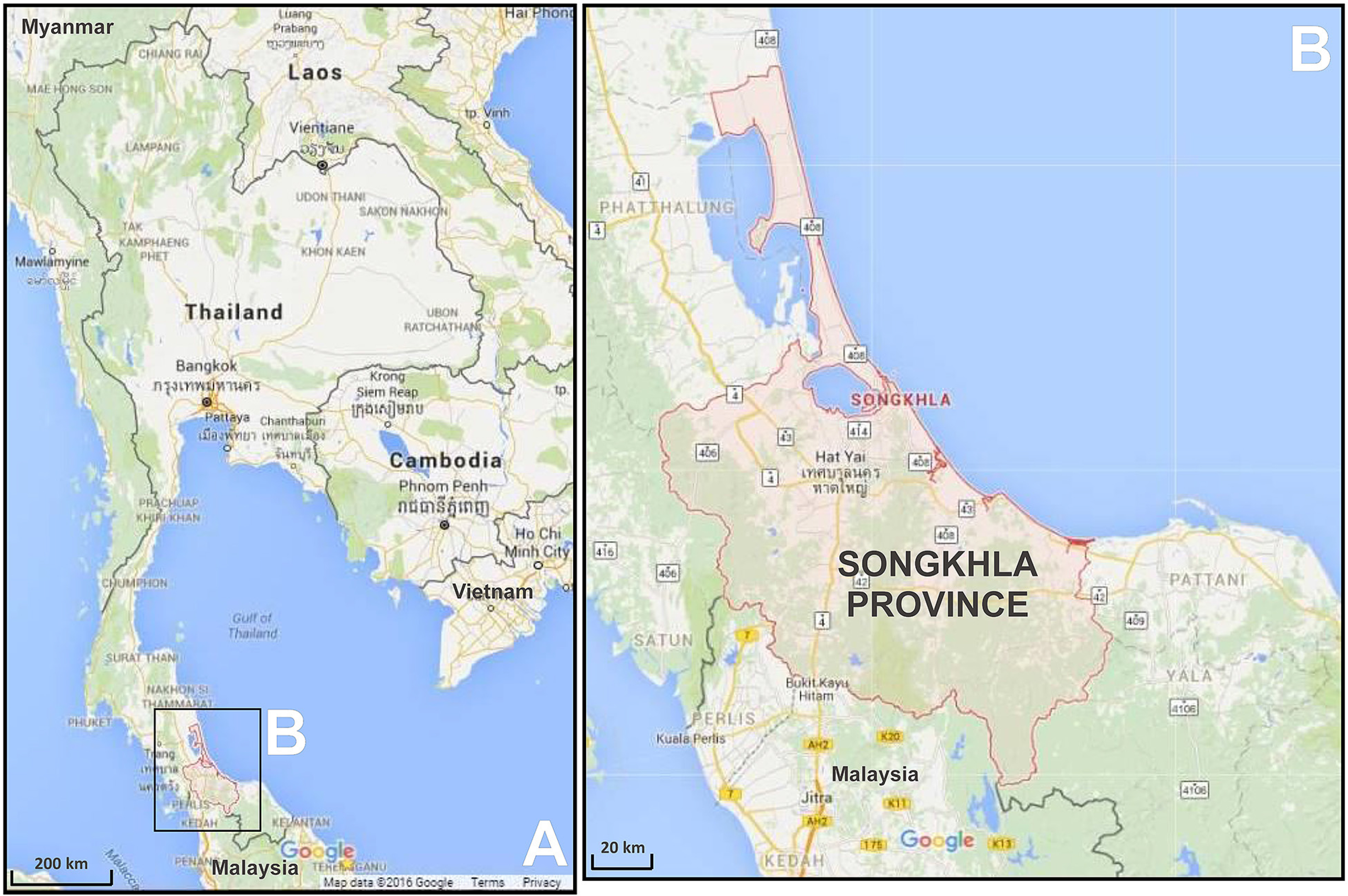
Fig. 1
Location map of the study area (source: Google Map, 2016).
A – map of Thailand, B – map of Songkhla Province.
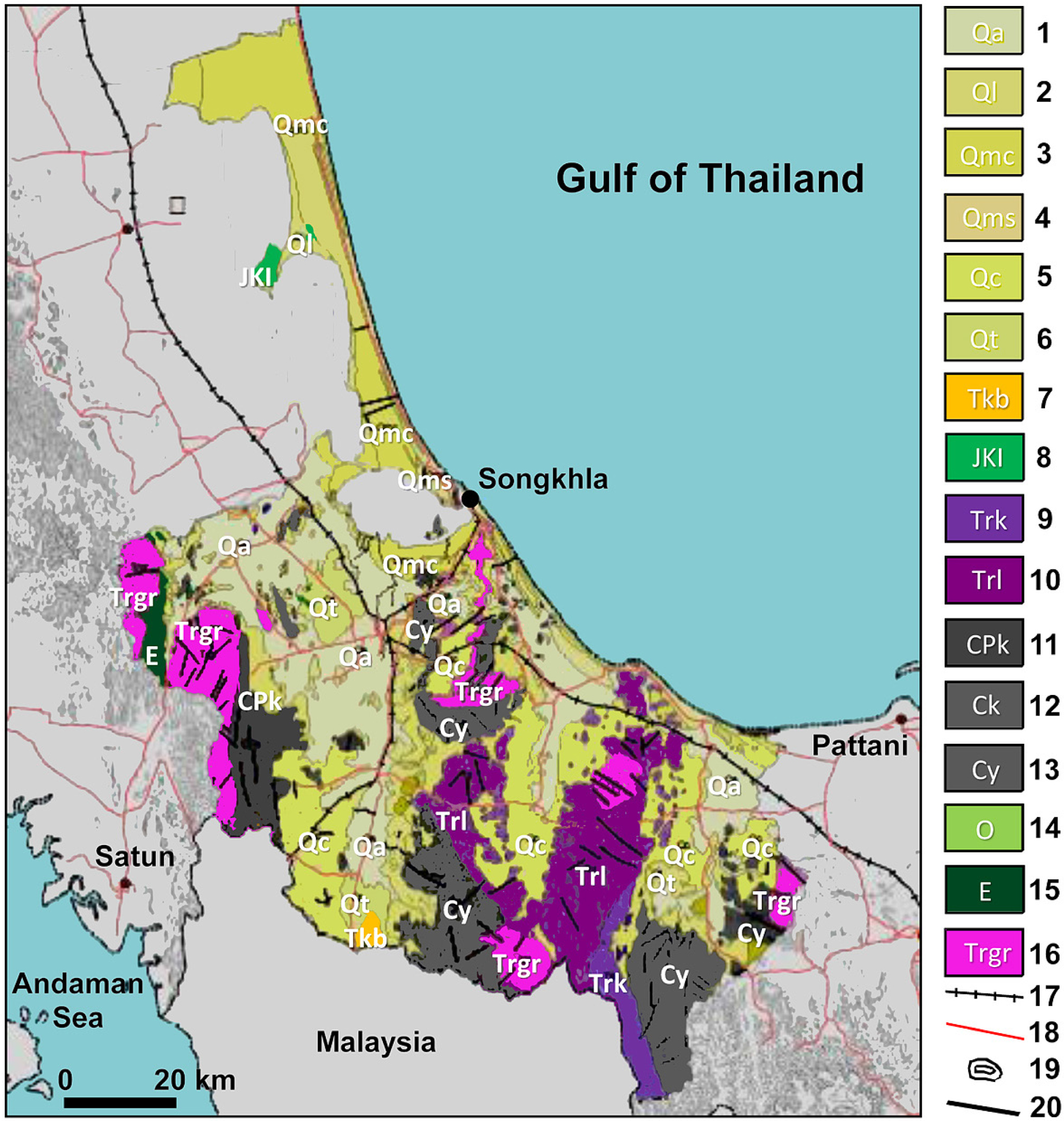
Fig. 2
Geological map of Songkhla Province (Adopted from DMR, 2007).
Sediments, sedimentary rocks and metamorphic rocks: 1 – Fluvial deposits: gravel, sand, silt, and clay of channel, river bank, and flood basin (Quaternary), 2 – Lagoon deposit: Silt and clay, light gray to white, small amount of yellow mottles, dense, loose (Neogene/Holocene), 3 – Coastal tide-dominated deposits: clay, silt, and fine-grained sand of tidal flat, marsh, mangrove swamp and estuary (Quaternary), 4 – Coastal wave-dominated deposits: sand and gravelly sand of beach ridge, barrier, and dune (Quaternary), 5 – Colluvial and residual deposits: gravel, sand, silt, laterite, and rock fragments (Quaternary), 6 – Terrace deposits: gravel, sand, silt, clay, and laterite (Quaternary), 7 – Shale, calcareous shale, sandstone, and siltstone, pale-brown, yellowish-brown, and white; limestone, lignite, oil shale, and gypsum locally intercalated; gastropods and plant remains in some beds; semi-consolidated mudstone, siltstone, sandstone, marl, 8 – Arkosic sandstone, mudstone, and siltstone, reddish brown; cross-bedded; conglomerate and sandstone in the upper part; fresh and brackish water bivalves in the lower part (ThungYai Group: Jurassic – Cretaceous), 9 – Limestone, light grey to dark grey, cryptocrystalline, massive with coral and small foraminifera (Triassic), 10 – Mudstone, limestone, sandstone, siltstone, conglomerate, with Halobia sp., Daonella sp. and Claraia sp. (Tha Song Yang Group: Triassic), 11 – Pebbly mudstone, shale, siltstone, chert, tuffaceous sandstone, quartzose sandstone, dark gray, greenish gray, and brown; with brachipods, bryozoans, corals, and crinoids (KaengKrachan Group: Carboniferous – Permian), 12 – Shale, brown to reddish brown and white to light gray, with Posidoniabecheri, brachiopods, and trilobites; intercalated with arkosic sandstone, quartzitic sandstone, siltstone and chert (Carboniferous), 13 – Sandstone, very thick-bedded; shale, siliceous shale with Posidoniabecheri, chert, and conglomerate (Carboniferous), 14 – Argillaceous limestone and limestone, gray and pink; dolomitic limestone and schistose marble; with interbedded shale, calcareous, and sandy; shale (Thung Song Group: Ordovician), 15 – Quartzite, orthoquartzite, sandstone, and calcareous shale (Cambrian); Igneous rocks: 16 – Biotite granite, tourmaline granite, granodiorite, biotite-muscovite granite, muscovite-tourmaline granite, and biotite-tourmaline granite (Triassic); Other: 17 – Railways, 18 – Main roads, 19 – Countur lines, 20 – Lineaments.
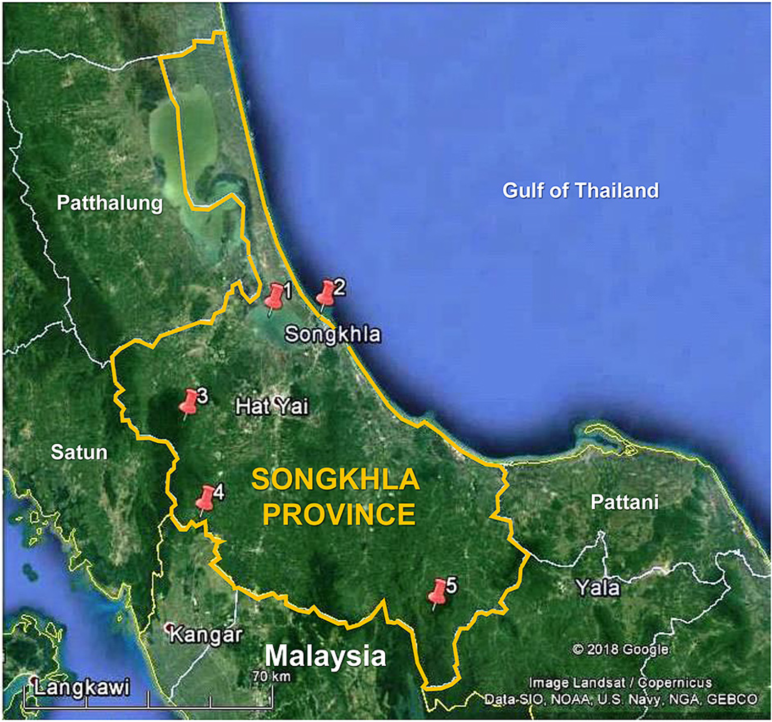
Fig. 3
Location map of selected geosites in Songkhla Province, Southern Thailand (plotted on the Google Earth).
1 – Songkhla Lagoon/Lake, 2 – Samila Beach, 3 – Tone Nga Chang Waterfall, 4 – Khao Rup Chang Cave, 5 – Khao Daeng Hot Spring.
Table 1
List of selected geosites as potential geoheritage resources and geotourism attractions in Songkhla Province, Thailand.
| No. | Geosite | Location | Main geological feature | Other features |
|---|---|---|---|---|
| 1 | Songkhla Lagoon/Lake | Amphoe or districts: Ranot, Krasae Sin, Sathing Pra, Singhanakhon, Khuan Niang, Mueang Songkhla, Hatyai (7°08′ N–7°48′ N; 100°08′ E–100°35′ E) | Great lagoon (lake) with Quaternary deposits and some rock outcrops | Several islands within the lagoon, and a great spit |
| 2 | Samila Beach | Amphoe Mueang Songkhla (7°13′40.00″ N; 100°34′57.83″ E) | Fine white sandy beach with a few rock outcrops in the area | Some nearby hilly areas and two islands off the shore of the beach (Ko Meaow and Ko Noo islands) |
| 3 | Tone Nga Chang Waterfall | Amphoe Hatyai (6°57′23.34″ N; 100°14′07.81″ E) | Seven-tier waterfall | Rock outcrops (granite, hornfels) |
| 4 | Khao Rup Chang Cave | Amphoe Sadao (6°42′55.80″ N; 100°16′35.47″ E) | Cave landforms | Buddhist temple |
| 5 | Khao Daeng Hot Spring | Amphoe Saba Yoi (6°28′56.05″ N; 100°51′47.62″ E) | Hot spring in a low-lying area | – |
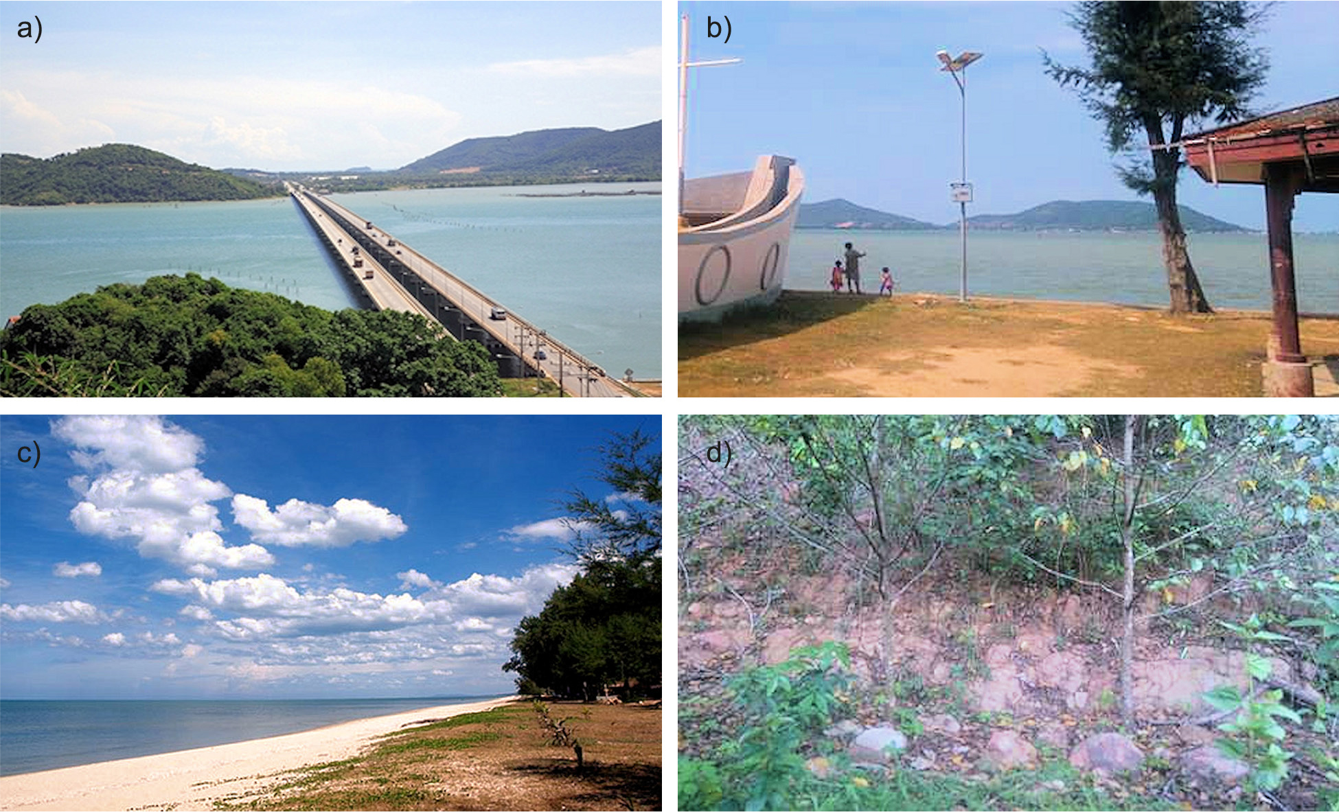
Fig. 4
Songkhla Lagoon area.
a – the aerial view of the lagoon with the Tinsulanond Bridge which spans the lagoon, b – The Quaternary deposits in the lagoon area where people usually enjoy the scenery of the water body, c – The Maharach Beach in Sathing Phra district (near the Songkhla Lagoon) is a part of the Songkhla Great Spit, d – The Jurassic – Cretaceous sedimentary rocks which dominantly composed of sandstone in the lagoon area in Amphoe Krasae Sin.
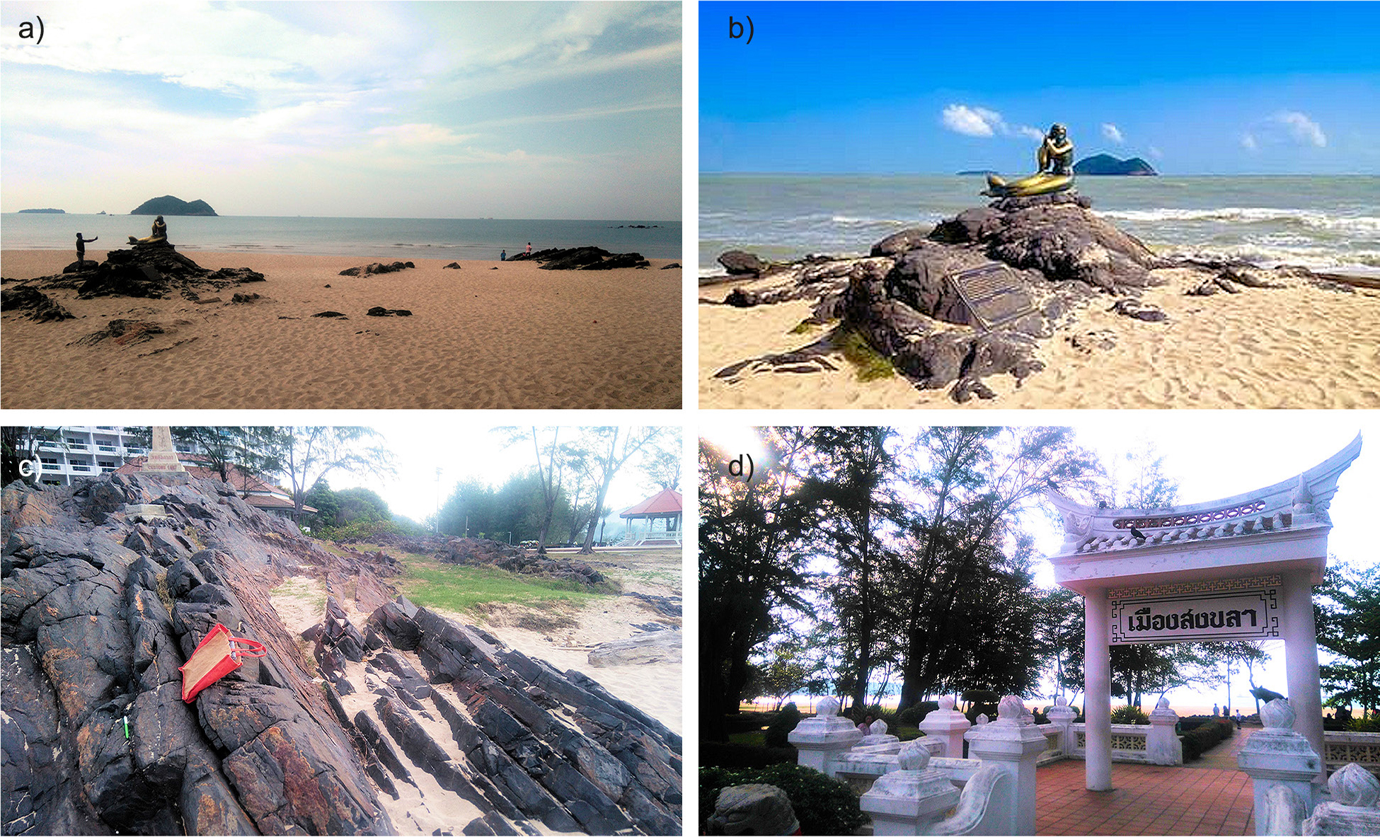
Fig. 5
Samila Beach.
a – the beautiful scenery of the beach, b – the mermaid statue on the outcrop of hornfels, c – the close-up view of the hornfels outcrop, d – Songkhla City gate as a decoration in the beach area.
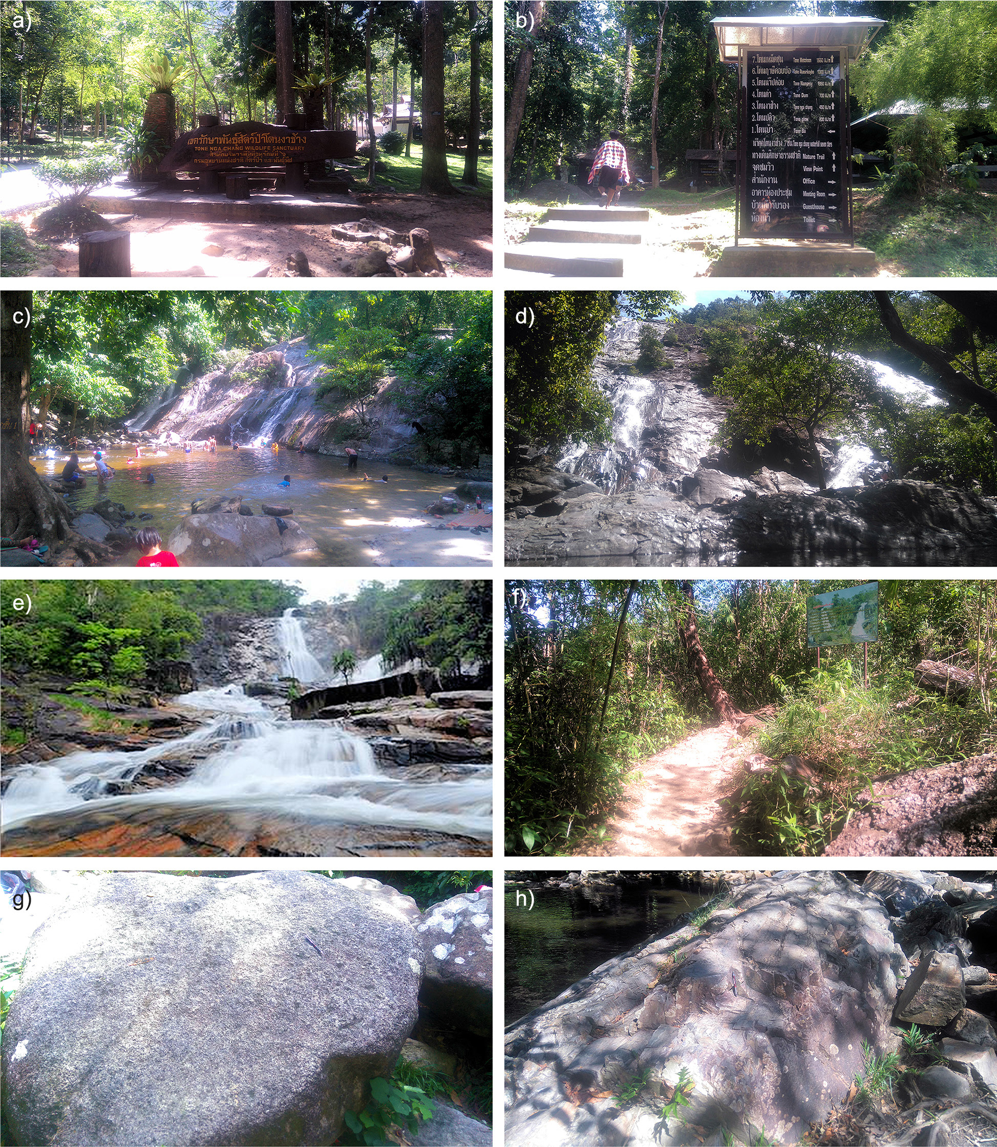
Fig. 6
Tone Nga Chang Waterfall.
a – the plank of the Tone Nga Chang Wildlife Sanctuary, b – the signboard shows the names of seven tiers of the waterfall and other facilities in the area, c – the first tier (Tone Ba) where many people like to swim in its wide pool, d – the second tier (Tone Plew), e – the third and the most beautiful tier (Tone Nga Chang), f – the trail to go to the third tier, g – an outcrop of granite, h – An outcrop of hornfels.
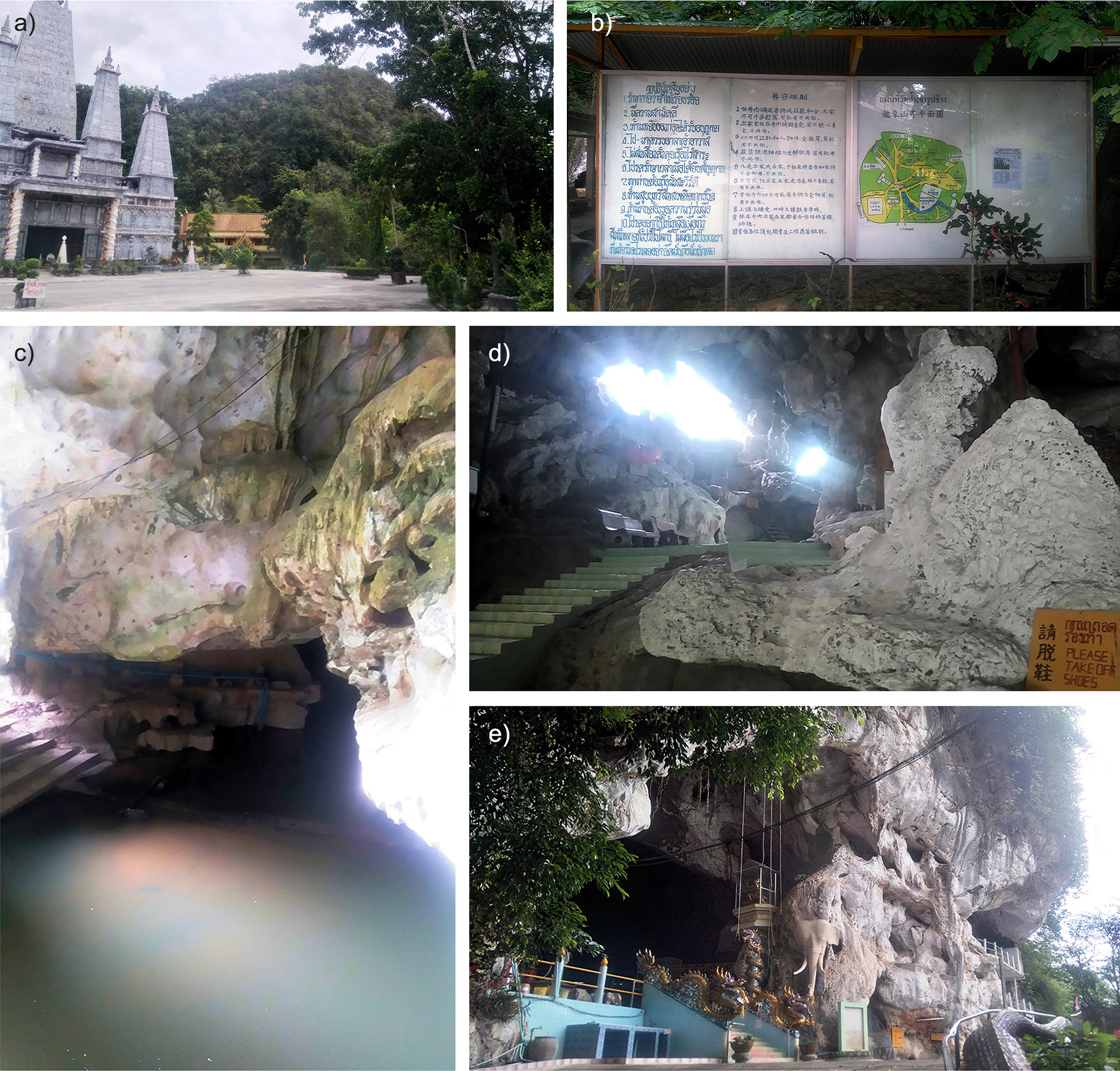
Fig. 7
Khao Rup Chang Cave.
a – the cave is in the limestone hill near a Chinese Buddist temple/pagoda, b – the signboard/notice board in the cave area, c – some cave structures and underground stream, d – inside of the Patriarch Cave, e – The Big Buddha Cave, the main and the biggest cave in the area.
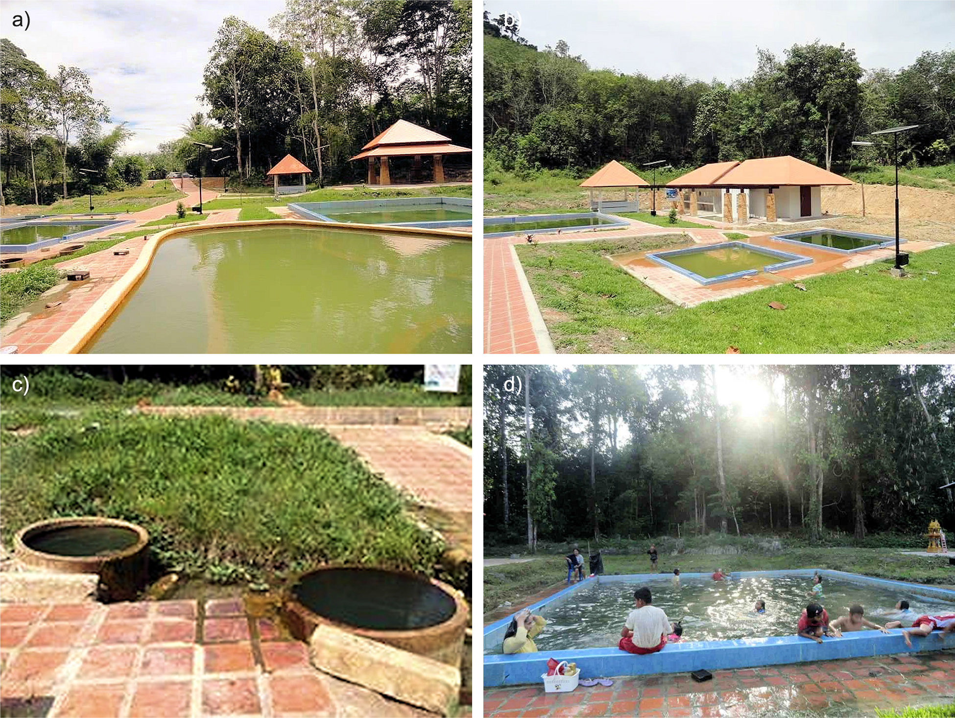
Fig. 8
Khao Daeng Hot Spring.
a – the hot spring site was built near a rubber plantation area, b – some facilities have been built in the site for the comforts of visitors such as pools, gazebos, tiled walkways, and toilets, c – two wells where the hot water originally come from, d – one of the pools where people like to swim in the hot water.
Table 2
Classification of some selected geosites in Songkhla Province, Thailand.
| No. | Geological site | Geodiversity (Gray 2005) | Scope (Brocx, Semeniuk 2007, Predrag, Mirela 2010) | Scale (Brocx, Semeniuk 2007) |
|---|---|---|---|---|
| 1 | SongkhlaLagoon/Lake | Landform/landscape, rock | Geomorphological site, petrological site | Large scale |
| 2 | Samila Beach | Landform/landscape, rock | Geomorphological site, petrological site | Medium scale |
| 3 | Tone Nga Chang Waterfall | Landform/landscape, rock | Geomorphological site, petrological site | Medium scale |
| 4 | Khao Rup Chang Cave | Landform/landscape, rock | Geomorphological site, petrological site | Small scale |
| 5 | Khao Daeng Hot Spring | Hydrogeologic process (hot spring) | Hydrogeological site | Small scale |
Table 3
Qualitative assessment of selected geosites for potential geoheritage resources and geotourism attractions in Songkhla Province, Thailand.
| No. | Geosite | Scientific (and educational) value | Aesthetic value | Recreational value | Cultural (and historical) value | Economic value | Functional value | Religious value | Level of significance | Contents |
|---|---|---|---|---|---|---|---|---|---|---|
| 1. | Songkhla Lagoon/Lake | Formation processes of lagoon; the lithology of the lagoon | Attractive landscape of lagoon and its surroundings | Water-based recreational activities and hiking in its surrounding hills | The lagoon has been a rich cradle for cultural and life of local people for a thousand years | Local community can generate their income by the production of agricultural products and fisheries in the lagoon area | – | – | National | Scenic |
| 2. | Samila Beach | Beach landforms and processes; lithology of the beach | Attractive landscape of the beach and its surroundings | Enjoy the scenic views and recreational activities in the beach area | Legends of the mermaid and Koh Meaow and Koh Noo (Cat and Rat islands) | Income generation from tourism and recreational activities in the beach area | – | – | State | Symbolic |
| 3. | Tone Nga Chang Waterfall | Formation processes of waterfall; the lithology of the waterfall | Attractive landscape of waterfall and its surroundings | Swimming and hiking/climbing, enjoying the clean air and green environments | – | Income generation from tourism and recreational activities in the waterfall area | – | – | State | Iconographic |
| 4. | Khao Rup Chang Cave | Karst landforms; cave formation | Attractive landscape of cave and its surroundings | Cave exploration | – | – | – | The cave is used as a temple (wat, the place of worship) for local and international Buddhist people | State | Indicial |
| 5. | Khao Daeng Hot Spring | Formation processes of the hot spring; structural control; geothermal system; water quality | A low-lying area surrounded by the green environment | Enjoy the fresh hot water and swimming/bathing | – | Income generation from recreational activities in the hot spring area | Hot spring therapy and skin treatment | – | State | Indicial |
Table 4
Numerical assessment of selected geosites for potential geoheritage resources and geotourism attractions in Songkhla Province, Thailand.
| No. | Geosite | Scientific (and educational) value | Aesthetic value | Recreational value | Cultural (and historical) value | Economic value | Functional value | Religious value | Level of significance | Total |
|---|---|---|---|---|---|---|---|---|---|---|
| 1. | Songkhla Lagoon/Lake | 5 | 5 | 5 | 5 | 5 | 0 | 0 | 4 | 29 |
| 2. | Samila Beach | 5 | 5 | 5 | 5 | 5 | 0 | 0 | 3 | 28 |
| 3. | Tone Nga Chang Waterfall | 5 | 5 | 5 | 0 | 5 | 0 | 0 | 3 | 23 |
| 4. | Khao Rup Chang Cave | 5 | 5 | 5 | 0 | 0 | 0 | 5 | 3 | 23 |
| 5. | Khao Daeng Hot Spring | 5 | 3 | 5 | 0 | 3 | 4 | 0 | 3 | 23 |
[i] Note: Geoheritage values: 0 = none; 1 = very poor; 2 = poor; 3 = fair; 4 = good; 5 = very good.
[ii] Level of significant: 1 = local; 2 = regional(within the states/provinces); 3 = state-wide; 4 = national; 5 = international.
Table 5
SWOT analysis to evaluate the selected geosites for geoconservation and development in Songkhla Province, Thailand.
| No. | Geosite | Strength | Weakness | Opportunity | Threat |
|---|---|---|---|---|---|
| 1. | Songkhla Lagoon/Lake | – Good potential for research and education – High aesthetic, cultural/historical, and economic values – Suitable for recreational activities – Excellent accessibility | Lack of promotion for tourism | – Establishing provisions and providing facilities for geotouristic activities (such as viewing points, etc.) – Potential for water sport and cultural events – Promotion and information to attract more visitors – Cooperation among stakeholders for geoconservation efforts | Rubbish dumps |
| 2. | Samila Beach | – Good potential for research and education – High aesthetic, cultural/historical, and economic values – Suitable for recreational activities – Excellent accessibility | This place is so famous that many people visit it (sometime this place is too crowded) | – Establishing provisions and providing facilities for geotouristic activities – Potential for water sport and cultural events – Need information panels to serve visitors (especially for the rock outcrop) – Cooperation among stakeholders for geoconservation efforts | Rubbish dumps |
| 3. | Tone Nga Chang Waterfall | – Good potential for research and education – High aesthetic value; has economic value – Suitable for recreational activities – Good accessibility | Some parts of the area are very steep and slippery | – Establishing provisions and providing facilities for geotouristic activities – Need information panels (especially for the rock outcrop and features) – Cooperation among stakeholders for geoconservation efforts | Rubbish dumps Potential danger for visitors (mainly in the slippery areas) |
| 4. | Khao Rup Chang Cave | – Good potential for research and education – High aesthetic value – Has religious value as the worship place for local and international Buddhist people – Good accessibility | Lack of promotion and information of the area | – Establishing provisions and providing facilities for geotouristic activities – Need information panels to serve visitors (especially for the cave morphology/structures) – Promotion to attract more visitors – Cooperation among stakeholders for geoconservation efforts | Possible to become a close area (only for worship activities, not for tourism anymore) |
| 5. | Khao Daeng Hot Spring | – Good potential for research and education – Suitable for recreational activities – Has functional value for hot spring therapy and skin treatment – Good accessibility | Lack of promotion and information of the area Bad management and protection | – Establishing provisions and providing facilities for geotouristic activities – Need information panels to serve visitors (especially for the water quality) – Good management and promotion to attract more visitors – Cooperation among stakeholders for geoconservation efforts | Rubbish dumps |
Table 6
Some possible tourism activities of some geosites in Songkhla Province, Thailand.
| No. | Geological sites | Possible activities | Swimming & bathing | Fishing/netting | Rafting/boating/kayaking | Hiking/climbing | Cave exploration | Hot water therapy and treatment | Photograph shot |
|---|---|---|---|---|---|---|---|---|---|
| 1 | Songkhla Lagoon/Lake | + | + | + | + | − | − | + | |
| 2 | Samila Beach | + | + | + | − | − | − | + | |
| 3 | Tone Nga Chang Waterfall | + | − | − | + | − | − | + | |
| 4 | Khao Rup Chang Cave | − | − | − | + | + | − | + | |
| 5 | Khao Daeng Hot Spring | + | − | − | − | − | + | − | |
[i] Note: + – possible; − – not possible.