
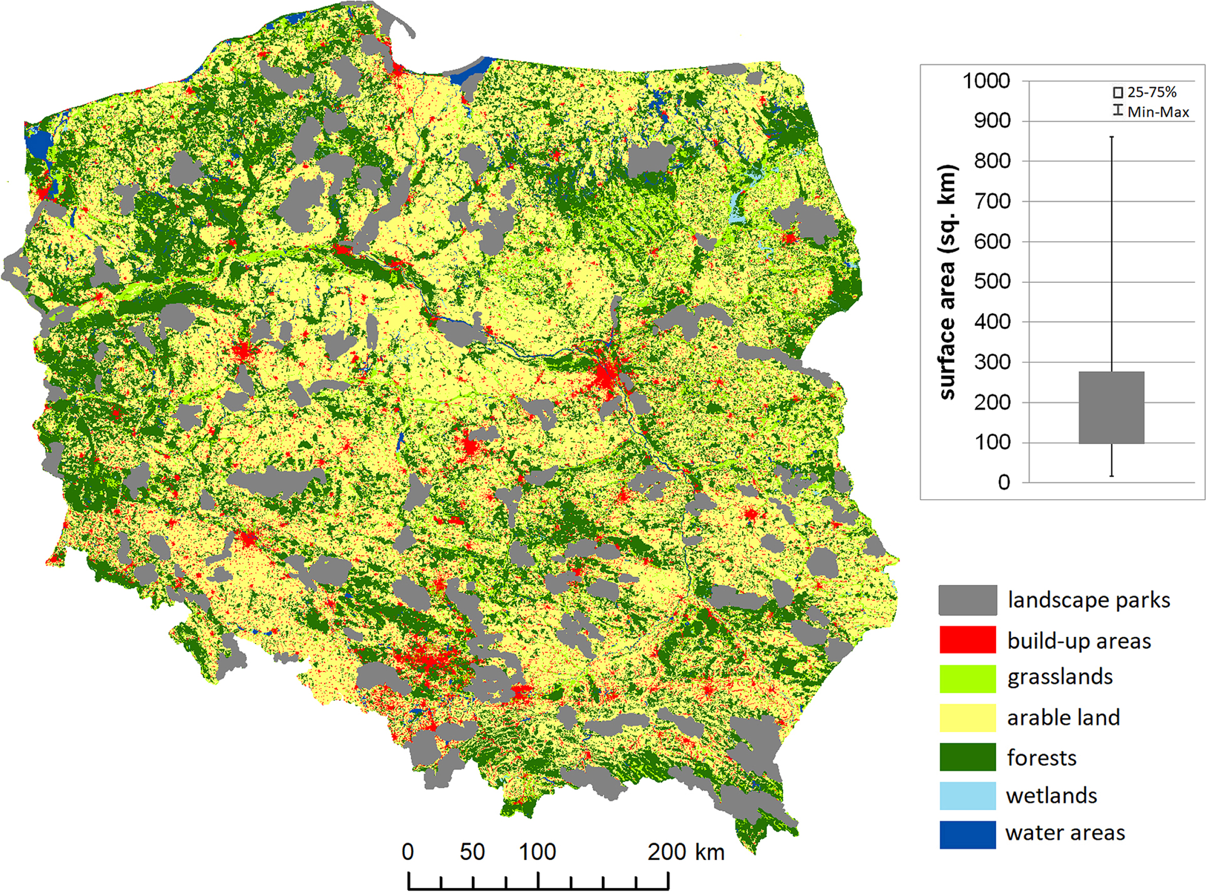
Fig. 1
The location of landscape parks on the background of Poland’s land cover.
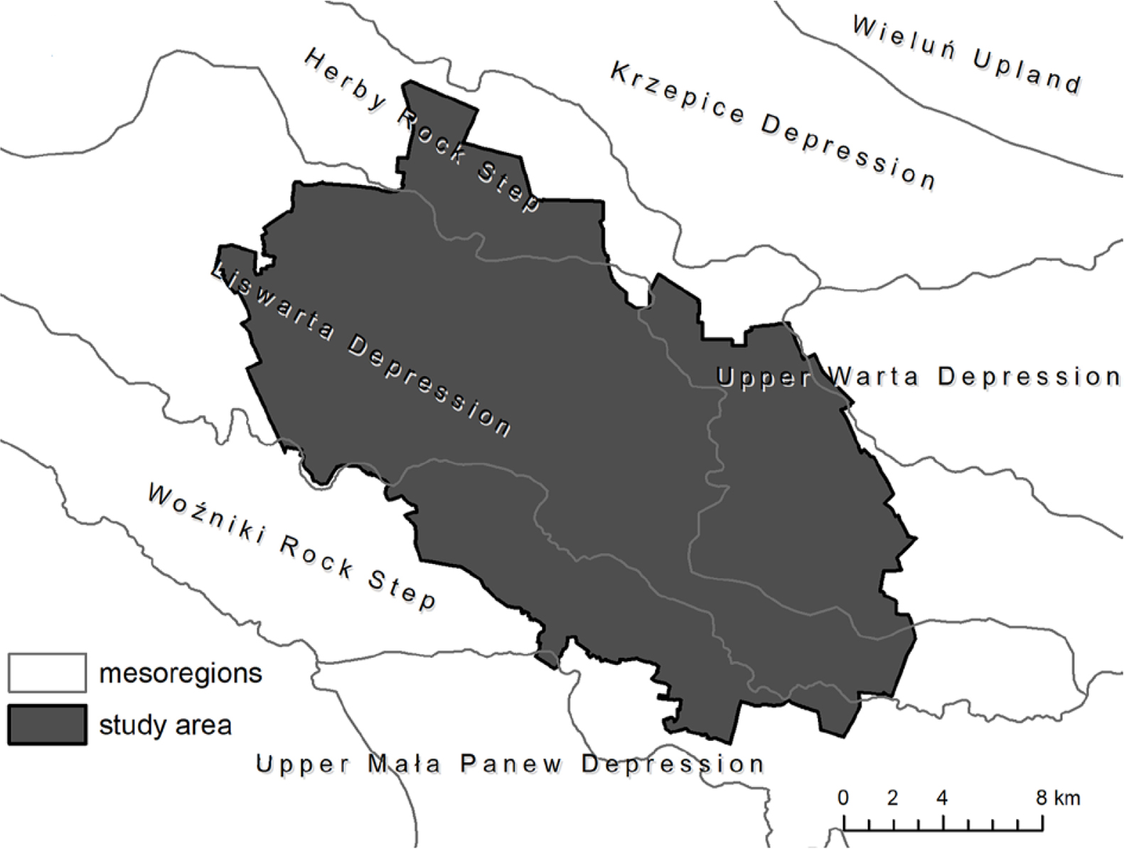
Fig. 2
Location of the Forests by Upper Liswarta Landscape Park on the background of mesoregions.
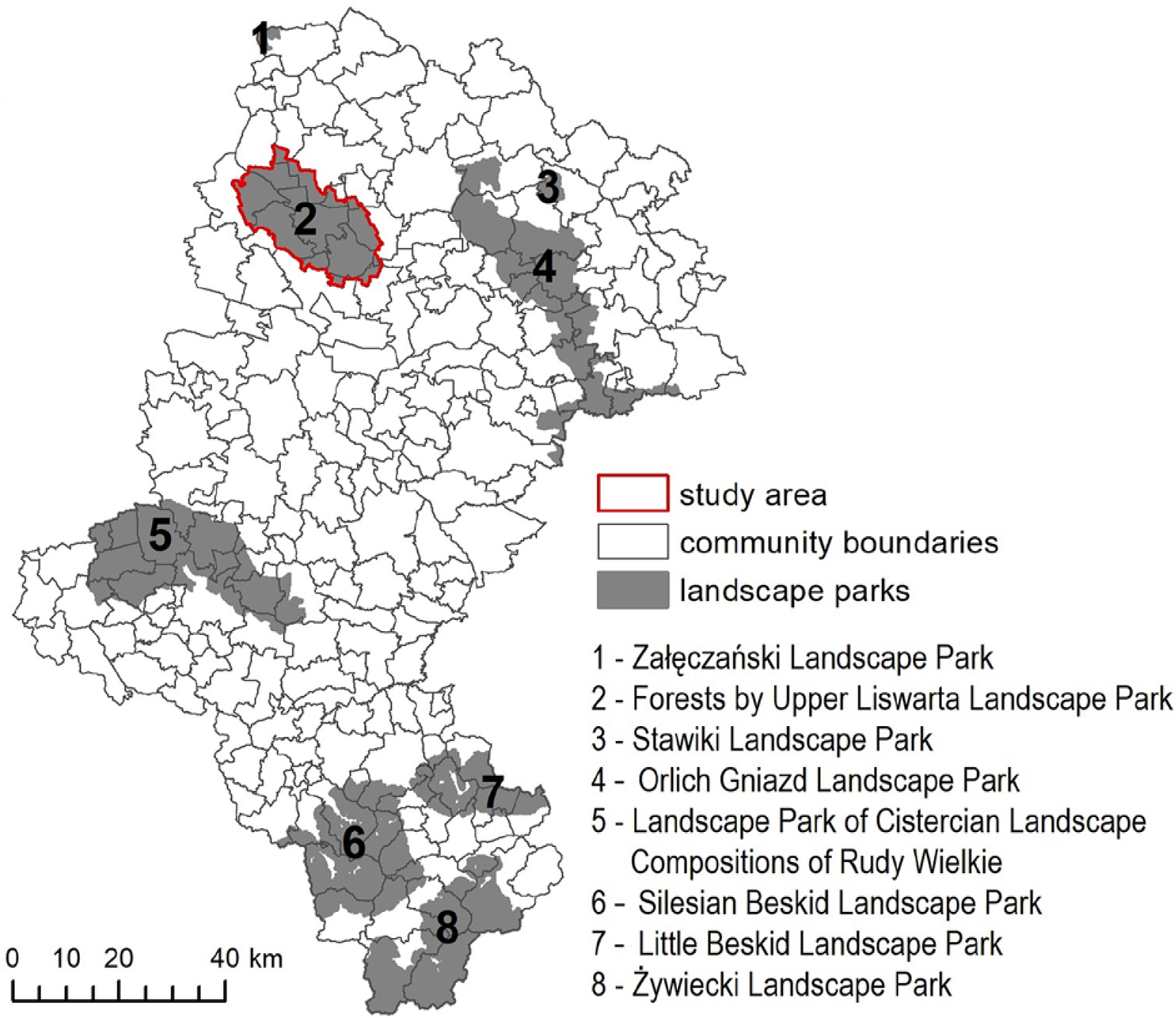
Fig. 3
Location of the Forests by Upper Liswarta Landscape Park in the background of the communes of the Silesian Voivodeship.
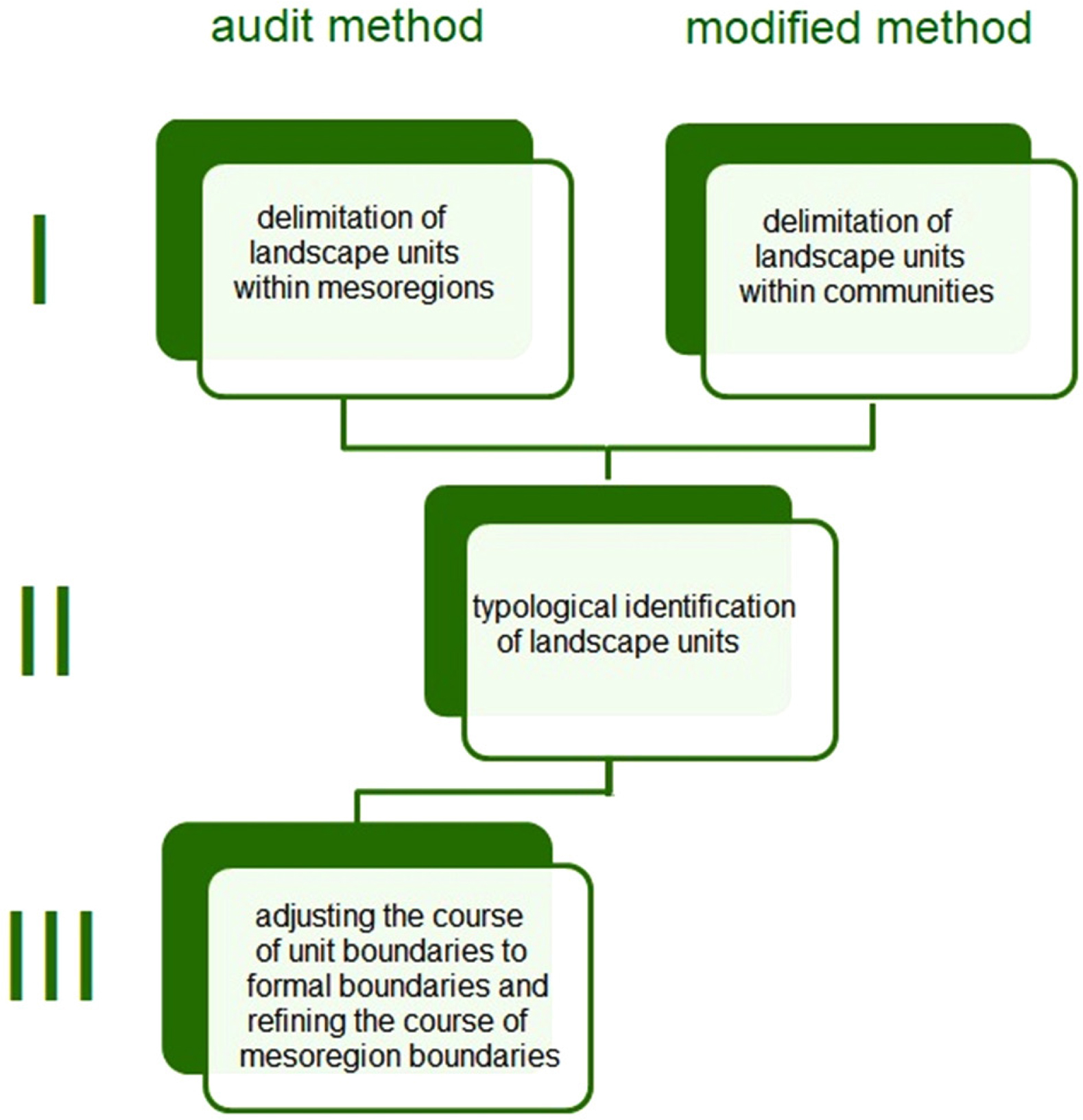
Fig. 4
Diagram showing the differences between the audit method and the modified method.
Table 1
Characteristics of landscapes subtypes.
| Landscape subtype | Audit method | Modified method | ||||
|---|---|---|---|---|---|---|
| Area (ha) | Number of units | Area (%) | Area (ha) | Number of units | Area (%) | |
| 2a – swampy meadow with extensively used wet meadows | 541.1 | 1 | 1.40 | 542.5 | 3 | 1.40 |
| 3a – coniferous forests | 23,138.3 | 10 | 59.74 | 20,106.7 | 17 | 51.92 |
| 3b – deciduous forests | 2,749.1 | 10 | 7.10 | 5,770.9 | 9 | 14.90 |
| 6a – rural (agricultural) artificial water reservoirs | 142.9 | 2 | 0.37 | 407.2 | 4 | 1.05 |
| 6b – rural (agricultural) with dominance of ribbon-like groups of small arable fields, meadows and pastures | 6,223.4 | 13 | 16.07 | 5,774.1 | 9 | 14.91 |
| 6c – rural (agricultural) with dominance of tessellated small arable lands | 5,532.2 | 11 | 14.29 | 4,589.4 | 11 | 11.85 |
| 6d – rural (agricultural) with dominance of tessellated medium arable lands | 96.2 | 1 | 0.25 | 1,026.2 | 3 | 2.65 |
| 6e – rural (agricultural) with dominance of large-area fields and / or meadows and pastures | 0.0 | 0 | 0.00 | 190.1 | 1 | 0.49 |
| 7a – mosaic with a predominance of natural elements | 0.0 | 0 | 0.00 | 66.7 | 2 | 0.17 |
| 8c – suburban and residential areas with compact, multi-row buildings with a rural character with home gardens and without field areas | 89.5 | 2 | 0.23 | 89.5 | 2 | 0.23 |
| 12a – large industrial complexes | 46.5 | 2 | 0.12 | 46.5 | 2 | 0.12 |
| 14a – communication and transport nodes | 102.9 | 1 | 0.27 | 117.0 | 1 | 0.30 |
| Total | 38,726.8 | 53 | 100.00 | 38,726.8 | 64 | 100.00 |
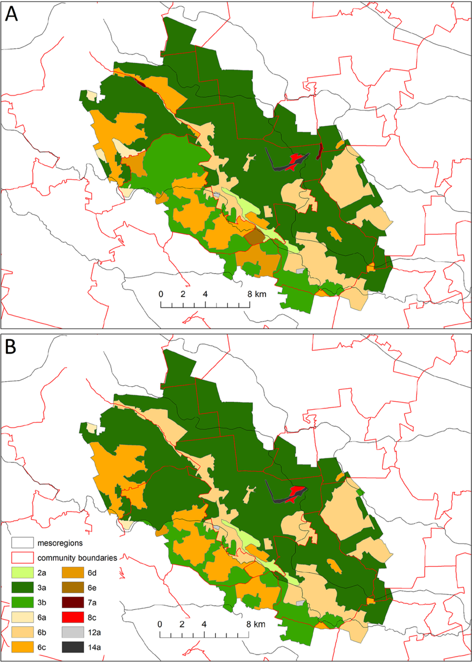
Fig. 5
Local landscapes distinguished by a modified method (A) and audit method (B). Explanation of landscape subtypes in Table 1.
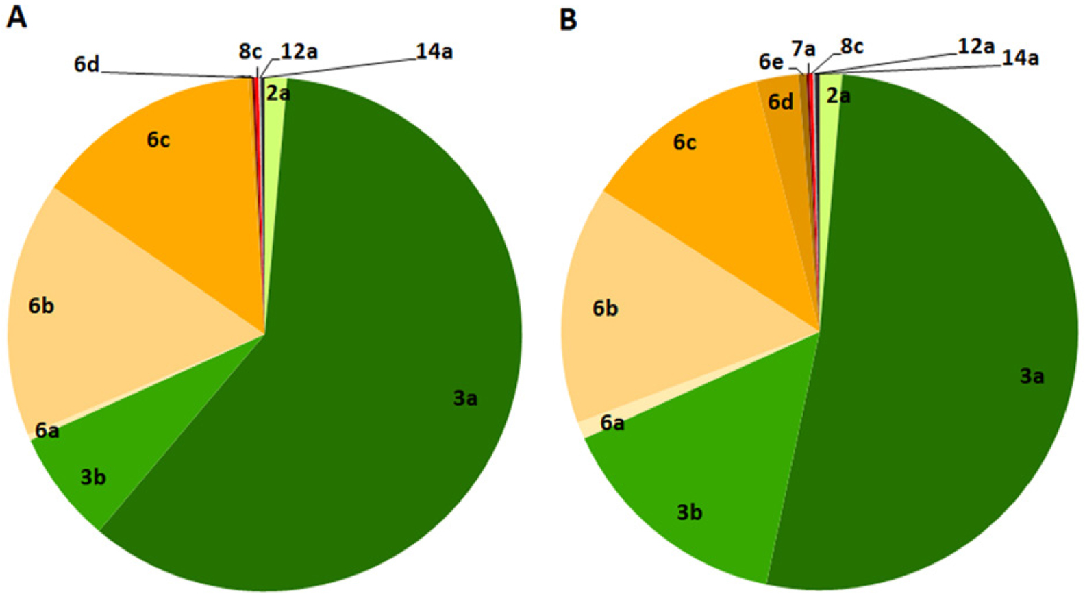
Fig. 6
Landscape subtypes structure in the study area developed by the audit method (A) and modified method (B). Explanations of landscape subtypes in Table 1.
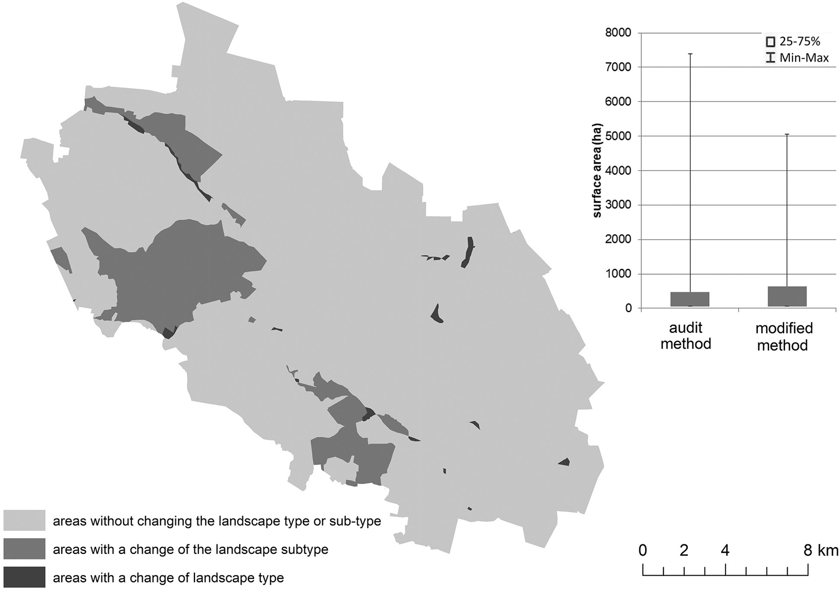
Fig. 7
Spatial range of differences in delimitated units. The graph presents the characteristic of the surface area of delimitated landscape units.
Table 2
Stages of methodological proceedings in the audit method and modified method.
| Stage of procedure | Audit method | Modified method | Justification |
|---|---|---|---|
| Border delimitation | Province (administrative border) and mesoregions (nature border) | Landscape park and communes (administrative border) | Development of planning and conservation documents for the landscape park |
| Unit coding | The code contains information about the location in the mesoregion and the order of the landscape within it | The code contains information about the location within the communes and the order of the landscape within it | Change made for the practical use of document entries within the boundaries of communes |
| Defining landscape unit boundaries | Defining the boundaries of administrative borders | There is no need to define landscape units elaborating |