
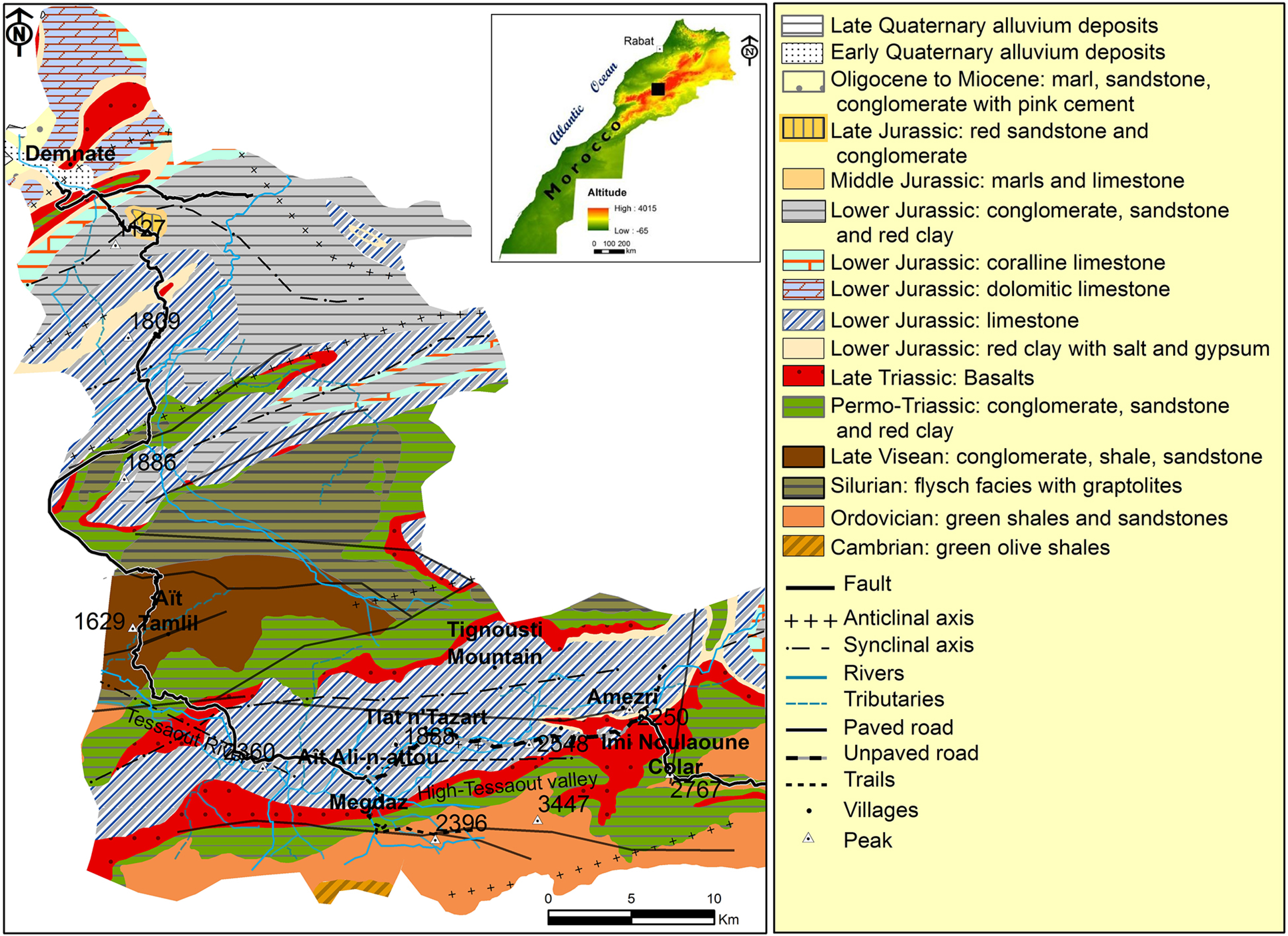
Fig. 1
Geographical location and geological map of the study area (acc. to Roch 1941).
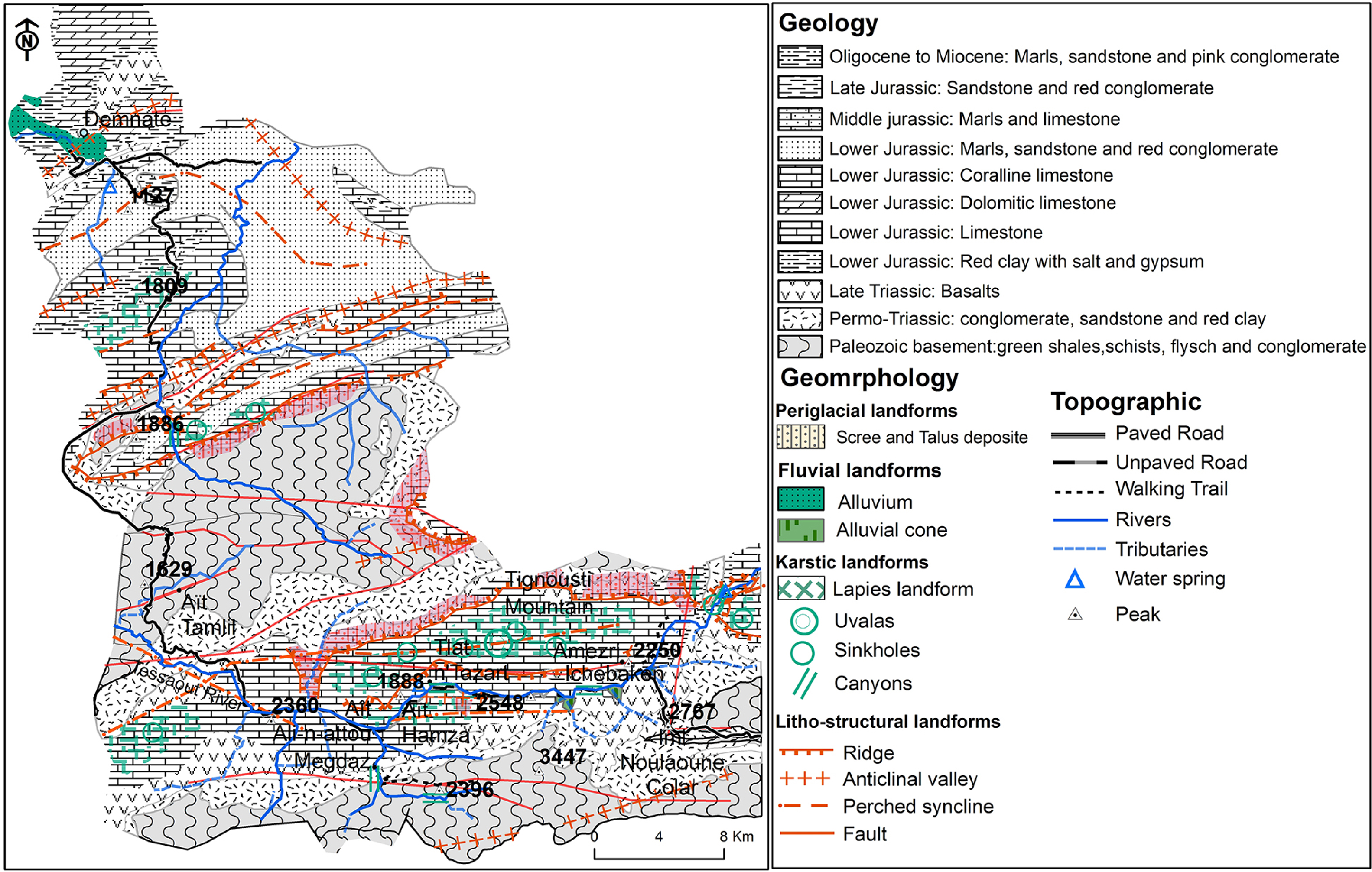
Fig. 2
Geomorphological map of the study area.
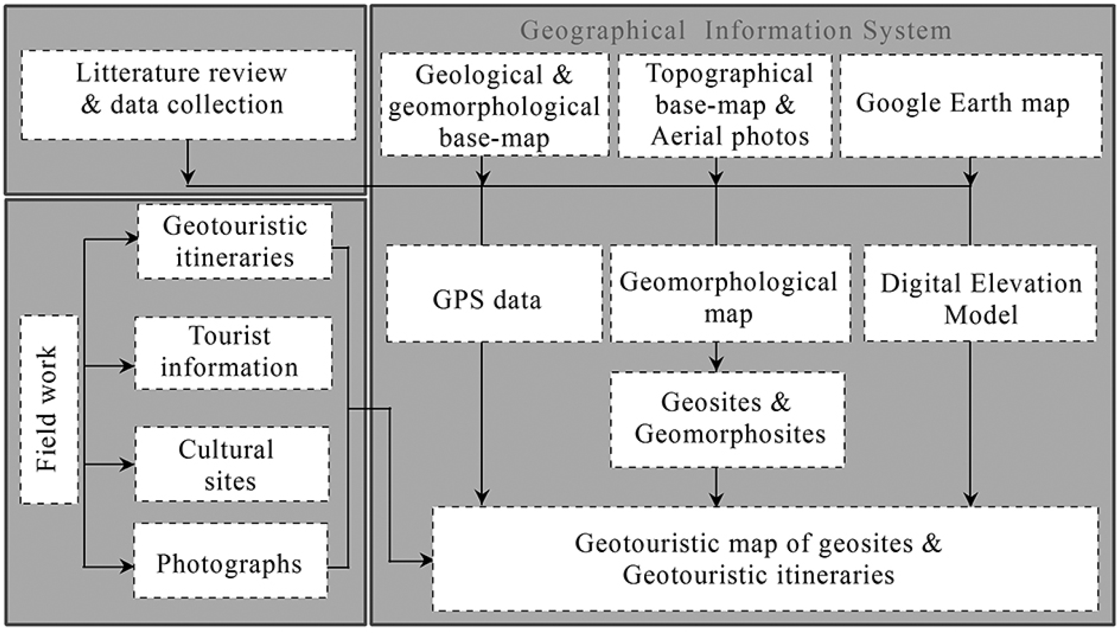
Fig. 3
Flow chart of used methodology.
Table 1
Most remarkable geosites of the area according to their location, lithology and typology.
| No. | Geosites | Commune | Lithology | Typology | Belonging to the M’goun Geopark |
|---|---|---|---|---|---|
| Geomorphological geosites ‘Geomorphosites’ | |||||
| 1 | Waterfall of Asfdar | Aït Tamlil | Limestone | Line | No |
| 2 | Springs and waterfall of Tlat-n-Tazart (Guigmi) | Aït Tamlil | Limestone | Site | No |
| 3 | Springs and waterfall of Imi-n-Ifri | Demnate | Limestone | Site | Yes |
| 4 | Springs and waterfall of M’goun | Imi Nouloune | Limestone | Site | No |
| 5 | Canyons of Almsa | Tifni | Limestone | Line | No |
| 6 | Canyons of Ichbaken | Imi Nouloune | Limestone | Line | No |
| 7 | Canyons of Megdaz | Aït Tamlil | Limestone | Line | No |
| 8 | Canyons of High-Tessaout | Imi Nouloune | Limestone | Line | Yes |
| 9 | Canyons of Asfdar | Imi Nouloune | Limestone | Line | No |
| 10 | Scree cone of Tlat-n-Tazart | Aït Tamlil | Limestone | Area | No |
| 11 | Alluvial fan of Ichebaken | Imi Nouloune | Limestone | Area | No |
| 12 | Alluvial fan of Amezri | Imi Nouloune | Limestone | Area | No |
| 13 | Scree slopes of Amezri | Imi Nouloune | Limestone | Area | No |
| 14 | Natural bridge of Imi-n-Ifri | Demnate | Limestone | Site | Yes |
| 15 | Landslide of Amezri | Imi Nouloune | Red Clay | Area | No |
| 16 | Fairy chimneys of Talat-n-Tazart | Aït Tamlil | Red Clay + Limestone | Site | No |
| Igneous and volcanic geosites | |||||
| 17 | Basaltic lava flow of Aït Aadel formation | Aït Tamlil | Basalts | Area | No |
| Paleontological geosites | |||||
| 18 | Footprints of unknown mammalian of Megdaz | Aït Tamlil | Limestone | Area | Yes |
| 19 | Footprints of herbivorous dinosaurs of Iouariden | Sidi Boulkhalf | Siltstones + Red Clay | Site | Yes |
| 20 | Footprints and moving tracks of carnivorous dinosaurs of Iouaridene | Sidi Boulkhalf | Siltstones + Red Clay | Site | Yes |
| Sedimentological geosites | |||||
| 21 | Ripple marks in Iouariden | Sidi Boulkhalf | Sandstone | Area | No |
| 22 | Inverted cross-bedded sandstone | Aït Tamlil | Sandstone | Site | No |
| 23 | Sedimentary structure in teepee | Aït Tamlil | Limestone | Site | No |
| 24 | Desiccation cracks (Mudcrack) | Sidi Boulkhalf | Limestone | Area | No |
| Stratigraphic and structural geosites | |||||
| 25 | Angular unconformity between the Precambrian (PIII) and the Paleozoic (Cambro-rdovician) | Megdaz | Rhyolite, quartzite+ Sandstone | Site | No |
| 26 | Angular unconformity between the Palaeozoic (Cambrian-Ordovician metamorphic rocks) and the secondary (Triassic sedimentary rocks) of Almsa | Aït Tamlil | Shale, sandstone + Limestone | Point | No |
| 27 | Normal and reverse faults | Aït Tamlil | Limestone | Point | No |
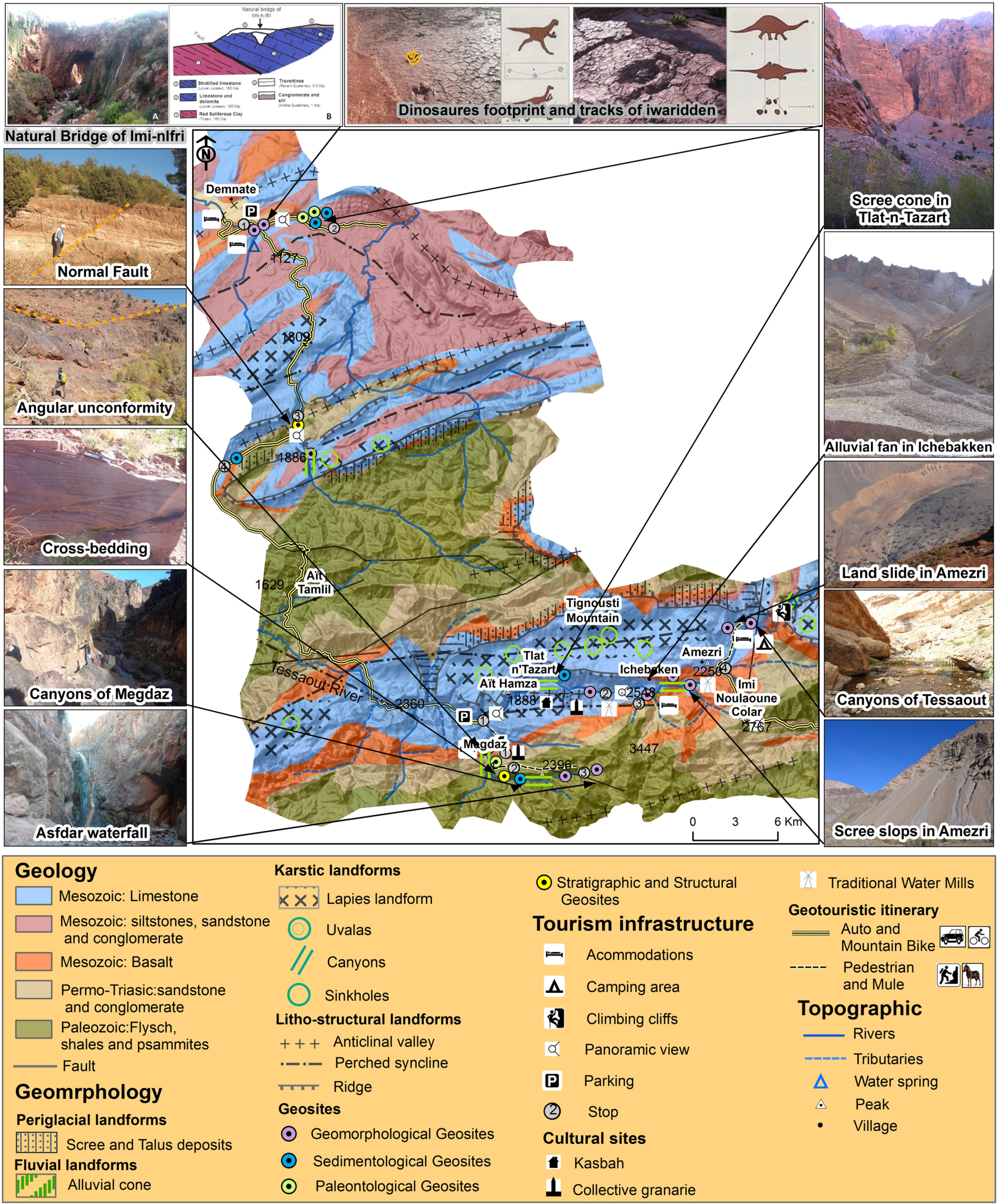
Fig. 4
Geotouristic map of the Demnate and High-Tessaout valley.
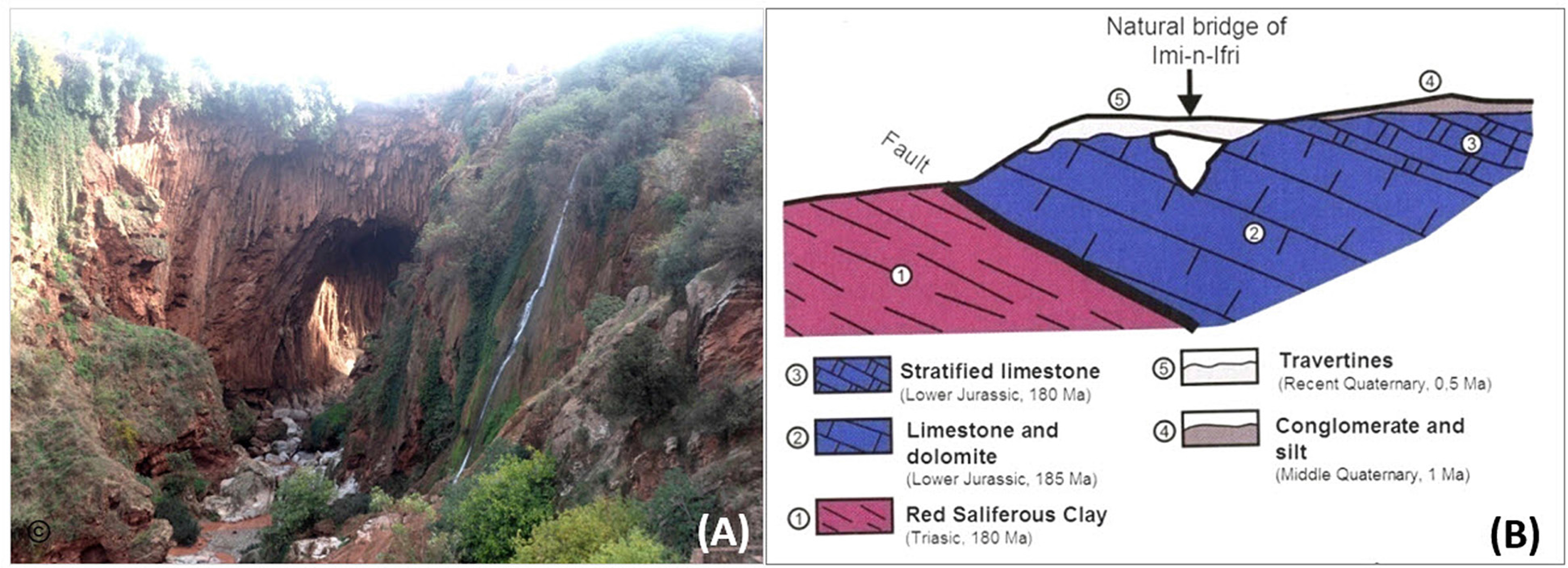
Fig. 5
The geosite of Imi-n-Ifri natural bridge.
A) photograph of the bridge, B) its geological cross-section according to Monbaron and Monbaron (2015).
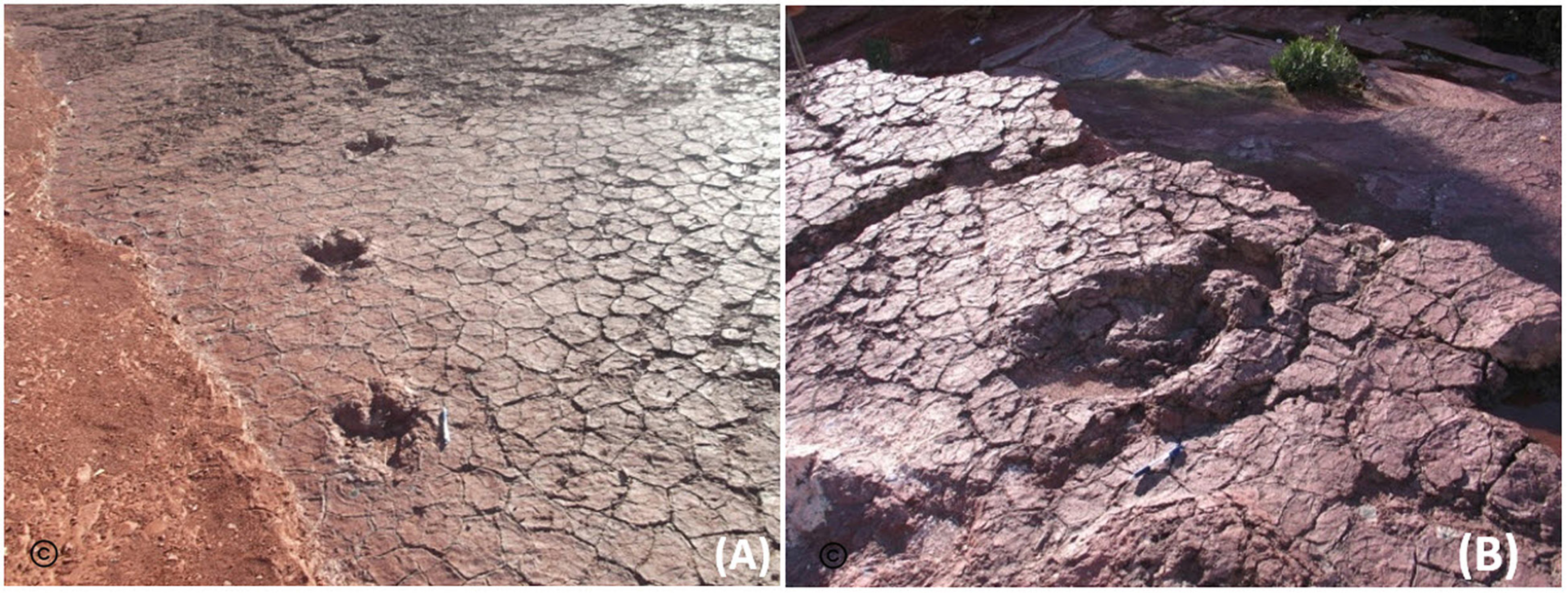
Fig. 6
The geosites of dinosaur footprints and tracks of Aït Iouaridene.
A) footprints and tracks of carnivores Theropods Two-Legged, B) footprints Herbivorous Quadrupedal Sauropod.
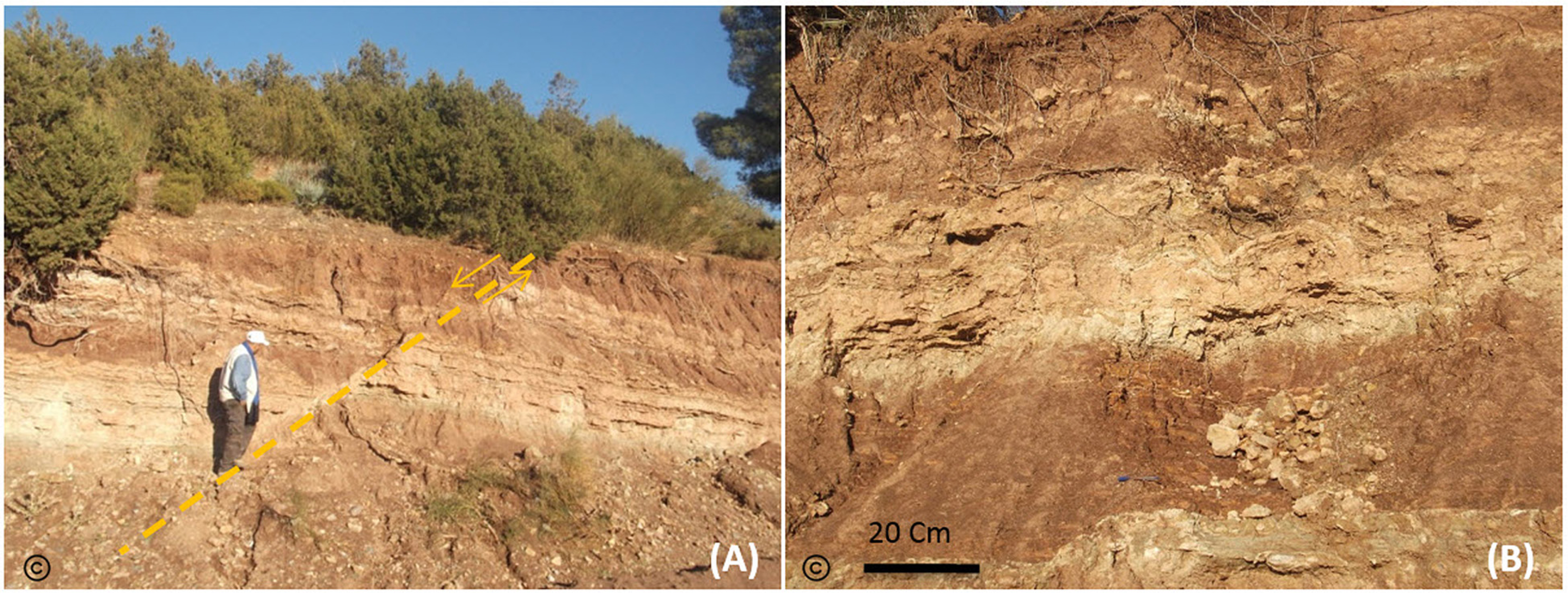
Fig. 7
A) Normal Fault of direction N70, B) Tepee sedimentary structures in limestone.
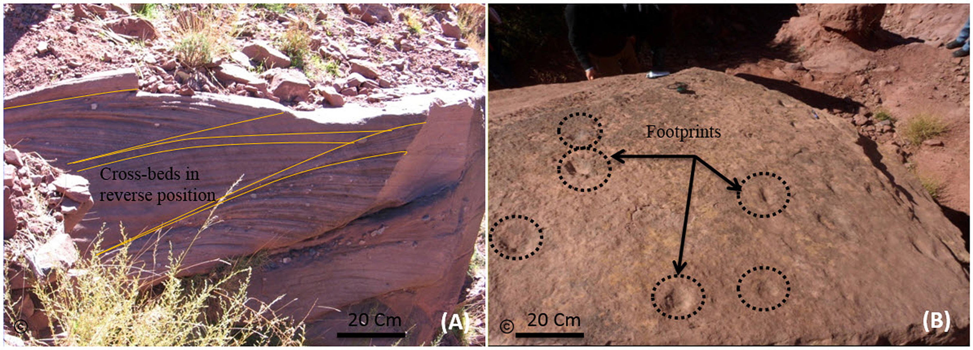
Fig. 8
A) Sedimentary structure of cross-stratification, B) footprints and two tracks of unknown wild mammalian.
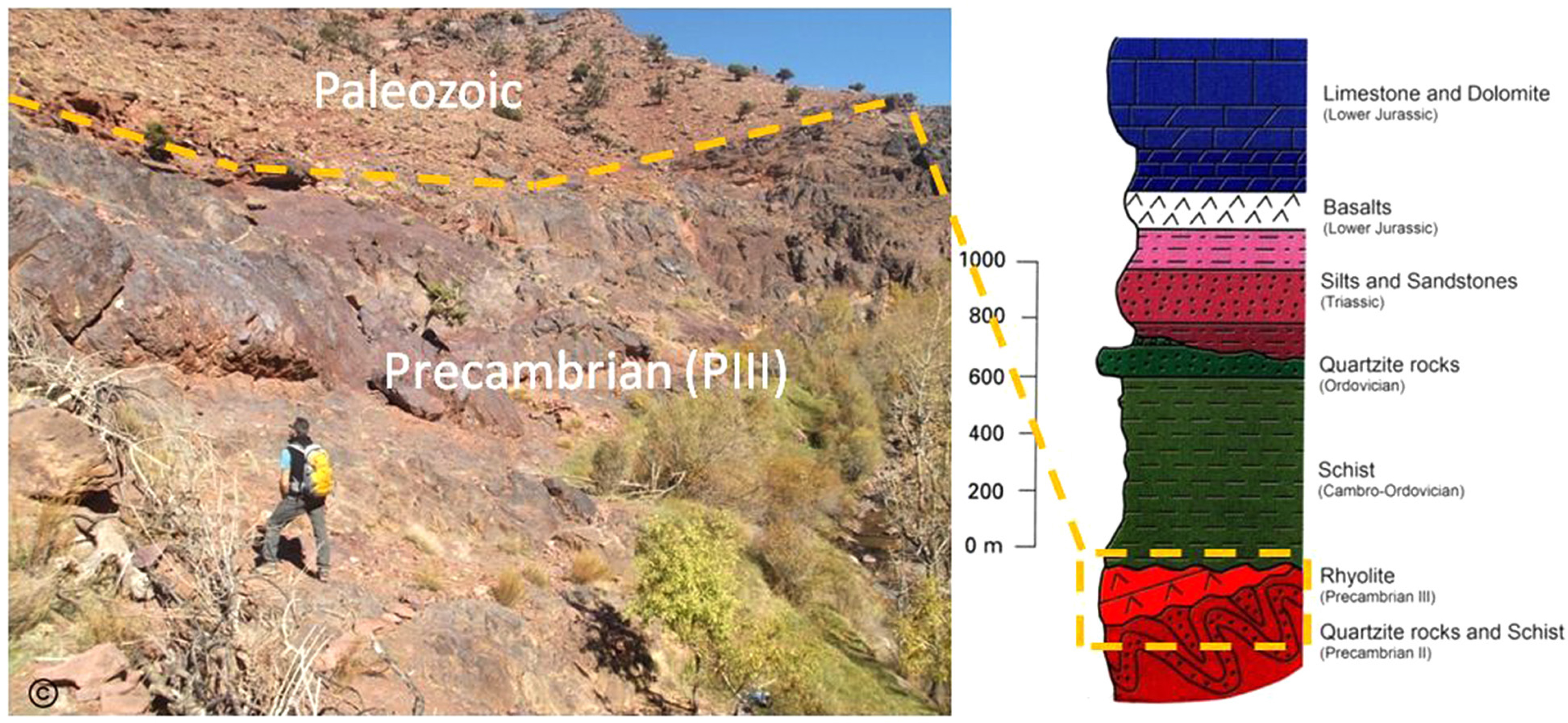
Fig. 9
Angular unconformity between the Paleozoic and Precambrian (PIII) with its stratigraphic column according to Monbaron and Monbaron (2015).
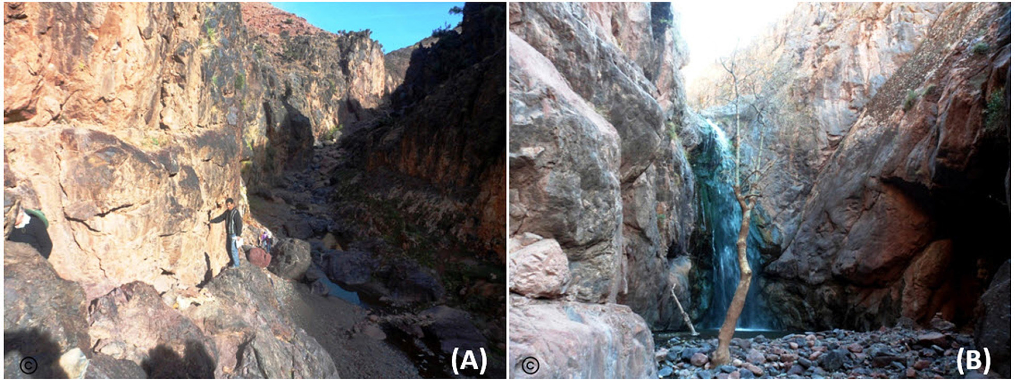
Fig. 10
Canyon of Megdaz, B) Asfdar waterfall.
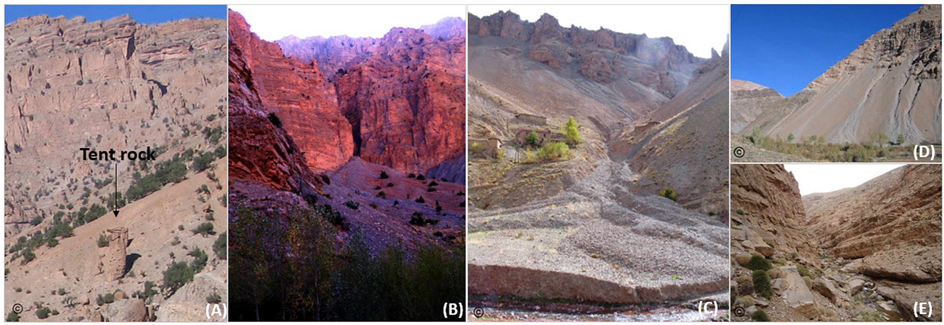
Fig. 11
The most notable geosites of the third geotouristic itinerary.
A) tent rock in Tlat-n-Tazart, B) scree cone in Tlat-n-Tazart, C) alluvial fan in Ichebaken, D) scree slopes in Amezri, E) canyons of High-Tessaout valley.