
Figure 1
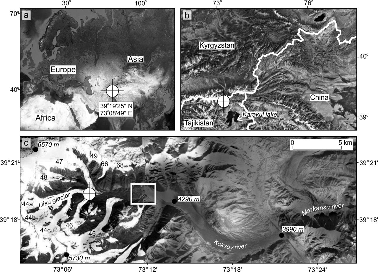
Figure 2
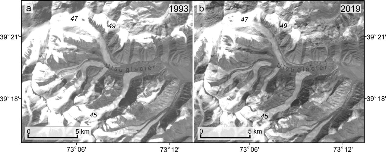
Figure 3

Figure 4
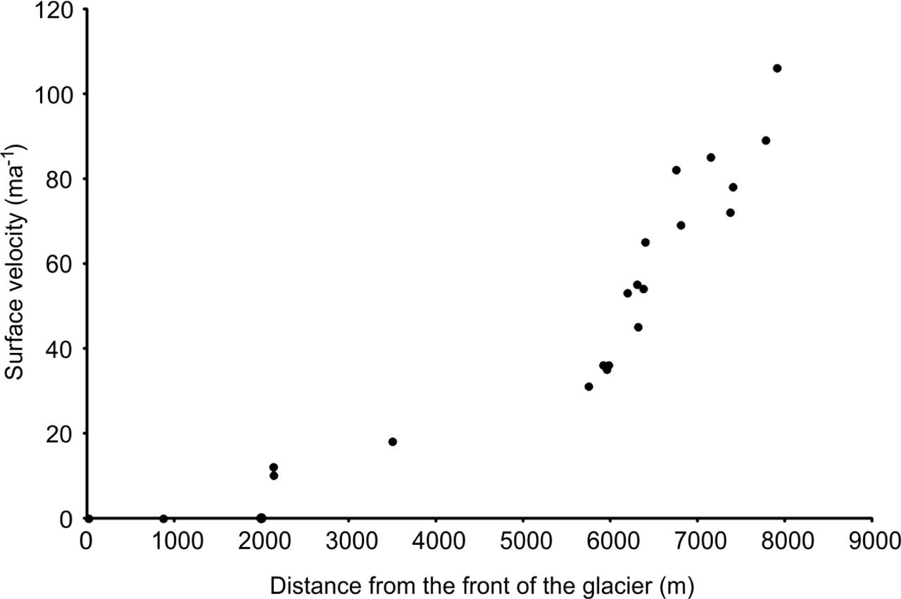
Figure 5

Figure 6

Figure 7

Figure 8

Figure 9

Figure 10

List of Landsat satellite scenes used_ MSS: MultiSpectral Scanner (Landsat 1), TM: Thematic Mapper (Landsat 5), ETM+: Enhanced Thematic Mapper + (Landsat 7), and OLI: Operational Land Imager (Landsat 8)_ “Date” shows day_month, and “P-R” shows path-row_ Source: USGS Earth Explorer
| No. | Sensor | Date | Year | P-R |
|---|---|---|---|---|
| 1 | MSS | 22.08 | 1977 | 162-033 |
| 2 | TM | 30.09 | 1993 | 151-033 |
| 3 | TM | 28.09 | 1998 | 151-033 |
| 4 | ETM+ | 28.09 | 2001 | 151-033 |
| 5 | ETM+ | 15.09 | 2008 | 151-033 |
| 6 | OLI | 05.09 | 2013 | 151-033 |
| 7 | OLI | 15.08 | 2017 | 151-033 |
| 8 | OLI | 22.09 | 2019 | 151-033 |