
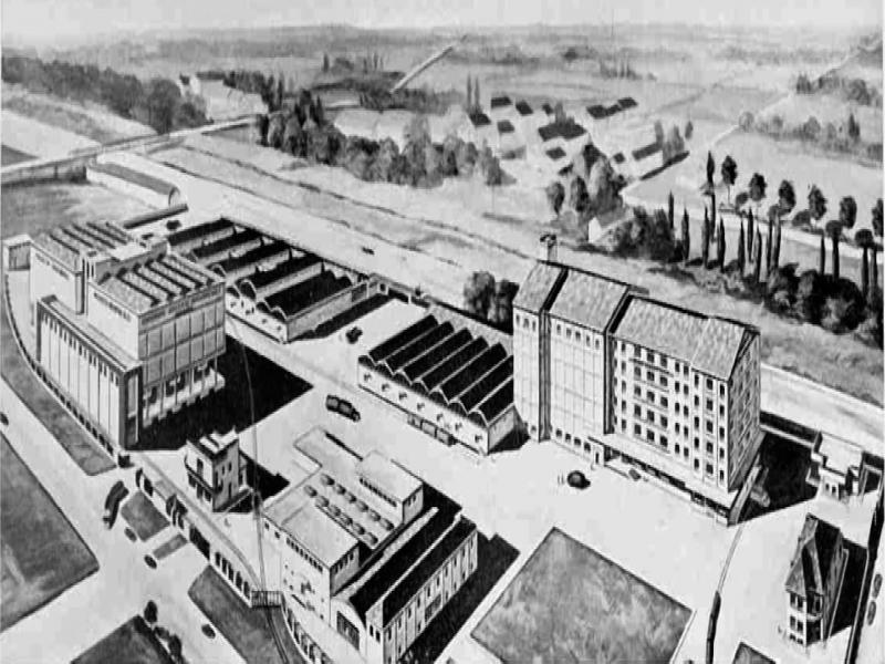
Figure 1.
Grain silo and other facilities of the agricultural consortium of Ferrara [18]
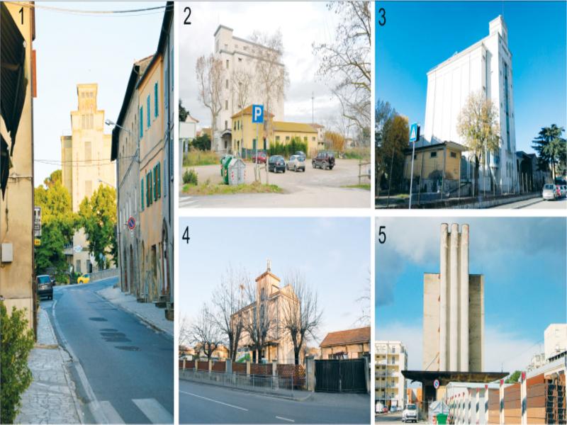
Figure 2.
Grain silos of: 1) Asciano di Siena; 2) Albinia; 3) Grosseto; 4) Saline di Volterra; 5) Arezzo (photo: author)
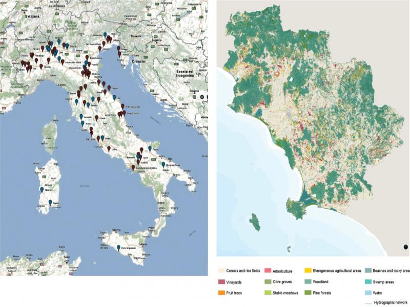
Figure 3.
(L) Mapping of the Italian grain silos [1]; (R) Case study: silo of Grosseto. Territorial analysis [32, translation by S. Landi]
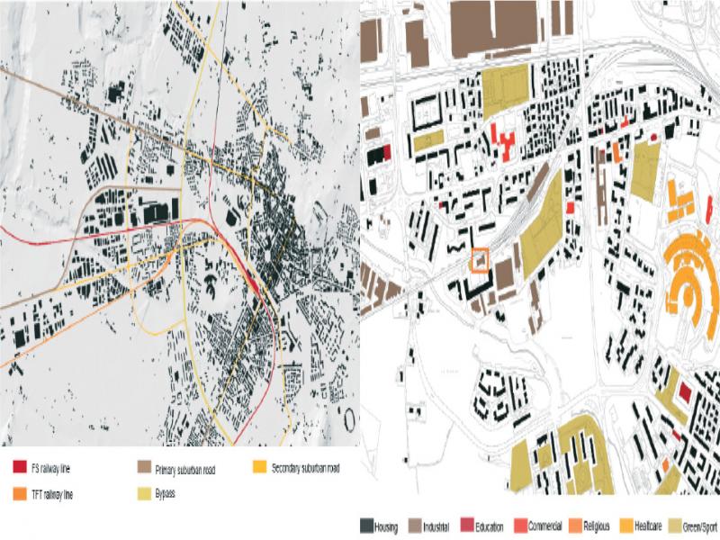
Figure 4.
Case study: silo of Arezzo. Urban Analysis (L: road and railway infrastructures:; R: functions) [33, p.74–75, translation by S. Landi]
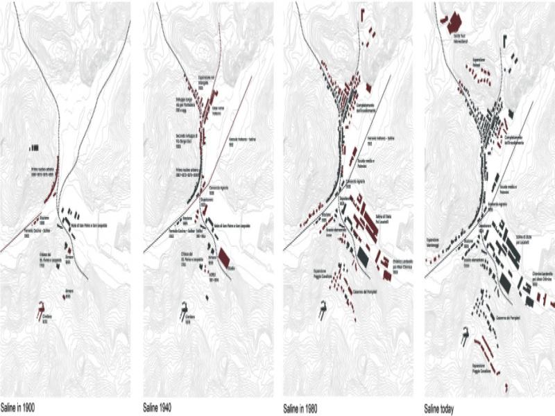
Figure 5.
Case study: silo of Saline di Volterra. Historical Urban development [34]
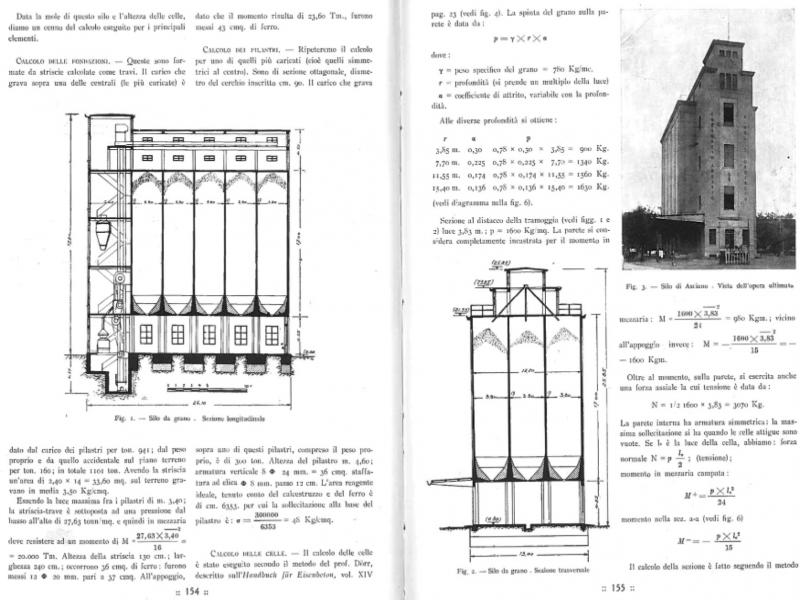
Figure 6.
Case study: silo of Asciano di Siena. Bibliographic sources (technical drawings and static calculations) [35]
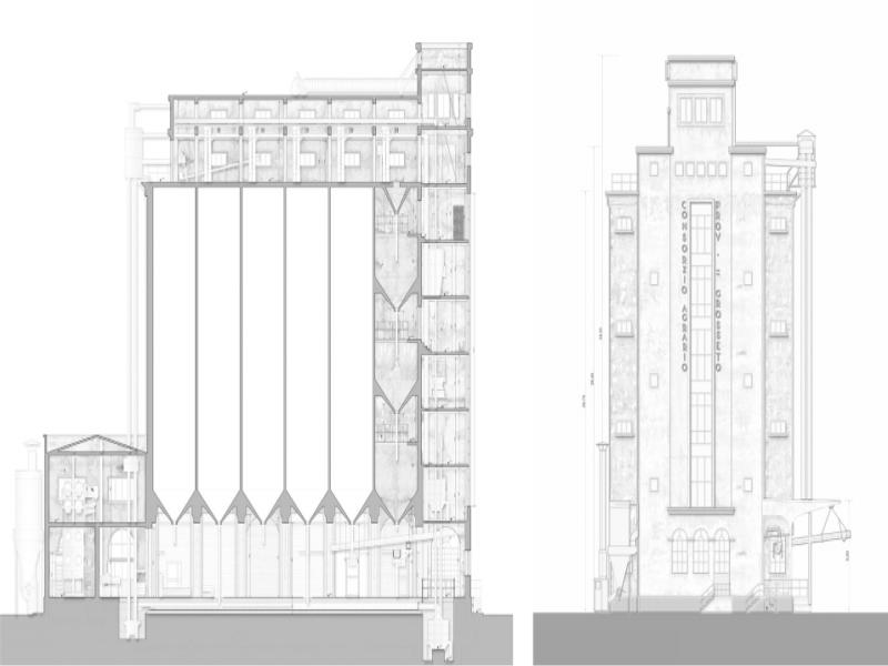
Figure 7.
Case study: silo of Grosseto. Analysis and representation of the grain silos (L: longitudinal section; R: main façade) [36]
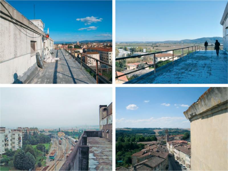
Figure 8.
Case study: silo of Grosseto. Surrounding context (photo: author)