
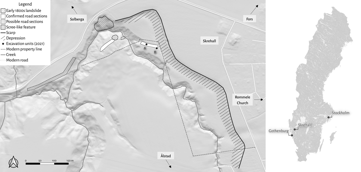
Figure 1
Map of the landslide site, with key features and its location within Sweden marked. Source: Paula Molander (2023).
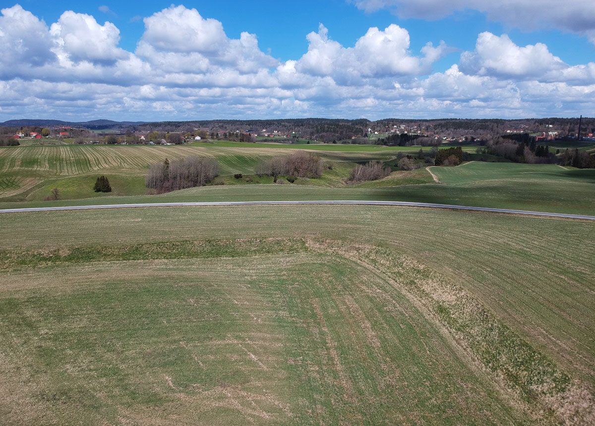
Figure 2
Drone photograph, showing the north-eastern bend of the landslide scarp, with the slope and depression below. The camera faces the north-east. Photo: Paula Molander (2021).
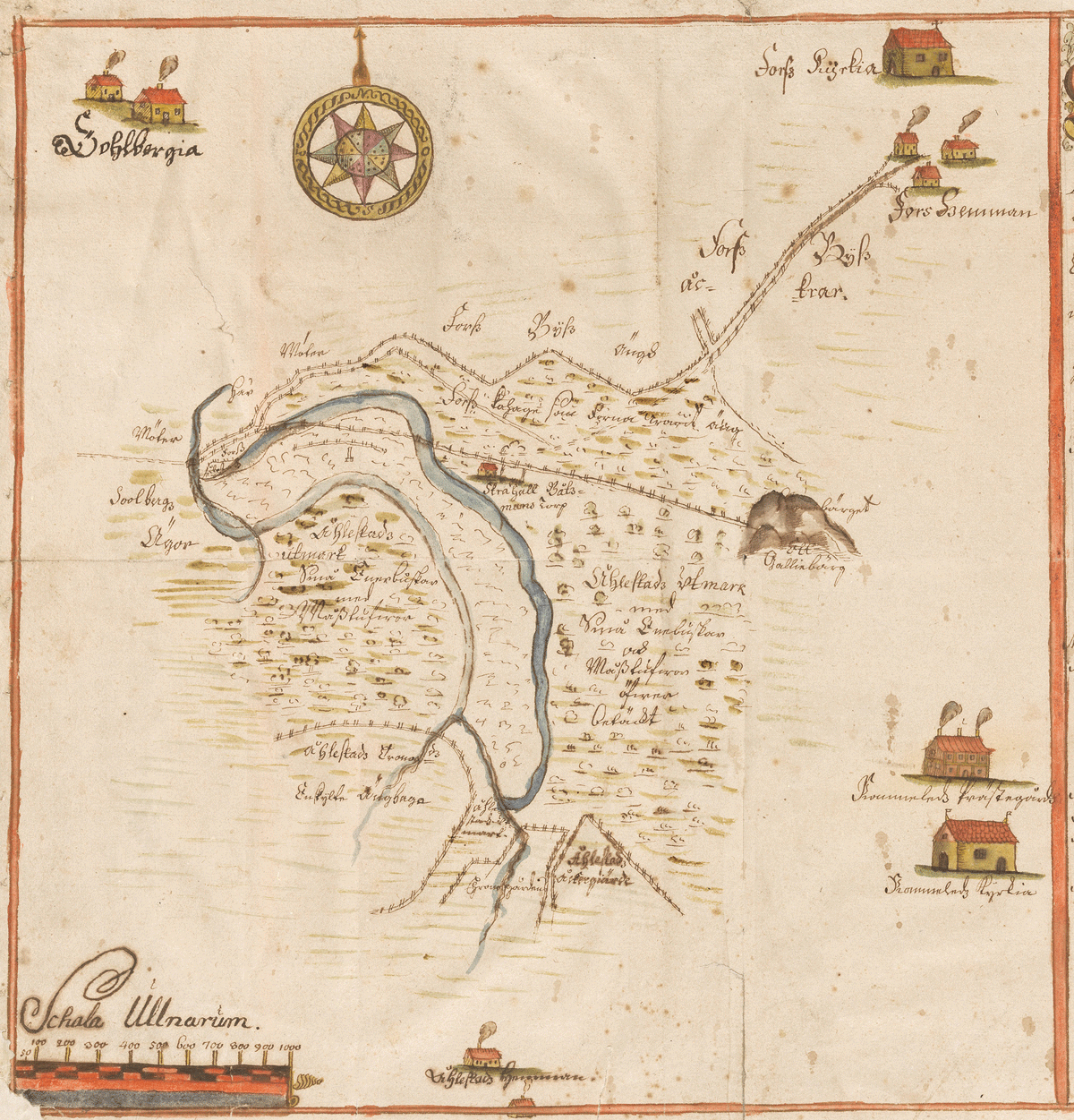
Figure 3
The ‘Lund map’ of the 1703 Skrehall landslide, by an anonymous surveyor. Source: Lund University Library. Retrieved from http://urn.kb.se/resolve?urn=urn:nbn:se:alvin:portal:record-97927. Accessed 3 May 2023.
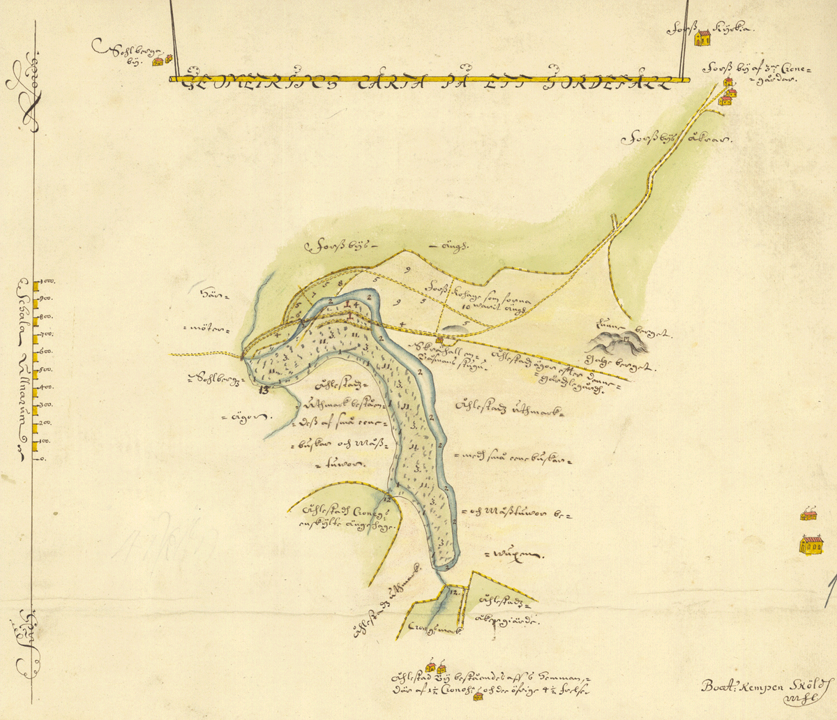
Figure 4
The ‘Arninge map’ of the 1703 Skrehall landslide, by Bo Samuelsson Kempensköld. Source: Lantmäteriet. Retrieved from https://historiskakartor.lantmateriet.se/historiskakartor/advancedsearch.html. Accessed 3 May 2023.
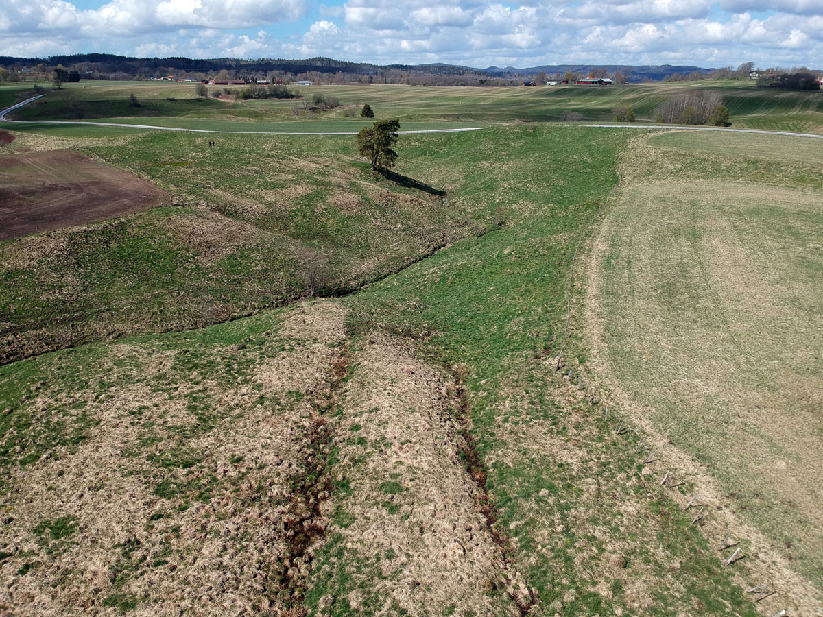
Figure 5
Drone photograph of the creek ravine, showing the eastern road section (foreground), the western road section (upper left), and the landslide scarp (upper right). Photo: Paula Molander (2021).
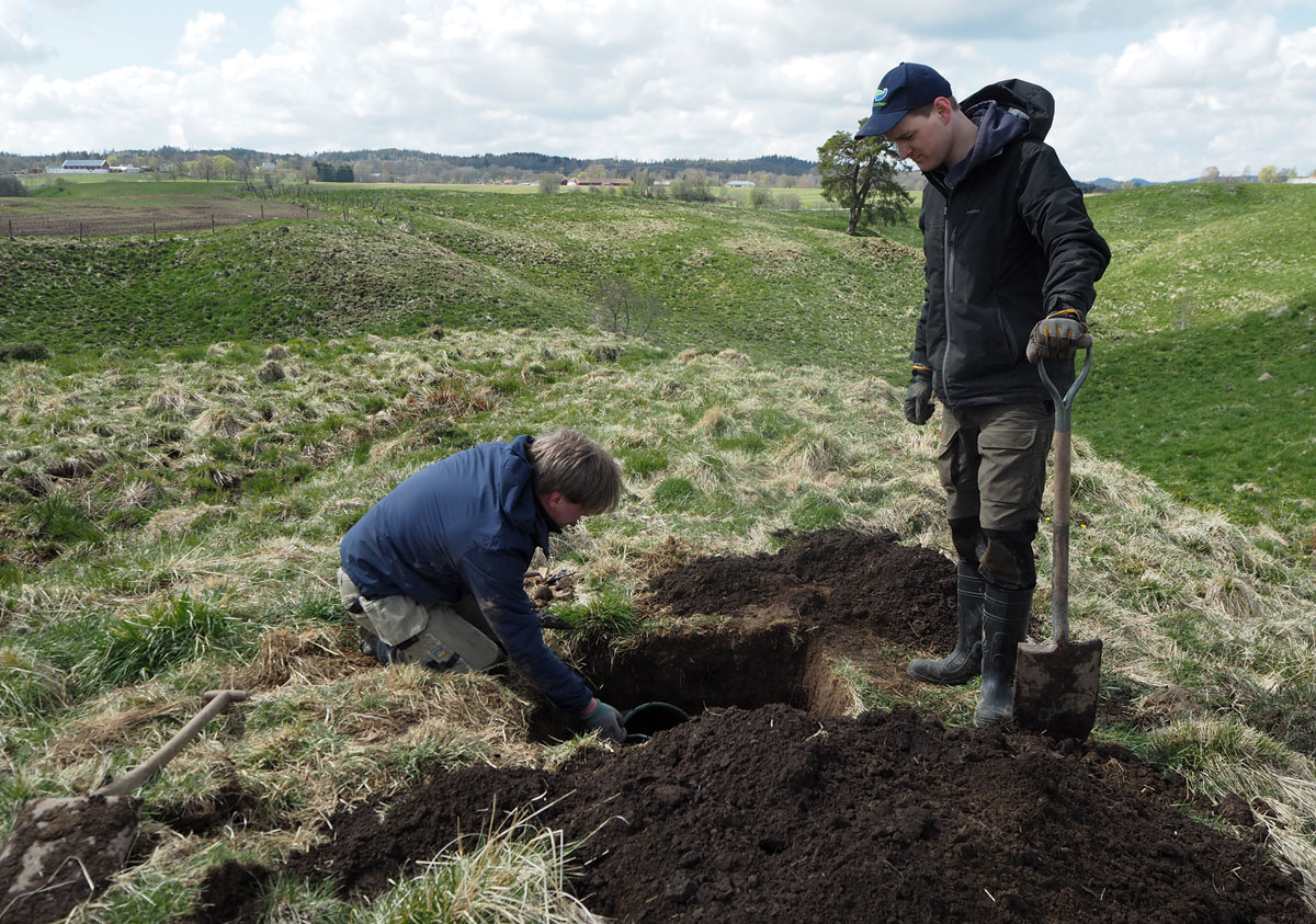
Figure 6
Snapshot from the May 2021 fieldwork, showing the process of excavating the test pit Unit A by shovel and trowel. Photo: Paula Molander (2021).