
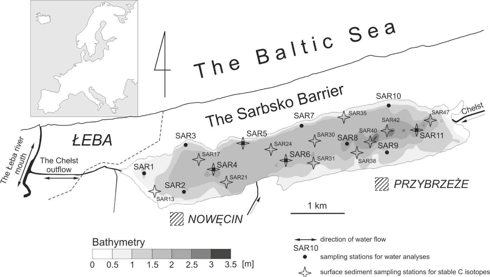
Figure 1
Location and bathymetry of Lake Sarbsko and distribution of the sampling stations
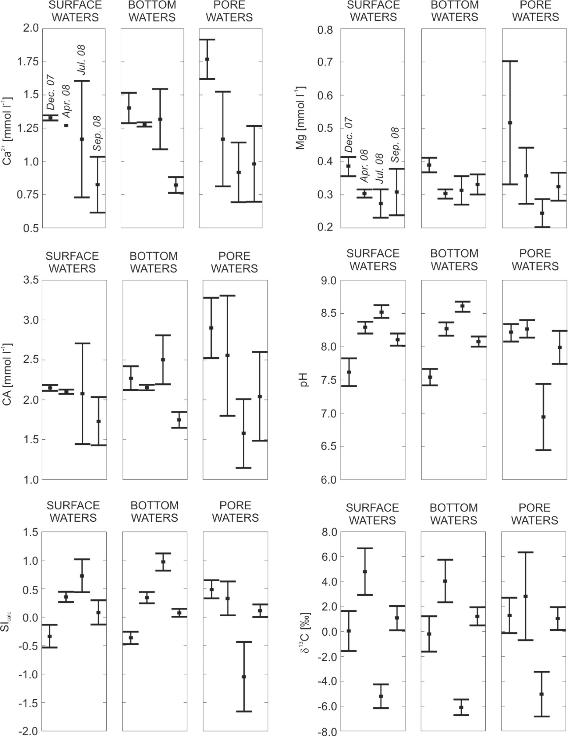
Figure 2
Chemical composition of Lake Sarbsko during the study period. Surface, bottom and pore waters are distinguished. Plots show average values of each parameter ±1 standard deviation in each data set. Dates of collection are given in the upper panels.
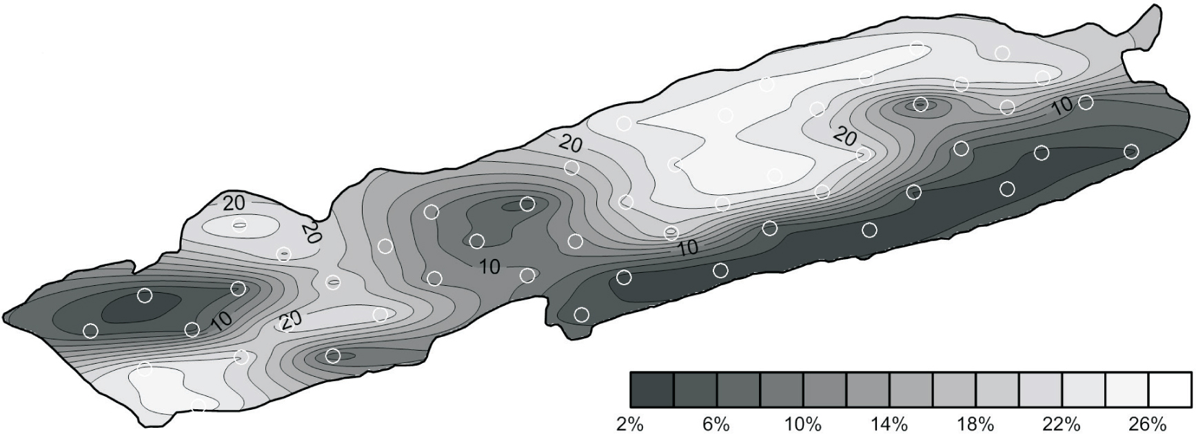
Figure 3
The spatial distribution of CaCO3 within the surface sediments of Lake Sarbsko. White circles indicate sediment sampling sites
Table 1
The content of CaCO3 and the stable C isotope composition of sedimentary carbonates (δ13Ccalc) from Lake Sarbsko. Locations of sampling sites is shown in Figure 1.
| Sample number | Depth b.l.f.* | CaCO3 | δ13Ccalc |
|---|---|---|---|
| (cm) | (wt.%) | (‰ V-PDB) | |
| SURFACE SAMPLES | |||
| SAR 4 | 0 – 5 | 24.0 | -1.69 |
| SAR 5 | 0 – 5 | 10.0 | -1.67 |
| SAR 13 | 0 – 5 | 28.0 | -1.49 |
| SAR 17 | 0 – 5 | 25.0 | -1.77 |
| SAR 21 | 0 – 5 | 25.0 | -1.60 |
| SAR 24 | 0 – 5 | 28.0 | -1.72 |
| SAR 30 | 0 – 5 | 25.0 | -1.69 |
| SAR 31 | 0 – 5 | 25.0 | -1.94 |
| SAR 35 | 0 – 5 | 25.0 | -1.63 |
| SAR 38 | 0 – 5 | 24.0 | -1.75 |
| SAR 42 | 0 – 5 | 28.0 | -1.98 |
| SAR 47 | 0 – 5 | 27.0 | -1.55 |
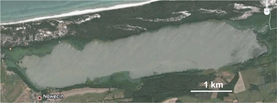
Figure 4
Satellite image of Lake Sarbsko from 09 July 2005 showing widespread whiting in the lake. The image comes from Google Earth.