
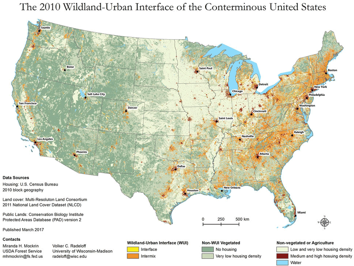
Figure 1
Map of US WUI in 2010.
Source: U.S. Forest Service, available at https://www.nrs.fs.fed.us/data/wui/.
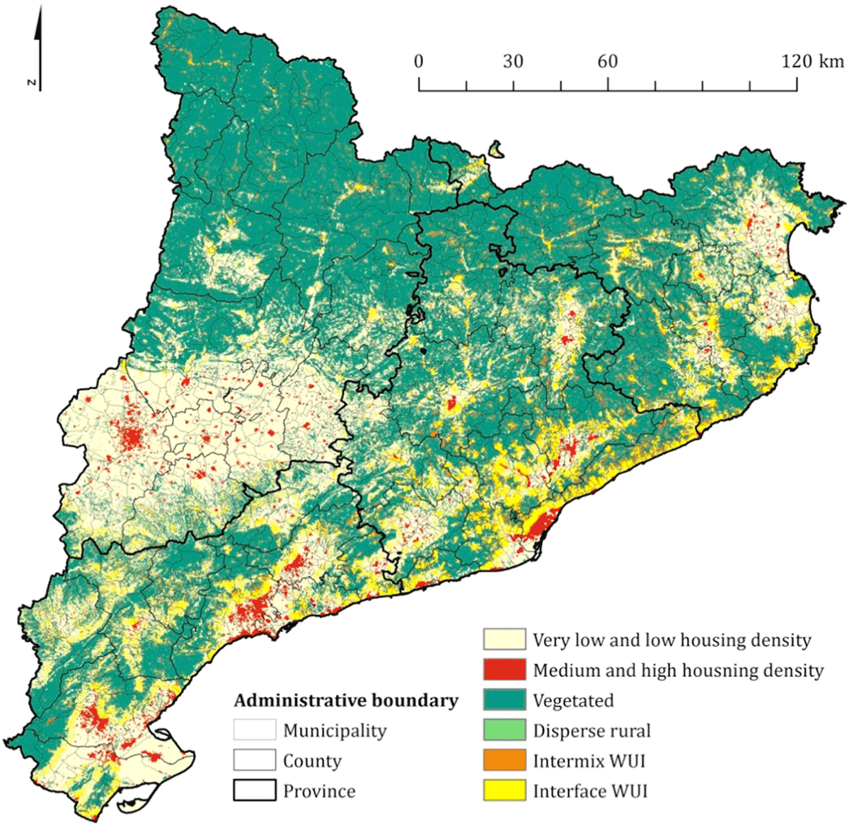
Figure 2
WUI map of the Province of Catalonia, Spain.
Source: Alcasena et al. (2018), reproduced with permission of the authors.
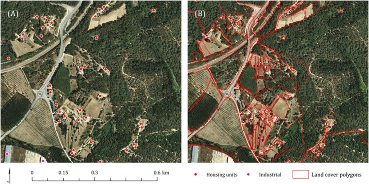
Figure 3
Close-up view of WUI in Catalonia showing land use polygons.
Source: Alcasena et al. (2018), reproduced with permission of the authors.