
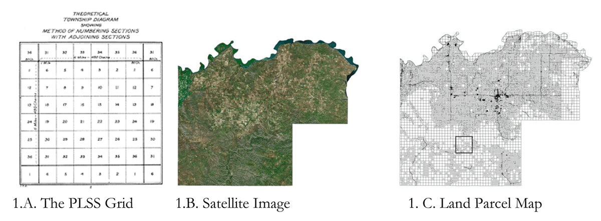
Figure 1
Parceling Using the Public Land Survey System. A. depicts the standard Public Land Survey System abstracted the township scale, which reflects 36 sections of 640 acres each. B. depicts a satellite photograph of McKenzie County, North Dakota. C. depicts the land parceling of McKenzie County, reflecting the application of the grid over the landscape.
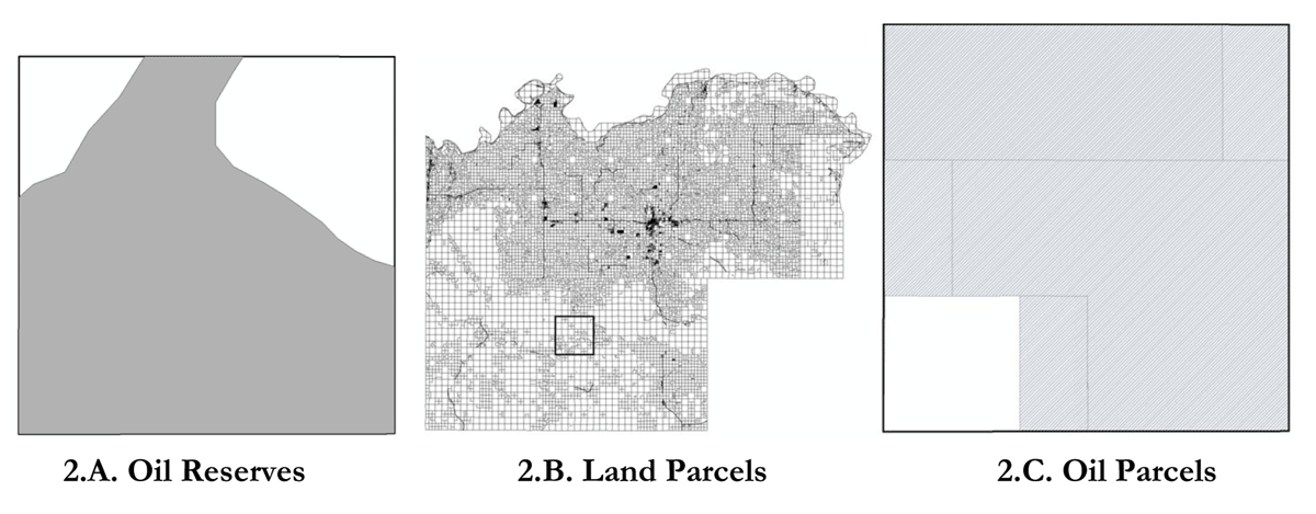
Figure 2
Land Parcels Fragmenting Natural Resources. 2.A. Depicts the naturally-occurring resource boundaries of oil reserves in for an example township McKenzie County, North Dakota. 2.B. depicts land parcels. As illustrated, the land parcels fragment the naturally occurring distribution of oil. 2.C. depicts a map of oil fields in an example township, the lines of which demarcate boundaries to oil rights—just as the lines in 2.B. demarcate land parcels. Note that the oil parcels are far larger than the land parcels.
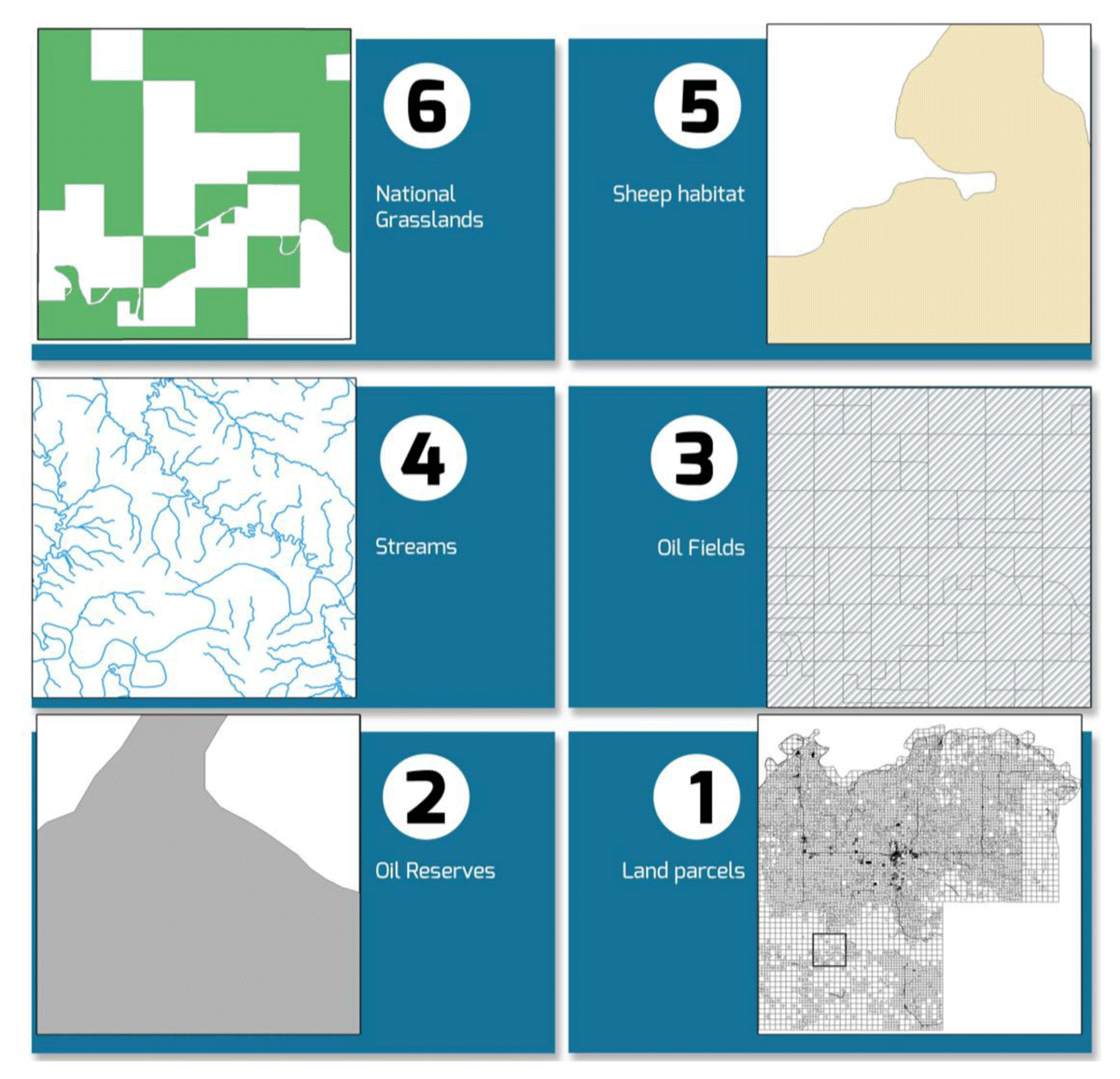
Figure 3
Resource Mix. Maps of six different natural resources and resource boundaries, which overlap in McKenzie County, North Dakota.
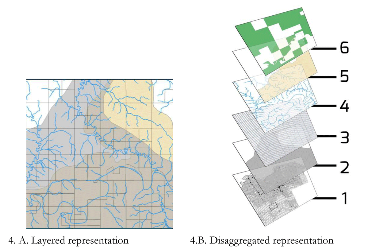
Figure 4
Overlapping Resources. Aggregated and disaggregated representations of the overlapping resources and resource boundaries in McKenzie County, North Dakota.
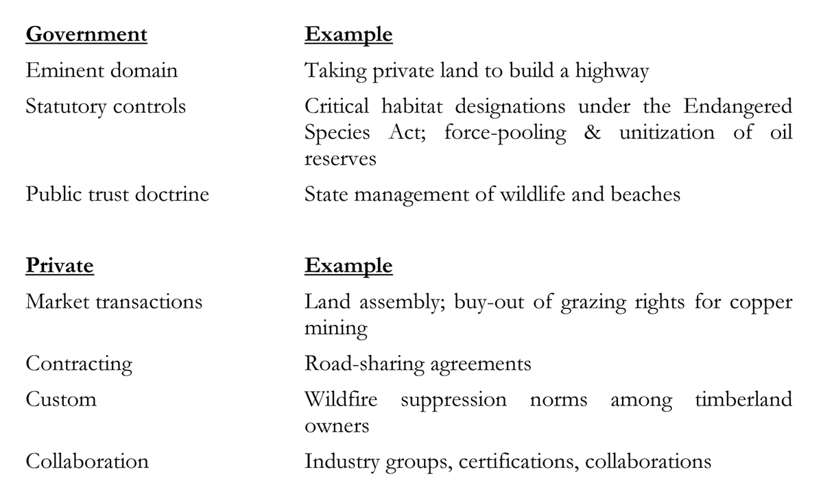
Figure 5
A non-exhaustive list of virtual parceling mechanisms.