
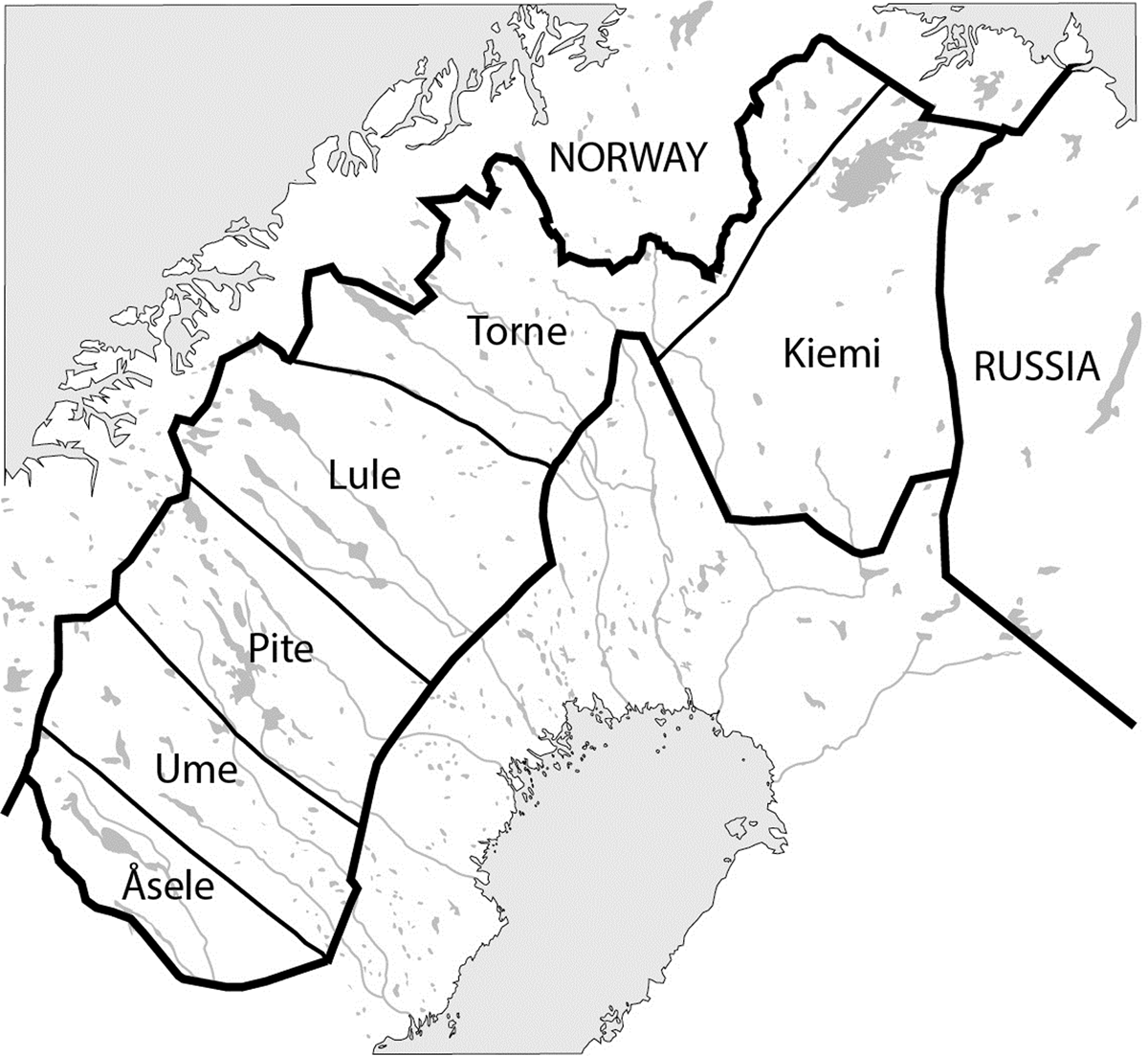
Figure 1
The Swedish lappmarks in the eighteenth century (adapted from Charta öfver Wästerbotten och Svenske Lappmarcken, https://commons.wikimedia.org/wiki/File:Västerbottens_län_och_svenska_lappmarken_1796.svg).
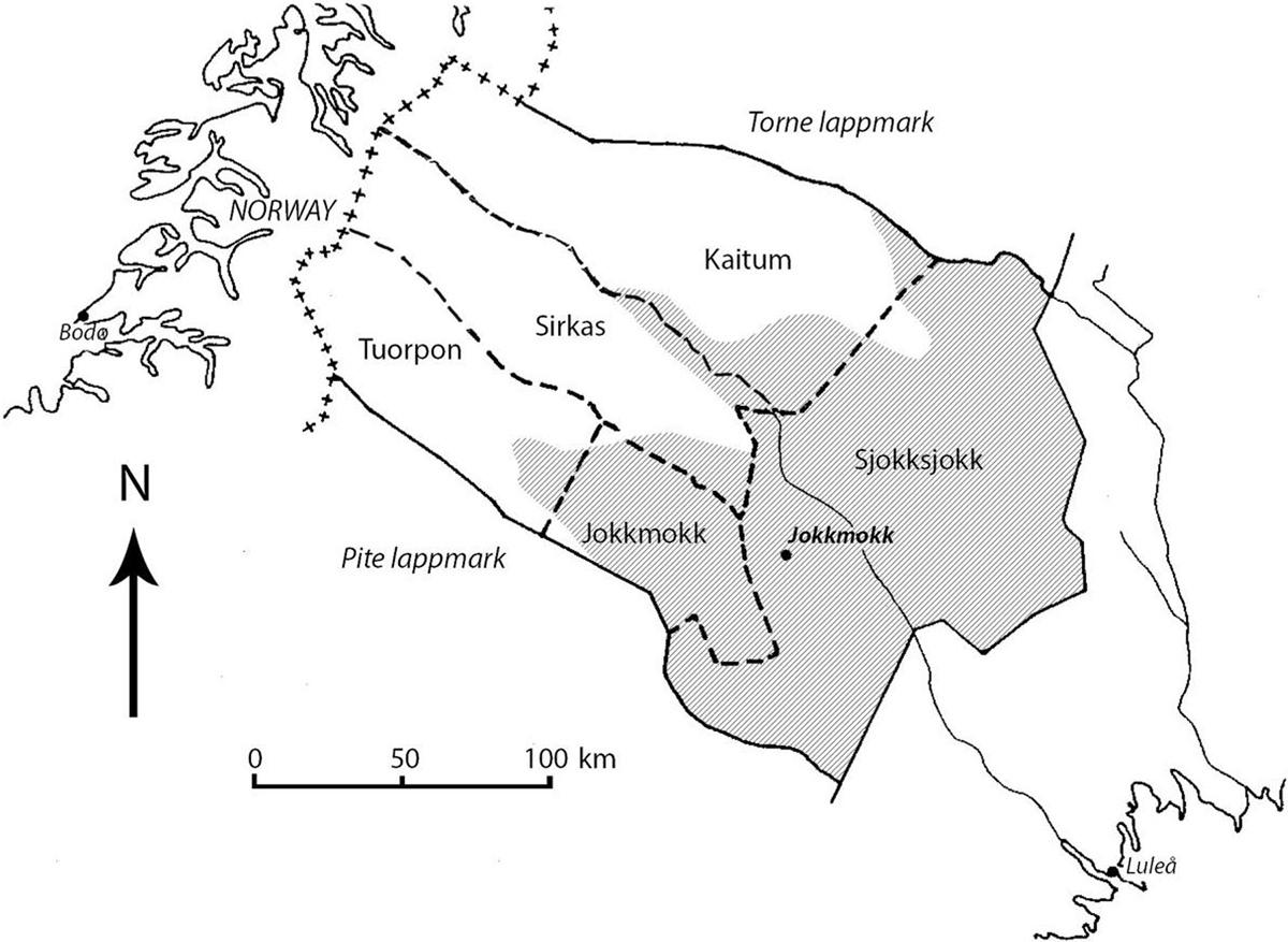
Figure 2
Map of Lule lappmark circa 1760, showing borders between Sami villages Sjokksjokk, Jokkmokk, Tuorpon, Sirkas, and Kaitum. Shaded and white areas represent the boreal forest and mountain regions, respectively. Adapted from Kvist (1989, 16) and Sveriges National Atlas (2011, 34–5).