
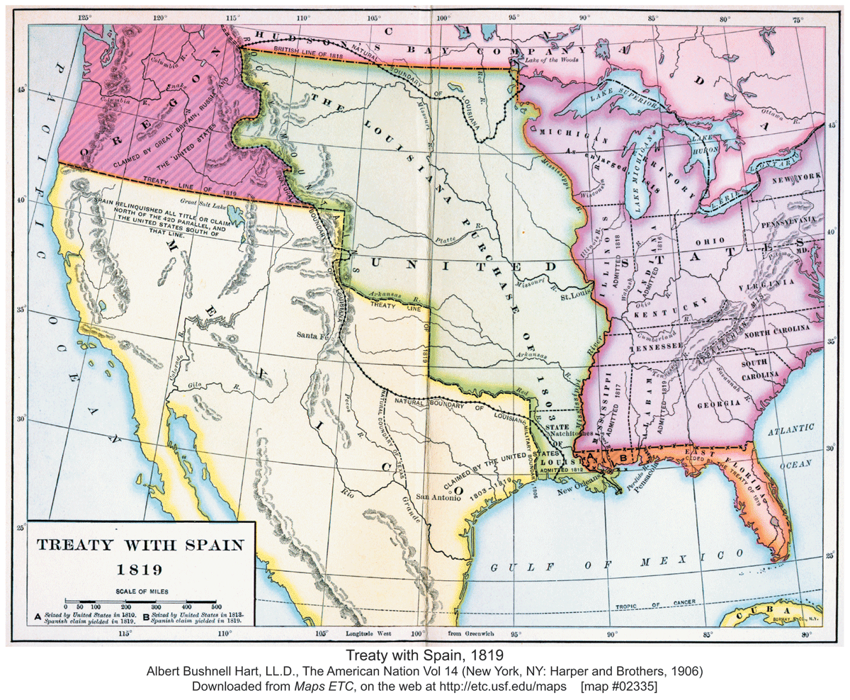
Figure 1
North American Spanish Territory, 1819.
Notes: Albert Bushnell Hart, LL.D., The American Nation Vol 14 (New York, NY: Harper and Brothers, 1906).Source: Maps ETC, downloaded from https://etc.usf.edu/maps/pages/2300/2335/2335.htm.
Table 1
Key Legal Changes for Acequias in New Mexico.
| YEAR | EVENT |
|---|---|
| 1598 | Spanish colonization begins |
| 1821 | Mexican independence |
| 1848 | Treaty of Guadalupe Hidalgo ends the Mexican-American War |
| 1851 | New Mexico Territory is formed and initial legislation codifies acequia traditions |
| 1887 | Legislation allows corporations to form for irrigation development |
| 1895 | House bill 72 alters and imposes new administrative structure on acequias |
| 1905 | Sweeping new water code creates private water rights for central administration |
| 1909 | Legislation allowing for irrigation districts passed |
| 1912 | New Mexico transitions from US Territory to State |
| 1914 | Snow v. Abalos decision disallows communal ownership of water |
[i] Notes: Summary of legal events discussed in the text. Bolded events indicate a change in sovereignty for the region.
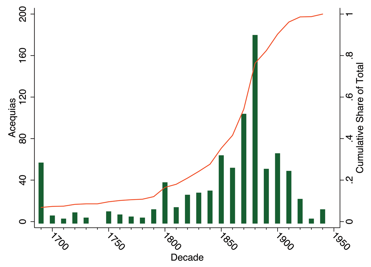
Figure 2
Acequia Formation in New Mexico.
Notes: Acequia formation in New Mexico binned by decade. Decades are marked by their first year (e.g., 1860 covers 1860 to 1869). The 1690 tally includes all pre-existing acequias. The cumulative share of the eventual total is indicated by the orange line.
Sources: Author’s rendering of Dos Rios Consultant, Inc. (1996) acequia data.
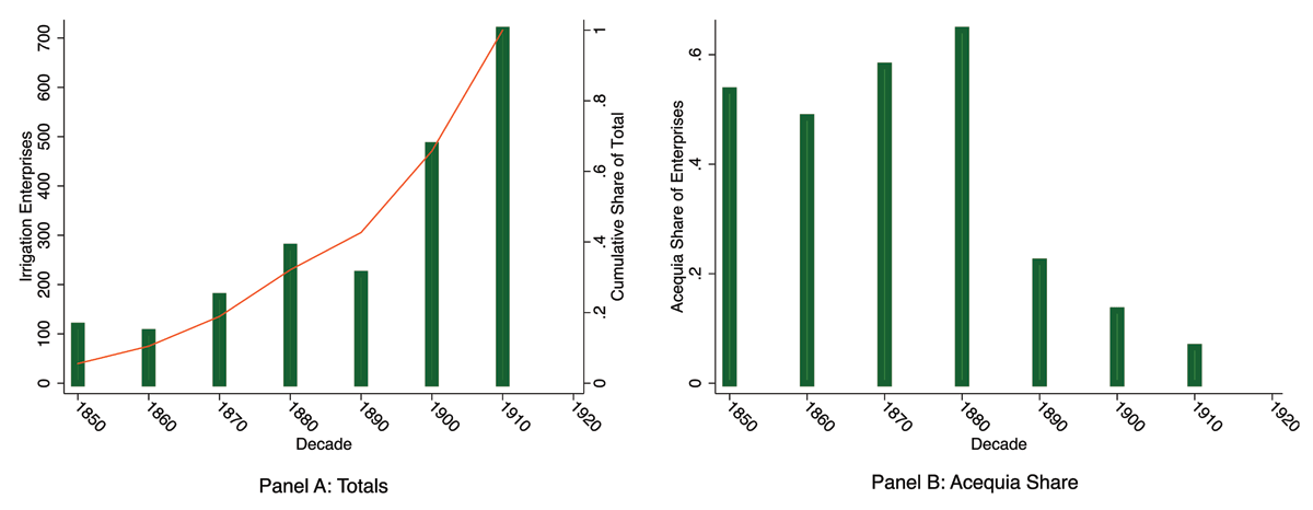
Figure 3
Irrigation Enterprise Formation in New Mexico.
Sources: Author’s rendering of 1920 U.S. Census (1922), State Compendium New Mexico, Irrigation Section, table 3, pg. 67 and Dos Rio Consultants, Inc. (1996) data.
Notes: Irrigation enterprise formation in New Mexico binned by decade. Decades are marked by their first year (e.g., 1860 covers 1860 to 1869). Panel A includes both acequias and non-acequias, which are not distinguished in the census data. The cumulative share of the eventual total is indicated by the orange line. Panel B shows the share of the total number of irrigation enterprises formed that were acequias during each decade by dividing the acequia count shown in figure 2 by the total count shown in Panel A of this figure.
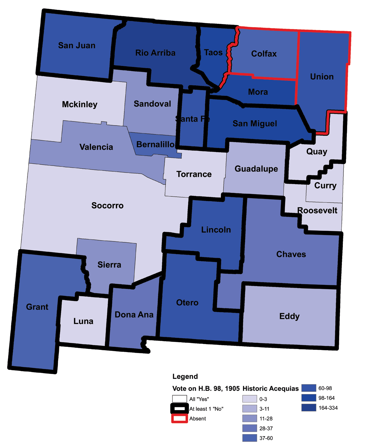
Figure 4
Historic Acequia Counts and Votes for Prior Appropriation Doctrine (1905).
Notes: Counties and their borders are as of 1910. Tables A2 and A3 in the appendix provide the underlying data.
Sources: Author’s rendering of Dos Rios Consultant, Inc. (1996) acequia data and voting records of the Council of House bill No. 98 as recorded in the New Mexico Territorial Archives (NMSCRA, 1971). 1910 Borders from NHGIS (Manson, Schroeder, Riper, Kugler, & Ruggles, 2020).