Have a personal or library account? Click to login
Making Drone Data FAIR Through a Community-Developed Information Framework Cover

Making Drone Data FAIR Through a Community-Developed Information Framework

Open Access
|Jan 2023

Figures & Tables

dsj-22-1463-g1.jpg
Figure 1

A high-level drone research workflow. Mission Planning & In Field refers to In Field Operations.

dsj-22-1463-g2.jpg
Figure 2

Core Classes of The Minimum Information Framework for sUAS datasets.
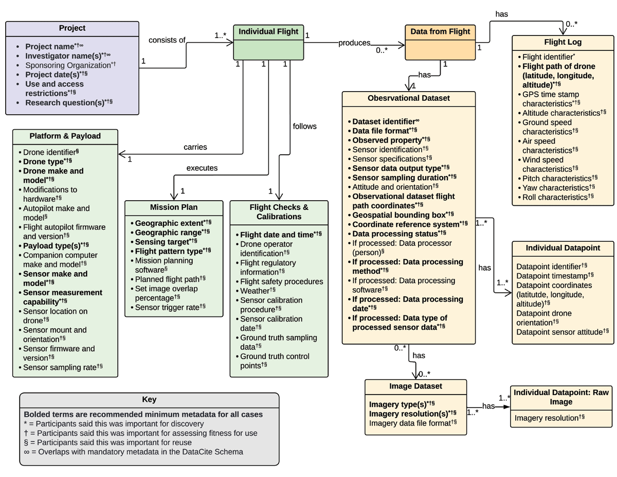
dsj-22-1463-g3.png
Figure 3

The Full Minimum Information Framework for sUAS datasets. Metadata in bold and starred were determined to be likely essential metadata for all scientific drone data users.

Language: English
Submitted on: Jun 2, 2022
|
Accepted on: Nov 4, 2022
|
Published on: Jan 25, 2023
Published by: Ubiquity Press
In partnership with: Paradigm Publishing Services
Publication frequency: 1 issue per year

© 2023 Lindsay Barbieri, Jane Wyngaard, Sarah Swanz, Andrea K. Thomer, published by Ubiquity Press
This work is licensed under the Creative Commons Attribution 4.0 License.