
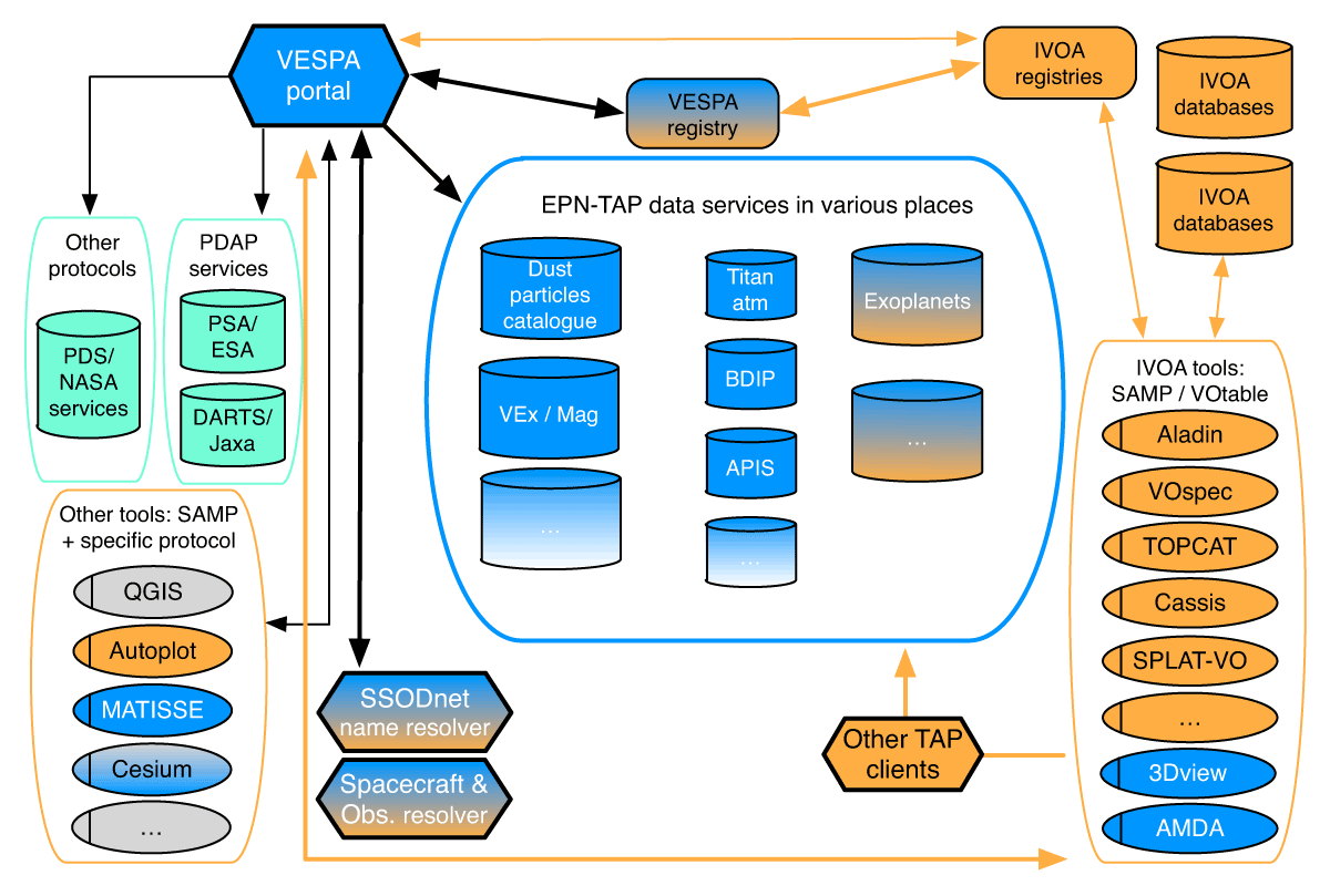
Figure 1
VESPA architecture and origin of developments (orange: IVOA; blue: Europlanet; cyan: PDS; grey: GIS elements).
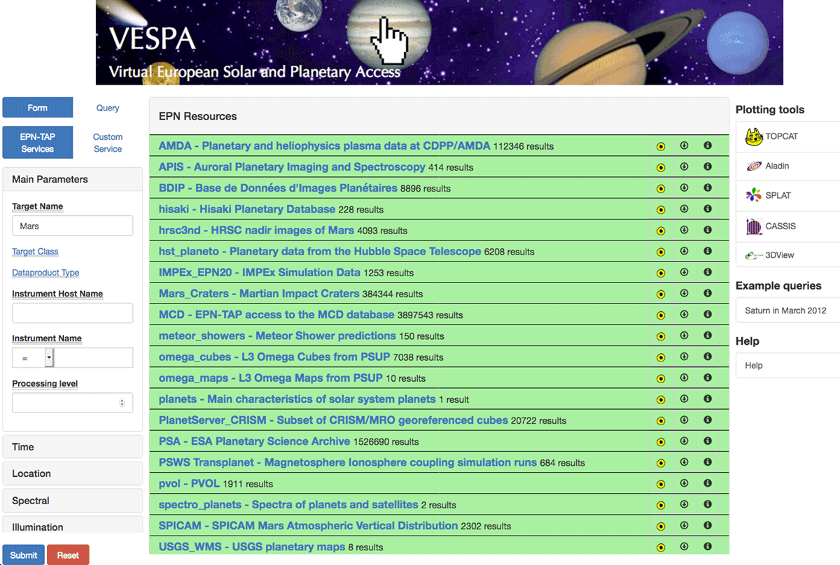
Figure 2
The VESPA main portal: http://vespa.obspm.fr.

Figure 3
Location of Mars in the sky from historical telescopic images (1905 to 1976) displayed in TOPCAT, evidencing retrograde motion around each opposition (the colour scale provides time in Julian Days).
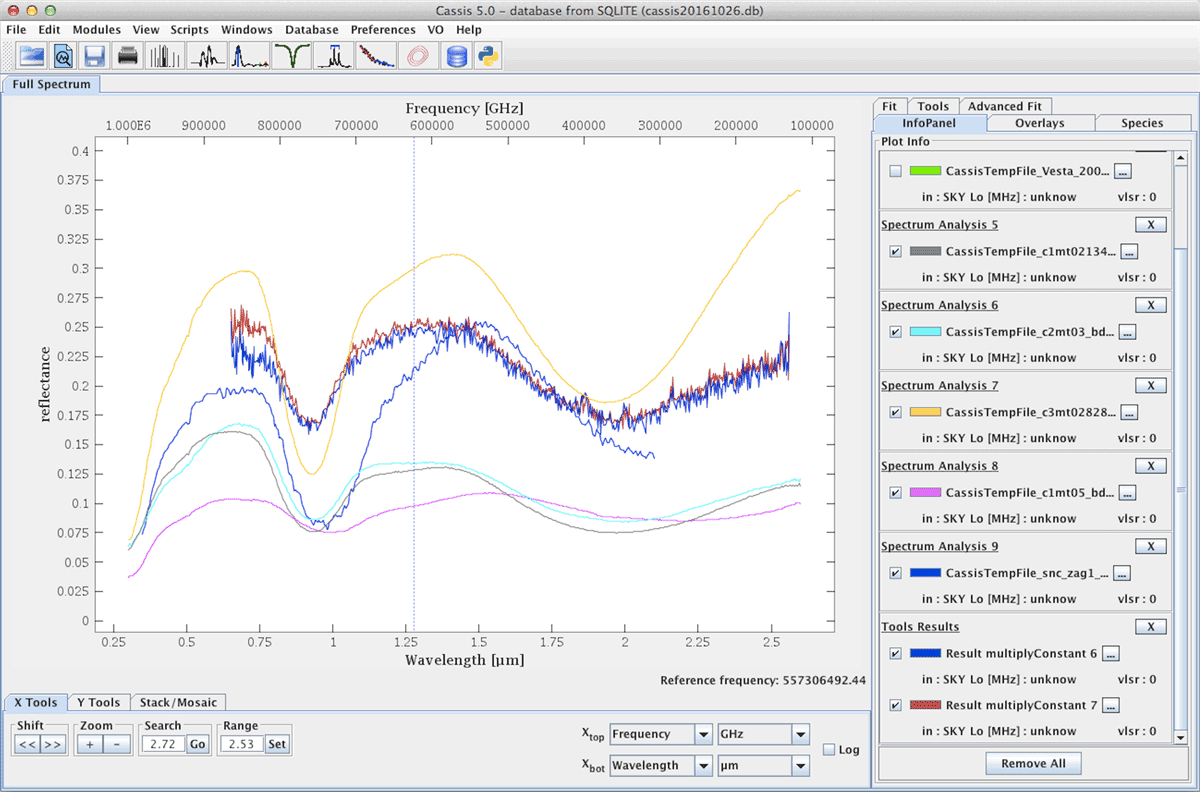
Figure 4
NIR telescopic spectra of 4 Vesta (from the m4ast service) compared to basaltic meteorites from the PDS spectral library in CASSIS, on a reflectance scale.
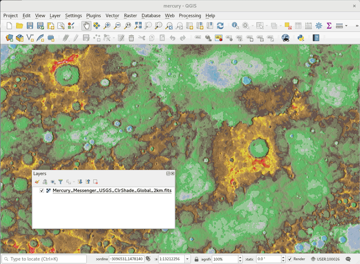
Figure 5
A MESSENGER multispectral image of Mercury converted to geofits format is directly opened in QGIS and plotted on a coordinate grid through the updated GDAL library.

Figure 6
Cassini RPWS/HFR Jupiter Flyby Calibrated Dataset displayed in Autoplot, using the das2server interface.
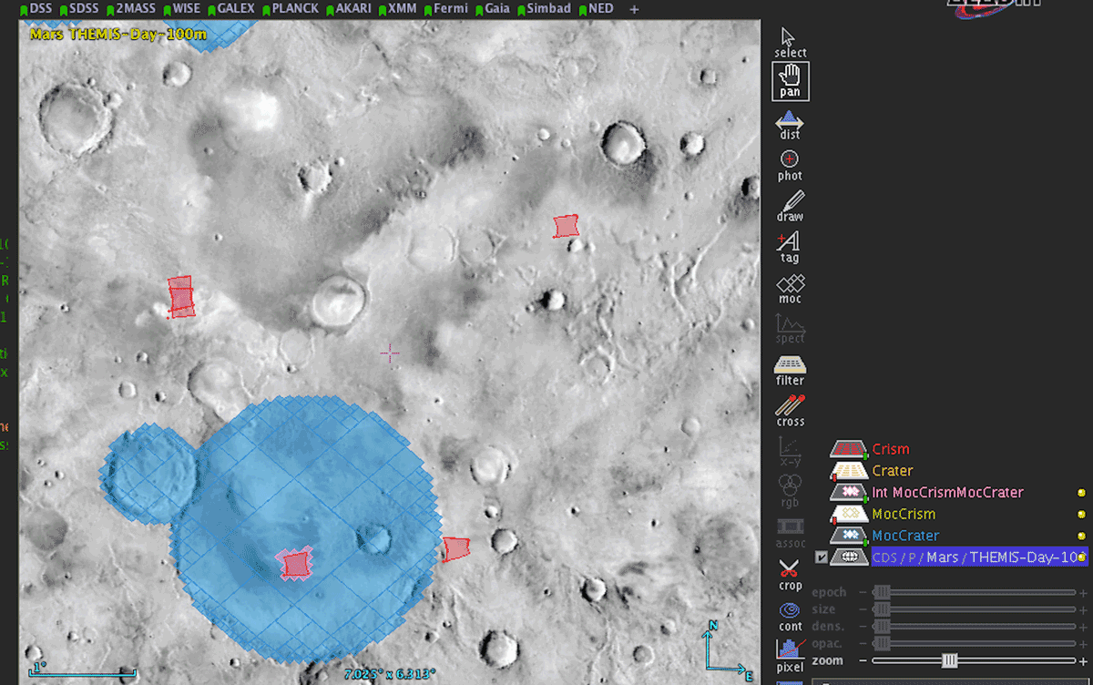
Figure 7
Selection of Mars Reconnaissance Orbiter CRISM spectral cubes located in large Martian craters, based on MOC in Aladin (over THEMIS daytime HiPS).