
Table 1
ROSA 1.0 database samples including data on Ghawar Field and Samotlor Field.
| Name | Ghawar Field | Samotlor Field |
|---|---|---|
| ID | 23 | 12 |
| Latitude | 26,316667 | 61,117 |
| Longitude | 50,133333 | 76,75 |
| Location | Ash Sharkiyya Province, Saudi Arabia | Khanty-Mansi Autonomous Area, Russian Federation |
| Type of hydrocarbon resource | Oil | Oil |
| Exploration methods | After 1945 the exploration of the En Nala anticline was resumed. Shallow drilling was supplemented by gravitational and magnetic surveys. The Field consists of five development areas that were discovered by drilling wells: Ain Dar (1948), Haradh (1949), Uthmaniyah (1951), Shedgum (1952) and Hawiyah (1953). A comprehensive 3D seismic survey was conducted in 1995. | Active 3D seismic survey and field test as well as processing and interpretation of seismic data are carried out annually, which contributes to the discovery of new deposits. |
| Discovery date | 1948 | 1965 |
| Start of production | 1951 | 1969 |
| Type of reservoir | Highly porous limestones with intercalations of clay | Sandstones with interlay of siltstone and clay |
| Age of reservoir | C1-J2 | K1-J3 |
| Mass density (g/c3) | 856 | 850 |
| Operator | Saudi Aramco | Rosneft |
| Oil reserves (million tons) | 10 | 7,1 |
| Extraction methods | Fountain | Pumping, fountain |
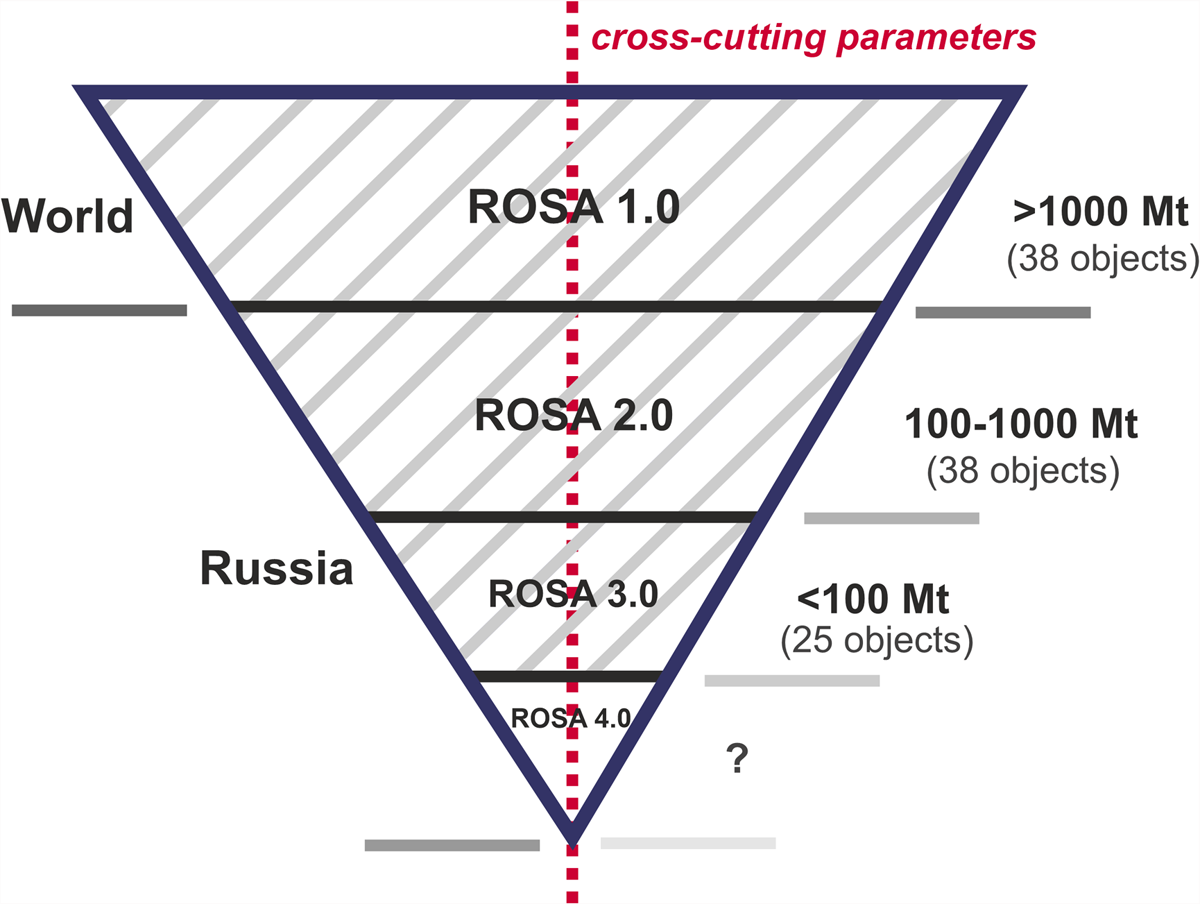
Figure 1
Inverted pyramid model for representing the structure of multilevel ROSA database.
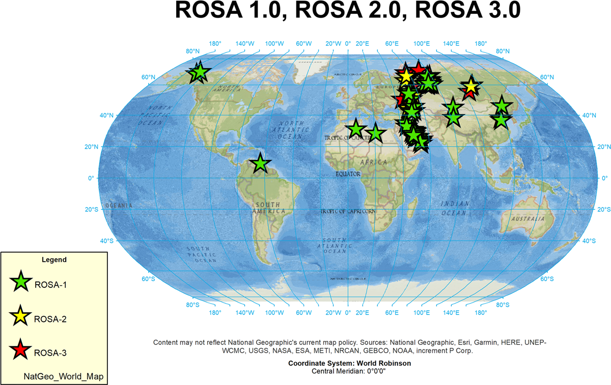
Figure 2
ROSA database visualization in ArcGIS.
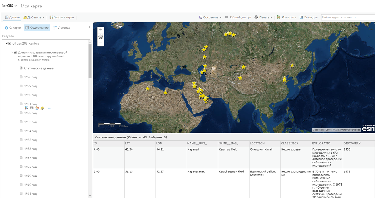
Figure 3
Online visualization of the ROSA database using ArcGIS web service.