
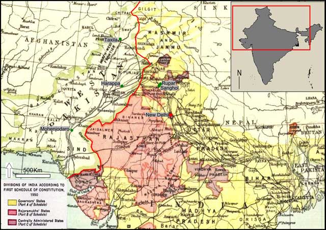
Figure 1
Map representing geopolitical and administrative units in northern India in 1950. New Delhi, the nation’s capital is represented in red, and the approximate locations of Mohenjodaro, Harappa, Taxila, Rupar and Sanghol are in green. The international boundary, in red, between India and Pakistan is approximate. Adapted from ‘Divisions of India according with the first schedule of the Constitution (1950)’, 1953.
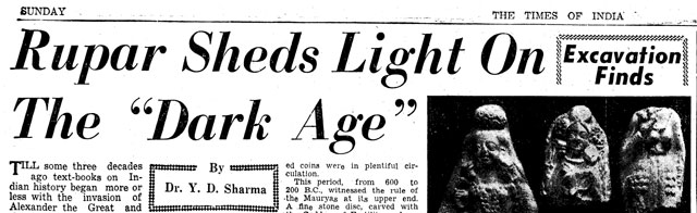
Figure 2
Image from Sharma, Y D’s article in The Times of India on his archaeological recovery at Rupar in 1954. Courtesy of Nehru Memorial Museum Library, New Delhi, India.
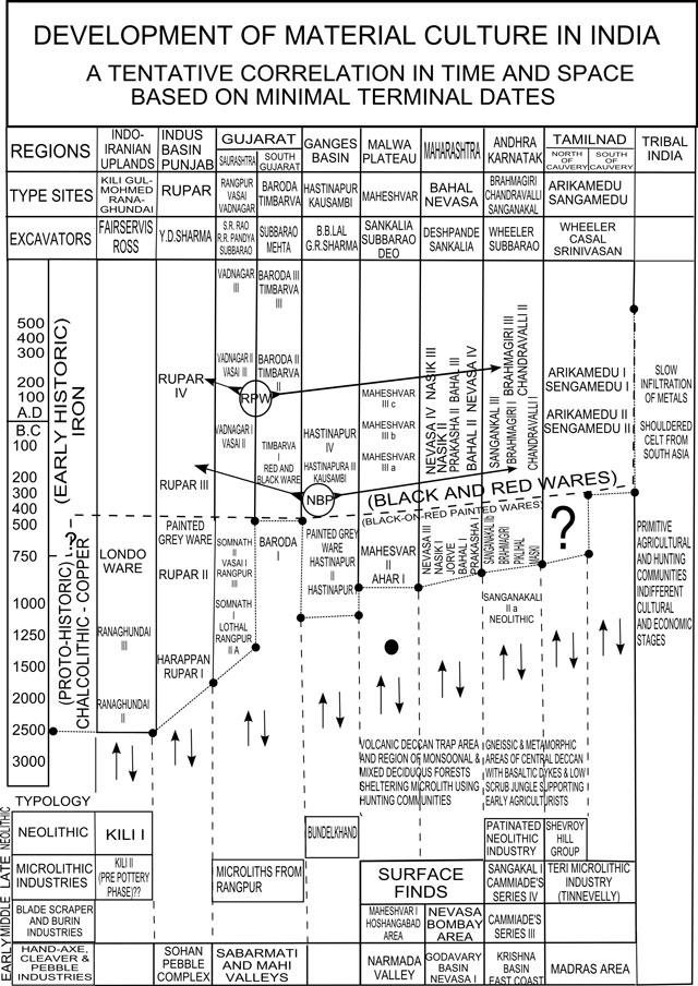
Figure 3
Image adapted from Subbarao’s ‘Development of Material Culture in India’, 1958. Subbarao depicted nine administrative-ecological ‘regions’, type-sites and excavators, including ‘Tribal India’ as a homogenous and timeless unit. Note early cultural development in northern India (Indus Basin, Gujarat, Ganges Basin) and its implied spread through time over southern India (Andhra, Karnatak, Tamil Nad), and the absence of such change in eastern India (Tribal India).
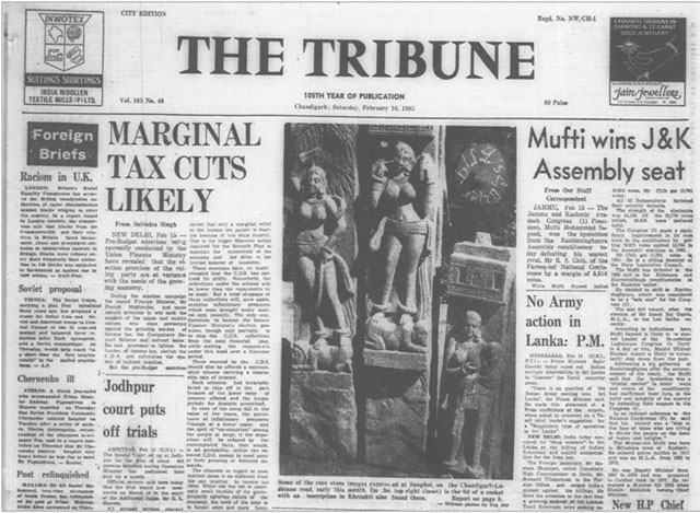
Figure 4
Image showing the front page of The Tribune from February 16, 1985, to announce the Punjab Department’s recovery of sculptures. The original caption reads ‘Some of the rare stone images excavated at Sanghol, on the Chandigarh-Ludhiana road, early this month. On the top right (inset) is the lid of a casket with an inscription in Khroshti also found there. Tribune photos by Yog Joy’. Courtesy of Nehru Memorial Museum Library, New Delhi, India.