
Figure 1:
Figure 2:
Figure 3:
Figure 4:
Figure 5:
Figure 6:
Figure 7:
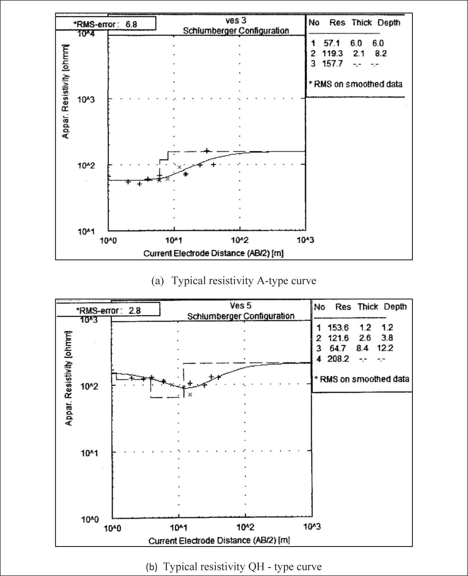
Figure 8:
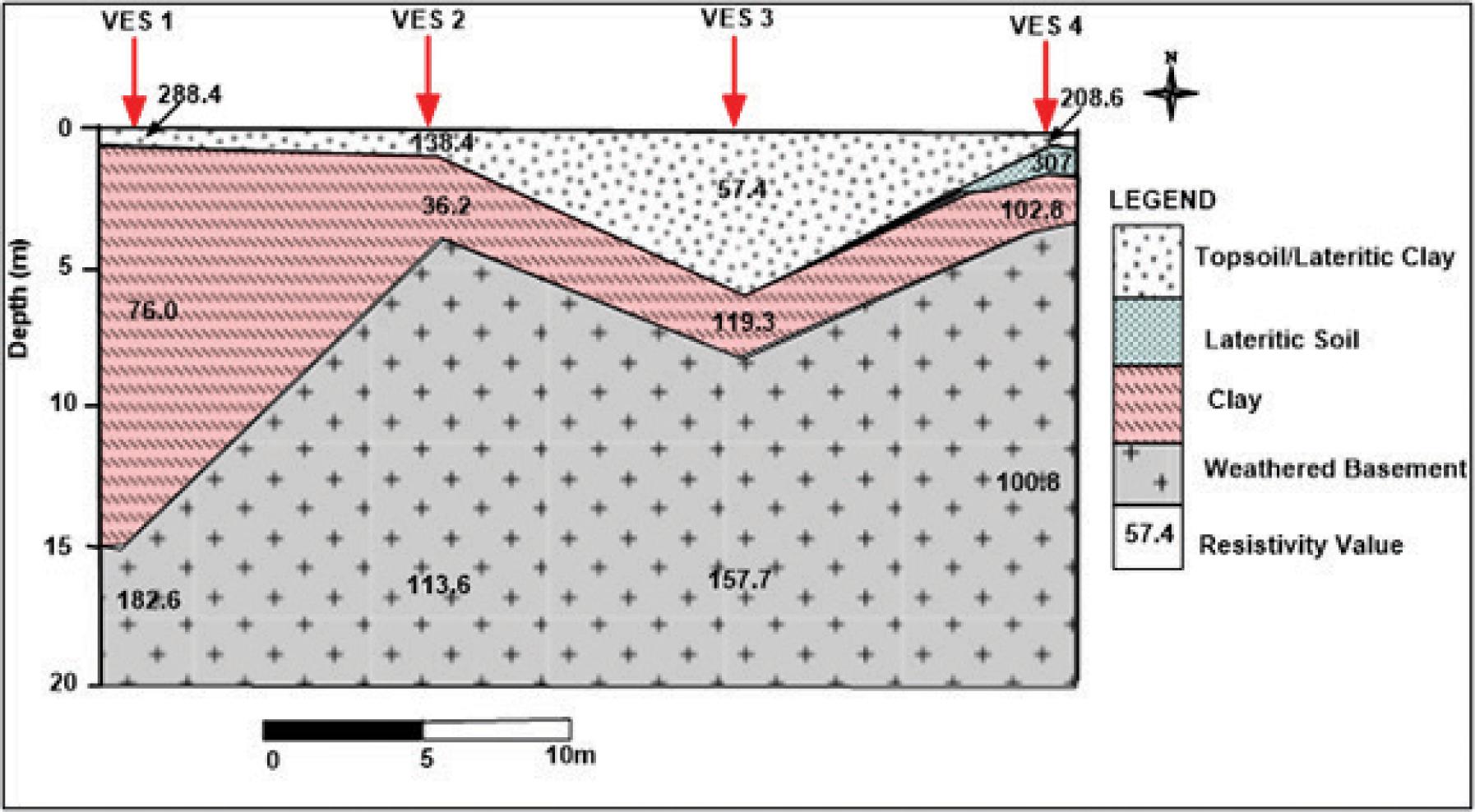
Figure 9:
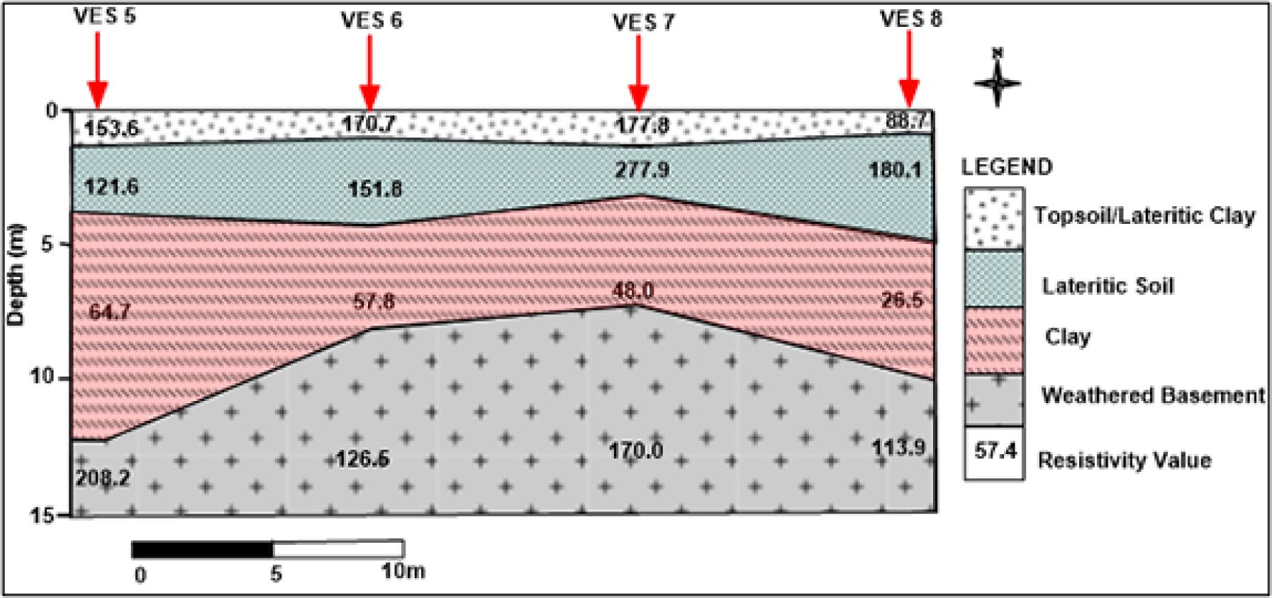
Figure 10:
The layer parameters and geoelectric characteristics_
| VES No. | Layer resistivity (Ωm) | Layer thickness (m) | Depth (m) | Curve types | Lithology |
|---|---|---|---|---|---|
| 1 | 288.4 | 0.5 | 0.5 | Topsoil/Laterite | |
| 76.6 | 14.5 | 15 | H | Clay | |
| 182.6 | - | - | Weathered layer | ||
| 2 | 138.4 | 0.9 | 0.9 | Topsoil/Laterite | |
| 36.2 | 3.1 | 4.0 | H | Clay | |
| 113.6 | - | - | Weathered layer | ||
| 3 | 57.1 | 6.0 | 6.0 | Topsoil/Laterite | |
| 119.3 | 2.1 | 8.2 | A | Clay | |
| 157.7 | - | - | Weathered layer | ||
| 4 | 208.3 | 0.5 | 0.5 | Topsoil | |
| 307.2 | 1.1 | 1.6 | KQ | Lateritic clay | |
| 102.8 | 2.0 | 3.6 | Clay | ||
| 100.8 | - | - | Weathered layer | ||
| 5 | 153.6 | 1.2 | 1.2 | Topsoil | |
| 121.6 | 2.6 | 3.8 | QH | Lateritic clay | |
| 64.7 | 8.4 | 12.2 | Clay | ||
| 208.2 | - | - | Weathered layer | ||
| 6 | 170.2 | 1.0 | 1.0 | Topsoil | |
| 151.8 | 3.2 | 4.2 | QH | Lateritic clay | |
| 57.0 | 4.0 | 8.2 | Clay | ||
| 126.5 | - | - | Weathered layer | ||
| 7 | 177.8 | 1.1 | 1.1 | Topsoil | |
| 277.9 | 2.1 | 3.2 | KH | Lateritic clay | |
| 48.0 | 4.2 | 7.4 | Clay | ||
| 170.0 | - | - | Weathered layer | ||
| 8 | 88.7 | 0.8 | 0.8 | Topsoil | |
| 180.1 | 4.0 | 4.8 | KH | Lateritic clay | |
| 26.5 | 5.0 | 9.8 | Clay | ||
| 113.9 | - | - | Weathered layer | ||
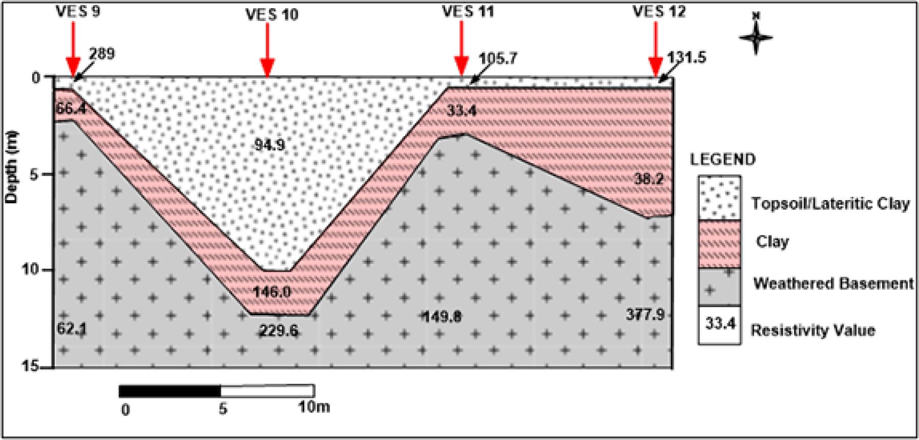
| 9 | 289.0 | 0.4 | 0.4 | Topsoil/Laterite | |
| 66.4 | 1.9 | 2.3 | Q | Clay | |
| 62.1 | - | - | Weathered layer | ||
| 10 | 94.9 | 9.9 | 9.9 | Topsoil/Laterite | |
| 146.0 | 2.4 | 12.3 | A | Clay | |
| 229.6 | - | - | Weathered layer | ||
| 11 | 105.7 | 0.9 | 0.3 | Topsoil/Laterite | |
| 33.4 | 2.1 | 3.0 | H | Clay | |
| 149.8 | - | - | Weathered layer | ||
| 12 | 131.5 | 0.5 | 0.5 | Topsoil/Laterite | |
| 38.2 | 6.8 | 7.3 | H | Clay | |
| 377.9 | - | - | Weathered layer |