
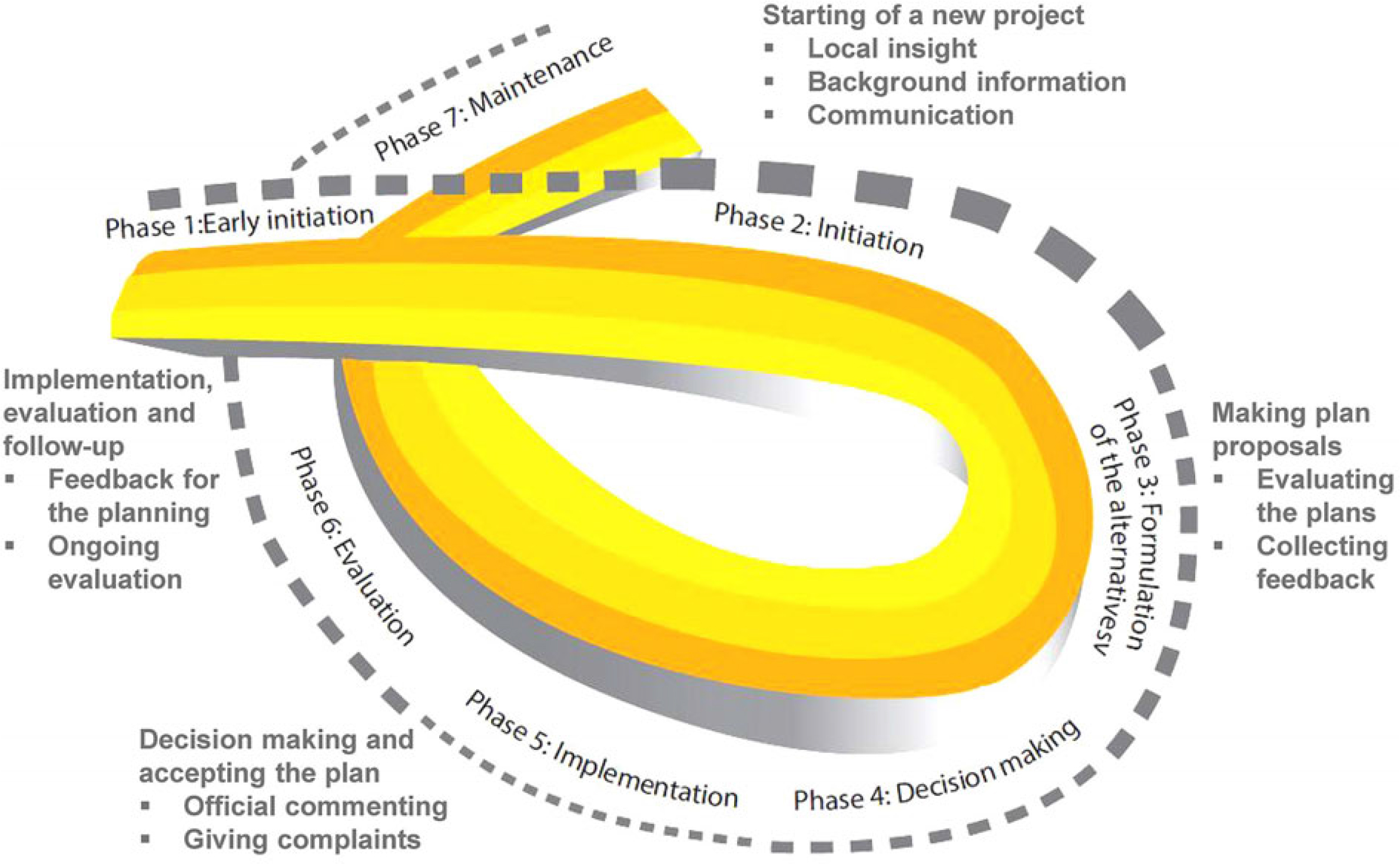
Fig. 1
Public participation support system by Kahila-Tani (2016).
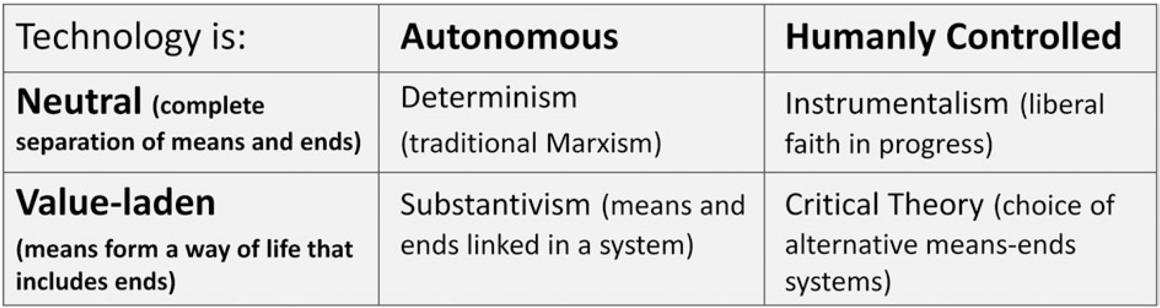
Fig. 2
M. Haklay’s interpretation of Freenberg’s (1999) opinion on technology.
Table 1
The complementary case study approach involves three case studies in Dublin, Nottingham, and London (by A. Corcoran and Z. Nedovic-Budic).
| Case study elements | Research step | Common methodology | Analysis method |
|---|---|---|---|
| Stakeholder group | |||
| Resilience principle | Pre-design data collection | Focus groups | Content analyses |
| Resilience issue | Pre-design data collection | Focus groups | Content analyses |
| G-ICT (geographical information and communication technology) | Pre-design data collection | Focus groups | Content analyses |
| Prototyping development | Programming | ||
| Implementation | Recruitment of prototype users/gathering of content | ||
| Evaluation | Controlled experiment | Statistical analysis | |
| Focus Groups | Content analyses | ||
| Survey | Statistical analysis |
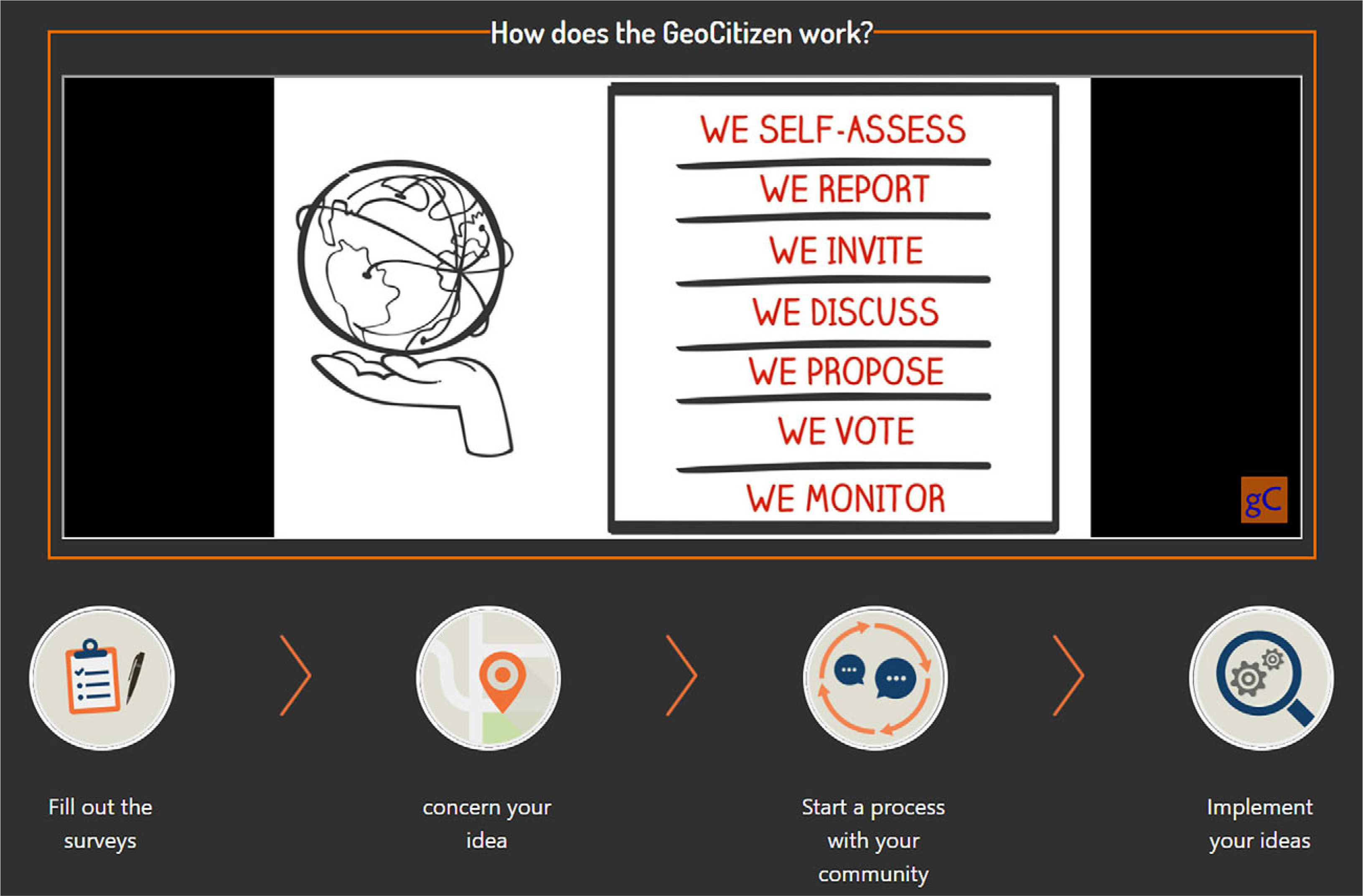
Fig. 3
Workflow for the GeoCitizen Platform (by Fundación CEC and Z-GIS Salzburg).
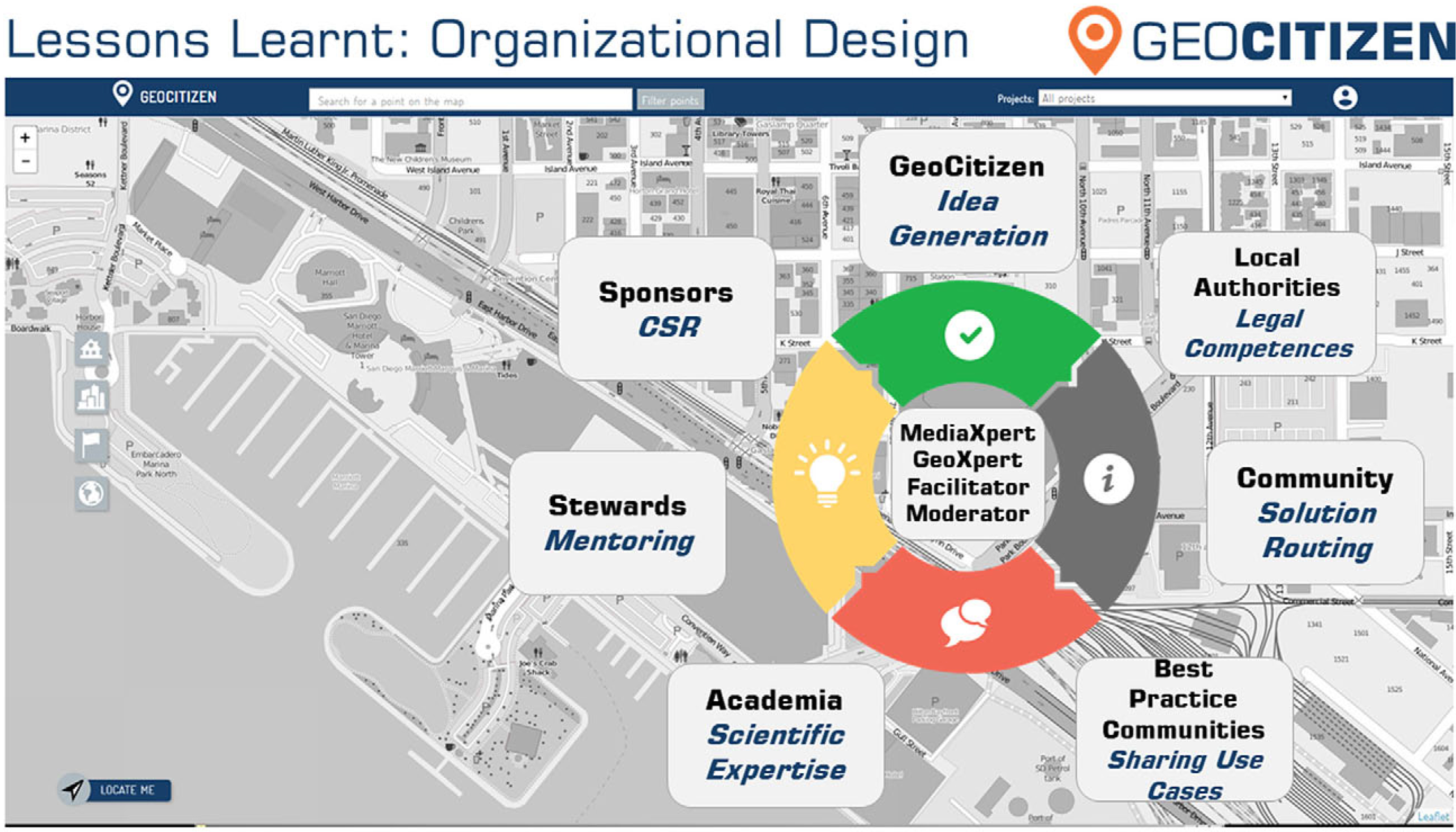
Fig. 4
Organisational design of the GeoCitizen Platform (by T. Blaschke and K. Atzmanstorfer).
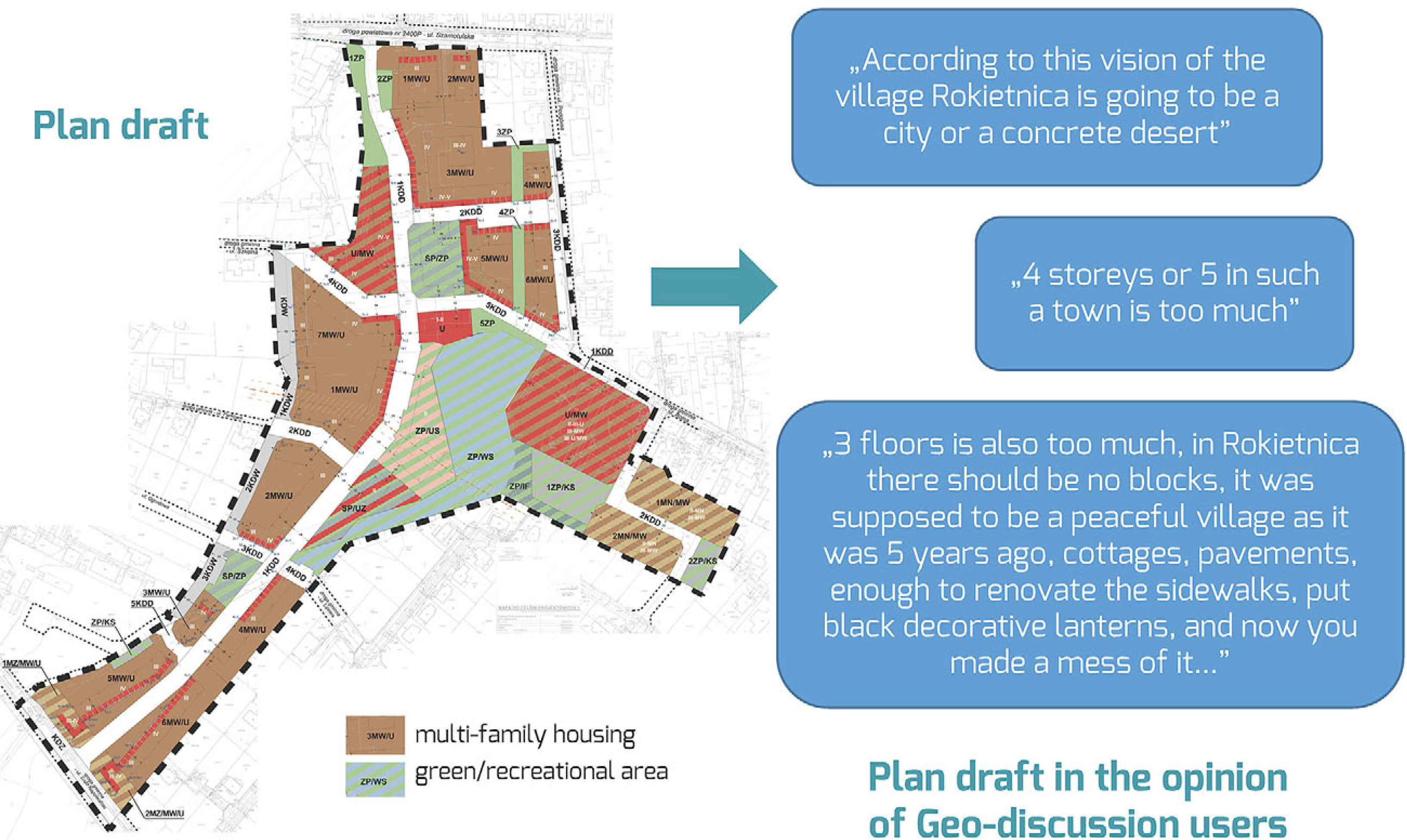
Fig. 5
Comments on draft plan of land use of the Rokietnica centre (by D. Walczak and M. Młodkowski).
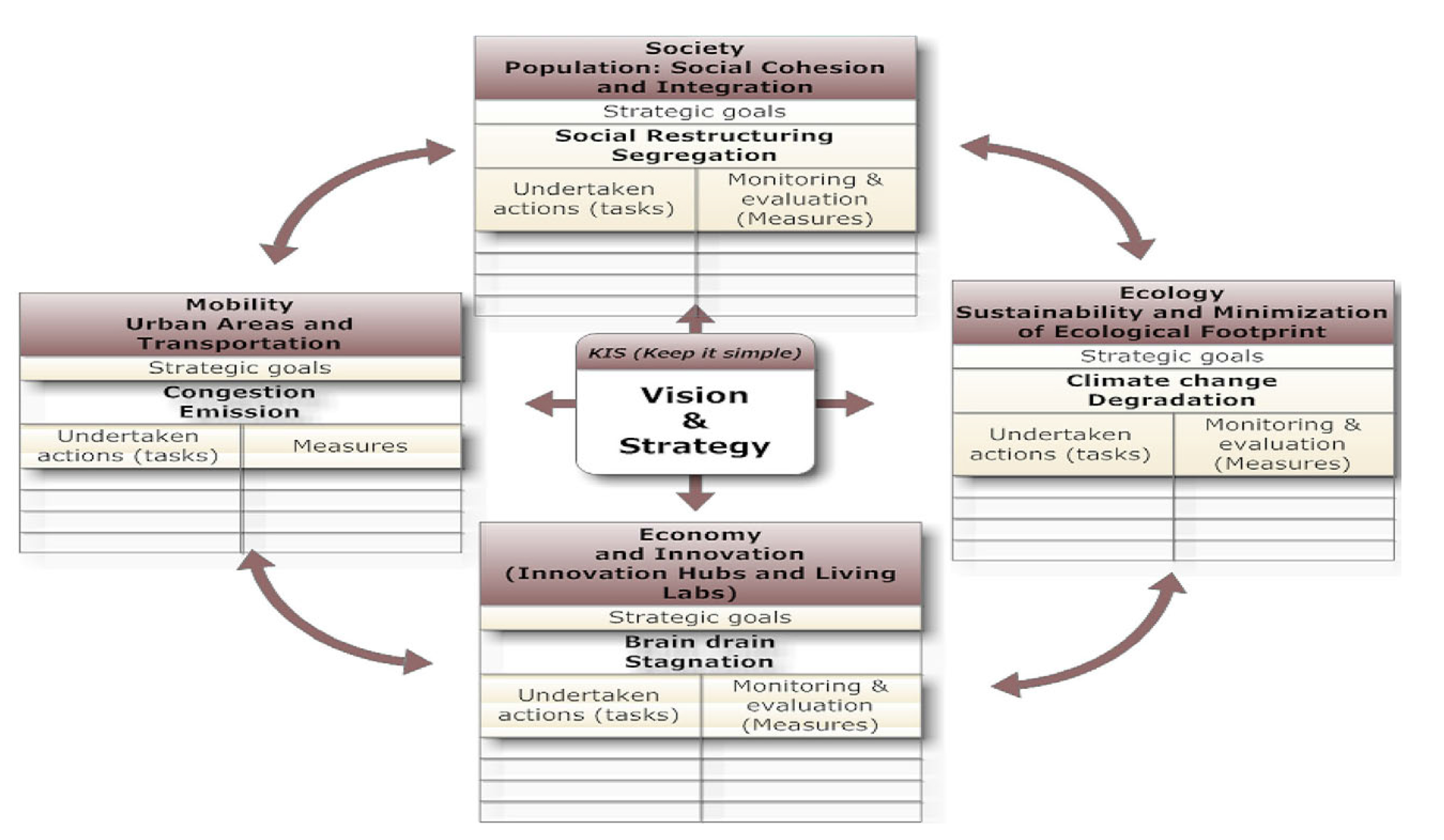
Fig. 6
P. Nijkmap’s view on a smart, interactive navigation tool based on a balanced trade-off of Society, Environment and Economy.
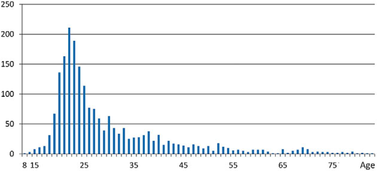
Fig. 7
Age distribution of respondents in Olomouc (by J. Pánek).
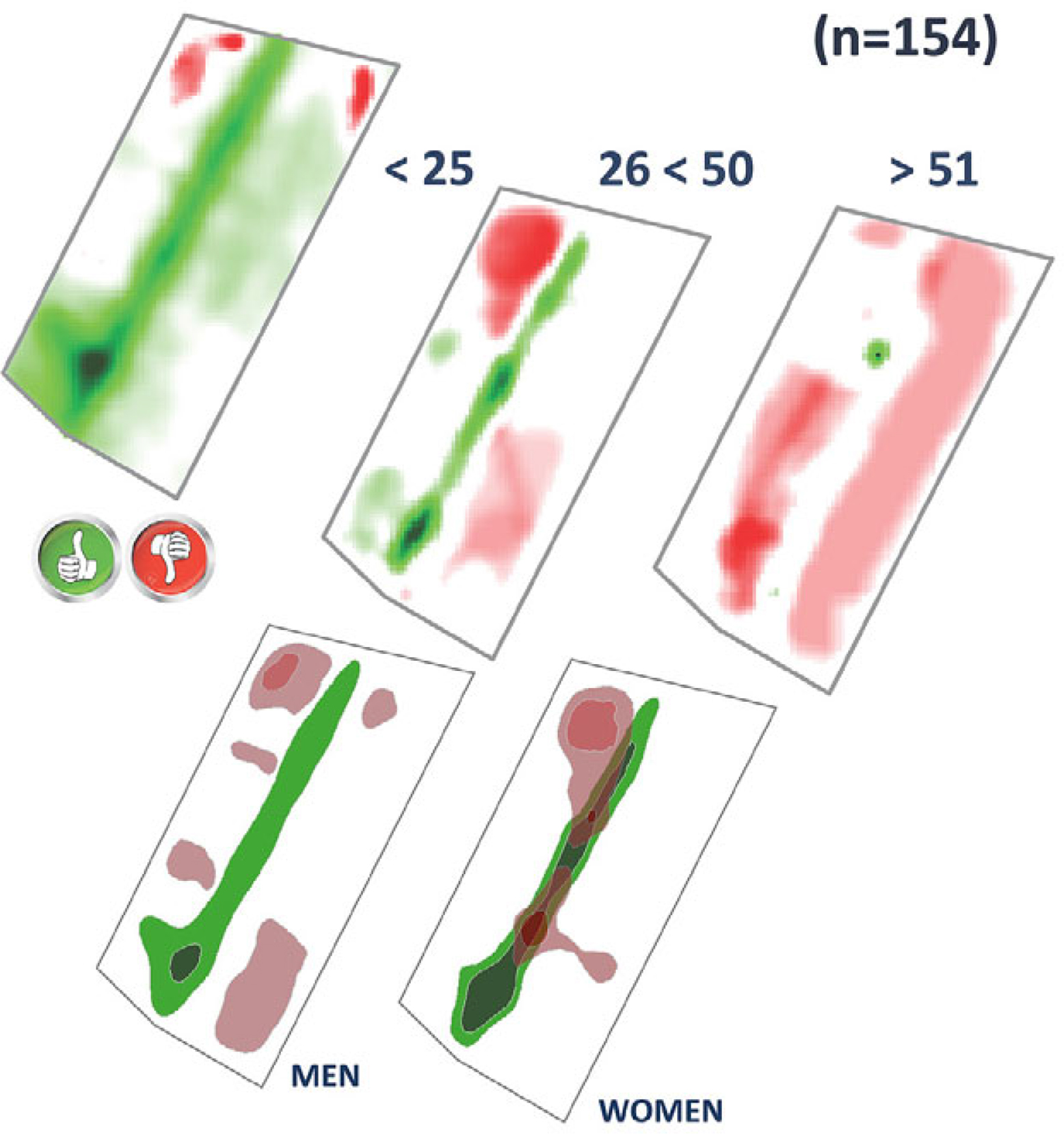
Fig. 8
Age and gender structure of respondents in geo-questionnaire on Tumska Street in Płock (by B. Kietlińska et al.).
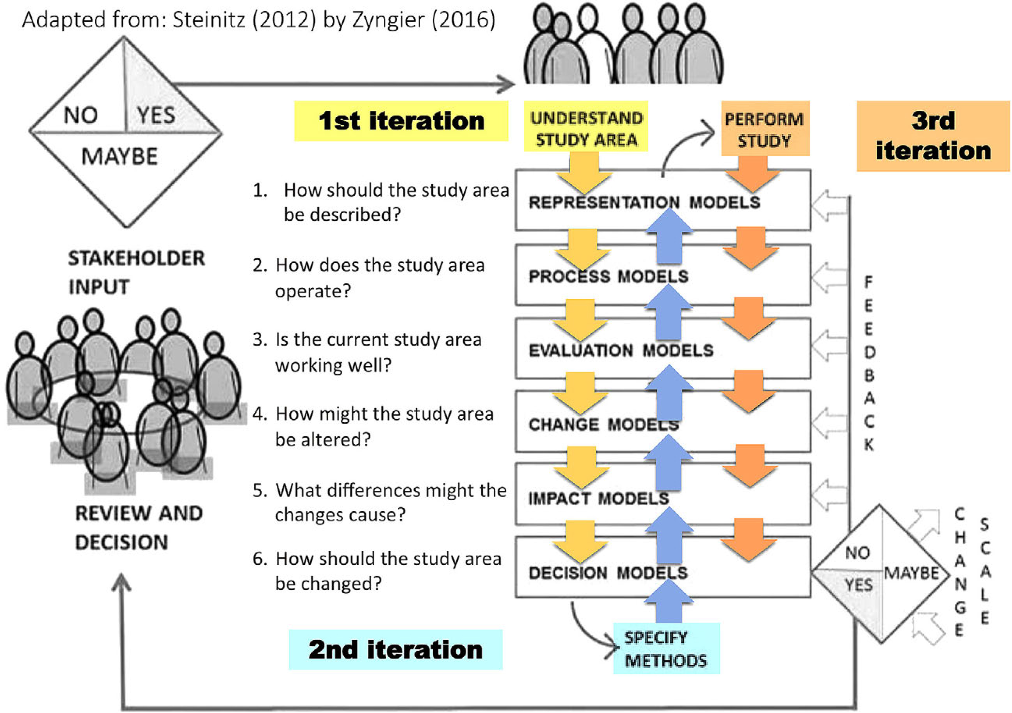
Fig. 9
Methodological framework of Geodesign for Pampulha in Brazil. The whole case study was developed in three iterations of Geodesign method (by A.C. Moura et al.).
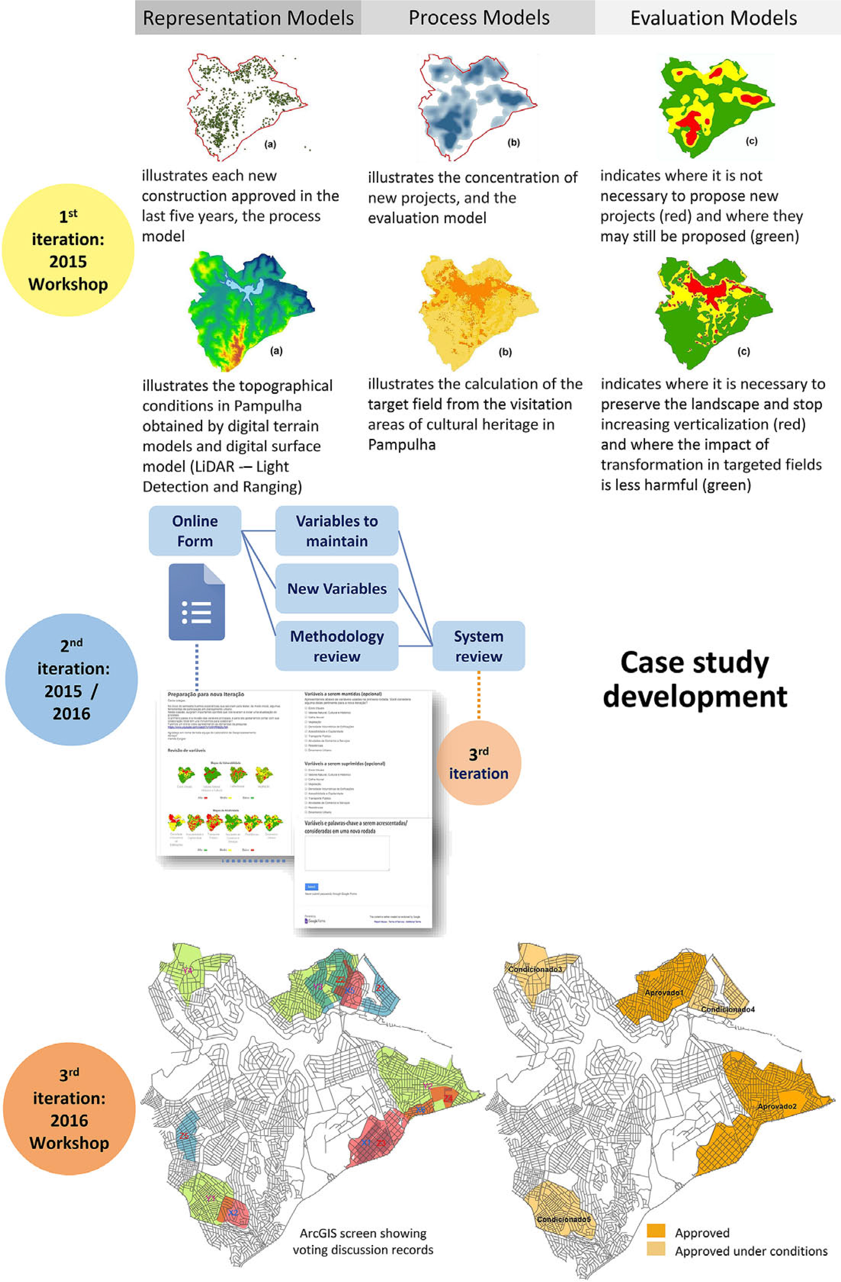
Fig. 10
The composition of three Geodesign iterations in the case study of Pampulha. Each iteration involves working with representation, process, and evaluation models resulting in the production of data, information, and knowledge, respectively. Following the account of the existing conditions, the proposal stage begins, which is related to change, impact and decision models that also produce data, information and knowledge, respectively (by A.C. Moura et al.).
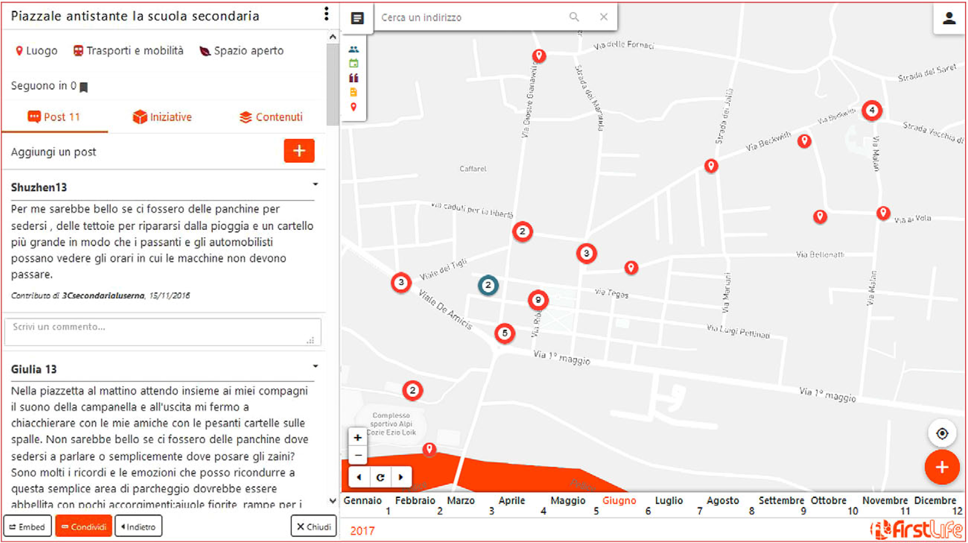
Fig. 11
Screenshot of Web-based application FirstLife (firstlife.org).
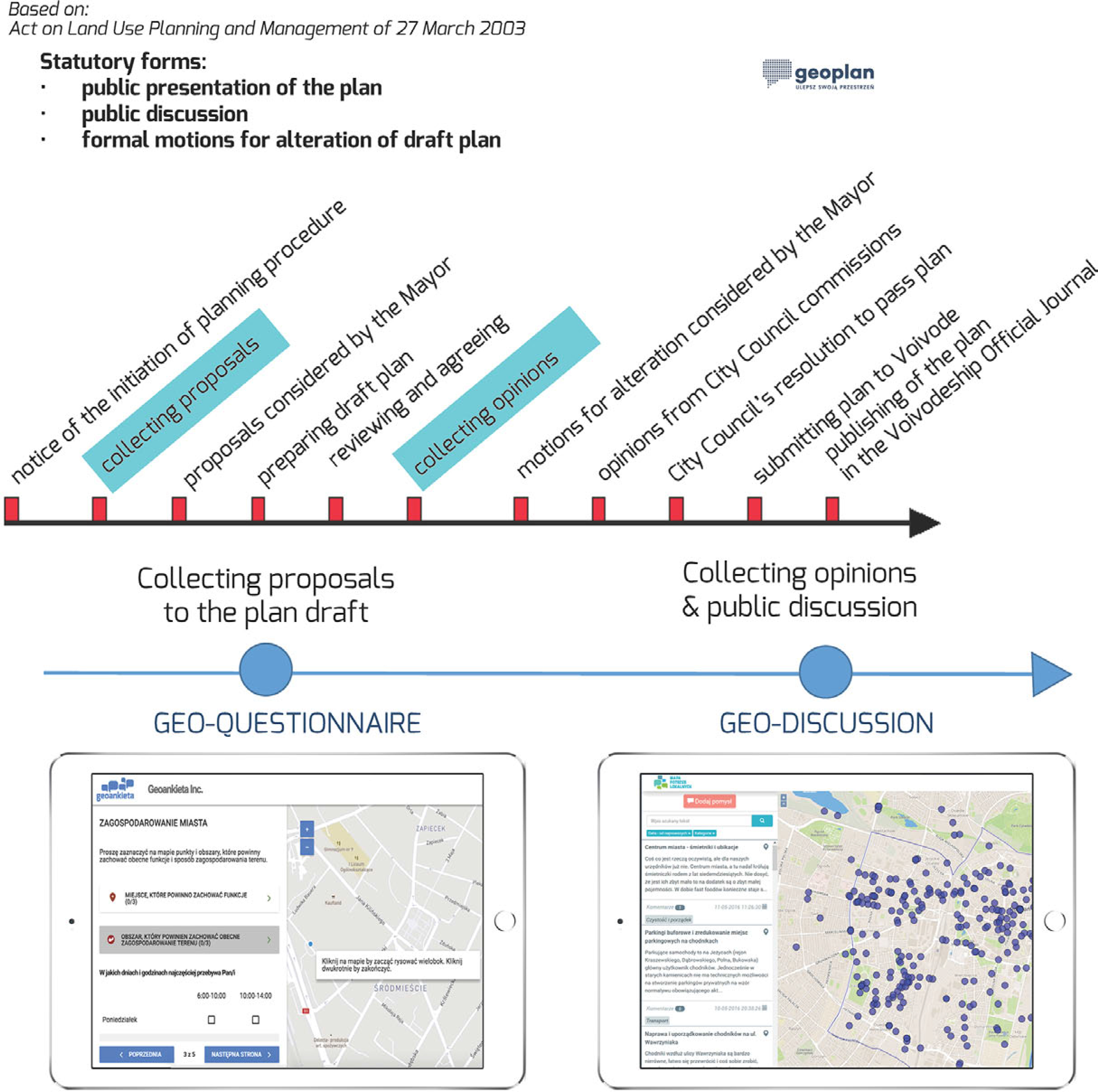
Fig. 12
Public participation in urban planning in Poland and Web-based applications of geo-questionnaire and geo-discussion (by E. Bąkowska et al.).
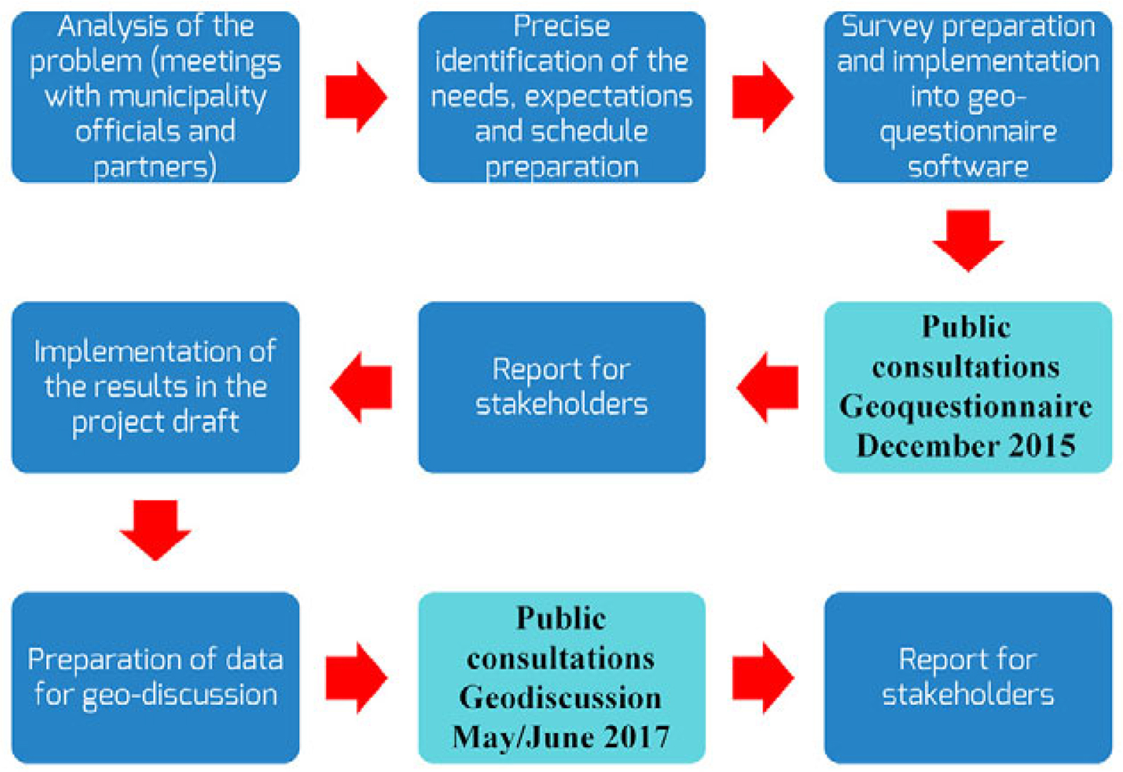
Fig. 13
Structured process of decision-making in urban planning (by E. Bąkowska et al.).
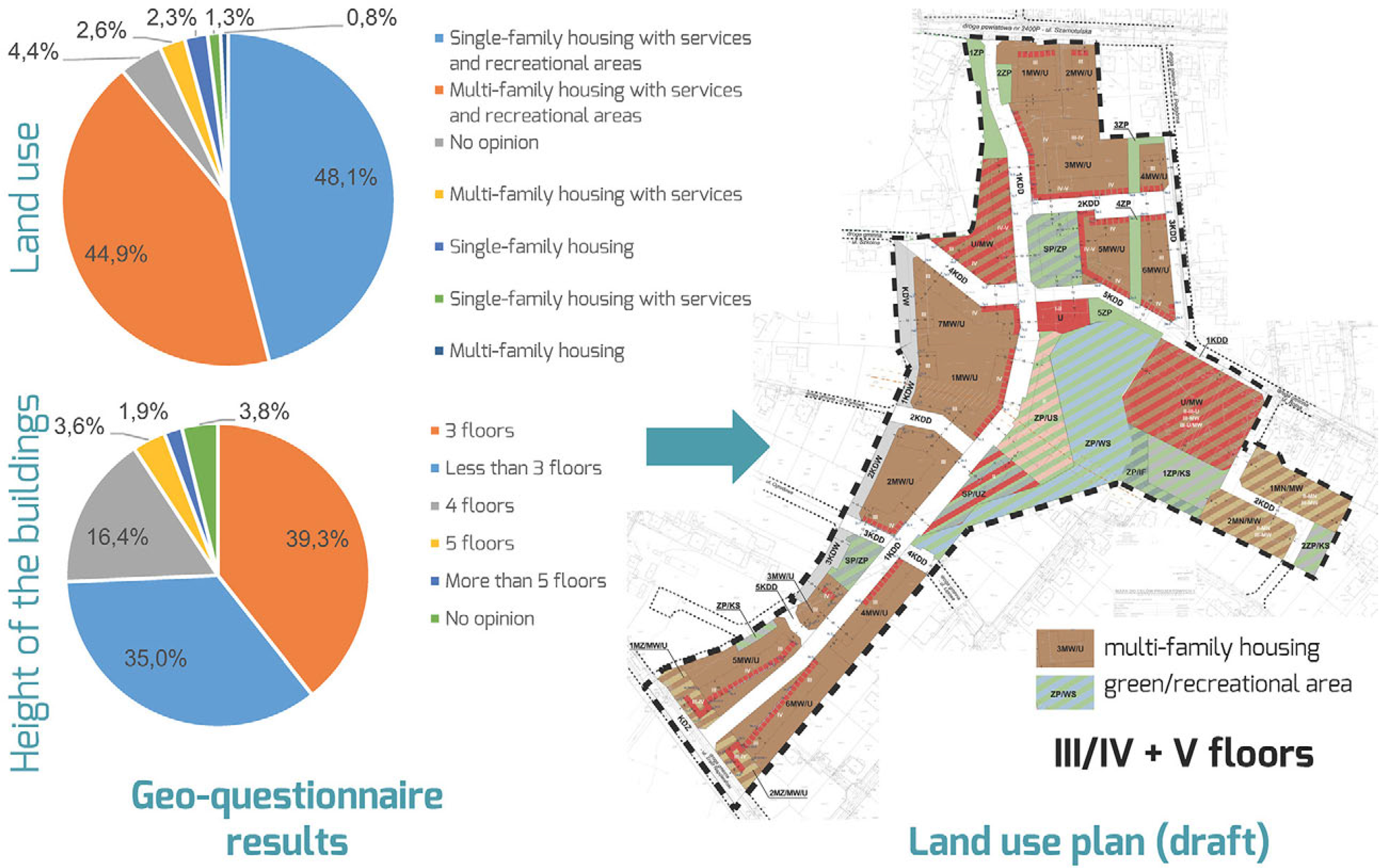
Fig. 14
Some results of geo-questionnaire and their influence on the formation of draft land use plan (by E. Bąkowska et al.).
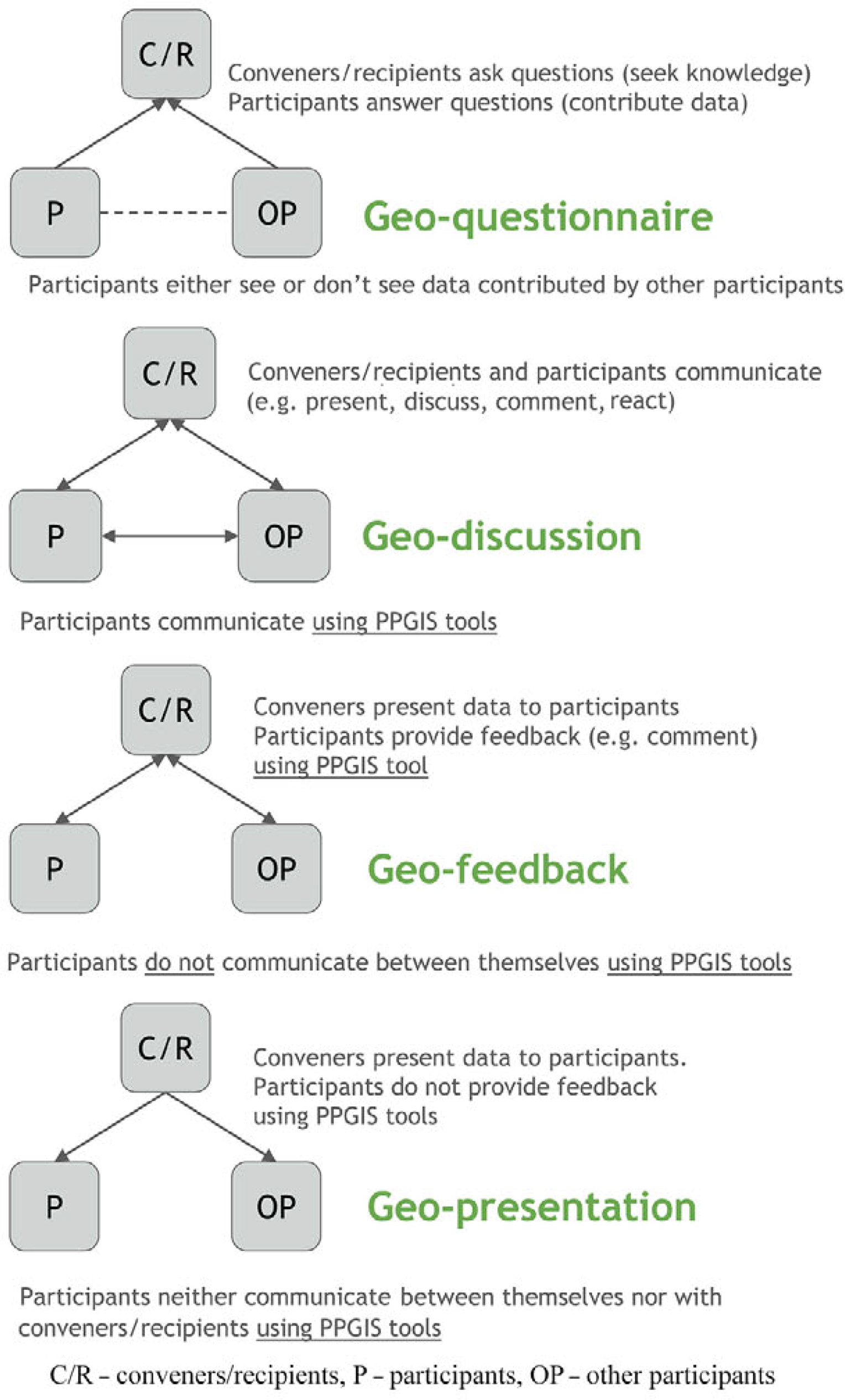
Fig. 15
Framework for an integrated approach to public participation in urban planning (by M. Czepkiewicz et al.).
Table 2
Proposed dimensions of PPGIS design (by M. Czepkiewicz et al.).
| Socio-institutional context of participation process | Participants Who is participating? | Technology Design considerations for PPGIS GIS tools |
|---|---|---|
| Rules and norms Planning approach Situation in the planning process Objectives Conveners and recipients Subject Resources System of tools and communication channels | Knowledge available to participants Selection criteria Group size Recruitment | Direction of communication Type of interactions between participants Types of contributions Input format Geographic information aids |