
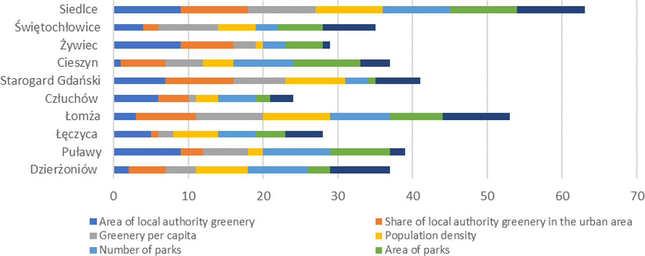
Figure 1.
The selection of cities for the case study of the climate change adaptation assessment method
Source: own elaboration based on LDB (Local Data Bank)
Table 1.
Characteristics of selected cities: Łomża and Siedlce in 2021
| Characteristics of cities | Łomża | Siedlce |
|---|---|---|
| Surface area [km2] | 32.71 | 32.00 |
| Population | 62 019 | 77 354 |
| Population density [person/km2] | 1 898 | 2428 |
| Contribution of municipal green [%] | 1.18 | 1.20 |
Table 2.
Monitoring indicators for the development of GI in the city of Łomża and Siedlce
| Monitoring indicator | Łomża | Siedlce | Target Value |
|---|---|---|---|
| Share of parks, greens, and neighbourhood green areas in total area [%] | No | Yes | Increase |
| Area of parks [ha] | Yes | No | Increase |
| Number of green and blue infrastructure facilities [units] | Yes | No | Increase |
| Number of tree plantings in urban areas [units] | Yes | Yes | Increase |
| Surface area of new built water management elements in the blue and green infrastructure system [m2] | No | Yes | Increase |
Table 3.
Indicators for assessing the accessibility of GI
| Indicator | Description of indicator | Range of the access buffer in a straight line |
|---|---|---|
| Indicator M | Share of the population living in the designated walking distance zone from GI facilities in the total population of the city [%] | |
| Indicator S1 | GI areas per inhabitant in designated zone [m2/inhabitant] | 300 m from residential areas |
| Indicator S2 | Total area of GI in comparison to the population of the city [m2/inhabitant] | Not applicable |
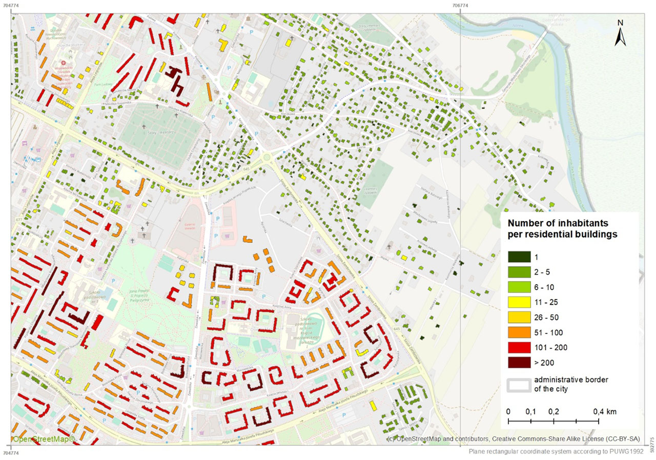
Figure 2.
Example distribution of the population of Łomża (city centre area)
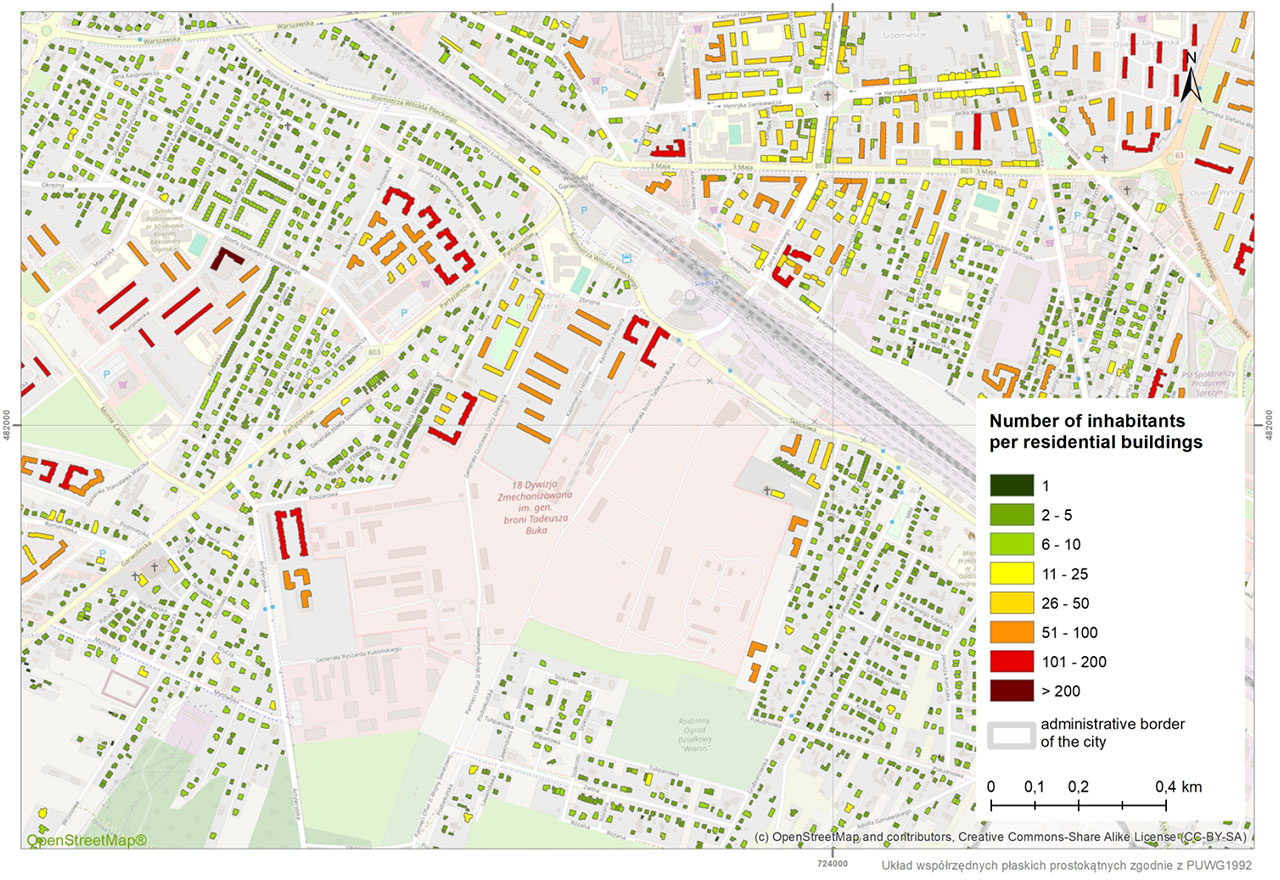
Figure 3.
Example of population distribution in Siedlce (central part of the city)
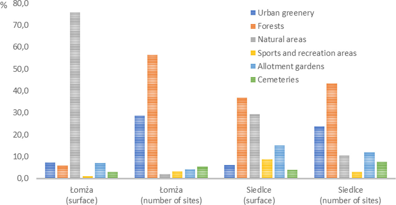
Figure 4.
Share of different types of public GI in Łomża and Siedlce by surface and number of sites
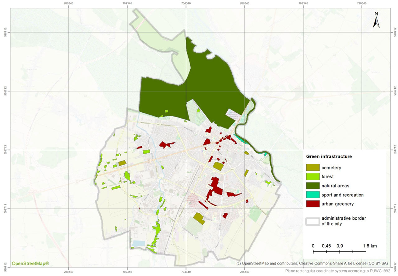
Figure 5.
GI in the public space of Łomża
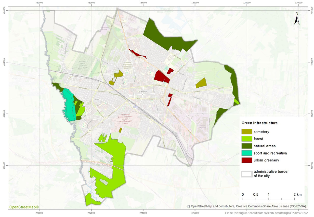
Figure 6.
GI in the public space of Siedlce
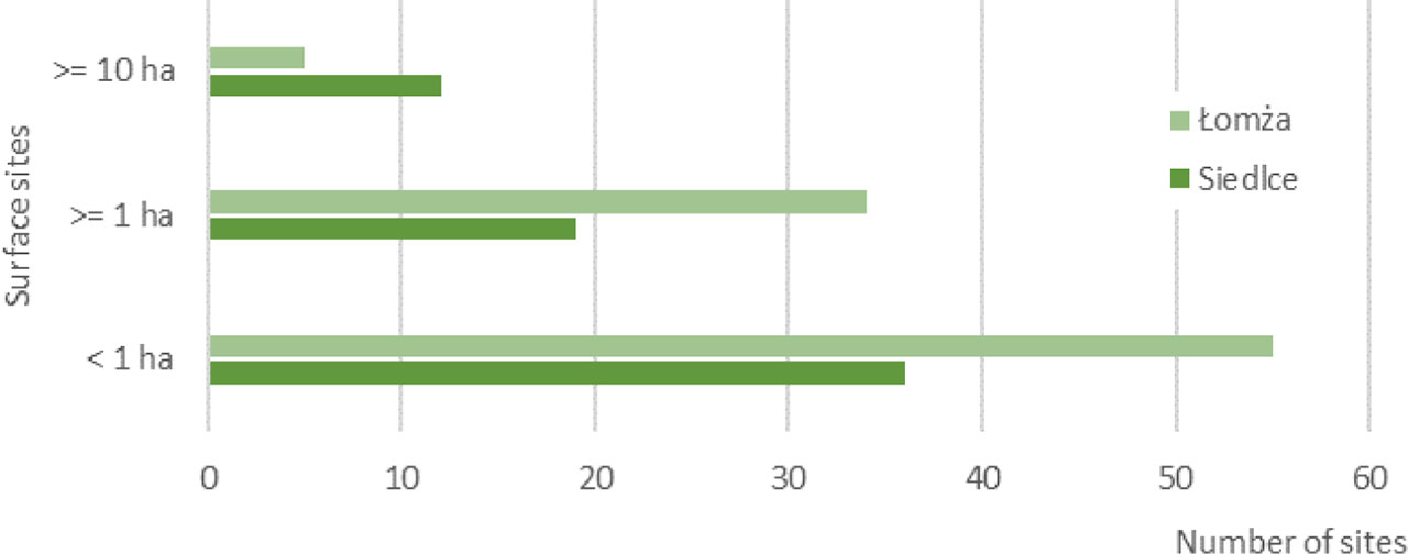
Figure 7.
Number of GI facilities in Łomża and Siedlce in designated area size ranges
Table 4.
GI accessibility indicator for Łomża and Siedlce
| Variation in GI | Green infrastructure (GI) accessibility indicators | |||||
|---|---|---|---|---|---|---|
| M indicator [%] | S1 indicator [m2/capita] | S2 indicator [m2/capita] | ||||
| Łomża | Siedlce | Łomża | Siedlce | Łomża | Siedlce | |
| GI ≥ 1ha | 89.95 | 69.54 | 27.21 | 94.73 | 107.55 | 58.57 |
| Total GI | 90.57 | 72.29 | 29.04 | 67.81 | 111.10 | 59.68 |
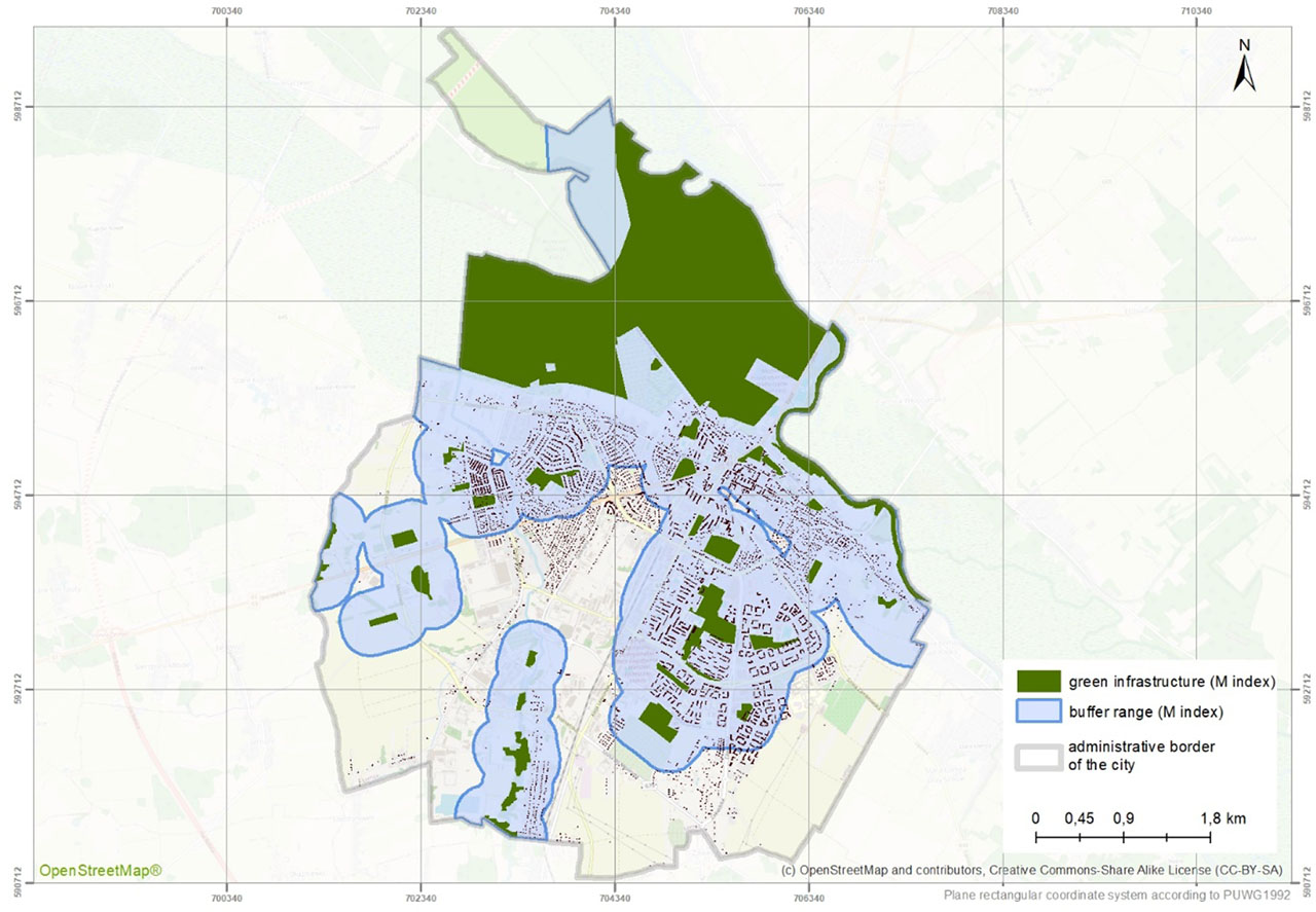
Figure 8.
Range of the M indicator buffer in Łomża calculated in relation to public GI sites of ≥ 1 hectare
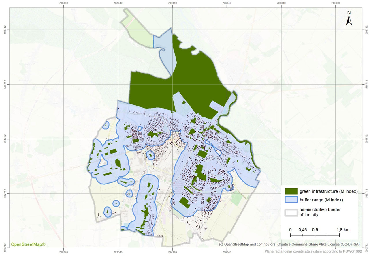
Figure 9.
Range of the M indicator buffer in Łomża calculated in relation to all public GI sites
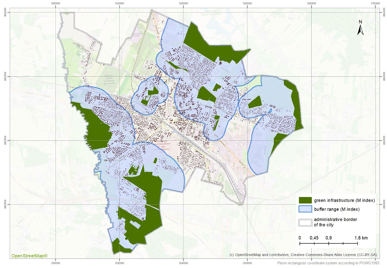
Figure 10.
Range of the M indicator buffer in Siedlce calculated in relation to public GI sites of ≥ 1 hectare
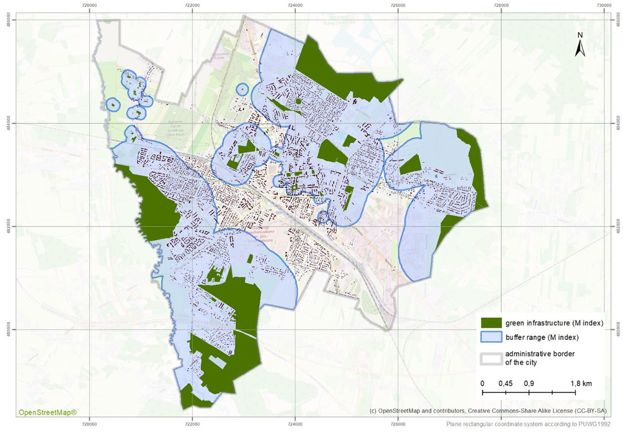
Figure 11.
Range of the M indicator buffer in Siedlce calculated in relation to all public GI sites
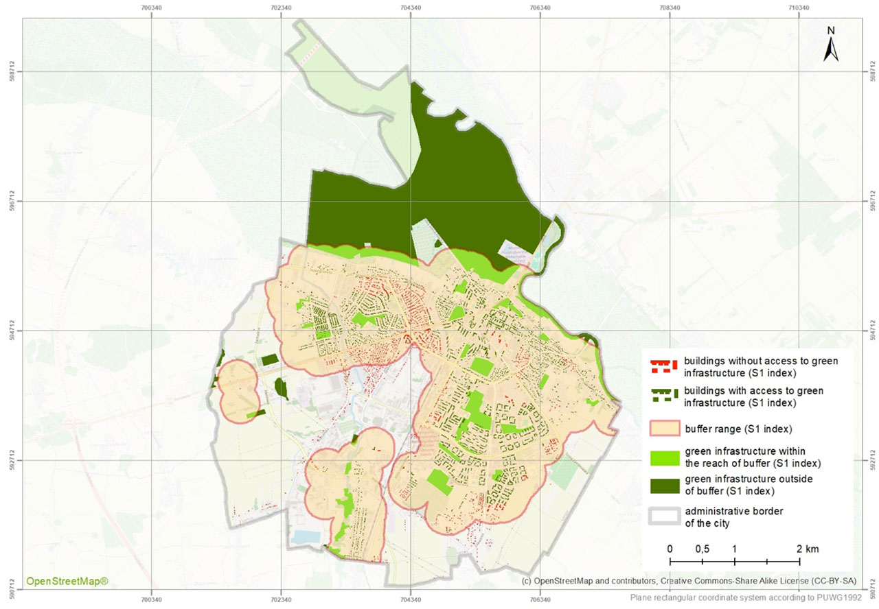
Figure 12.
Range of the S1 indicator buffer in Łomża calculated in relation to the place of residence. Includes elements of public GI of ≥ 1 hectare
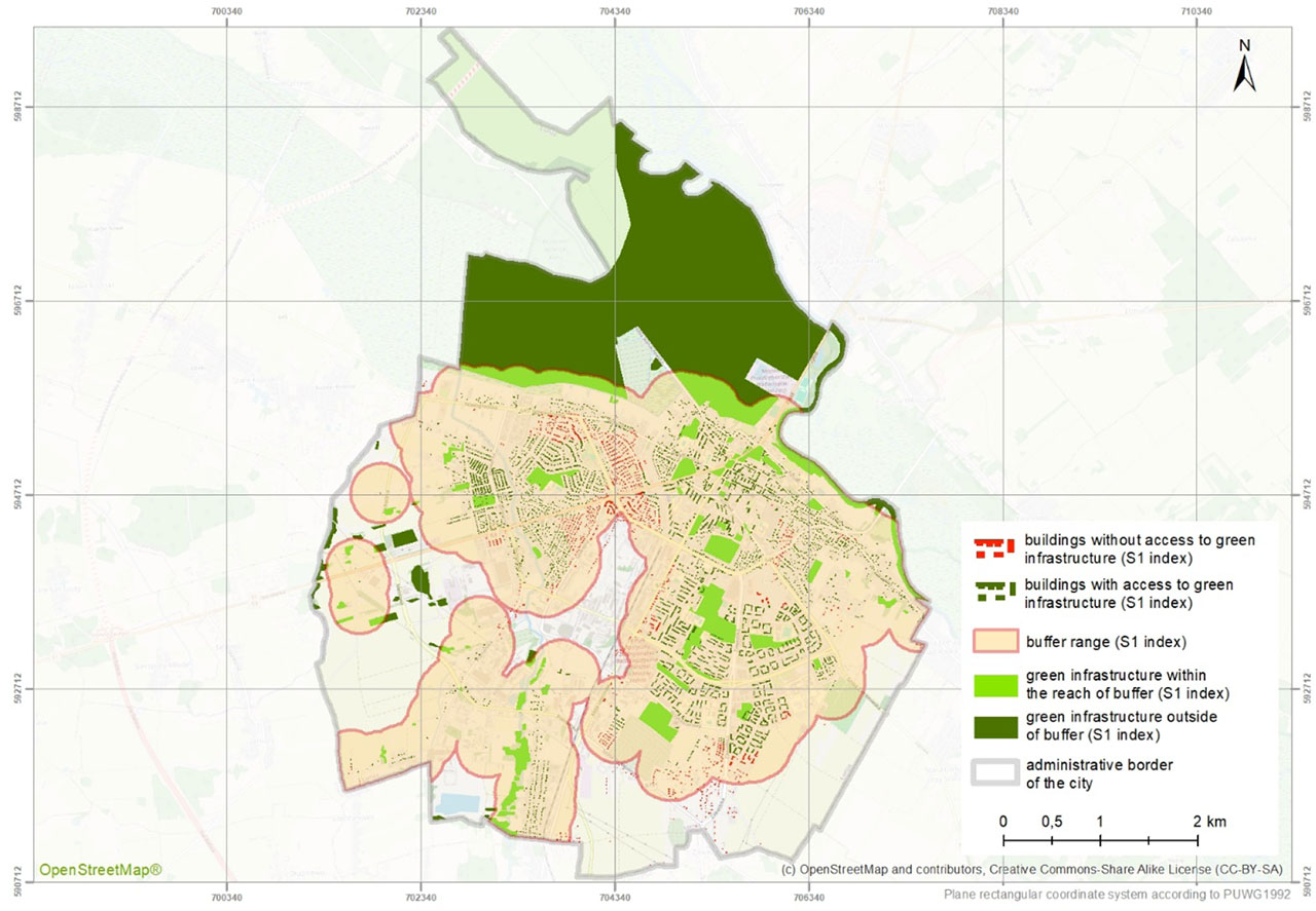
Figure 13.
Range of the S1 indicator buffer in Łomża calculated in relation to the place of residence. Includes all public GI sites
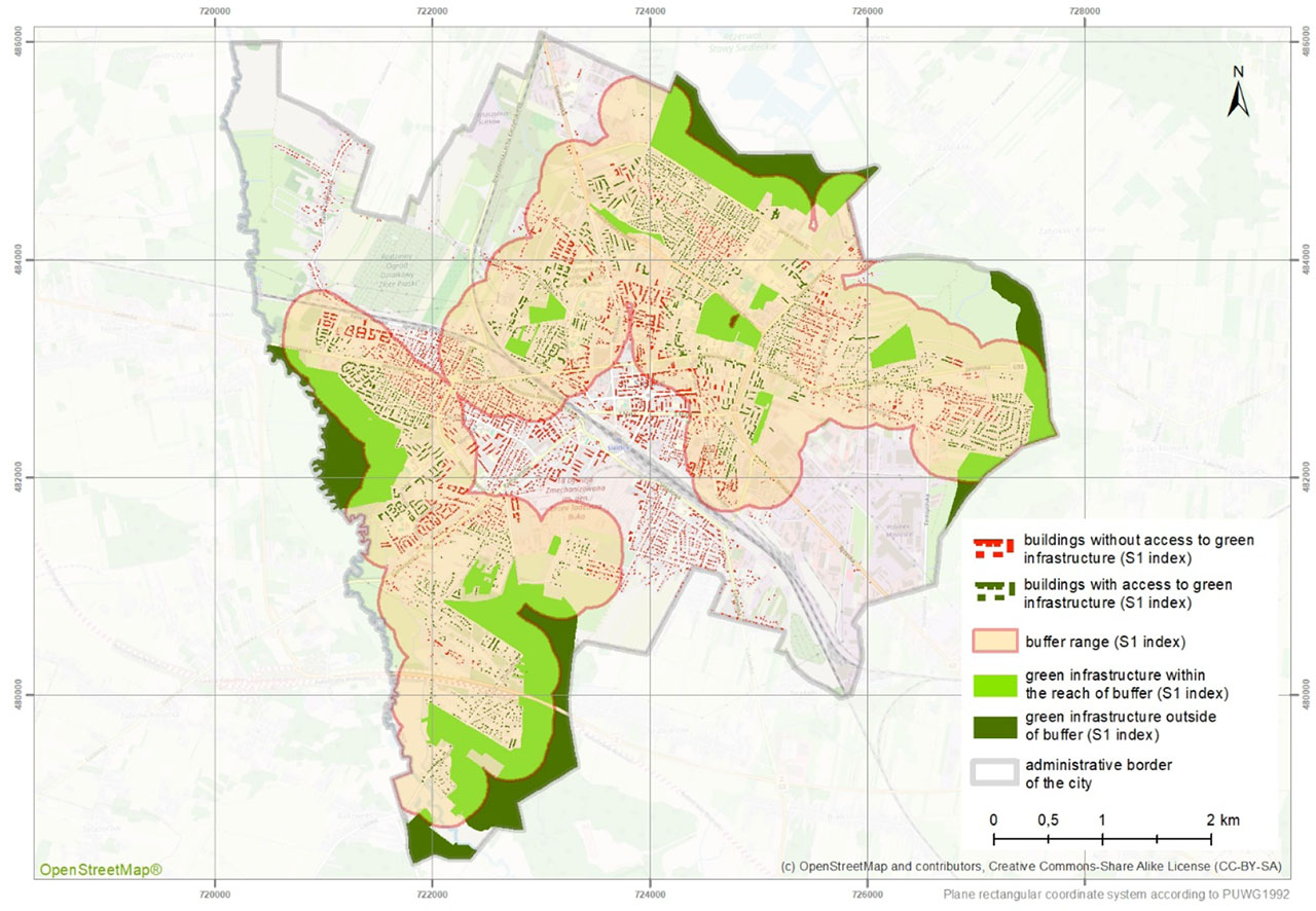
Figure 14.
Range of the S1 indicator buffer in Siedlce calculated in relation to the place of residence. Includes elements of public GI of ≥ 1 hectare
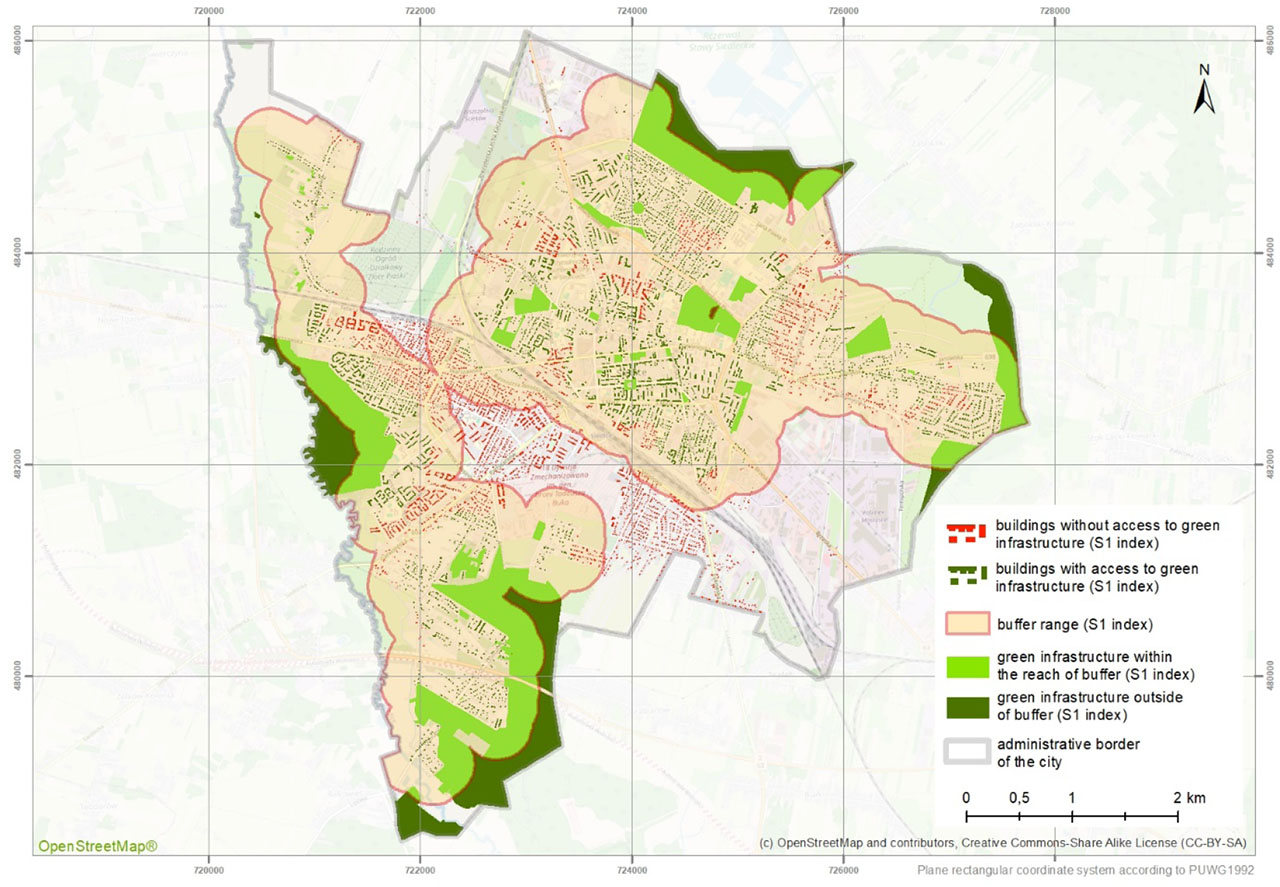
Figure 15.
Range of the S1 indicator buffer in Siedlce calculated in relation to the place of residence. Includes all public GI sites
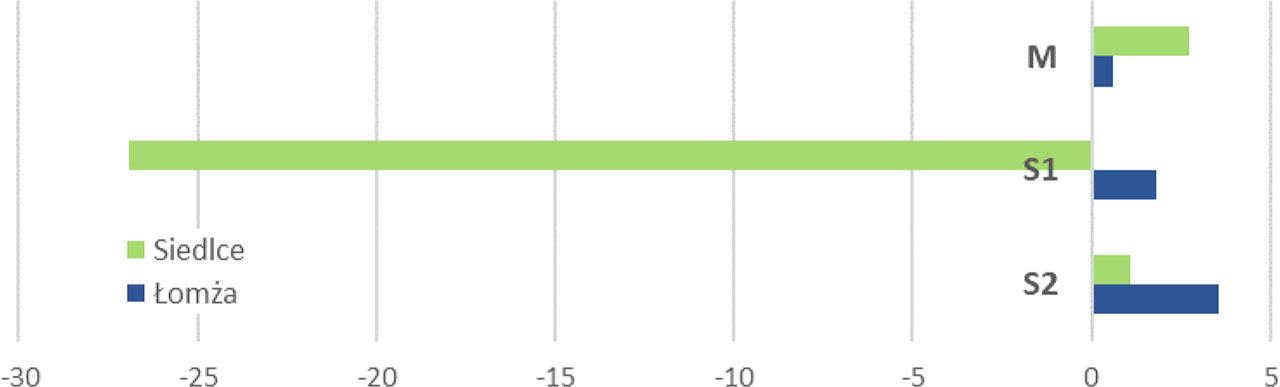
Figure 16.
Differences in the value of indicators between the two analysis variants [%] (author’s approach versus original)
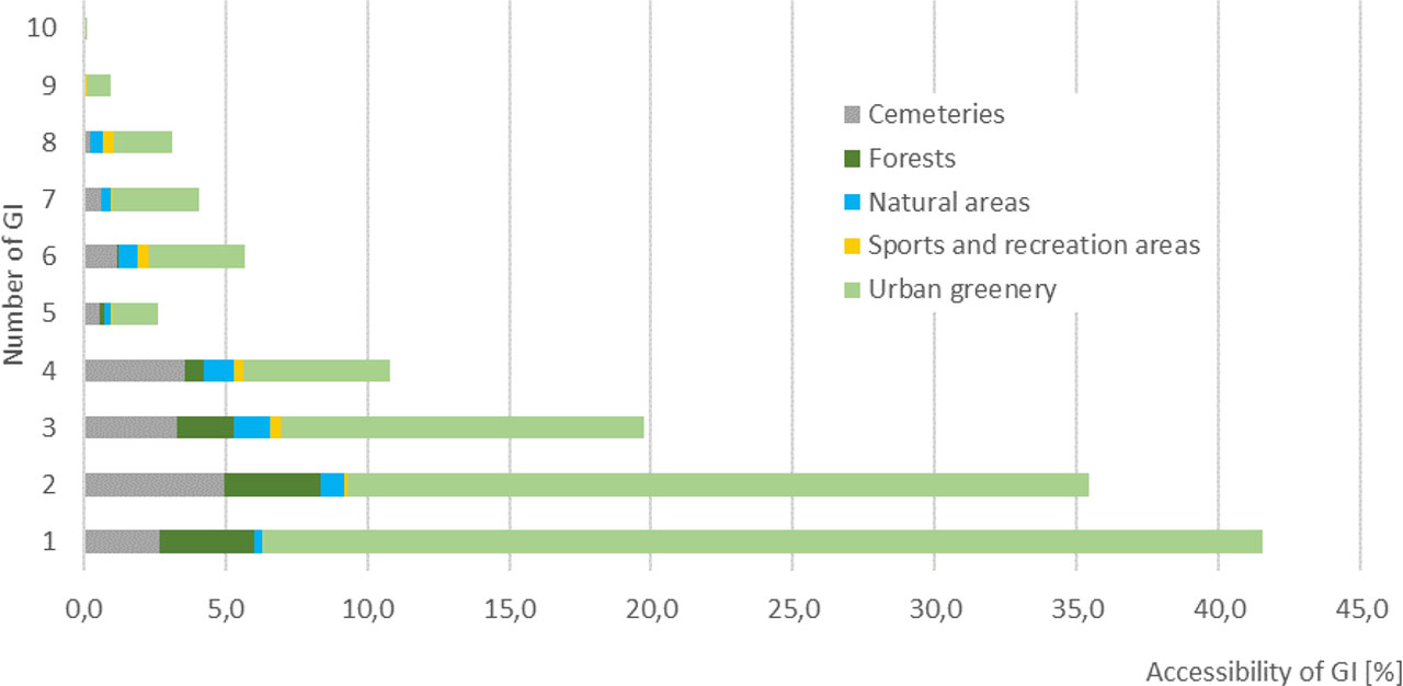
Figure 17.
Structure of accessibility of Łomża residents to different categories of GI (all sites of GI) within a distance of 300 m [%]
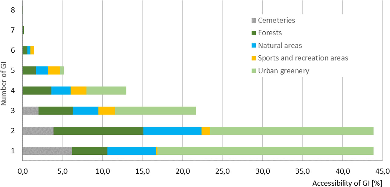
Figure 18.
Structure of accessibility of Siedlce residents to different categories of GI sites (includes all sites of GI) within a distance of 300 m [%]
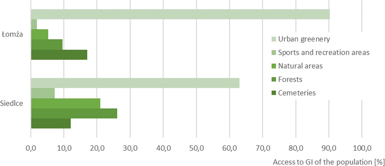
Figure 18.
Residents of Lomża and Siedlce with access to different categories of GI (includes all GI)