
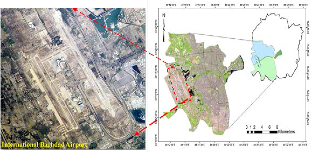
Figure 1.
A picture of the study area (left) with its location in the southwest of Baghdad (right)
Table 1.
Some properties for Landsat images and their acquisition dates
| Satellite | Sensor | No. of bands | Acquisition date |
|---|---|---|---|
| Landsat-5 | TM | 7 | 1985/07/29 |
| Landsat-5 | TM | 7 | 1990/07/11 |
| Landsat-5 | TM | 7 | 1995/07/09 |
| Landsat-7 | EMT+ | 8 | 2000/07/14 |
| Landsat-5 | TM | 7 | 2005/07/27 |
| Landsat-5 | TM | 7 | 2010/07/18 |
| Landsat-8 | OLI | 11 | 2015/07/23 |
| Landsat-8 | OLI | 11 | 2020/07/20 |
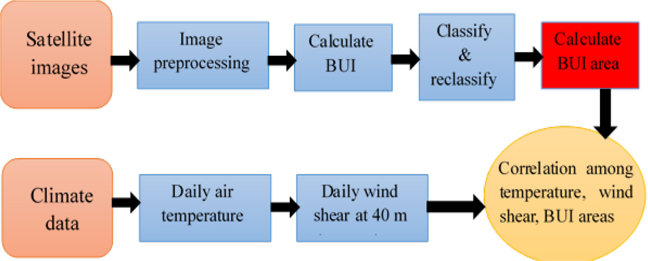
Figure 2.
Flowchart of methodology
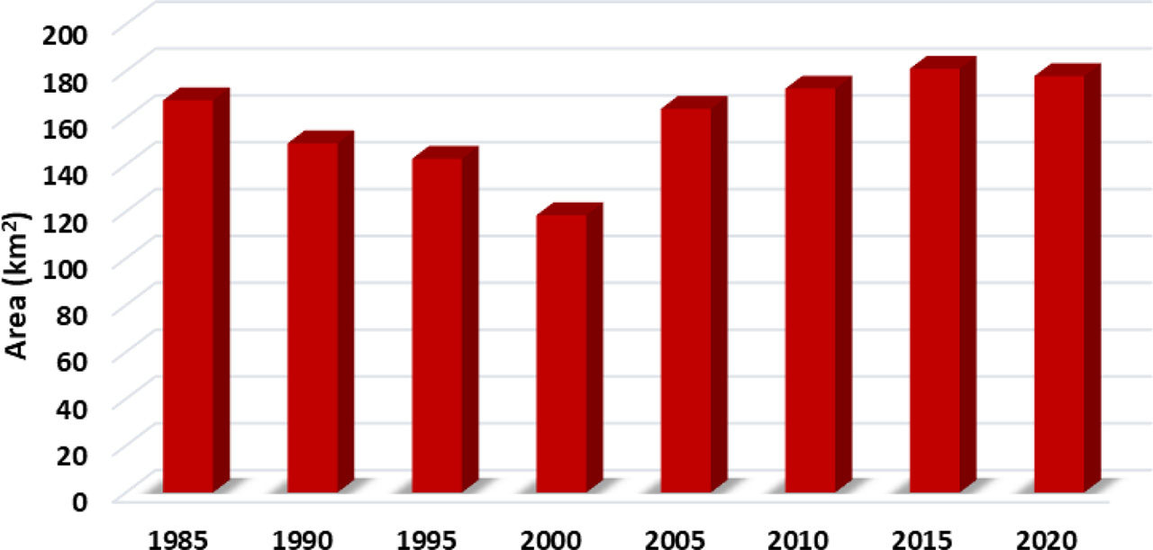
Figure 3.
Histogram of the built-up areas according to the years studied
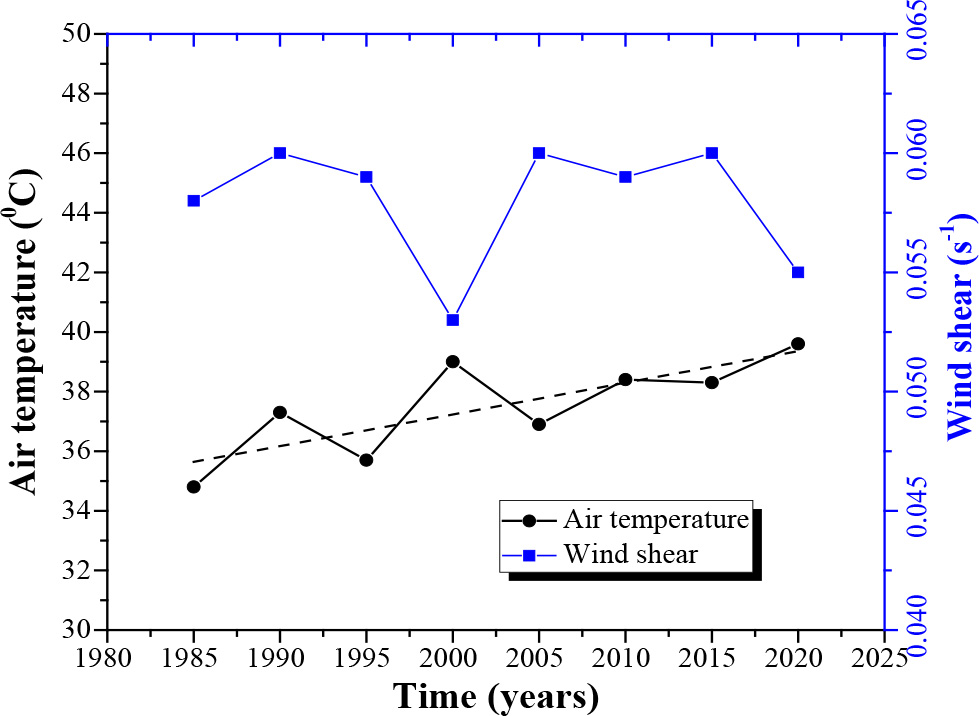
Figure 4.
Time series of air temperature and wind shear for July for the studied five-year intervals
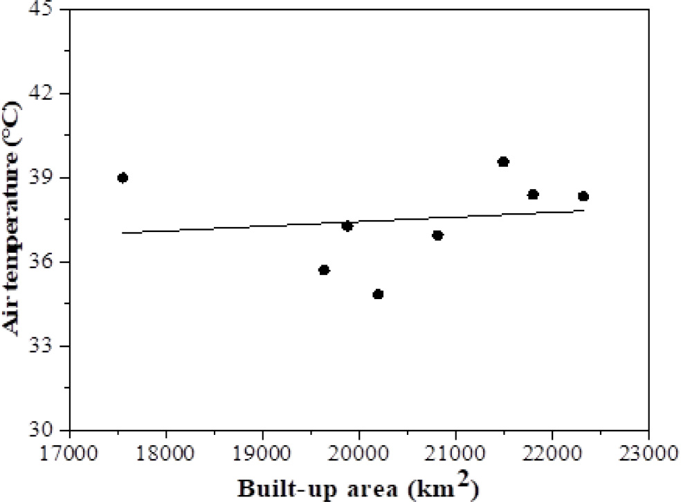
Figure 5.
Monthly air temperature vs. BUI area
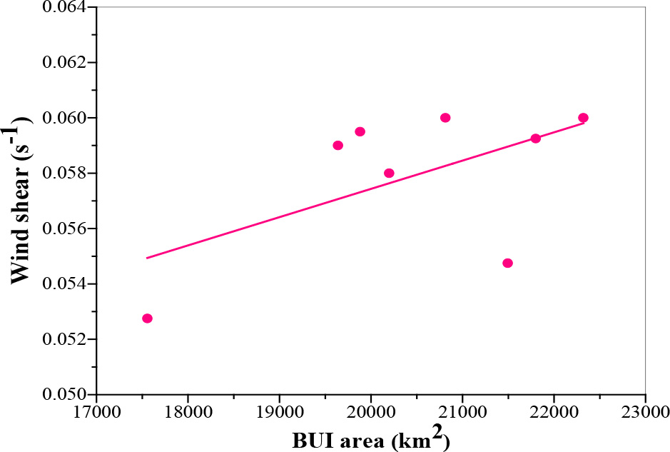
Figure 6.
The relationship between wind shear (s−1) and BUI area (km2)