
Figure 1
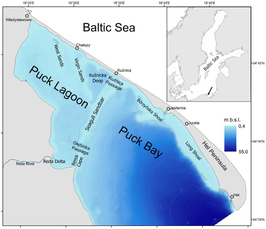
Figure 2

Figure 3
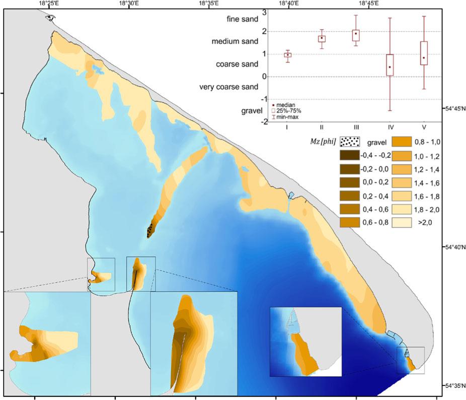
Figure 4
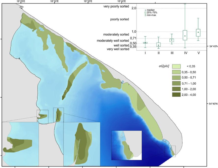
Figure 5
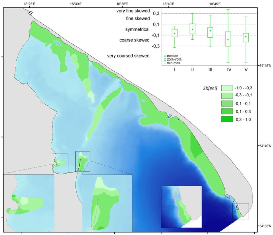
Figure 6
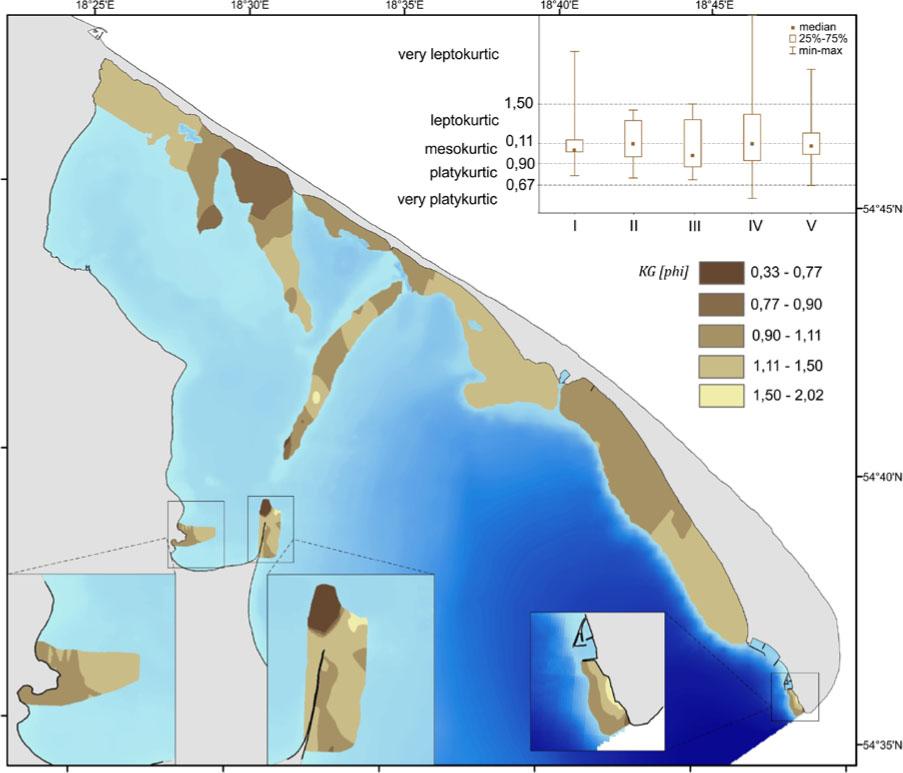
Figure 7

Content of samples according to the types of depositional environments (Passega & Byramjee 1969)
| Surveyed fields | Field in the C/M diagram (percentage of samples) | |||||
|---|---|---|---|---|---|---|
| I | II | IV | V | |||
| I | Tip of Hel Peninsula | 89 | - | 11 | - | |
| II | Long Shoal and Bórzyńska Shoal | 13 | - | 87 | - | |
| III | Virgin Sands | 45 | 11 | 22 | 22 | |
| Western Sands | 61 | - | 31 | 8 | ||
| IV | Rewa Cape | inner part | 100 | - | - | - |
| outer part | 50 | 10 | 33 | 7 | ||
| Seagull Sandbar | 84 | 3 | 10 | 3 | ||
| V | Delta Reda | 88 | 12 | - | - | |
Anomalies of lithological parameters
| Grain size parameters of rock debris (phi scale) | Anomalies of lithological parameters | ||
|---|---|---|---|
| confidence interval of the mean | positive anomalies | negative anomalies | |
| mean grain size | 0 | D | R |
| sorting | 0 | R | D |
| skewness | 0 | D | R |
| kurtosis | 0 | R | D |