
Figure 1.
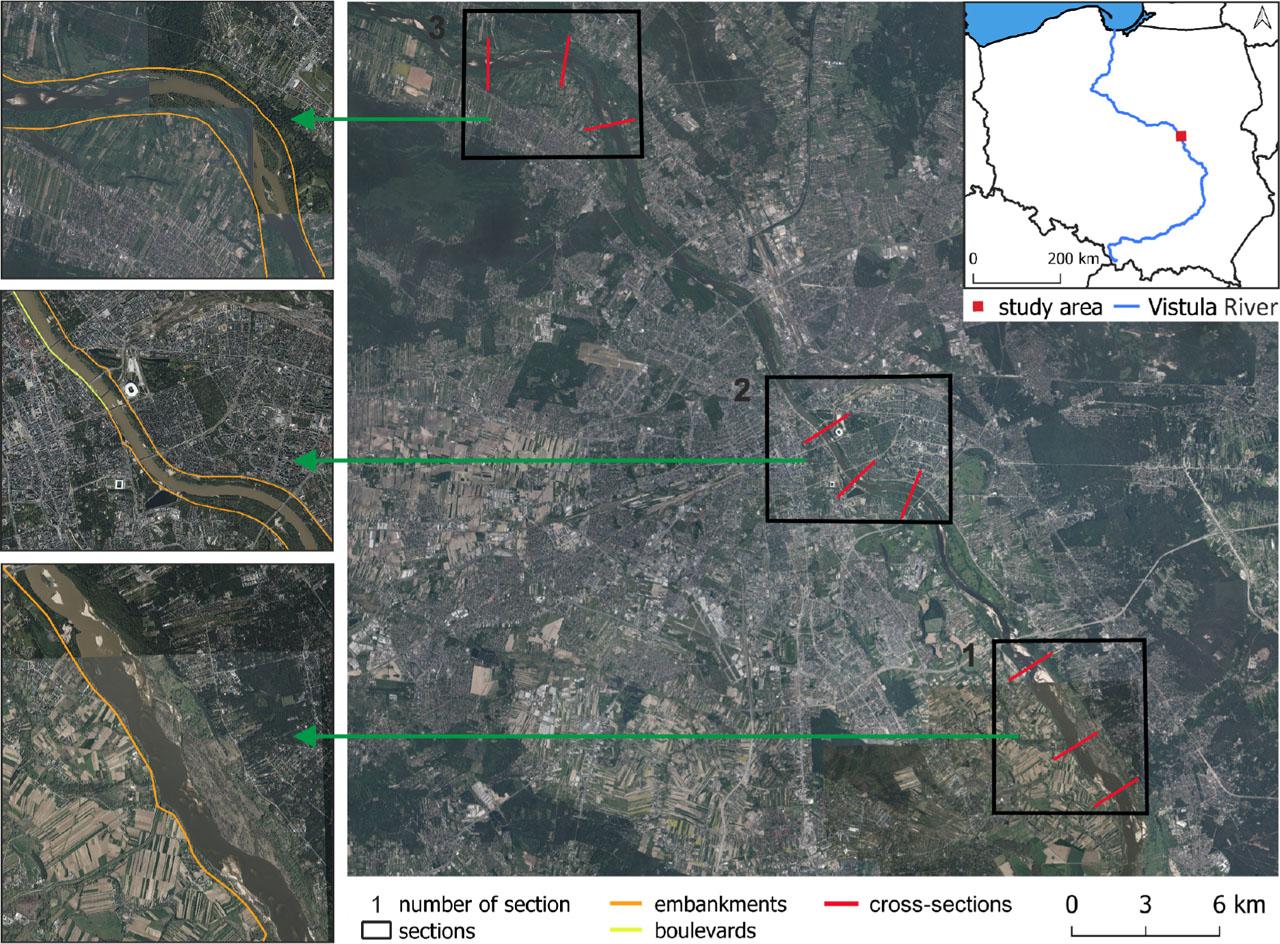
Figure 2.
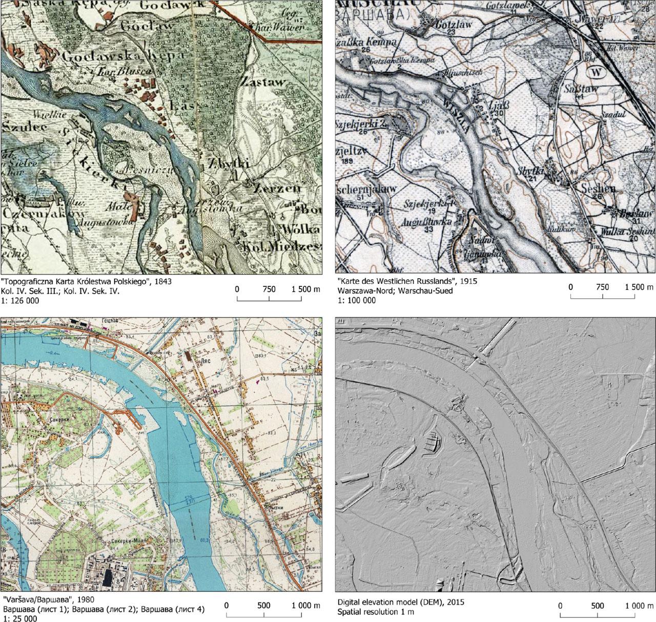
Figure 3.
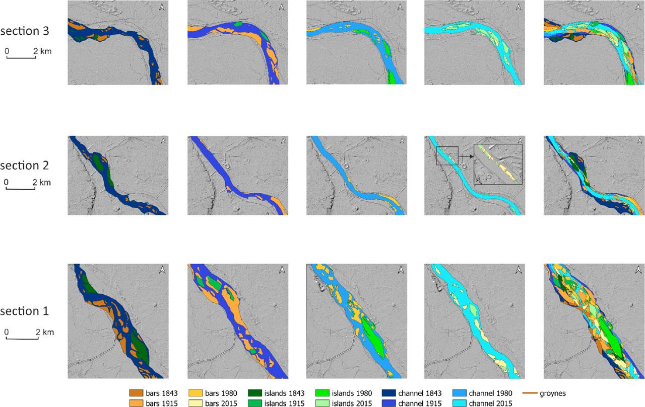
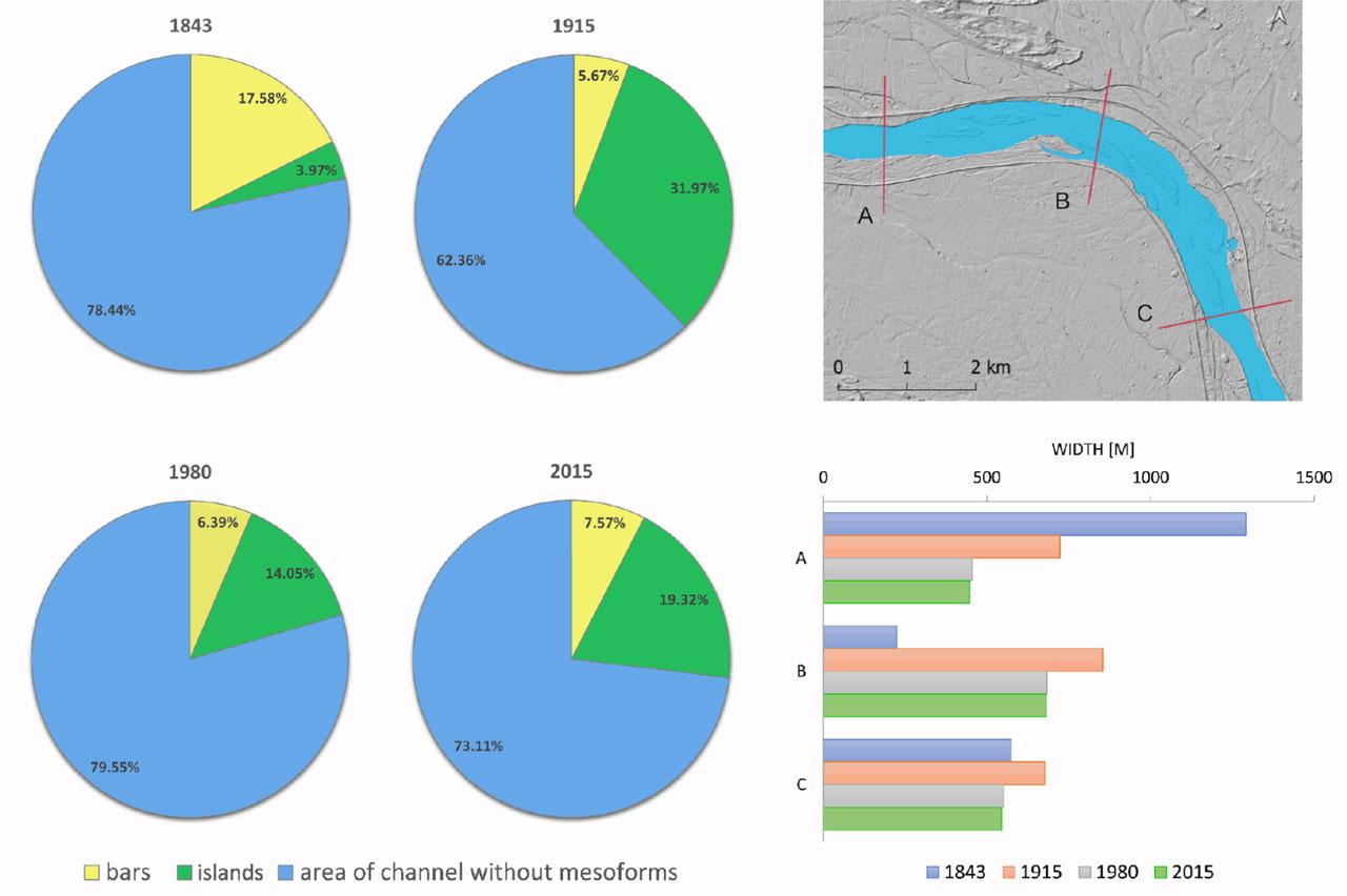
Figure 4.
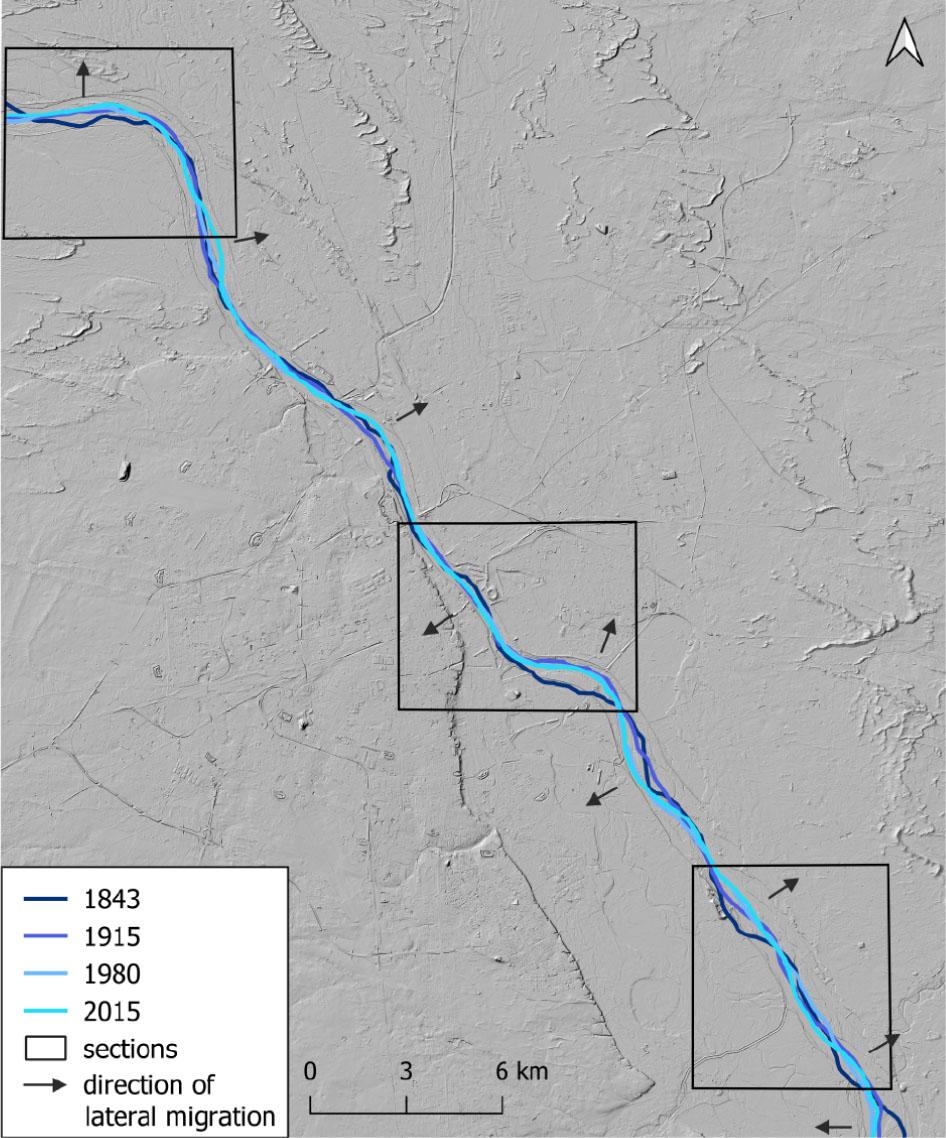
Figure 5.
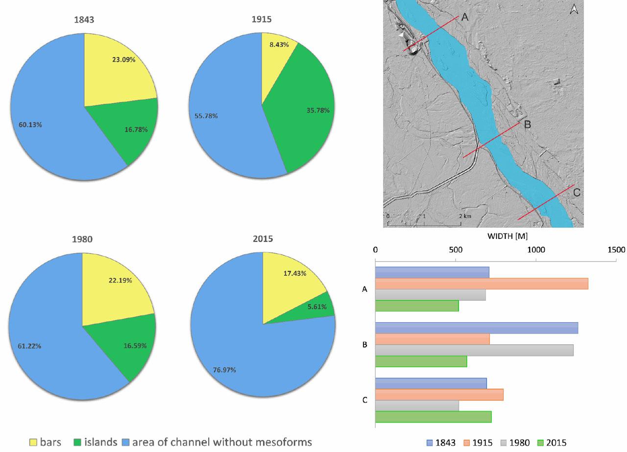
Figure 6.
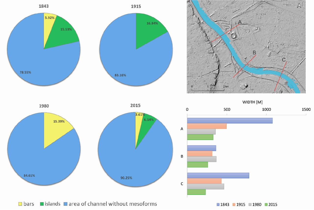
Figure 7.
Maps from archival sources
| Title | „Topograficzna Karta Królestwa Polskiego” | „Karte des Westlichen Russlands” | „Warszawa” |
|---|---|---|---|
| Year of publication | 1843 | 1915 | 1980 |
| Scale | 1:126 000 | 1:100 000 | 1:25 000 |
| Sheet title | Kol.IV. Sek. III.; Kol.IV. Sek. IV. | Warszawa-Nord; Warchau-Sued | Варшава (лист 1); Варшава (лист 2); Варшава (лист 4) |
Morphometric parameters of the Vistula riverbed 1843–2015_ Estimated values
| year | 1843 | 1915 | 1980 | 2015 | 1843–2015 |
|---|---|---|---|---|---|
| sandbars – numbers | 87 | 51 | 100 | 51 | −36 |
| stabilized vegetated bars (islands) – numbers | 13 | 9 | 35 | 61 | 48 |
| sandbars – area [km2] | 9.028 | 10.349 | 5.511 | 1.842 | −7.187 |
| stabilized vegetated bars (islands) – area [km2] | 4.048 | 4.159 | 3.041 | 1.964 | −2.084 |
| area of the channel [km2] | 30.558 | 35.890 | 27.719 | 21.035 | −9.523 |
| length of the channel [km] | 47.361 | 45.917 | 45.712 | 46.297 | −1.064 |
| sinuosity of the channel | 1.089 | 1.055 | 1.051 | 1.064 | −0.024 |