
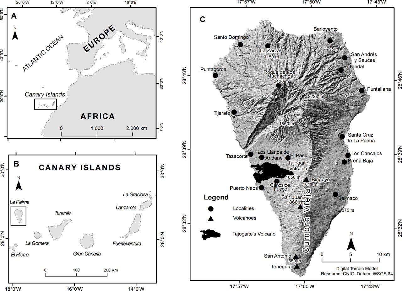
Figure 1.
A – Location of Canary Islands. B – Canarian Archipelago. C – La Palma study area
Source: prepared by the authors, based on Grafcan
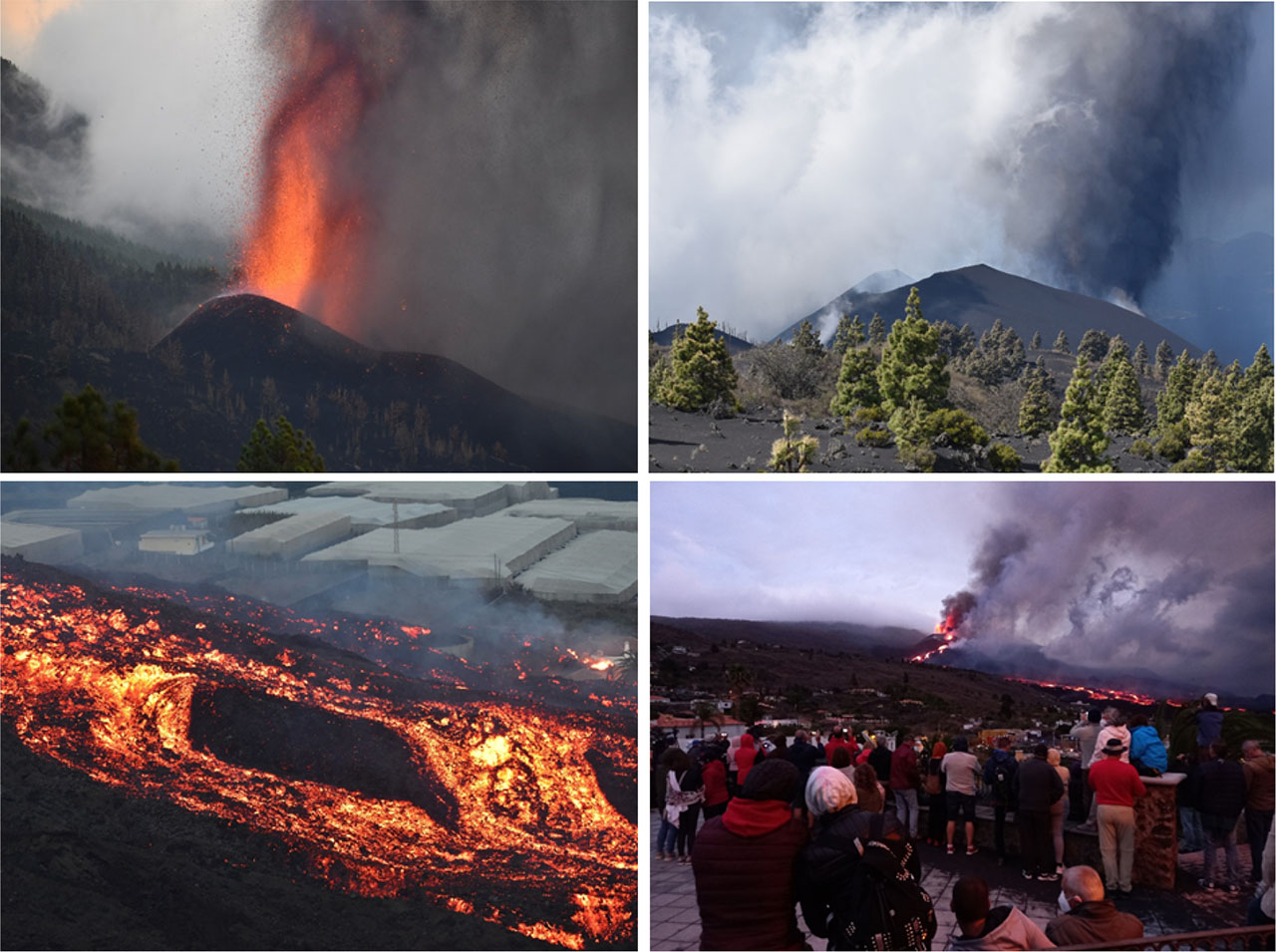
Figure 2.
Tajogaite monogenetic eruption, 2021, La Palma
Source: authors
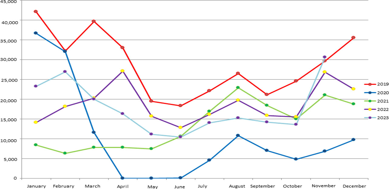
Figure 3.
Evolution of the number of visitors to La Palma.
Source: IS-185 Istac, 2023 Prepared by the authors
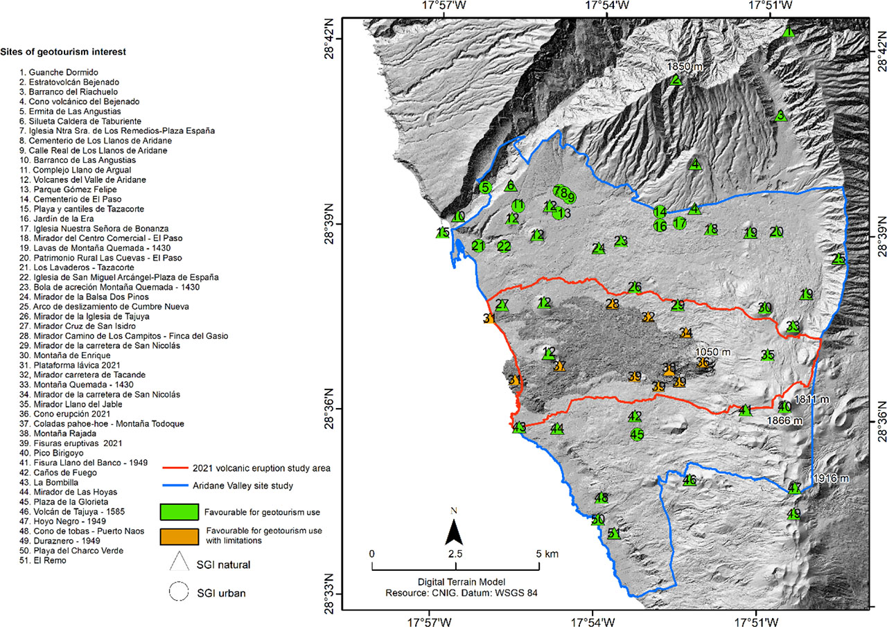
Figure 4.
Sites of geotourism interest, natural and urban, in the Aridane Valley and its surroundings
Source: prepared by the authors based on Grafcan
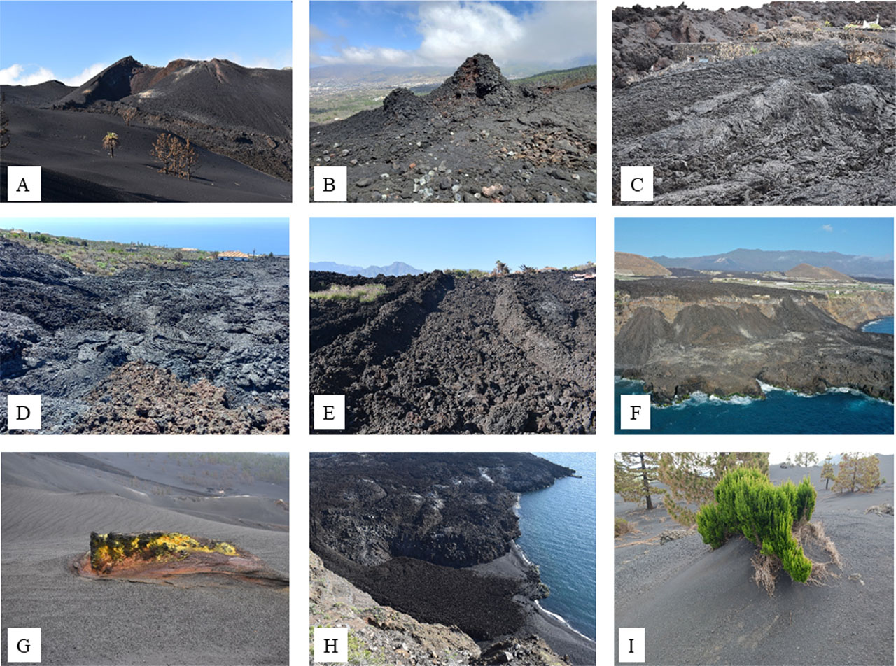
Figure 5.
Geoforms generated by the Tajogaite eruption. A – cinder cone. B – hornitos spatter. C – effusive fissure. D – pahoehoe lava flows. D – aa lava channel. F – lava delta. G – lapilli field. H – beaches. I – lapilli dunes
Source: authors and R. Gosálvez (photo F)