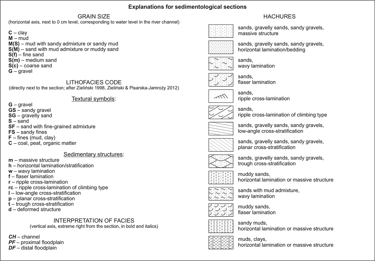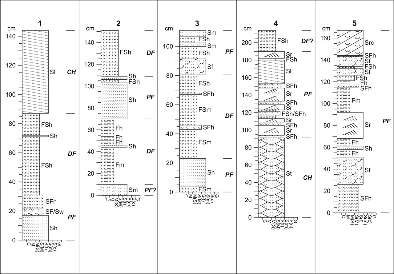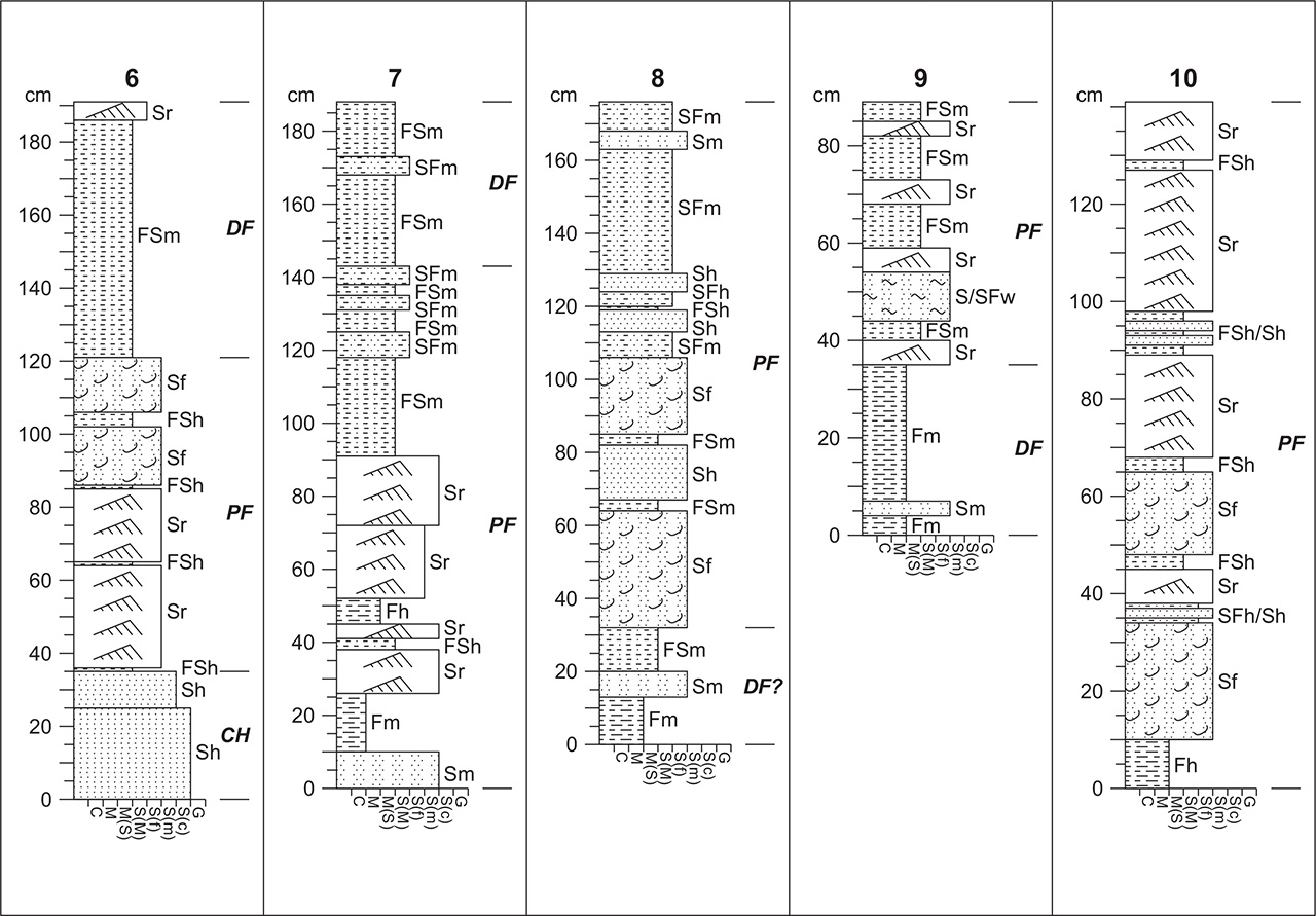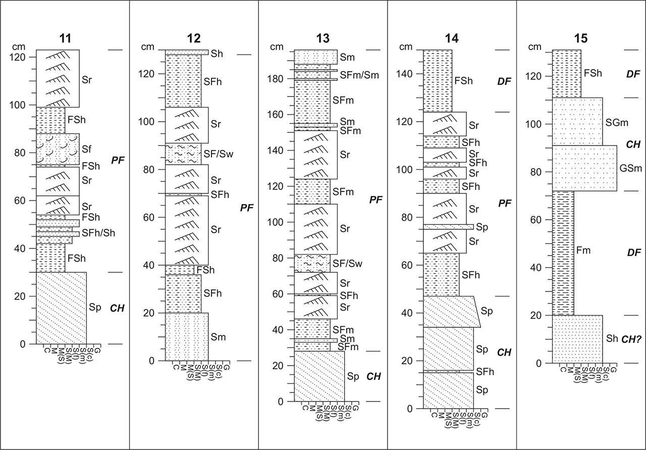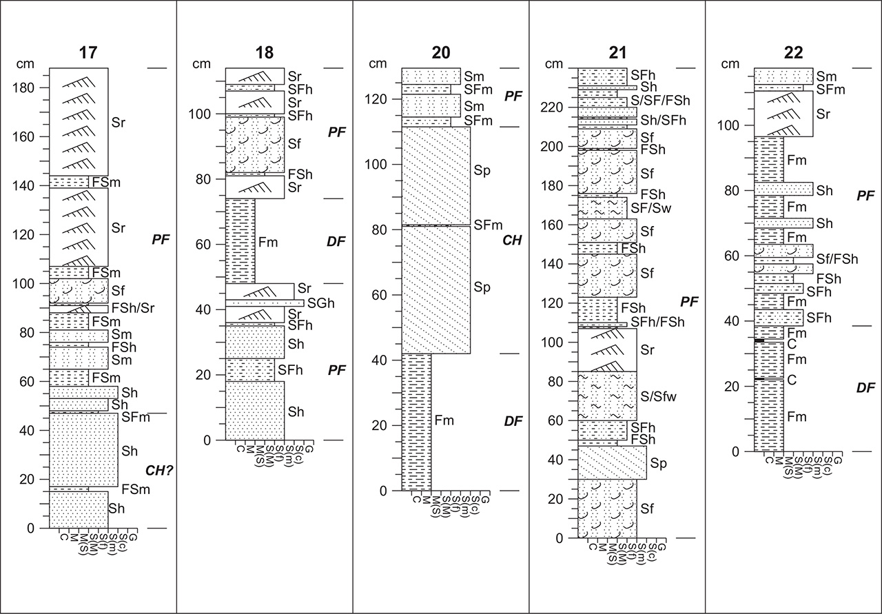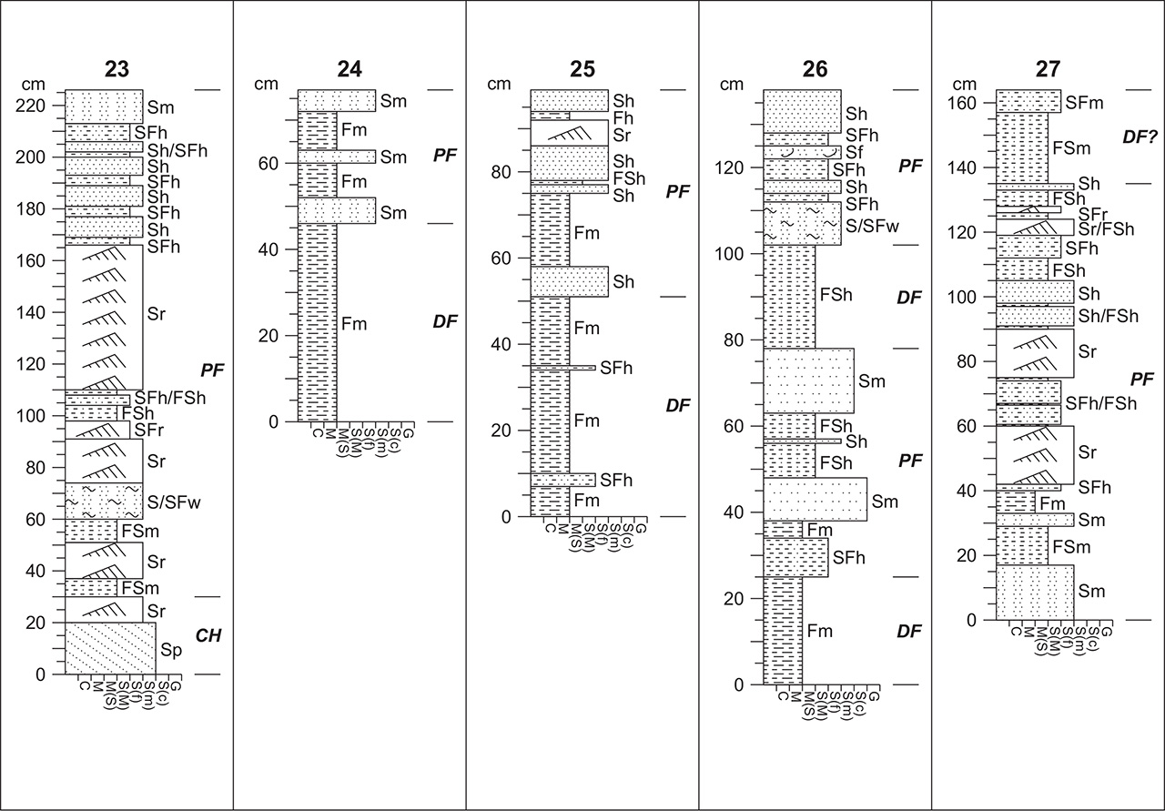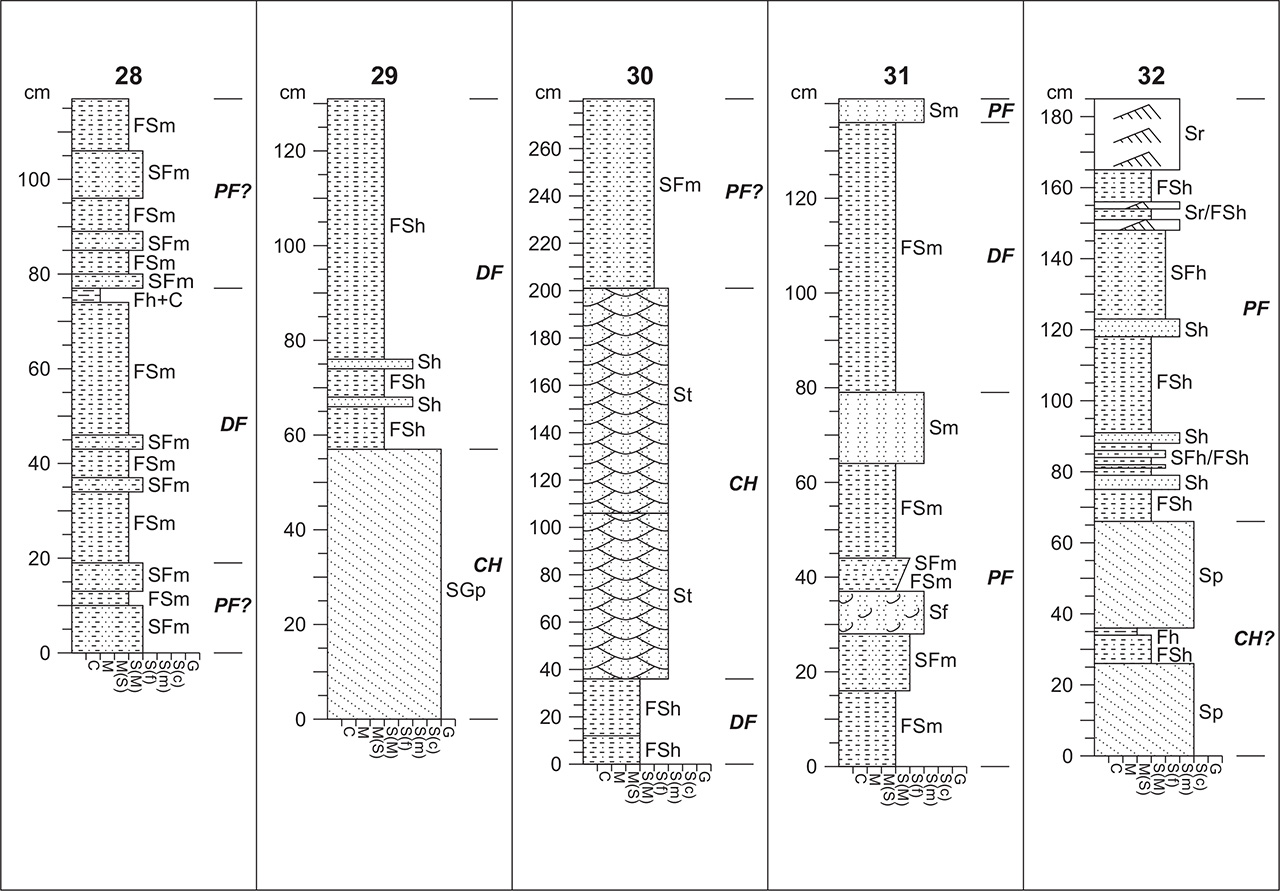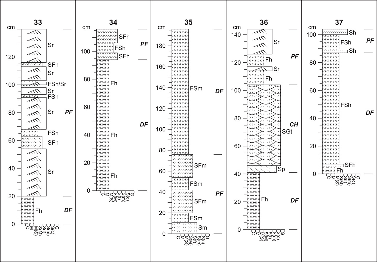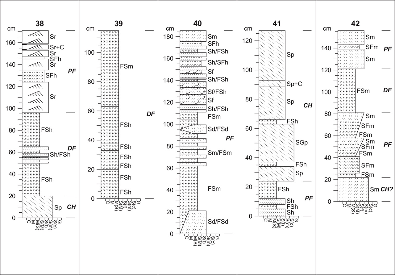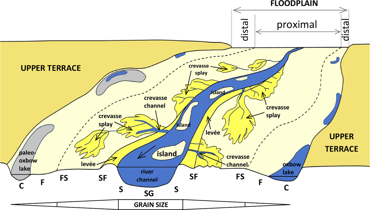
Figure 1.
Model of floodplain geomorphology (type of meandering river), including distribution of particular lithofacies (see supplemental information for description of abbreviations)
Source: own study based on Bridge 2003, Ostrowski et al. 2021 and Szmańda 2011
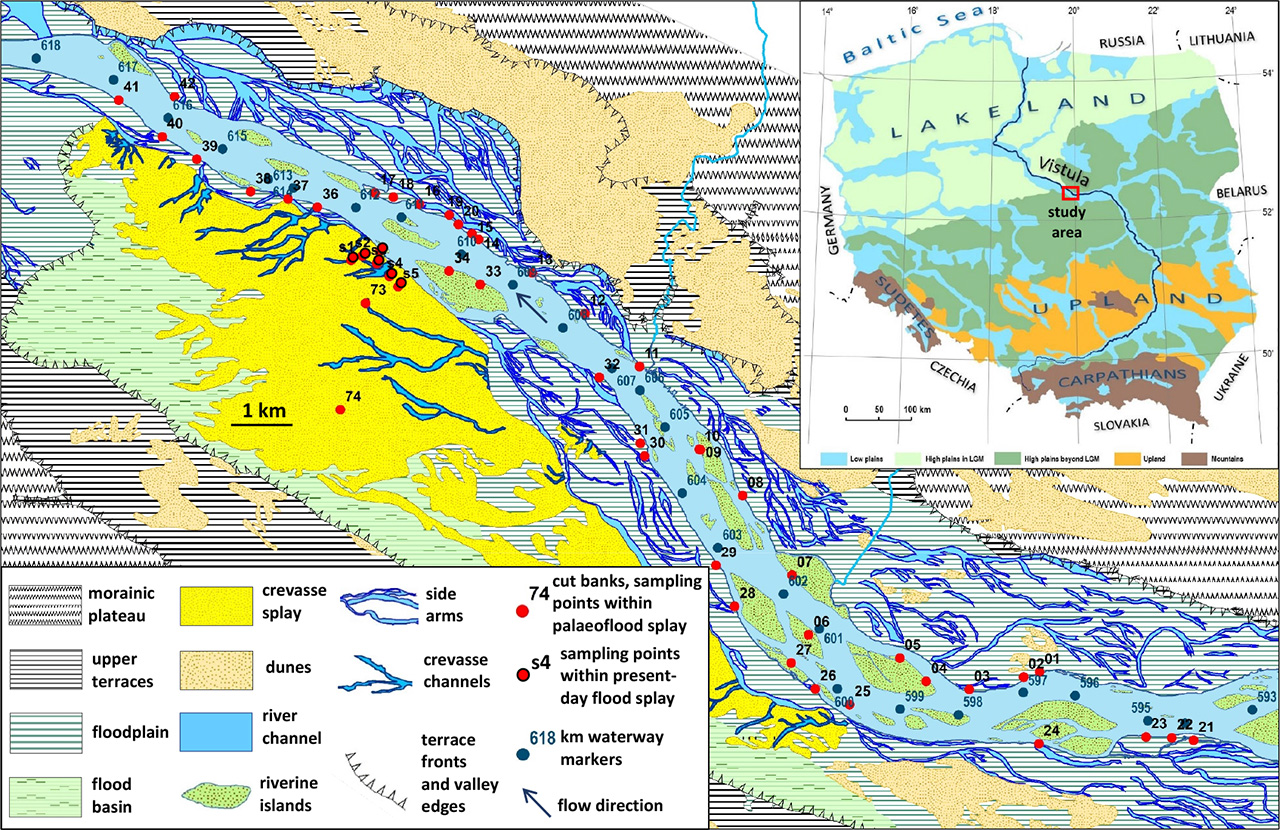
Figure 2.
Geomorphological map of the study area and locator map with simplified landscape typology of Poland based on Kondracki & Richling 1994
Source of the main map: own study adopted from Wierzbicki, Ostrowski & Falkowski 2020 and modified
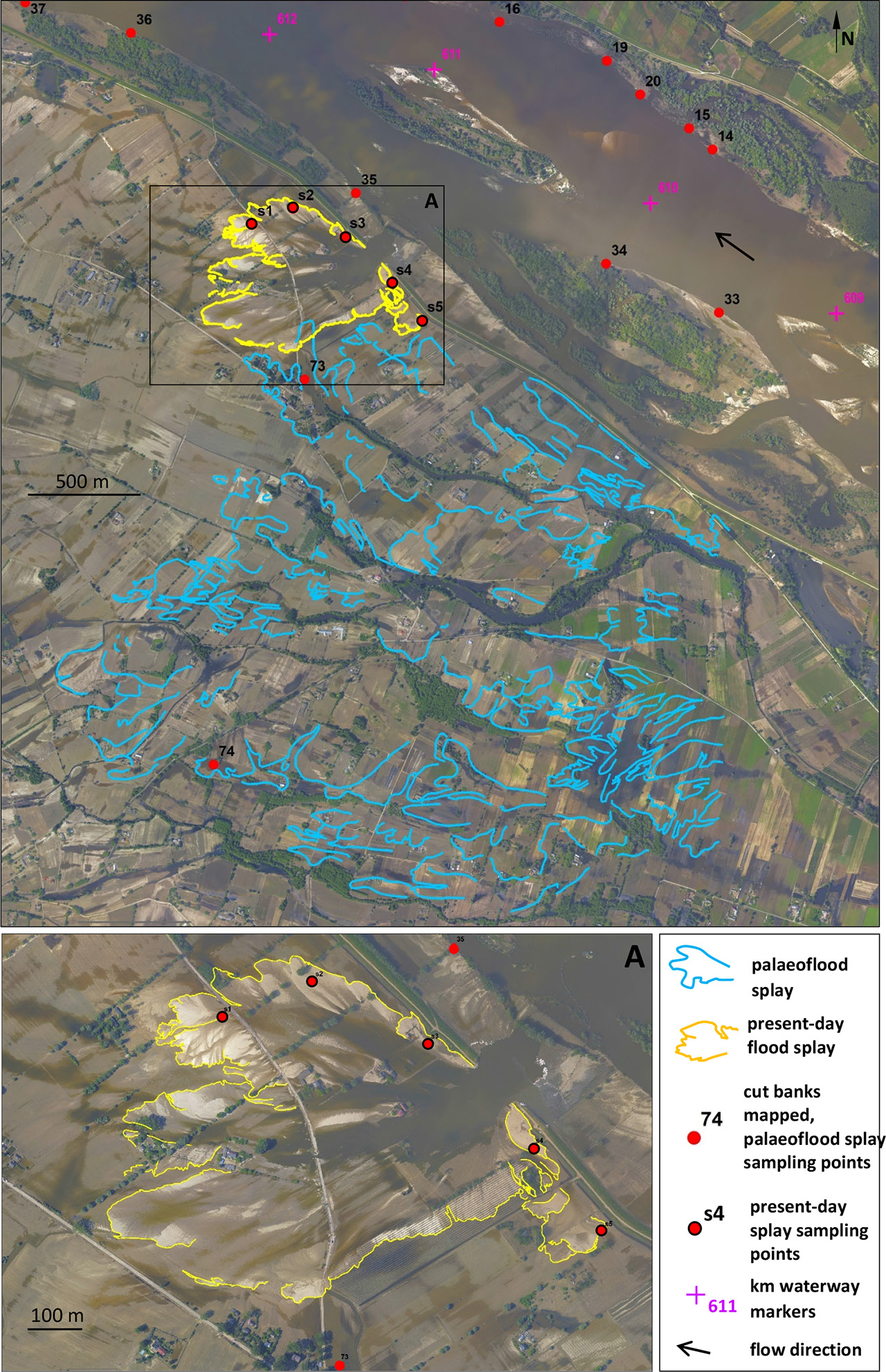
Figure 3.
Aerial orthophotomap taken shortly after levee breach
Source of the image: KZGW by courtesy of Łukasz Sławik (MGGP Aero); see Wierzbicki et al. 2013
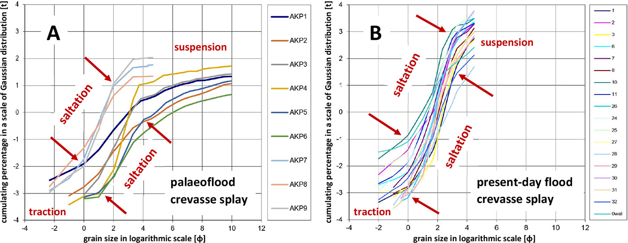
Figure 4.
Particle size distribution graph of deposits taken from the study area
Source: own study
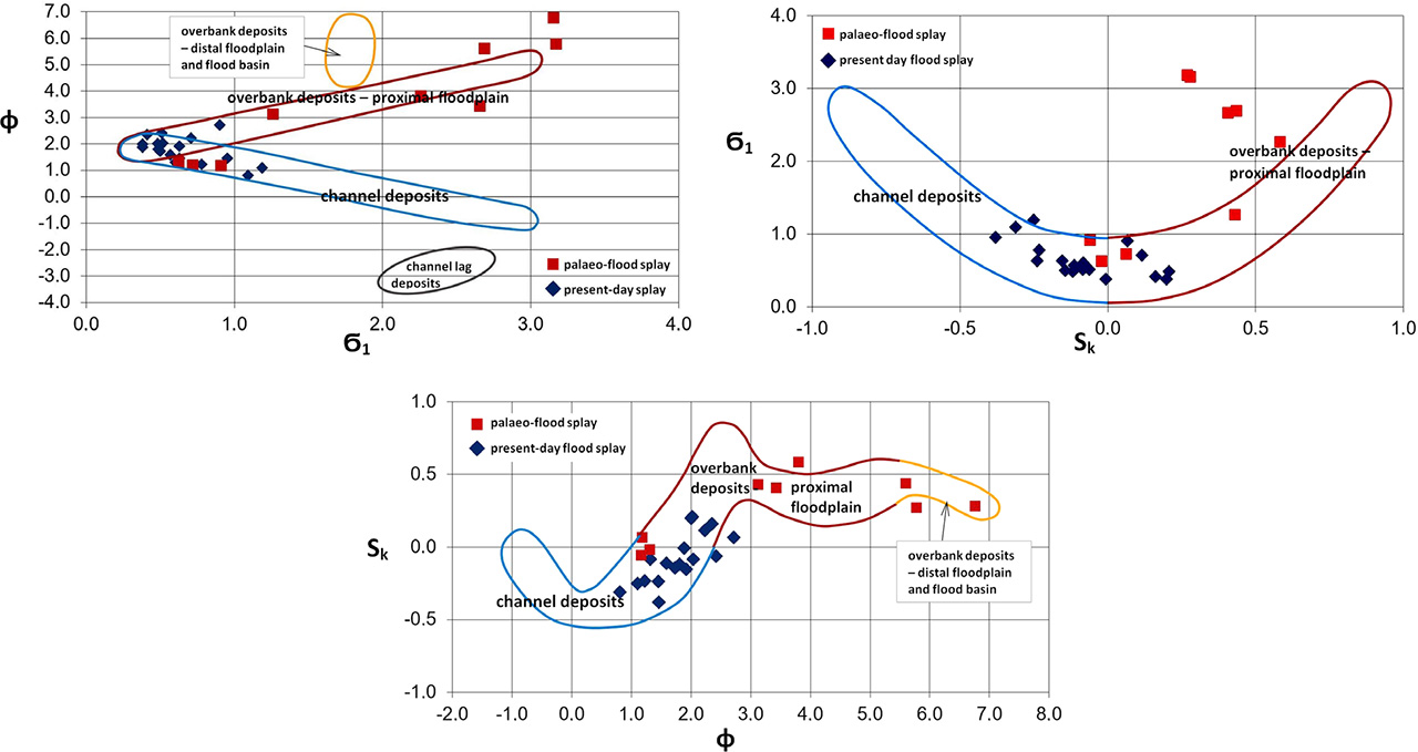
Figure 5.
Grain size statistical parameters (Folk & Ward 1957) of deposits taken from the study area
Source: own study
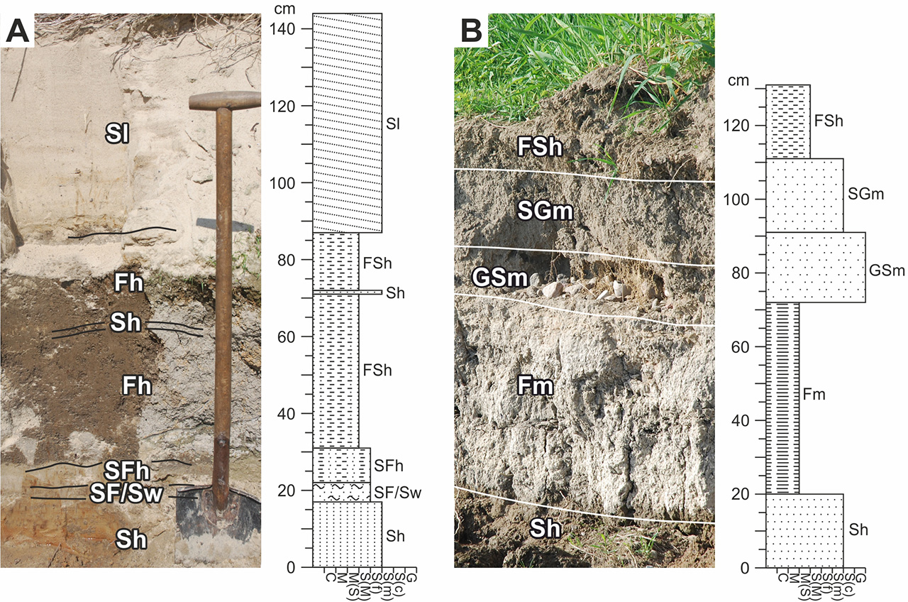
Figure 6.
Sections No. 1 and No. 15. See supplemental information
Source: own study