
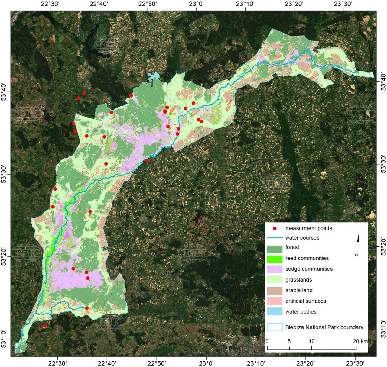
Figure 1
Study area – Biebrza National Park and its buffer zone. Localization of measurement points: grasslands – bright green; reed communities – green; sedge communities - purple; red dots – measurement points. The background is a mosaic of Sentinel-2 images for Poland which was prepared in 2020. Available via WMS (IGiK, 2020)
Source: own elaboration
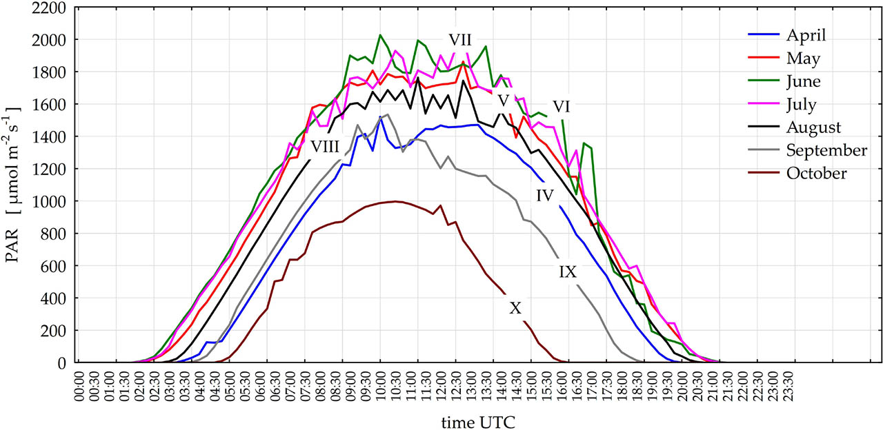
Figure 2
Maximum values of PAR across daytime in growing season months
Source: own elaboration
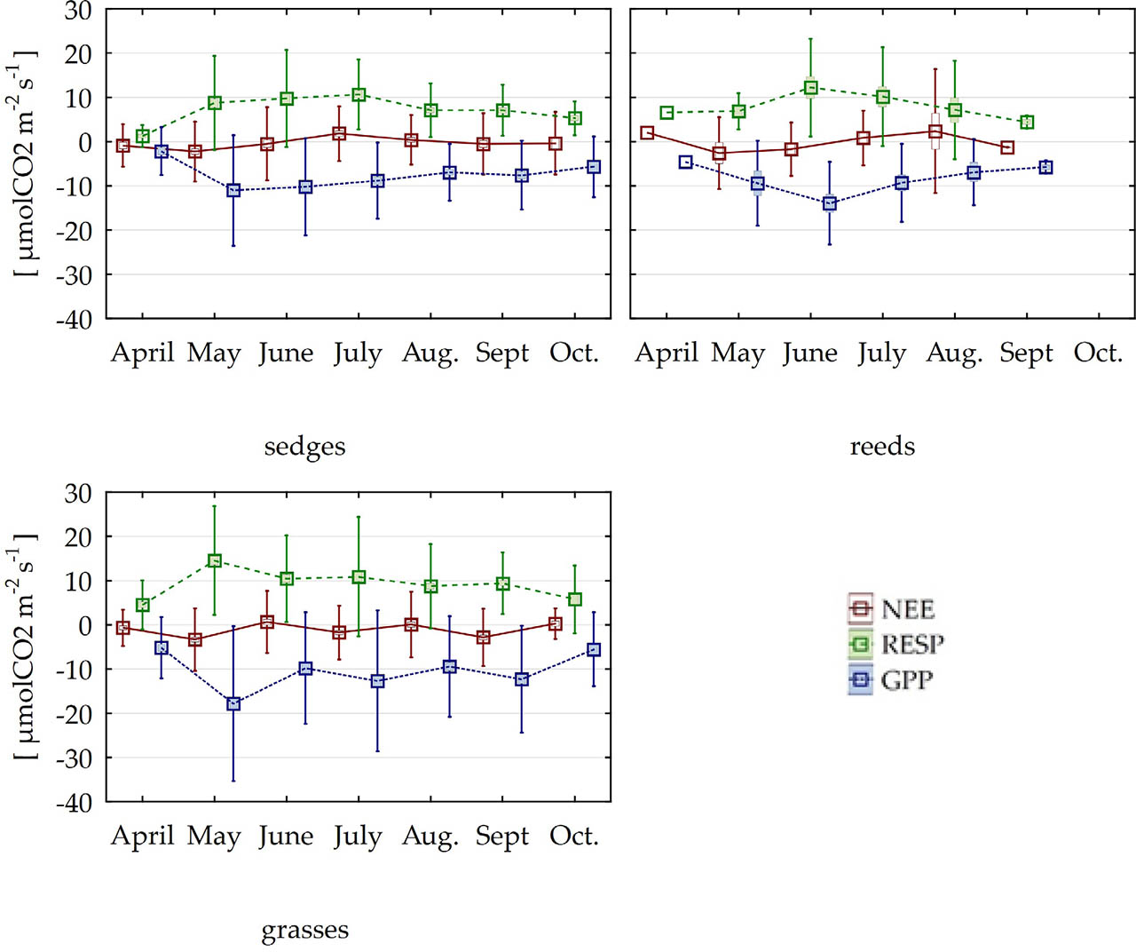
Figure 3
Chamber measurements of CO2 flux on Biebrza Wetland in the period 2015–2022 in monthly cross-sections (means and twice standard deviation)
Source: own elaboration
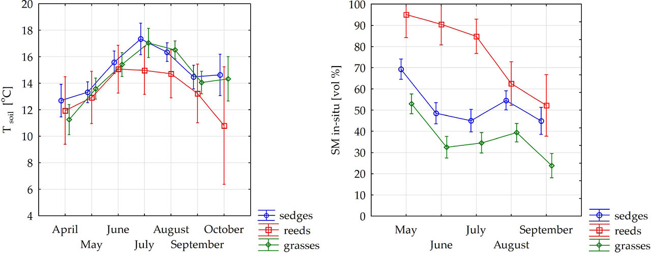
Figure 4
Soil temperature (left) and soil moisture (right) measured in situ in Biebrza habitats in monthly cross-sections (means and 0.95 confidence interval)
Source: own elaboration
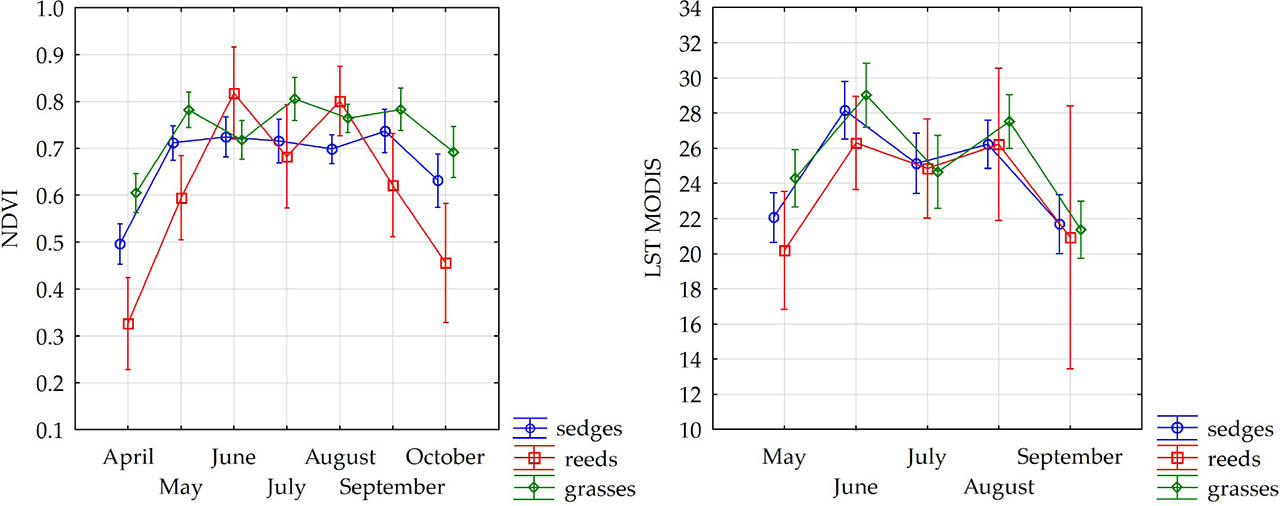
Figure 5
Terra MODIS NDVI (left) and LST (right) in Biebrza habitat observation points from 2015–2022 in monthly cross-sections (means and 0.95 confidence interval)
Source: own elaboration
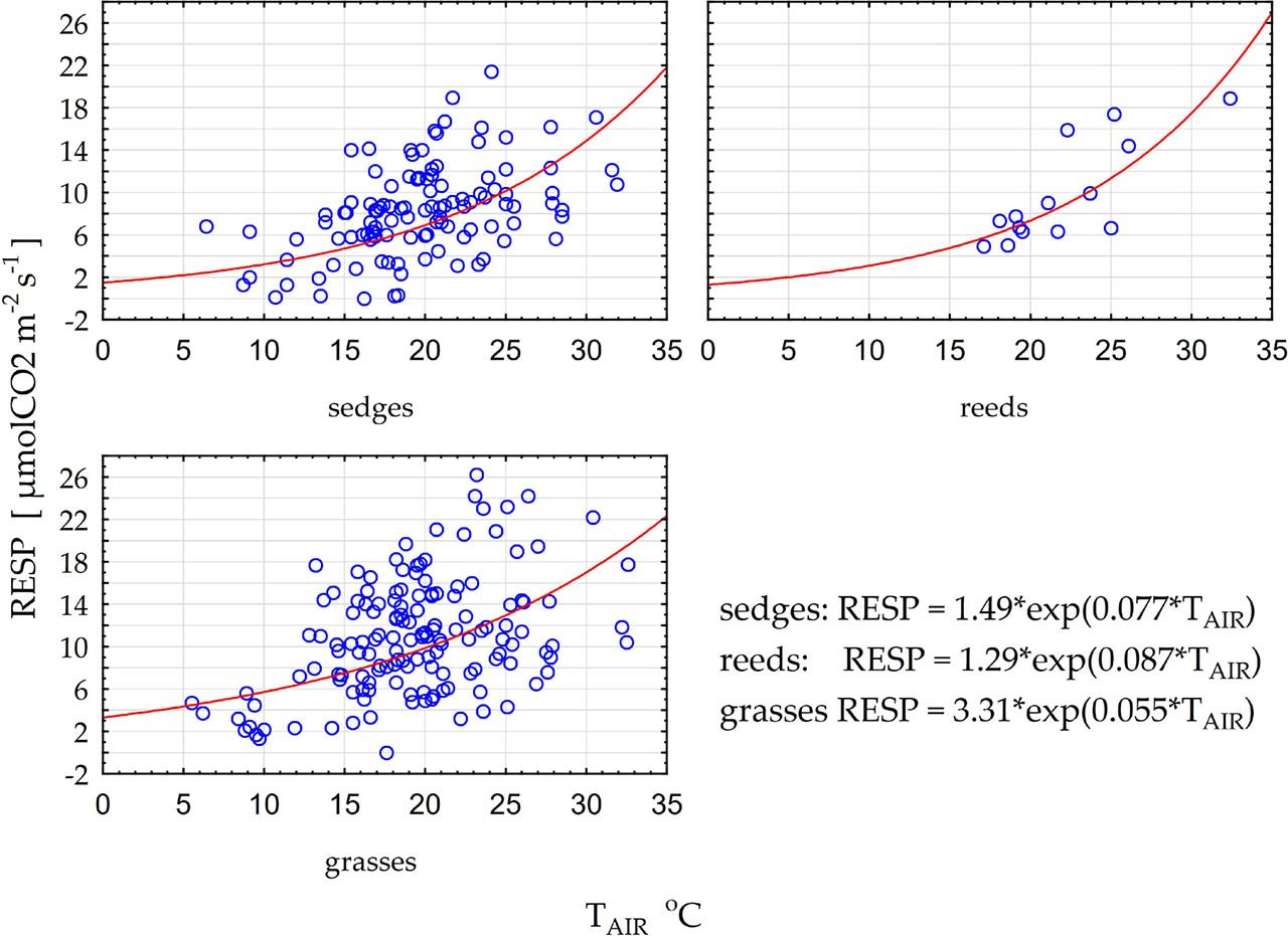
Figure 6
Exponential dependency of Biebrza ecosystem respiration from air temperature during the RESP in situ measurement
Source: own elaboration
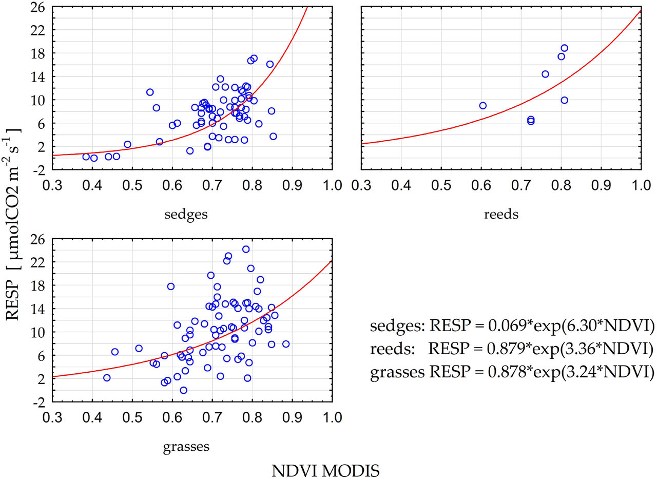
Figure 7
Exponential dependency of Biebrza ecosystem respiration measured in situ and MODIS NDVI index
Source: own elaboration
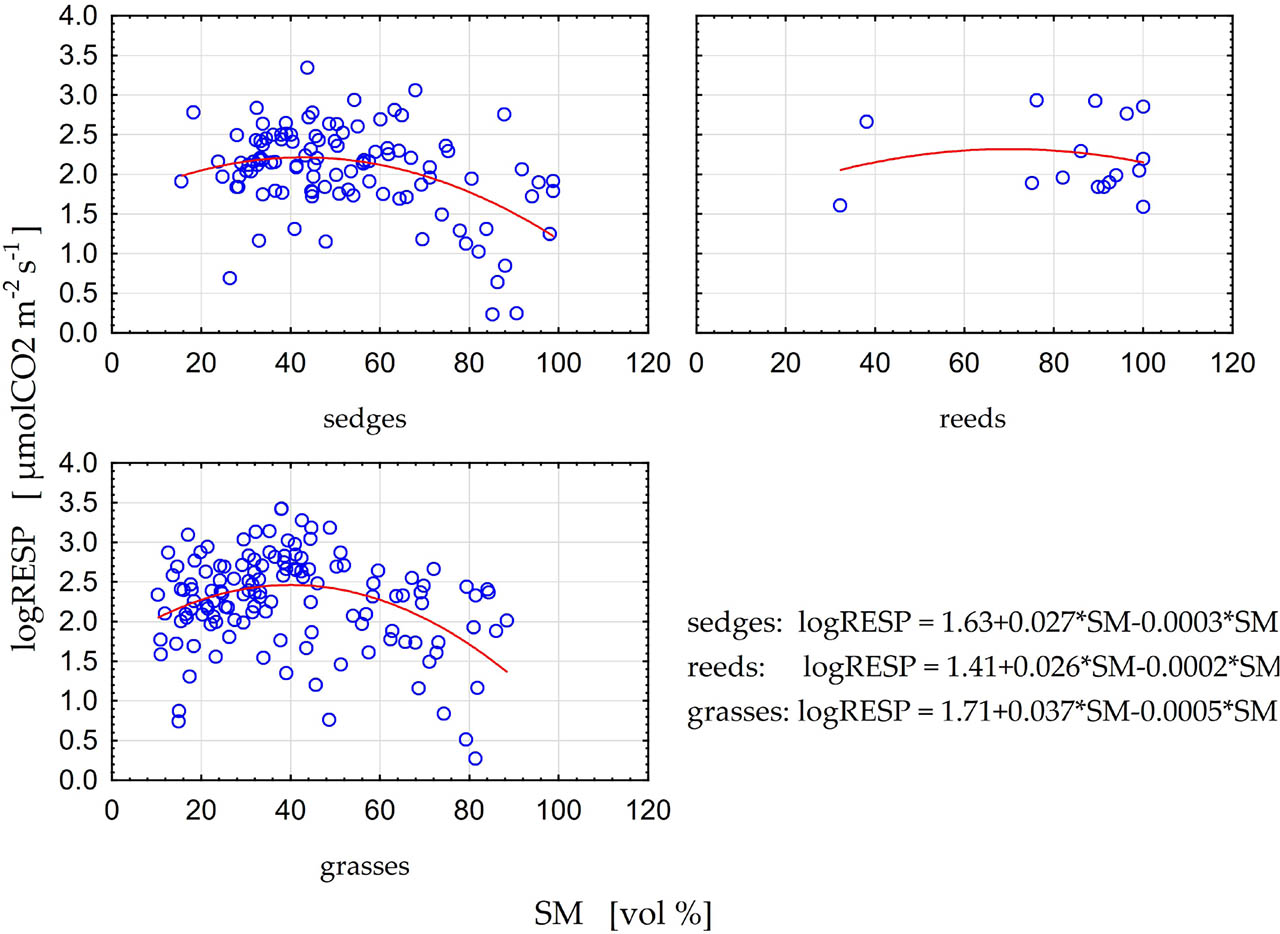
Figure 8
Polynomial dependency of Biebrza ecosystem respiration versus soil moisture for sedges, grasses and reed habitats
Source: own elaboration
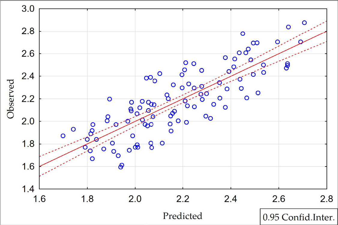
Figure 9
Scatterplot for log-linear respiration model (4) and measured respiration
Source: own elaboration
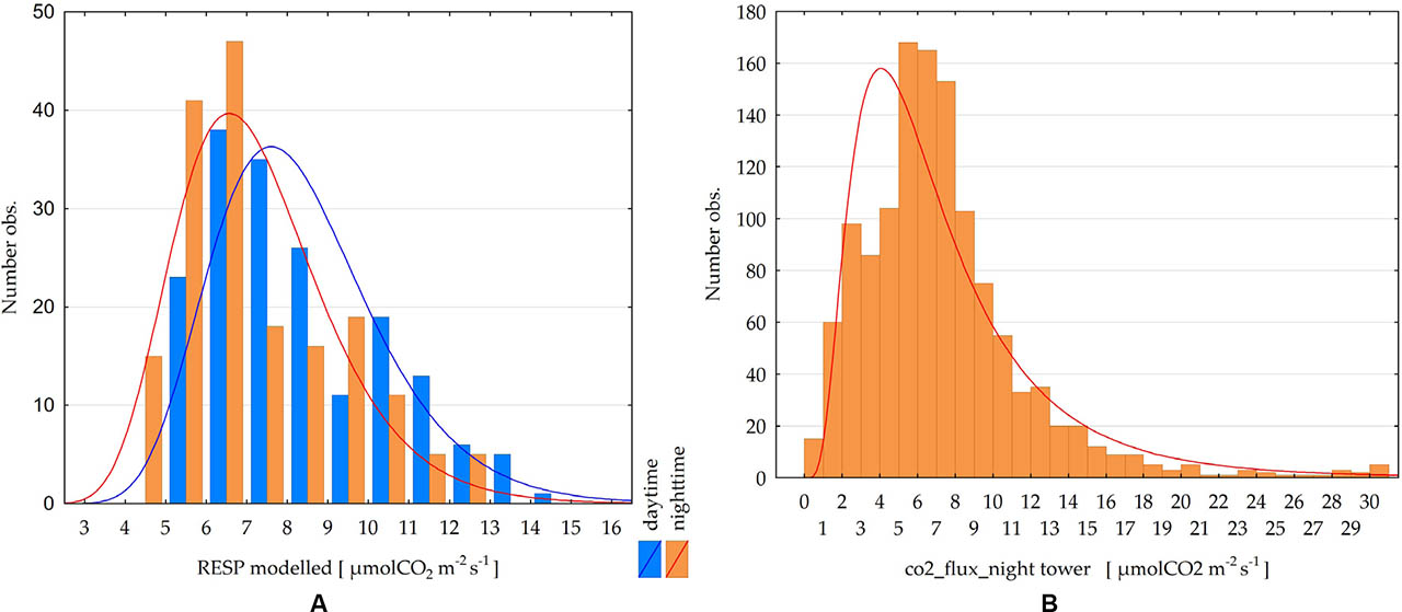
Figure 10
A (left): Distributions of daytime and nighttime means of respiration calculated with the model (4) for chamber observation points. B (right): Distribution of nighttime values of respiration from EC tower measurements for the period May–September
Source: own elaboration
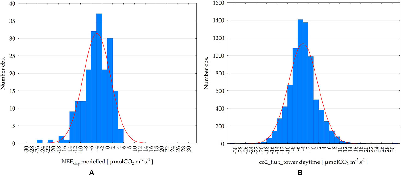
Figure 11
A (left): Distributions of daytime means of NEE calculated with model (5a) for chamber observations at the points. B (right): Distribution of daytime values of CO2 flux from EC tower measurements over the period May–September
Source: own elaboration
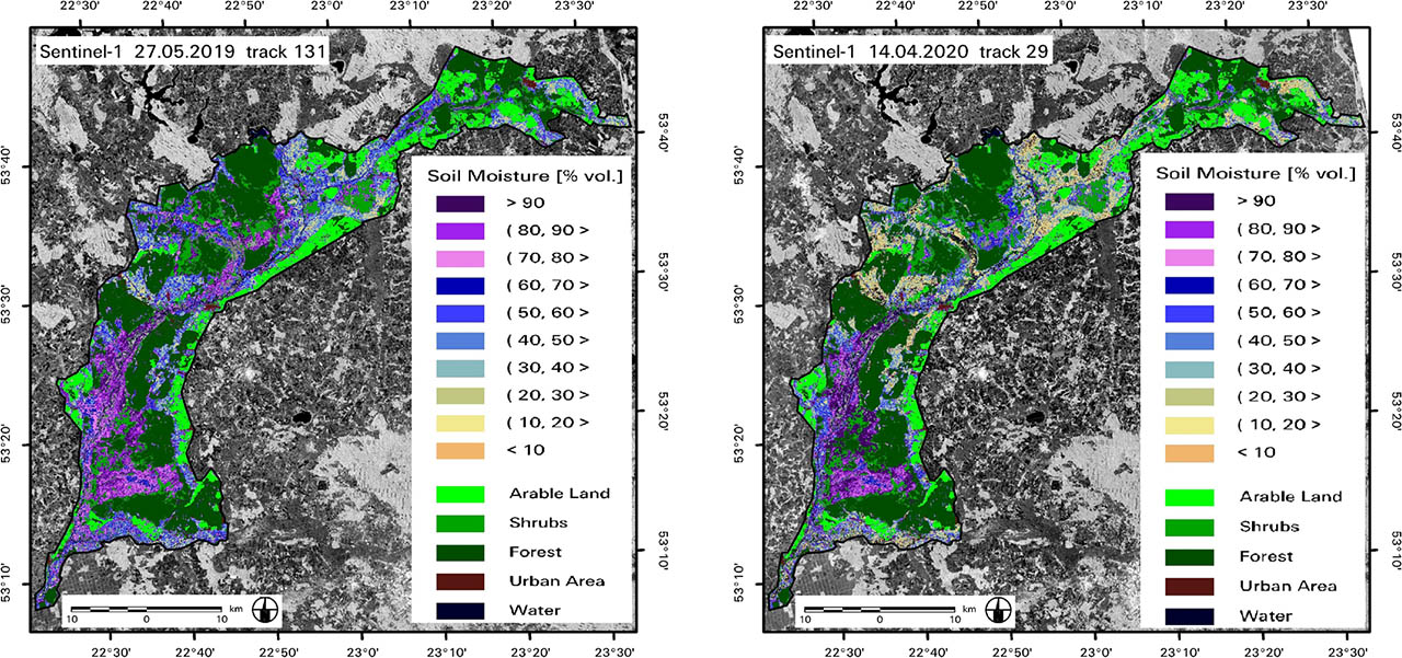
Figure 12
Soil moisture on the Biebrza Wetlands area calculated with model (eq. 6)
Source: own elaboration
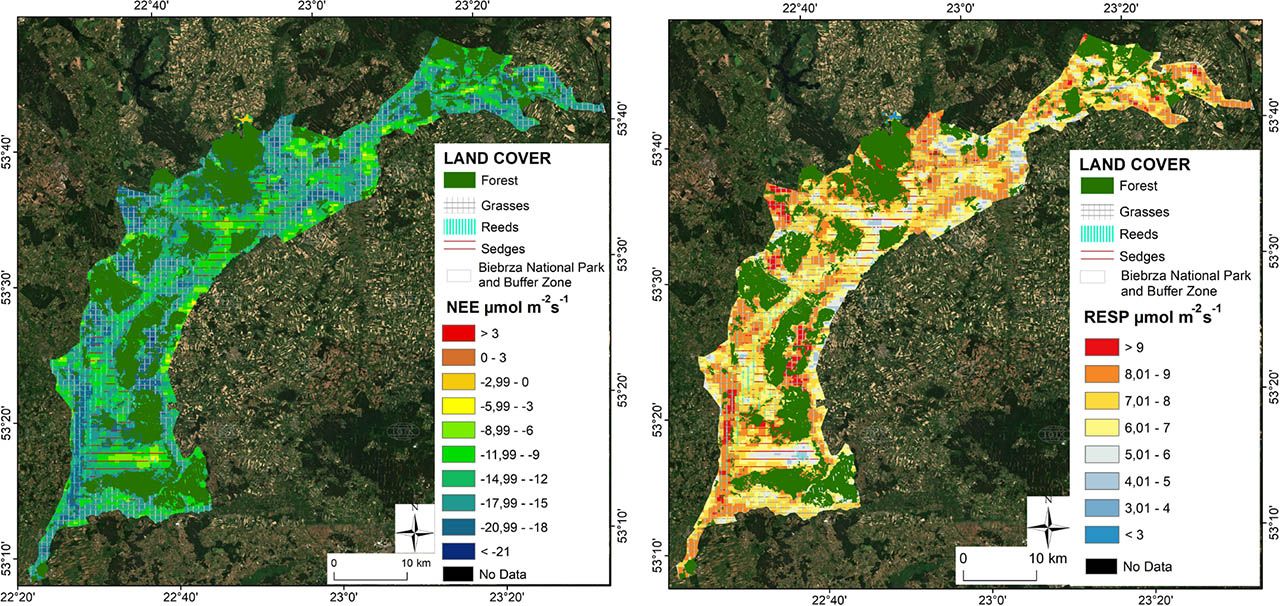
Figure 13
NEE (left) and RESP (right) distribution maps calculated from satellite data as of 31.05.2019
Source: own elaboration