
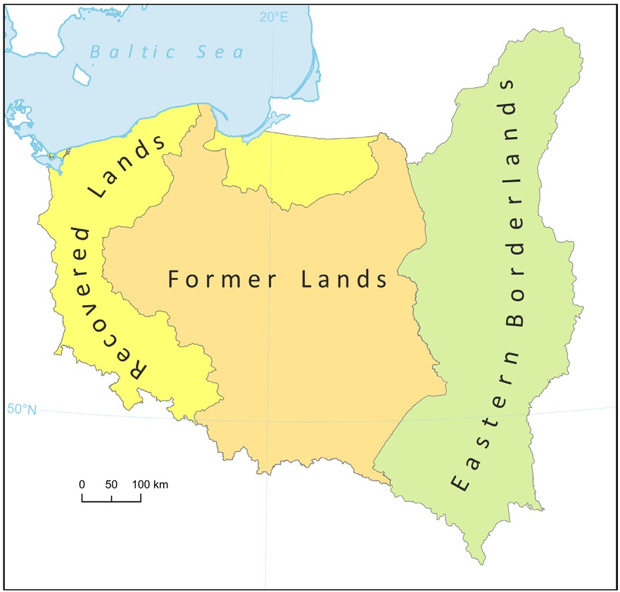
Figure 1
Research area.
Source: own elaboration
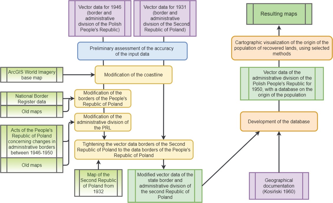
Figure 2
Diagram of the research methodology (own elaboration)
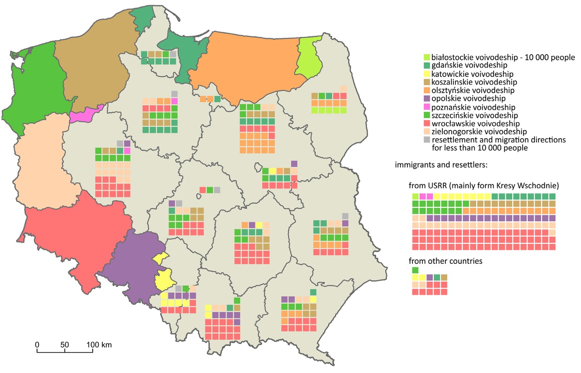
Figure 3
Immigrants and forced re-settlers to the Recovered Lands from particular areas of former Poland according to the 1950 census
Source: Author’s map based on Kosiński 1960
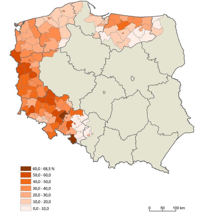
Figure 4
Population from the USSR (mainly from the Eastern Borderlands of pre-war Poland) in the Recovered Territories in 1950
Source: Author’s map based on Kosiński 1960
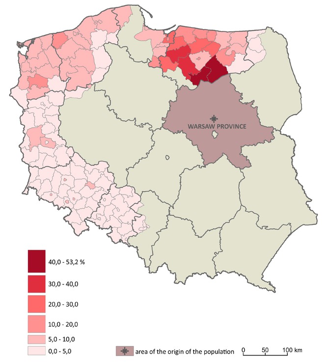
Figure 5
Population from Warsaw Province in the Recovered Territories in 1950
Source: Author’s map based on Kosiński 1960
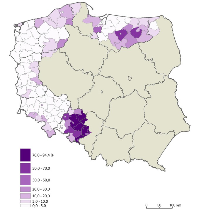
Figure 6
Indigenous population in the Recovered Territories in 1950
Source: Author’s map based on Kosiński 1960
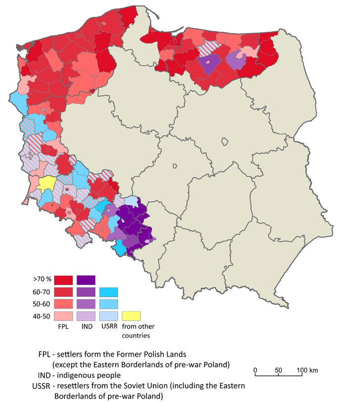
Figure 7
Population of the Recovered Territories by Territorial origin in 1950
Source: Author’s map based on Kosiński 1960