
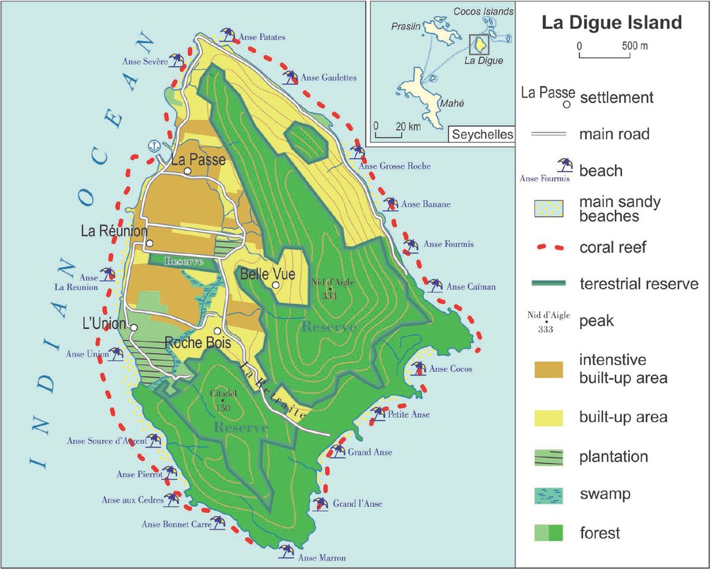
Figure 1
Main types of use and land cover of La Digue (Authors: M. Jędrusik, I. Gołębiowska)
Table 1
Population changes on La Digue
| Year | Population | Pop. density (pop. /km2) | Plateau pop. density (pop. /km2) |
|---|---|---|---|
| 1804 | 52 | 5 | 32 |
| 1818 | 414 | 42 | 252 |
| 1825 | 350 | 35 | 213 |
| 1931 | 1,255 | 127 | 765 |
| 1960 | 1,842 | 187 | 1,123 |
| 1971 | 1,985 | 201 | 1,210 |
| 1977 | 1,911 | 194 | 1,165 |
| 1987 | 1,926 | 195 | 1,174 |
| 1997 | 1,998 | 202 | 1,218 |
| 2002 | 2,104 | 213 | 1,283 |
| 2010 | 2,269 | 230 | 1,384 |
| 2018 | 2,408 | 244 | 1,468 |
[i] Sources: Dupon 1977, Eymeret 1984, The population of the islands of the Seychelles 2018
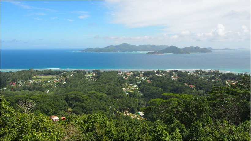
Figure 2
Plateau La Passe and Praslin Island (photo by Maciej Henryk Jędrusik)
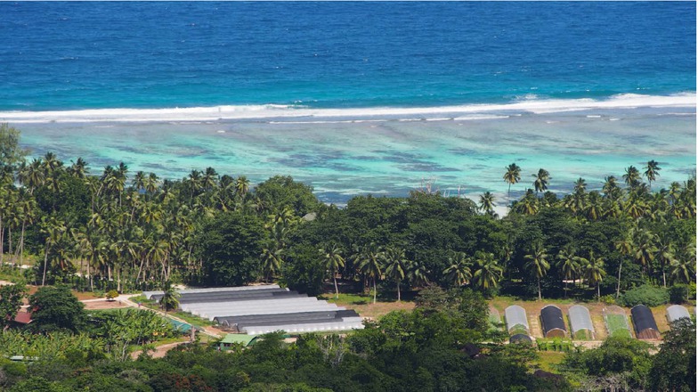
Figure 3
Union Estate and Anse Source d’Argent (photo by Maciej Henryk Jędrusik)
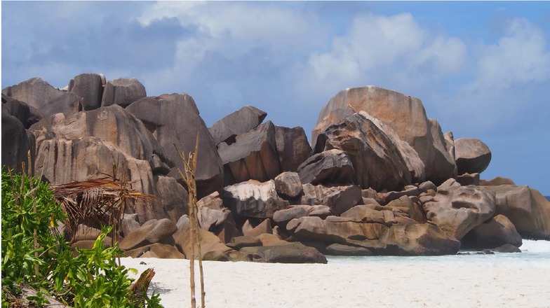
Figure 4
Granites on Anse Cocos beach (photo by Maciej Henryk Jędrusik)
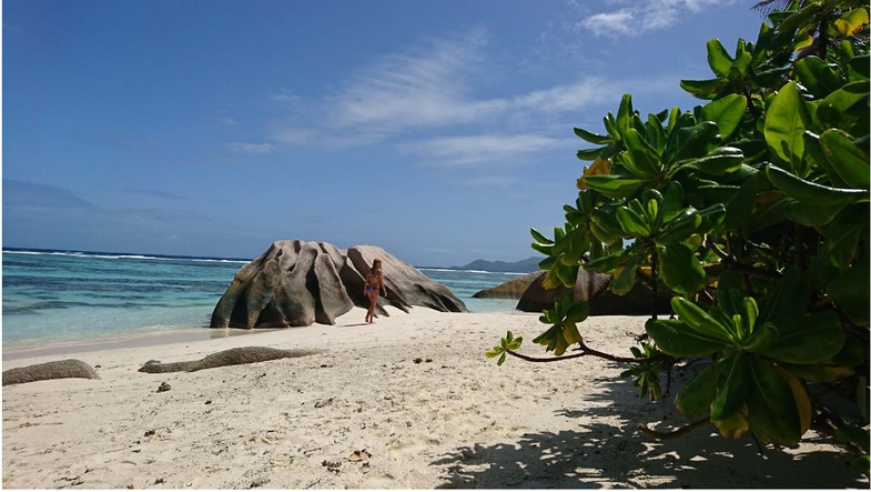
Figure 5
Anse Source d’Argent (photo by Maciej Henryk Jędrusik)
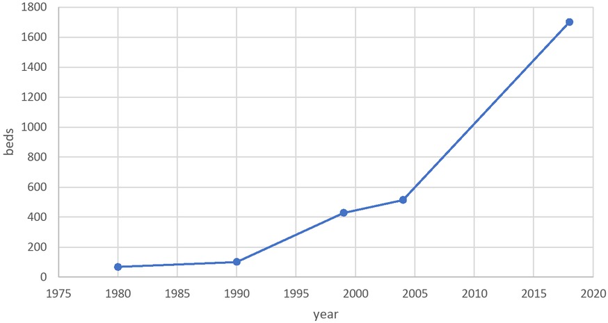
Figure 6
Evolution of the accommodation base on La Digue
Sources: based on Beylot-Turcotte 2018, Doumenge J.-P. 1987, Günther 2004
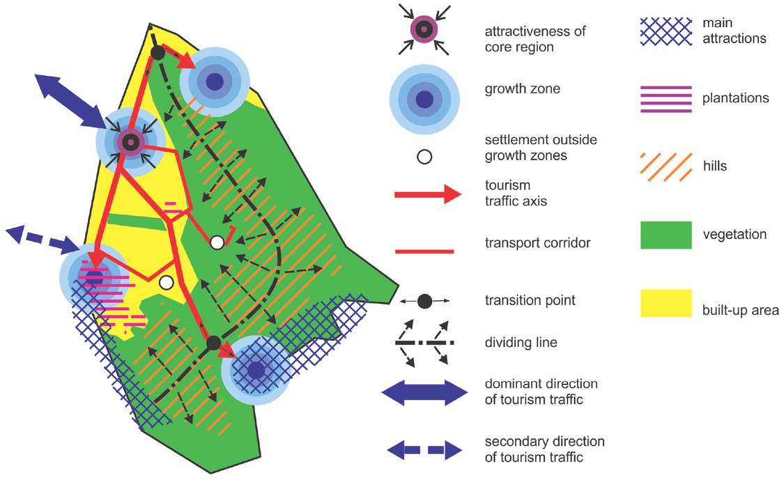
Figure 7
La Digue – chorème (Authors: M. Jędrusik, I. Gołębiowska)
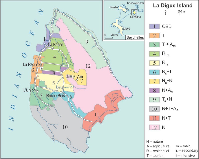
Figure 8
Functional micro-regions on La Digue (Authors: M. Jędrusik, I. Gołębiowska)
Table 2
Prevailing functions of La Digue micro-regions
| CBD | T (tourism) | A (plantation-agriculture) | Rim (residential intensive main) | Ris (residential intensive secondary) | Rs (residential secondary) | N (nature) | |
|---|---|---|---|---|---|---|---|
| CBD | 1 | ||||||
| T | 2 | 6 | 10, 11 | ||||
| A | 3 | 8 | |||||
| Rim | 4 | ||||||
| Ris | 5 | ||||||
| Rs | |||||||
| N | 9 | 7 | 12 |