
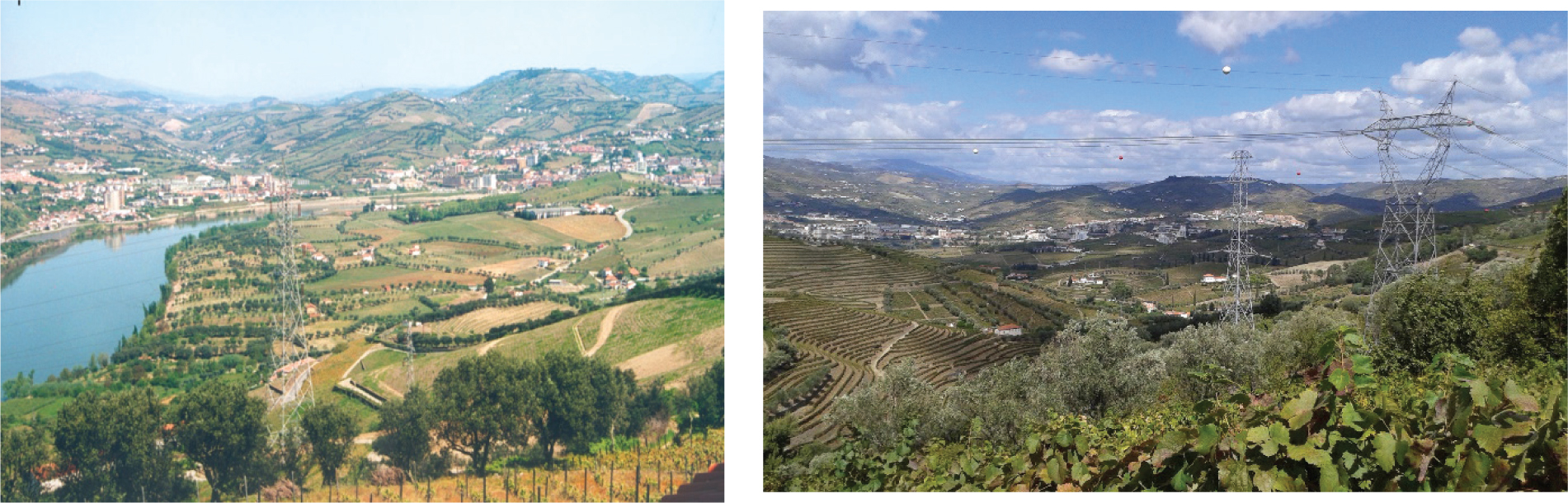
Photos 1 and 2
Two images of Baixo Corgo with farmhouses scattered throughout the landscape and olive groves surrounding the plots. (Photo by Helena Pina, 2016)
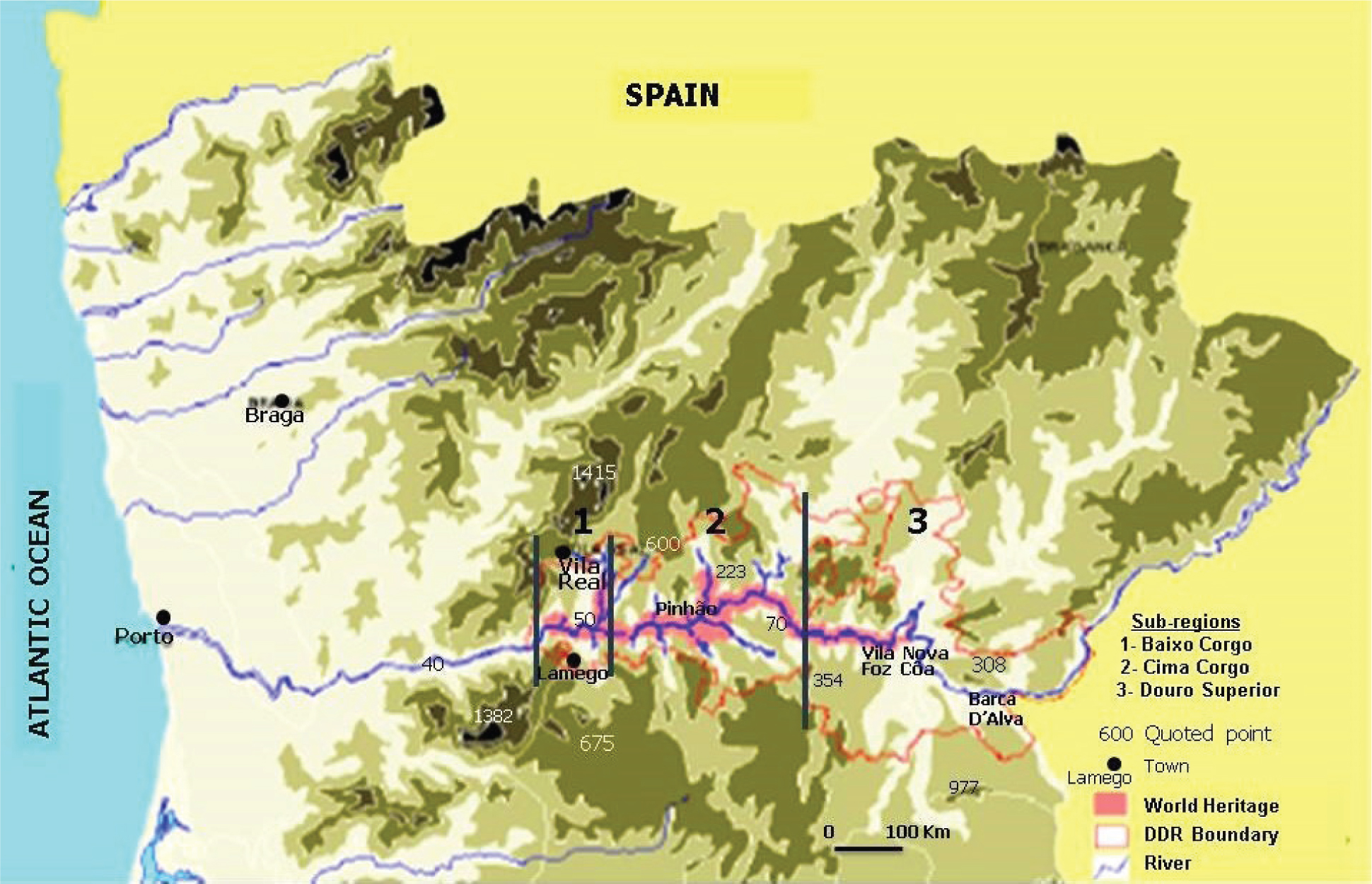
Figure 1
The Douro Demarcated Region
Source: Plano Interm. De Orden. Territ. Do Alto Douro Vinhateiro, UTAD
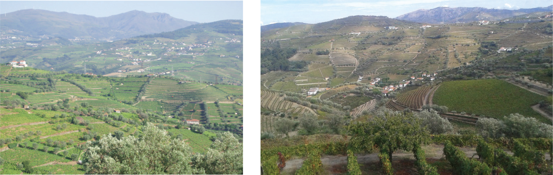
Photos 3 and 4
Two images of Baixo Corgo, one with traditional vineyards and the other with a mix of different types of terraces. (Photos by Helena Pina, 2016)
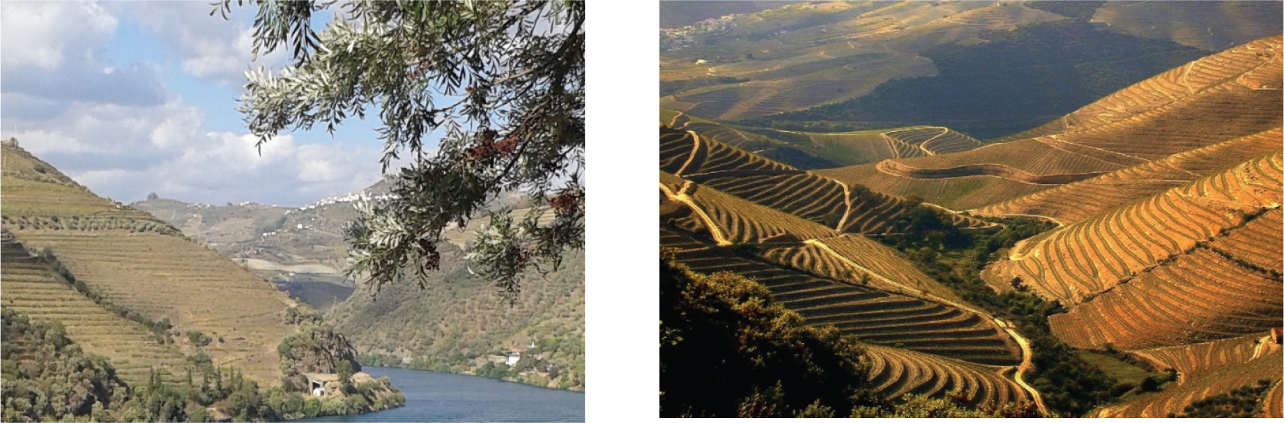
Photos 5 and 6
Cima Corgo, with the extensive mechanised business vineyards (Photos by Helena Pina, 2016)
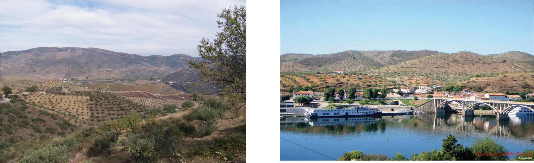
Photos 7 and 8
Douro Superior – dominion of the olive and almond tree (Photos by Helena Pina, 2016)
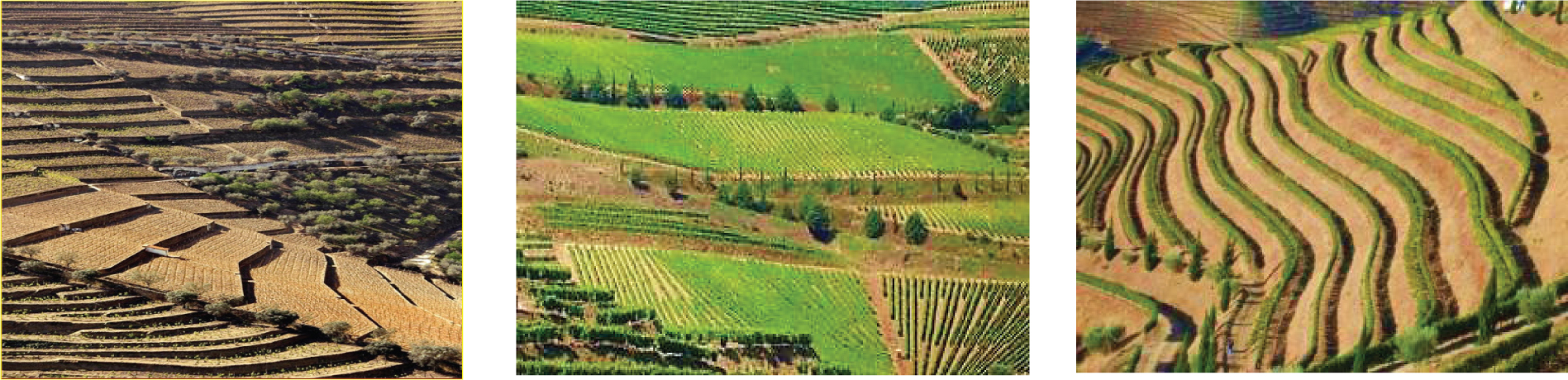
Photo 9
Vineyards with traditional terraces, at different times, flanked by “vertical vines” and “vines on ledges.” (Photos J. Queiroz, 2016)
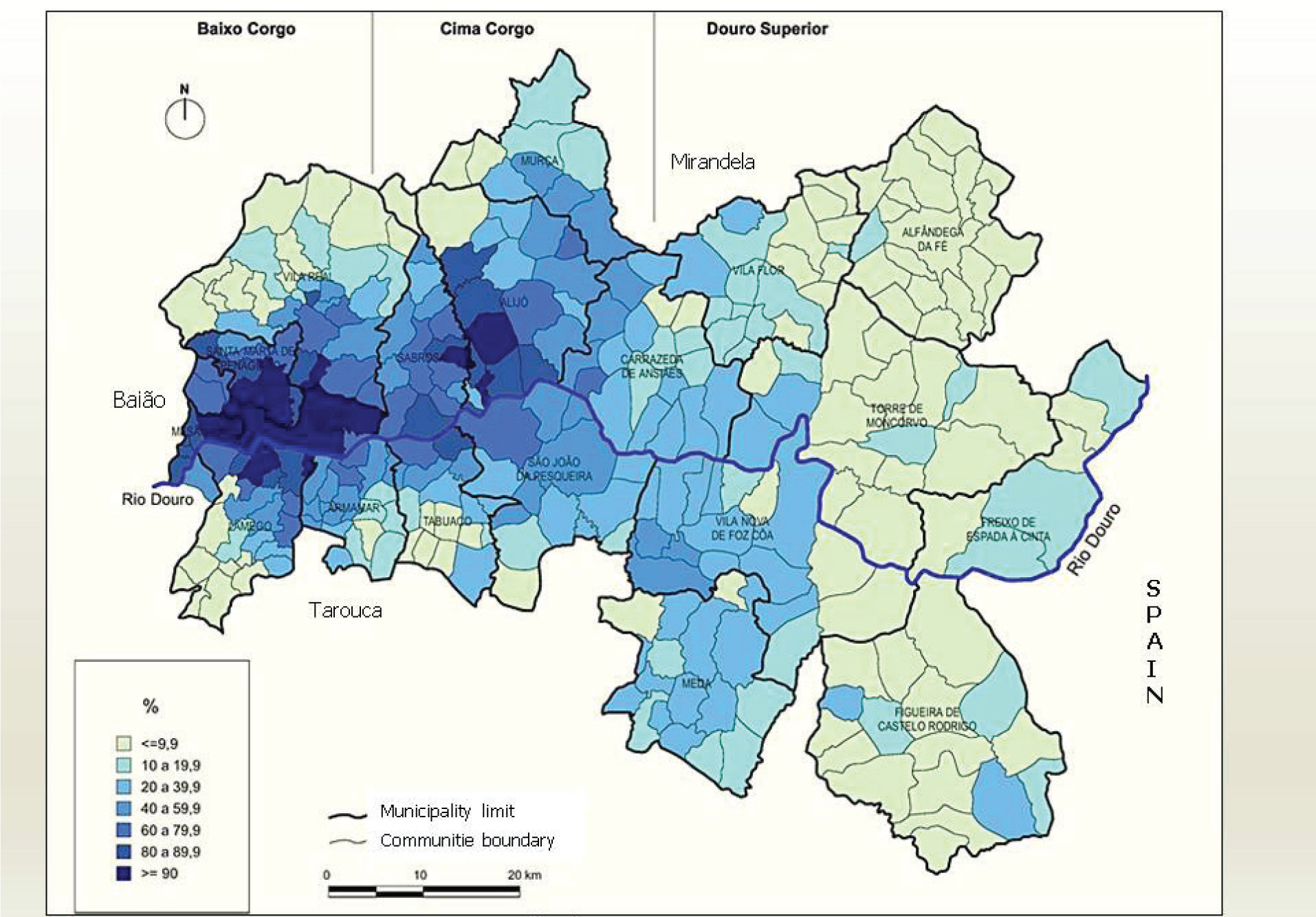
Figure 2
Proportion of area with vineyards in the SAU,7 per community, in 1989 (%)
Source: own elaboration based on Rec. Agrícola, INE 1989
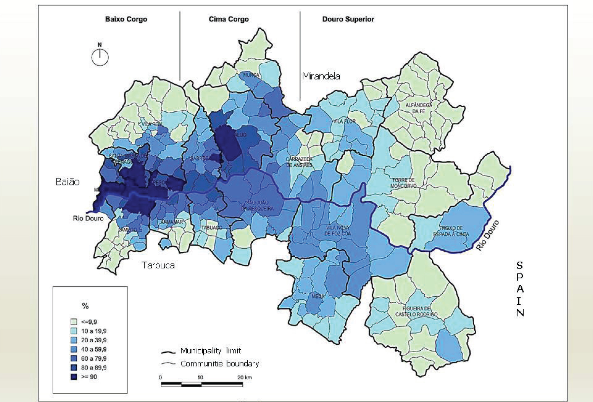
Figure 3
Proportion of area with vineyards in the SAU,8 per community, in 2009 (%)
Source: own elaboration based on Rec. Agrícola, INE 2009
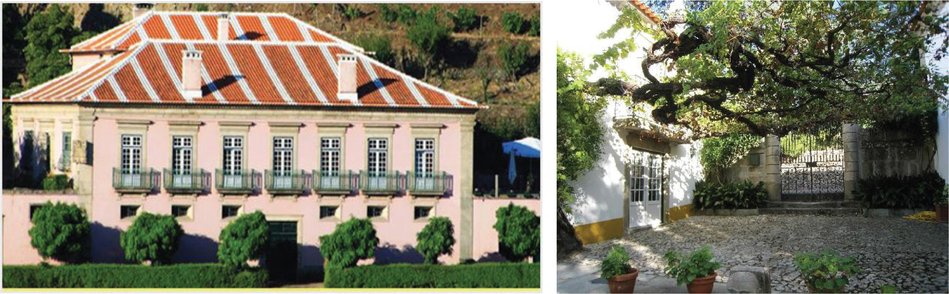
Photos 10 and 11
Two examples of manor houses adapted to tourism (Casa dos Varais and Casa da Azenha, Lamego) Source: Casa dos Varais and Casa da Azenha Archives