
Table 1
Number of analysed papers per journal (since 2000)
| Title of a journal | Published since | Number of published papers since 2000 (nPp) | Number of analysed papers since 2000 (nAp) | |
|---|---|---|---|---|
| The Cartographic Journal | 1964 | 422 | 40 | 9.5% |
| Cartographica: The International Journal for Geographic Information and Geovisualization | 1965 | 273 | 17 | 6.2% |
| Cartography and Geographic Information Science | 1973 | 465 | 39 | 8.4% |
| International Journal of Cartography | 2015 | 36 | 7 | 19.4 % |
| 1196 | 103 | 8.6% | ||
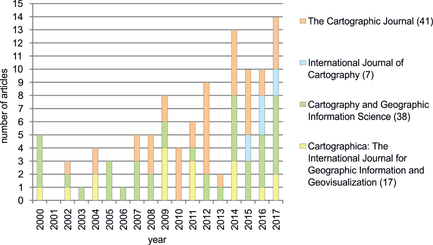
Figure 1
Number of analysed papers per year
Source: own elaboration
Table 2
Types of maps used in analysed papers
| Feature | Medium | Interactivity | Method of cartographic presentation | Familiarity with data or area | |||||
|---|---|---|---|---|---|---|---|---|---|
| Type | paper | screen | non-interactive | interactive | qualitative | quantitative | fictional | familiar | unfamiliar |
| Number of papers | 19 | 89 | 68 | 40 | 91 | 59 | 14 | 35 | 64 |
| Percent of papers | 18,4% | 86,4% | 66,0% | 38,9% | 88,3% | 57,3% | 13,6% | 34,0% | 62,1% |
Table 3
Types of maps
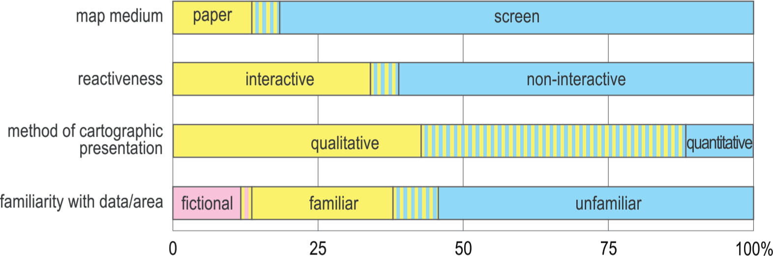
Figure 2
Percent of map types used in analysed papers
Source: own elaboration
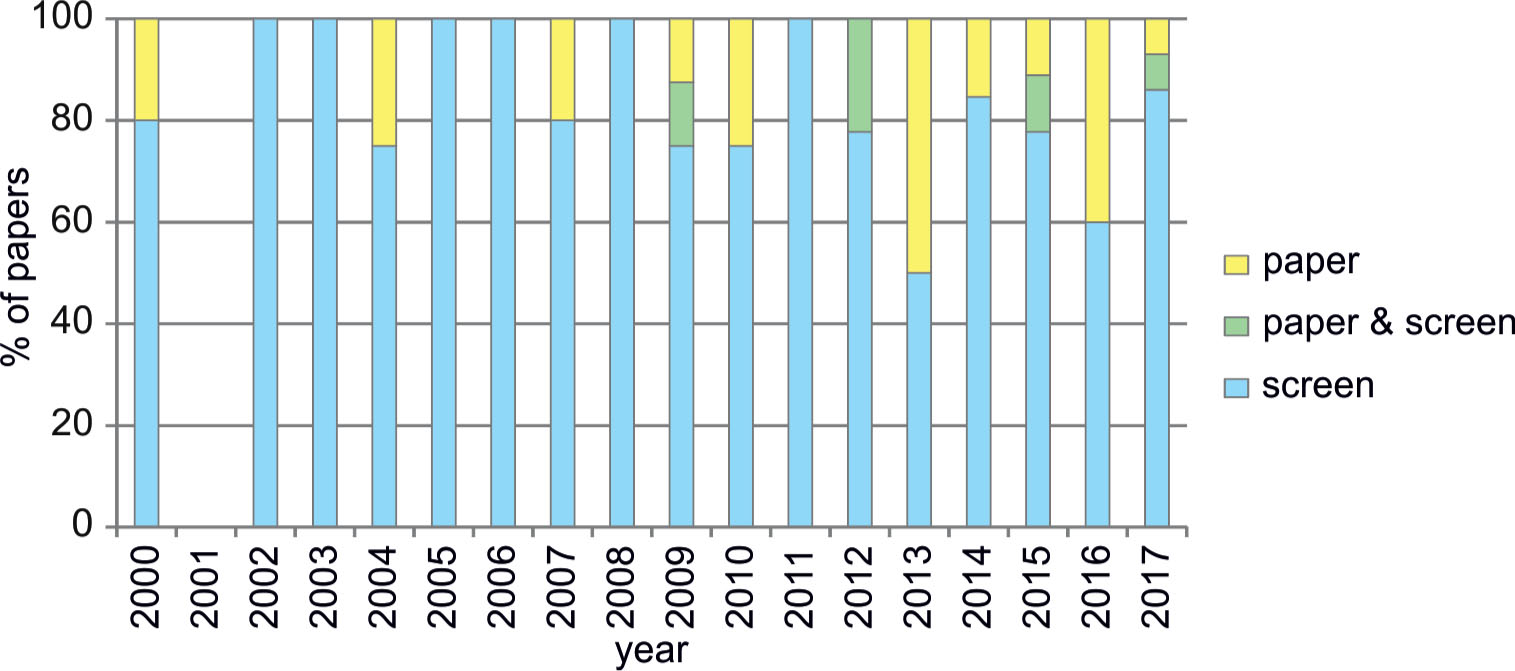
Figure 3
Percentage of paper and screen maps
Source: own elaboration
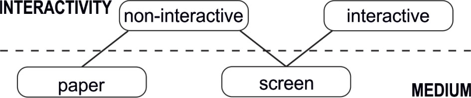
Figure 4
Relation between medium and level of reactiveness
Source: own elaboration based on Kraak & Brown 2001
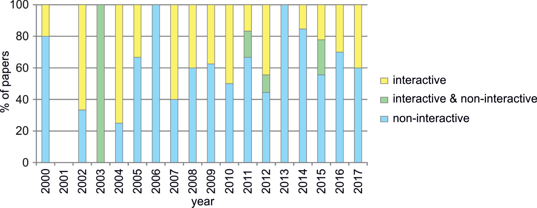
Figure 5
Percentage of interactive and non-interactive maps
Source: own elaboration
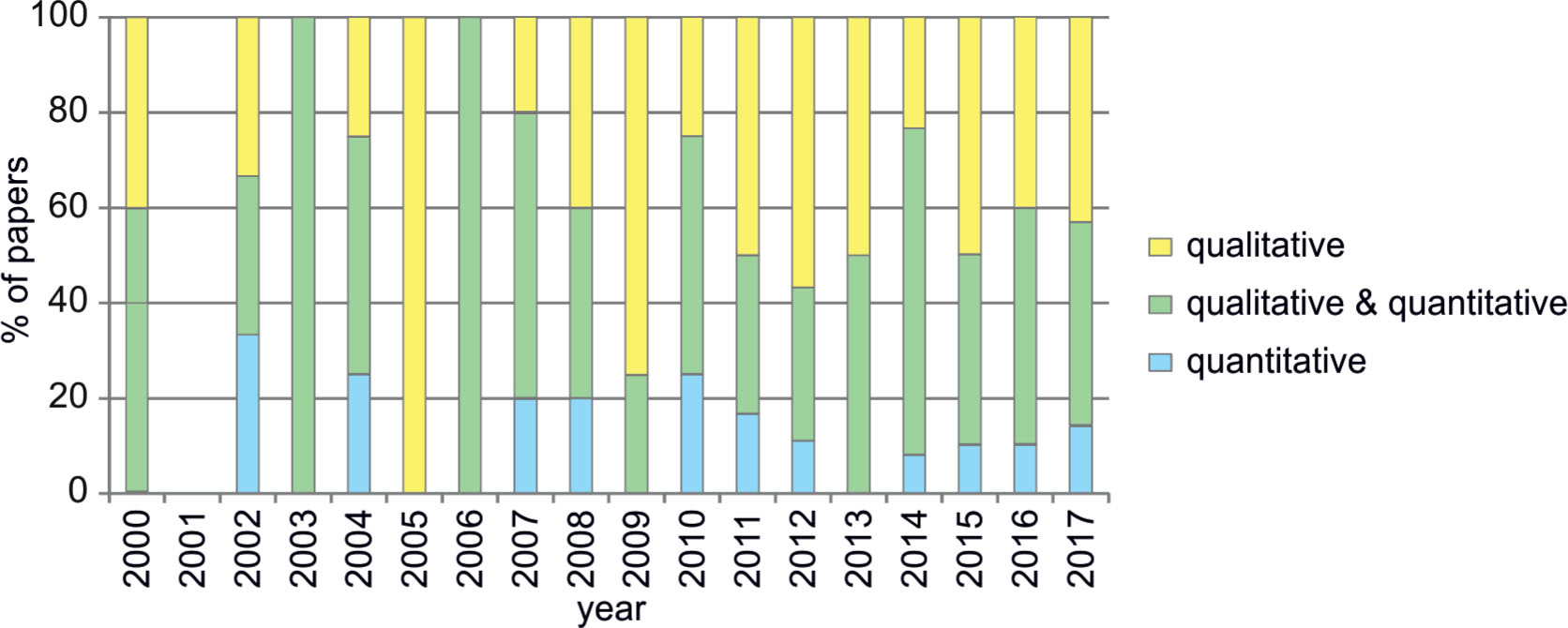
Figure 6
Percentage of maps elaborated with qualitative and quantitative methods of cartographic presentation
Source: own elaboration
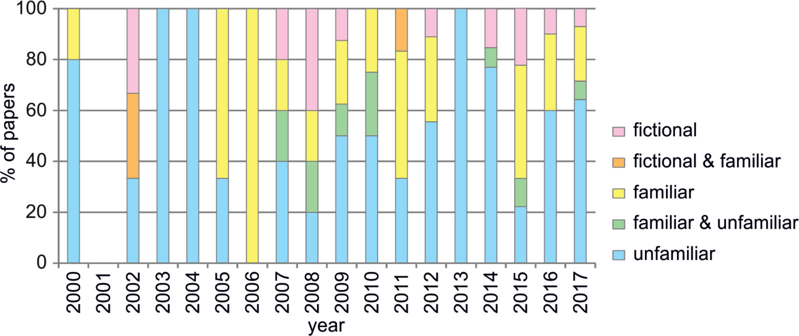
Figure 7
Percentage of maps of fictional, familiar and unfamiliar data or area
Source: own elaboration