
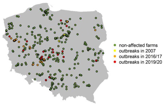
Fig. 1
Locations of affected and unaffected commercial farms. The map was produced using the maps package (maps: Draw Geographical Maps, R package version 3.3.0 (21))
Table 1
The list of preliminary selected risk factors with their spatial distribution in Poland and the distribution of values in experimental (from affected farms) and control (from unaffected farms) groups. The maps and graphs were produced using raster and ggplot2 packages (ggplot2: Elegant Graphics for Data Analysis, R package (21)), respectively
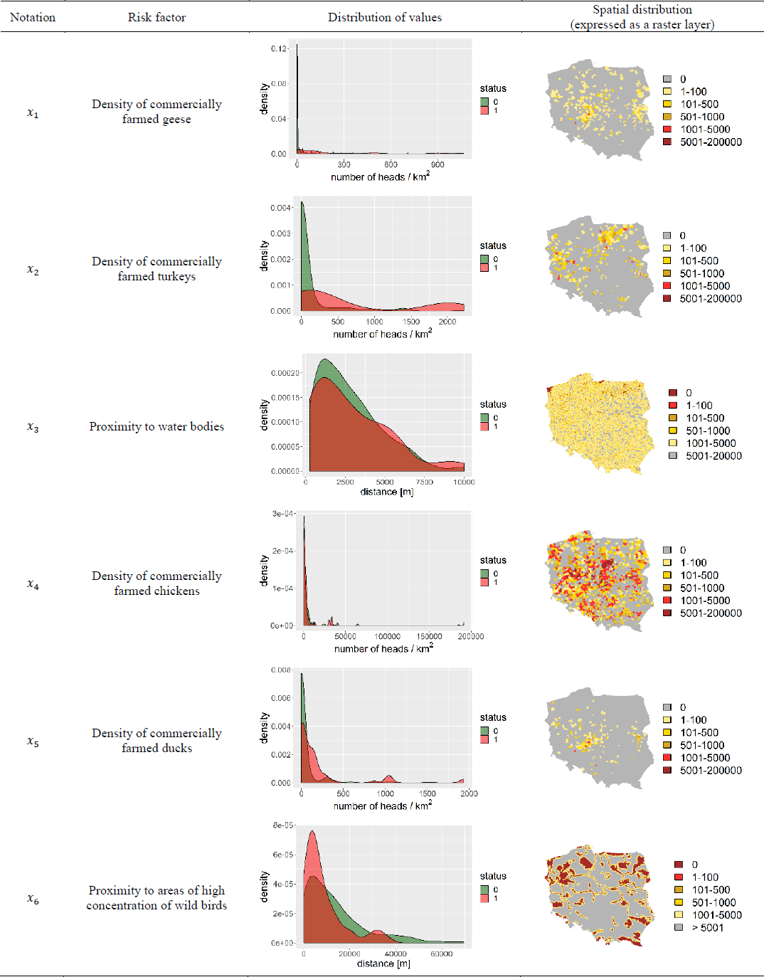 |
Table 2
Results of logistic regression model
| Notation | Description of the variable | Estimation | 95% Confidence interval | P value |
|---|---|---|---|---|
| log(x1+50) | log-transformed density of turkeys | 0.973 | [0.634, 1.355] | 9.94e−08 |
| log(x2+5) | log-transformed density of geese | 0.409 | [0.113, 0.709] | 6.92e−03 |
| log(x3+10) | log-transformed density of ducks | 0.447 | [0.108, 0.791] | 9.8e−03 |
| log(x4+10) | log-transformed density of chickens | −0.193 | [−0.375,−0.018] | 3.31e−02 |
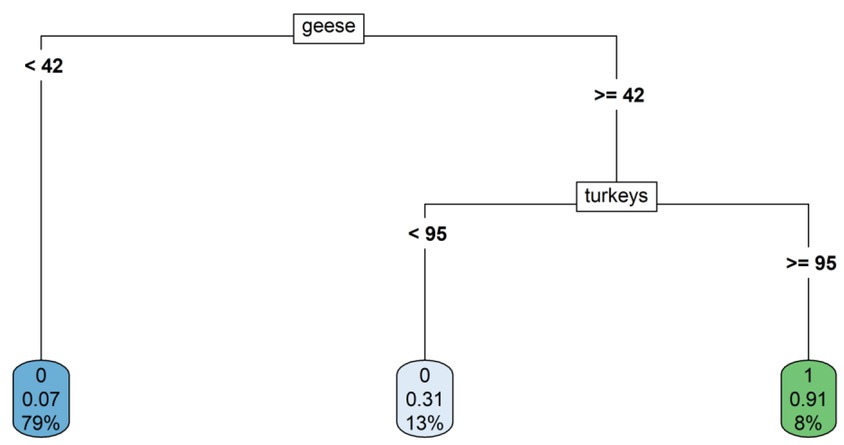
Fig. 2
Results of decision tree model
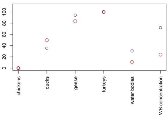
Fig. 3
The importance of considered risk factors designated by the decision tree (red dots) and random forest (blue dots) models. WB – wild birds. The importance values were scaled to 0 and 100 (values of 100 and 0 indicated the most important and the least important risk factor in the model, respectively)
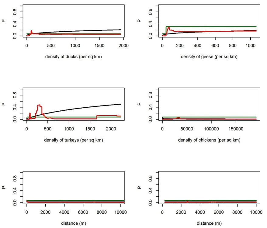
Fig. 4
Impact of changes in the selected variables on the predicted value of probability of HPAI occurrence using different models: logistic regression (black line), decision tree (green line), and random forest (red line). WB – wild birds
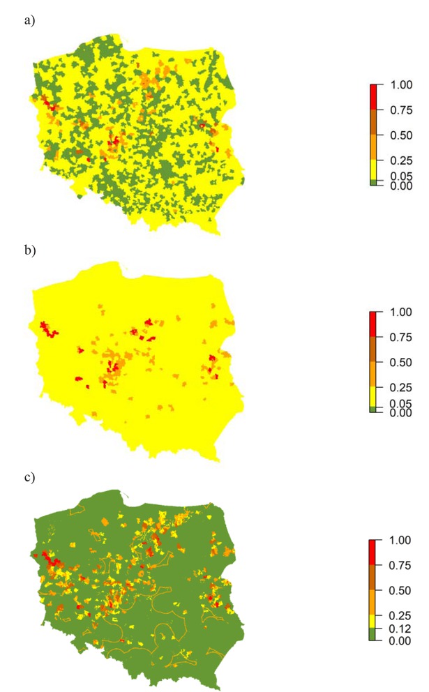
Fig. 5
Spatial distribution of the predicted values of the probabilities using different models: a) logistic regression, b) decision tree, and c) random forest