
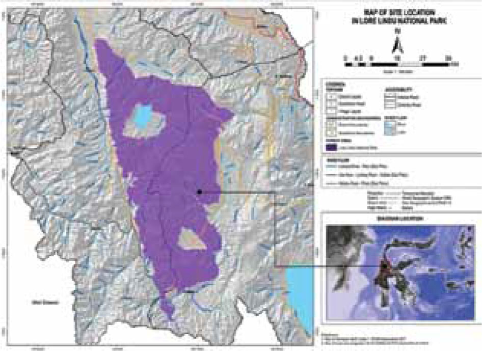
Figure 1.
Map of the research implementation site, which includes the Palu and Jeneberang watersheds that are are located in the Central and West Sulawesi provinces, Indonesia
Table 1.
Variables of forest damage level (Y) and explanatory/independent (X) variables in CART analysis
| Response variable | ||
| Encroachment rate by community (Y) | 1 | Quite severe |
| 2 | Severe | |
| 3 | Really severe | |
| Explanatory variable | ||
| Number of family (people) (X1) | 1 | 1–3 |
| 2 | >3 | |
| Age of the head of family (years) (X2) | 1 | 36–45 |
| 2 | >45 | |
| Health of the head of family (X3) | 1 | Supporting |
| 2 | Not supporting | |
| Flood (X4) | 1 | Heavy |
| 2 | Really heavy | |
| Landslide (X5) | 1 | Wide |
| 2 | Very wide | |
| Whirlwind (X6) | 1 | Speedy |
| 2 | Very speedy | |
| Earthquake/liquefaction (X7) | 1 | High |
| 2 | Very high | |
Table 2.
Result of relationship analysis between response variable (community encroachment rate) and explanatory variables
| Explanatory variables | Variable response (Y) | P-value | ||
|---|---|---|---|---|
| quite severe | severe | really severe | ||
| Number of family members | 0.919 | |||
| 1–3 People | 10 | 21 | 20 | |
| >3 People | 33 | 61 | 55 | |
| Age of the head of the family | <0.001 | |||
| 36–45 years | 20 | 14 | 8 | |
| >45 years | 23 | 68 | 67 | |
| Health of the head of the family | 0.517 | |||
| Not supporting | 7 | 19 | 19 | |
| Supporting | 36 | 63 | 56 | |
| Flood | <0.001 | |||
| Heavy | 30 | 17 | 3 | |
| Really heavy | 13 | 65 | 72 | |
| Landslide | <0.001 | |||
| Wide | 30 | 16 | 5 | |
| Really wide | 13 | 66 | 70 | |
| Whirlwind | <0.001 | |||
| Speedy | 43 | 71 | 28 | |
| Really speedy | 0 | 11 | 47 | |
| Earthquake/liquefaction | <0.001 | |||
| High | 15 | 62 | 58 | |
| Really high | 28 | 20 | 17 | |
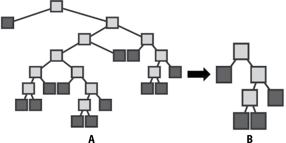
Figure 2.
Maximum regression tree topology for Y (A) and optimal regression tree topology for Y (B)
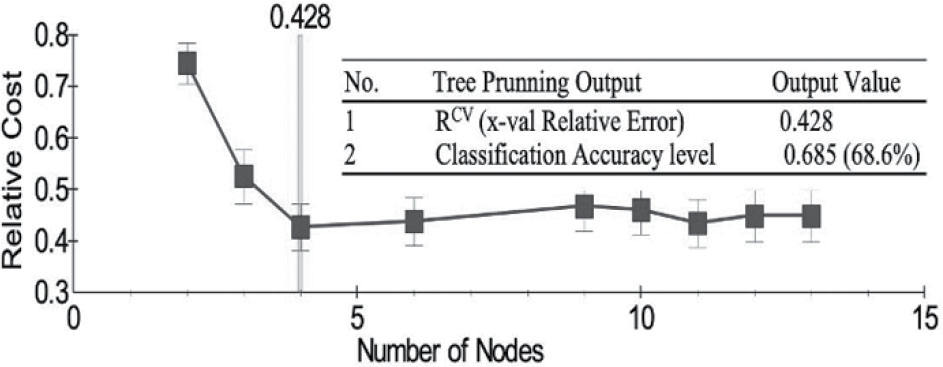
Figure 3.
RCV (x-Val relative error) plot of community encroachment rate (Y) response variable
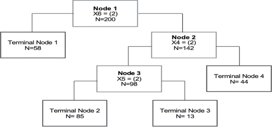
Figure 4.
Optimum classification tree with four final terminals on the community encroachment rate (Y) response variable
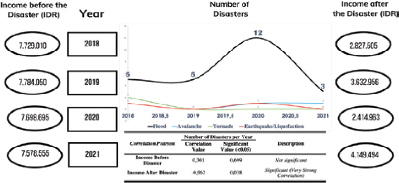
Figure 5.
Integration of time series, flood disaster, incomes before and after disaster, and Chi-square correlation test
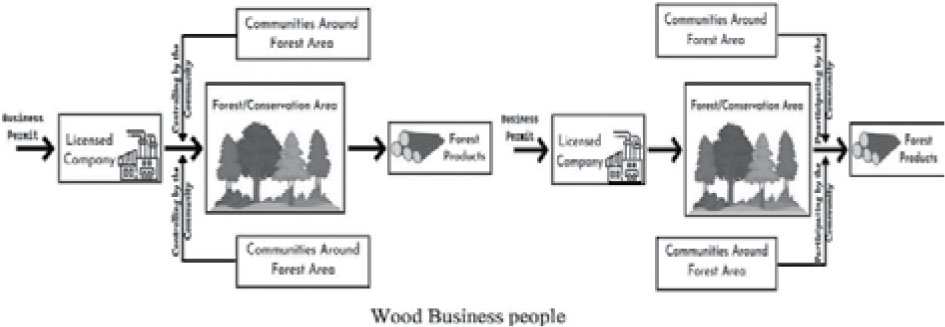
Figure 6.
The cycle of the socioecological system before the community is involved (A) and after the community is involved in forest encroachment (B) as a silent partner for the wood businesspeople
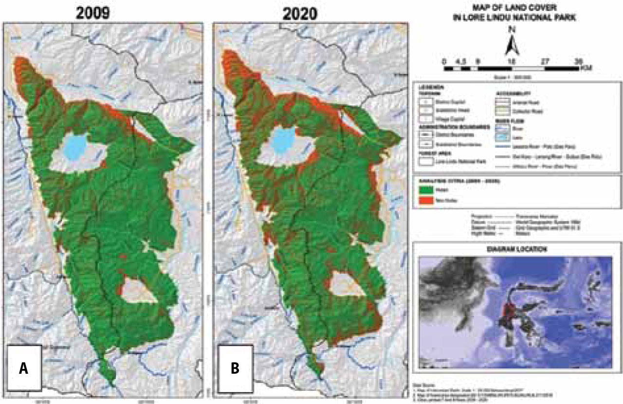
Figure 7.
Integration of 2019 flood, wood business partnerships and flood victims of various ethnicities, and the level of deforestation
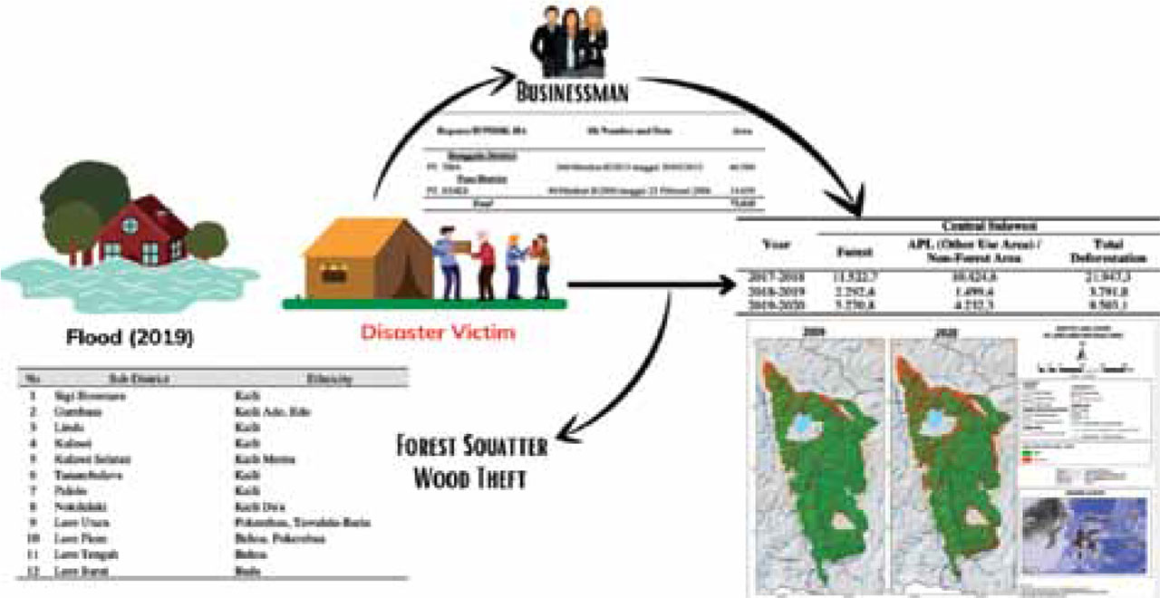
Figure 8.
Changes in land cover from 2009 to 2021