

Figure 1
a) Segura river basin in southeast Spain. b) Aquifers of the Segura river basin. The Caravaca aquifer is highlighted in dark gray. c) Subunits of the Caravaca aquifer. Lines: Simo; points: Gavilán; plain gray: Revolcadores-Serrata. Points and crosses represent the main springs in the study area used and unused in agriculture respectively.
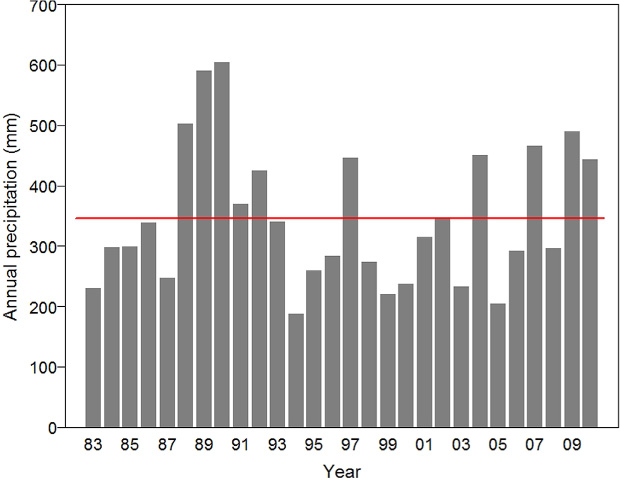
Figure 2
Annual precipitation in the study area from 1983 to 2010. The red line indicates the mean annual precipitation of this period.
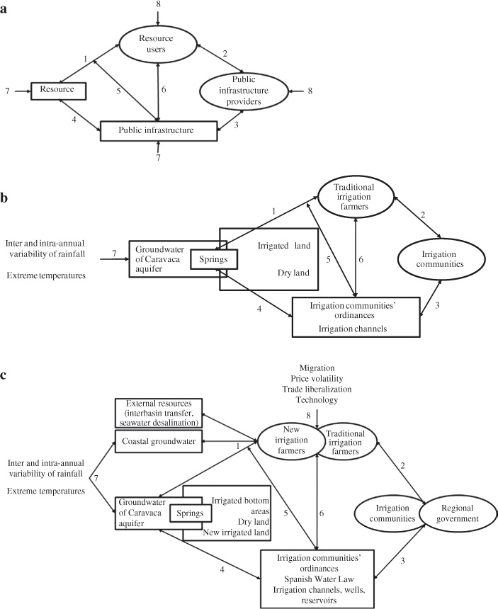
Figure 3
Application of the conceptual social-ecological systems model (Anderies et al. 2004) (a) to the Caravaca aquifer irrigation system in the two study periods: (b) the traditional system before the intrusion of new resource users and (c) the current situation after the intrusion of new resource users.

Figure 4
Official values of the mean volume of flow (l/s) of some of the springs of the Revolcadores-Serrata unit from 1984 to 2010. Source: adapted from Cabezas 2010.
Table 1
Characteristics of the irrigation communities of the study area and situation of springs they use (information obtained from interviews to ICs)

Table 2
Main processes and vulnerabilities detected in the entities and links (see Figure 3) of the traditional SES under study due to the incursion of intruders
