
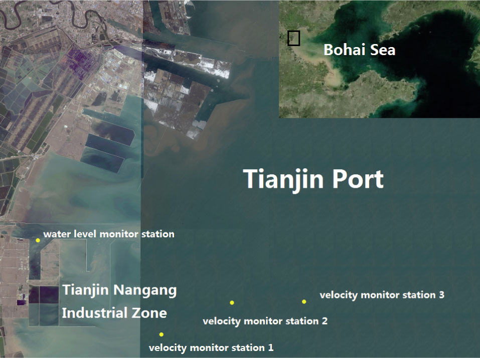
Figure 1
The Port of Tianjin in the Bohai Sea (satellite images from bing maps)
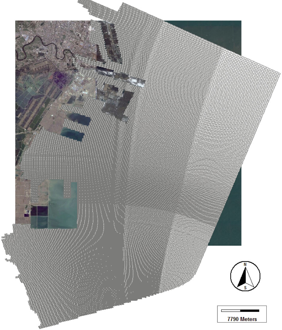
Figure 2
The grid of the Tianjin port model (satellite image from bing maps)
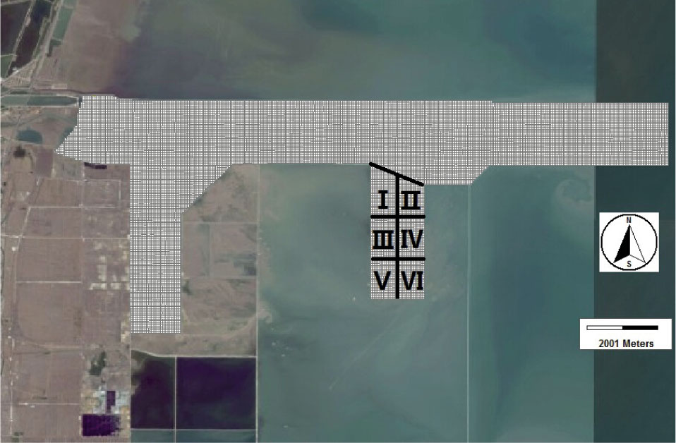
Figure 3
The grid of Nangangmodel with the six simulation oil spill regions in the eastern harbor of Tianjin Nangang (satellite image from bing maps)
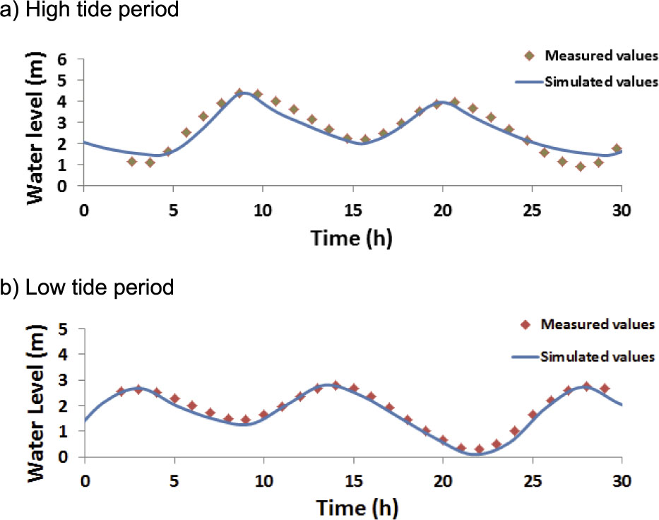
Figure 4
Model validation of the water level at the water level monitoring station
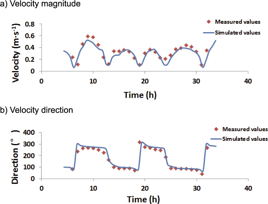
Figure 5
Model validation of the velocity magnitude and direction at monitor station 2 during the high tide period
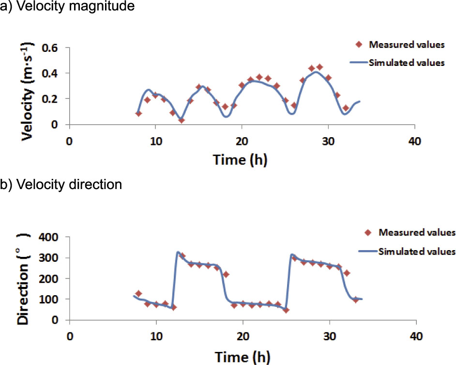
Figure 6
Model validation of the velocity magnitude and direction at monitor station 2 during the low tide period
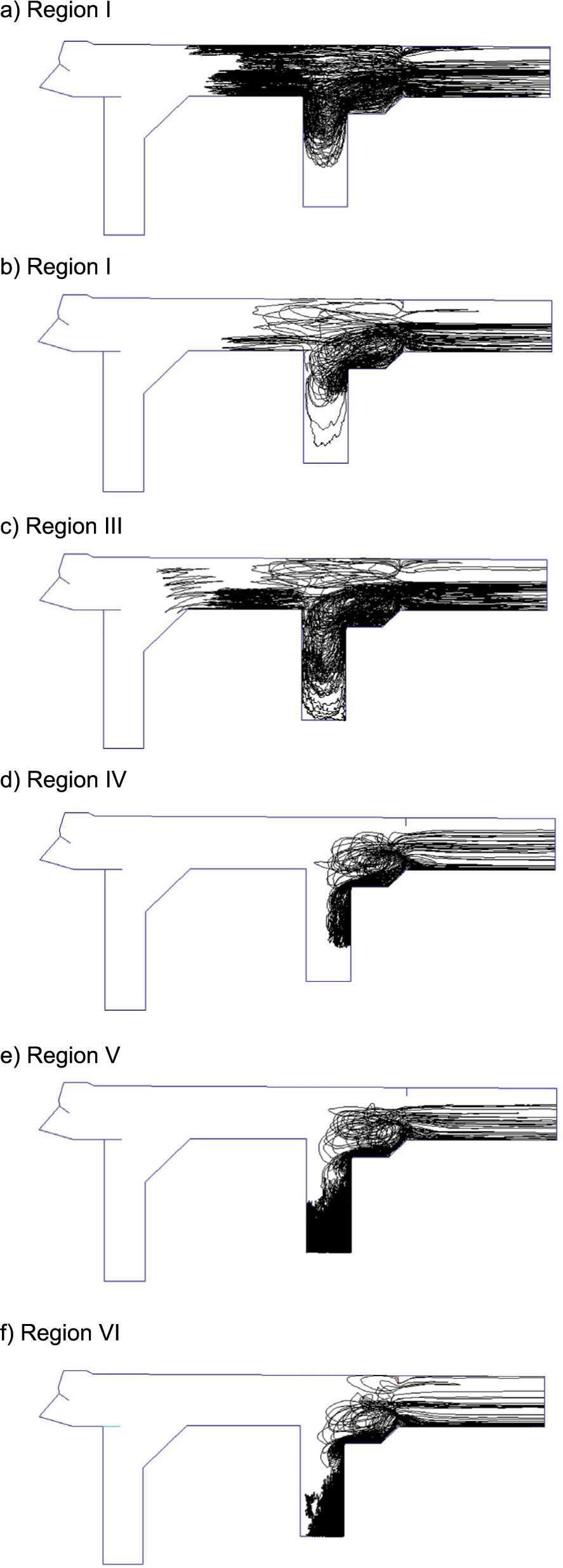
Figure 7
Trajectory of oil particles from different regions (no wind)
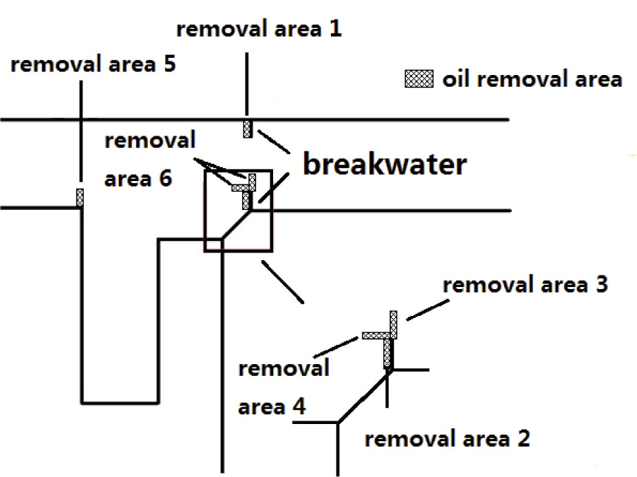
Figure 8
Position of different oil removal areas
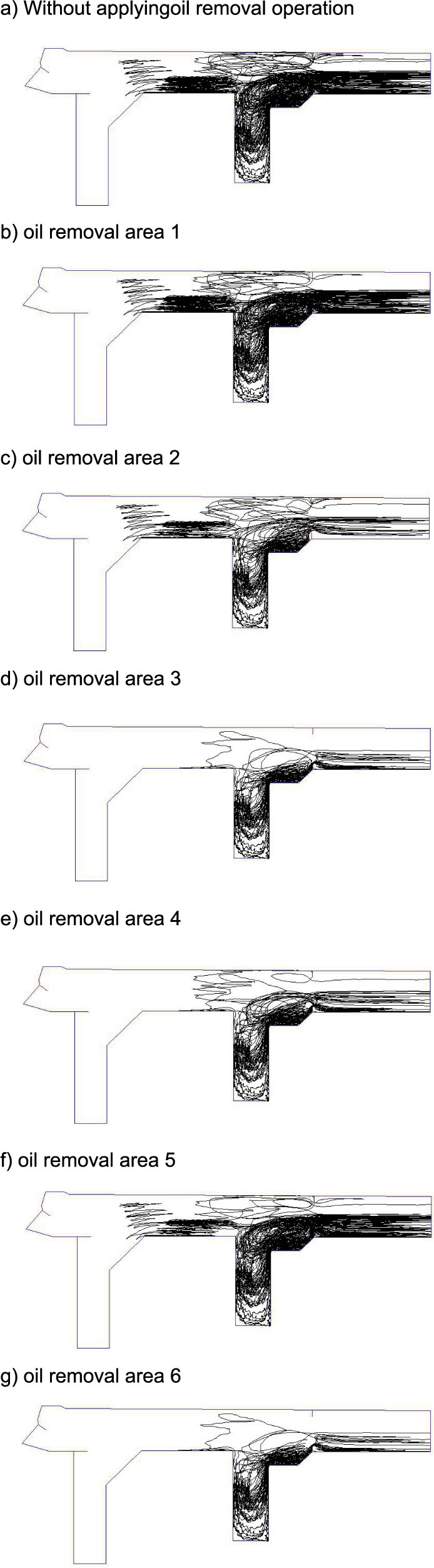
Figure 9
Trajectory of oil particles from region III after 100 days of the oil removal operation in different oil removal areas
Table 1
Speed, direction and probability of prevailing wind based on the local climate data
| Season | Wind Direction | Wind Speed (m s-1) | Probability (%) |
|---|---|---|---|
| Spring | SW | 5.0 | 15 |
| Summer | SWS | 4.1 | 12 |
| Autumn | S | 4.5 | 15 |
| Winter | N | 4.5 | 13 |
Table 2
Removal rate of oil spill in the harbor after 100 days of the oil removal operation in different removal areas (%)
| Removal area | No wind | Spring | Summer | Autumn | Winter | Annual Average |
|---|---|---|---|---|---|---|
| 1 | 7.5 | 1.3 | 3.1 | 7.5 | 9.6 | 5.4 |
| 2 | 62.3 | 65.8 | 70.6 | 44.3 | 20.6 | 50.3 |
| 3 | 74.6 | 85.5 | 89.9 | 74.1 | 64.9 | 78.6 |
| 4 | 66.7 | 80.7 | 84.2 | 74.1 | 72.4 | 77.9 |
| 5 | 18.4 | 11.4 | 15.4 | 17.1 | 22.8 | 16.7 |
| 6 | 77.6 | 87.7 | 92.5 | 79.8 | 79.4 | 84.5 |